Howar Sand

Beach in Orkney

Scotland

Howar Sand

Cata Sand Dunes and Beach Looking NNE along almost 3km of pristine sand. This is the seaward side of the Cata Sand dune complex.
Cata Sand Dunes and Beach Credit: Ian Balcombe

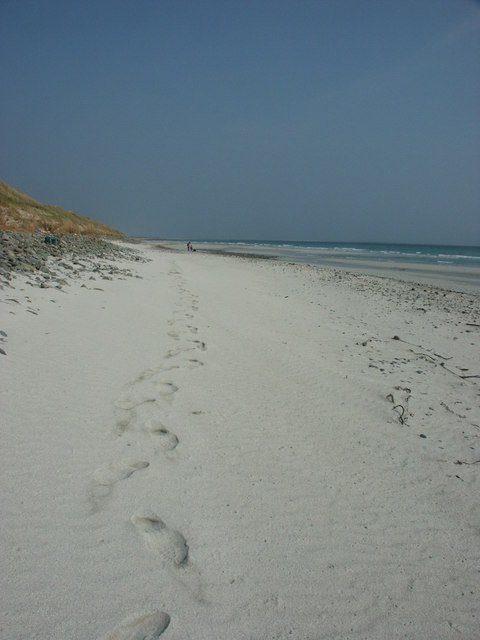
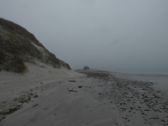
Howar Sand is a picturesque beach located on the island of Sanday in the Orkney archipelago, off the northeastern coast of Scotland. Stretching over a mile in length, it is considered one of the most stunning and pristine beaches in the region.

With its soft, golden sand and crystal-clear turquoise waters, Howar Sand offers a tranquil and idyllic setting for visitors to enjoy. The beach is backed by rolling sand dunes and boasts breathtaking views of the surrounding coastline and the North Sea.

Popular activities at Howar Sand include sunbathing, swimming, and picnicking. The beach's calm and shallow waters make it suitable for families with young children, who can safely splash and play in the sea. The extensive stretch of sand also provides ample space for beach games and long walks, particularly during low tide when the beach expands even further.

Nature enthusiasts will appreciate the diverse wildlife that can be spotted in and around Howar Sand. Seals are often seen basking on the nearby rocks, while various seabirds, including puffins, fulmars, and kittiwakes, nest along the cliffs and sand dunes.

Facilities at Howar Sand are limited, with no lifeguards or public amenities available. However, there is a car park nearby, allowing easy access to the beach. It is advisable to bring necessary supplies, such as food, water, and sun protection, as there are no shops or cafes in the immediate vicinity.

Overall, Howar Sand offers a serene and unspoiled beach experience, perfect for those seeking a peaceful retreat in the stunning natural beauty of the Orkney Islands.

If you have any feedback on the listing, please let us know in the comments section below.

Howar Sand Images

Images are sourced within 2km of 59.256643/-2.5020008 or Grid Reference HY7141. Thanks to Geograph Open Source API. All images are credited.

Cata Sand Dunes and Beach Looking NNE along almost 3km of pristine sand. This is the seaward side of the Cata Sand dune complex.
Cata Sand Dunes and Beach
Looking NNE along almost 3km of pristine sand. This is the seaward side of the Cata Sand dune complex.
Shoreline by Cata Sand, Sanday
B9069 passing Sanday Golf Club
B9069 approaching Newark Cottages, Sanday
Ruin at Newark, Sanday
Track by Cata Sand, Sanday
Shoreline by Cata Sand, Sanday
Track through the dunes, Sanday
Flooded track near Cleat, Sanday
Drainage ditch on Sanday This ditch is just east of the track shown on the map, which barely exists on the ground although there is still a space between the fences. The eastern peninsula of Sanday is less than 10 metres height across its whole width at this point.
Drainage ditch on Sanday
This ditch is just east of the track shown on the map, which barely exists on the ground although there is still a space between the fences. The eastern peninsula of Sanday is less than 10 metres height across its whole width at this point.
The brickie hut This wartime building was the control room for a dummy airfield on the Plain of Fidge. It was one of eight dummy installations intended as decoys for air raids on the fleet at Scapa Flow.
The brickie hut
This wartime building was the control room for a dummy airfield on the Plain of Fidge. It was one of eight dummy installations intended as decoys for air raids on the fleet at Scapa Flow.
Saltmarsh near Cleat In Lady parish in the island of Sanday
Saltmarsh near Cleat
In Lady parish in the island of Sanday
Farm of Cruddy In Lady Parish
Farm of Cruddy
In Lady Parish
Sanday Golf Club Taken from the B9069 by The Plain of Fidge, and featuring Sanday's 9 Hole links Golf Course. Genuinely the only feature of this grid square, not counting the cows that is.
Sanday Golf Club
Taken from the B9069 by The Plain of Fidge, and featuring Sanday's 9 Hole links Golf Course. Genuinely the only feature of this grid square, not counting the cows that is.
Course map Supplemental info: the map of the course, in the clubhouse window
Course map
Supplemental info: the map of the course, in the clubhouse window
Rounding the bend, Cata Sands, Sanday The inshore side of the tombolo which leads to Tresness. Looking NE.
Rounding the bend, Cata Sands, Sanday
The inshore side of the tombolo which leads to Tresness. Looking NE.
Cata Sand Dunes and Beach Looking along the length of the dunes towards Tresness. It was so windy that sand was being removed, and pebbles being left exposed on tiny raised plinths. Look at the foreground.
Cata Sand Dunes and Beach
Looking along the length of the dunes towards Tresness. It was so windy that sand was being removed, and pebbles being left exposed on tiny raised plinths. Look at the foreground.
Back to mum, Cata Sands. These cattle were grazing just behind the dunes. The sand beneath the grass has been exposed in places. The new calf had somehow managed to get itself on the wrong side of the fence, much to the distress of my daughters, and the calf. We managed to help it on its way and dad was a hero (for about 5 minutes).
Back to mum, Cata Sands.
These cattle were grazing just behind the dunes. The sand beneath the grass has been exposed in places. The new calf had somehow managed to get itself on the wrong side of the fence, much to the distress of my daughters, and the calf. We managed to help it on its way and dad was a hero (for about 5 minutes).
Show me another place!

Howar Sand is located at Grid Ref: HY7141 (Lat: 59.256643, Lng: -2.5020008)

Unitary Authority: Orkney Islands

Police Authority: Highlands and Islands

What 3 Words

///waged.founders.seasonal. Near Kettletoft, Orkney Islands

Related Wikis

East Sanday Coast

The East Sanday Coast is a protected wetland area on and around the island of Sanday, the third-largest of the Orkney islands off the north coast of Scotland...

Sanday, Orkney

Sanday (, Scots: Sandee) is one of the inhabited islands of Orkney that lies off the north coast of mainland Scotland. With an area of 50.43 km2 (19.5...

Sanday Airport

Sanday Airport (IATA: NDY, ICAO: EGES) is located 20 NM (37 km; 23 mi) north northeast of Kirkwall Airport on Sanday, Orkney Islands, Scotland. Sanday...

Broughtown

Broughtown is a village on the island of Sanday, in Orkney, Scotland. The settlement is within the parish of Cross and Burness. Sanday Airport is adjacent...

Scar boat burial

The Scar boat burial is a Viking boat burial near the village of Scar, on Sanday, in Orkney, Scotland. The burial, which dates to between 875 and 950 AD...

Scar, Orkney

Scar is a village and farm complex on the island of Sanday in Orkney, Scotland. The B9068 road runs from Scar to Kettletoft. The Scar boat burial was found...

Kettletoft

Kettletoft is a settlement on the island of Sanday in Orkney, Scotland. The B9068 road runs from Kettletoft to Scar and the B9069 from Kettletoft to Northwall...

Have you been to Howar Sand?

Leave your review of Howar Sand below (or comments, questions and feedback).