Horn's Brae

Beach in Banffshire

Scotland

Horn's Brae

Mouse-ear Hawkweed Hawkweeds, Hawksbeards and Hawkbits all have dandelion-like flowers and are notoriously difficult to tell apart. This is the exception, instantly recognisable because its flowers are lemon-yellow, while all the others are more canary-yellow.
Mouse-ear Hawkweed Credit: Anne Burgess

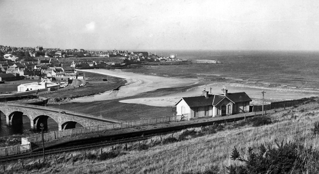
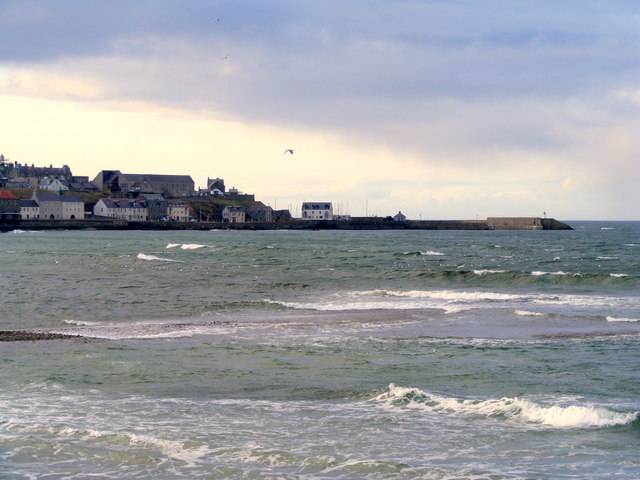
Horn's Brae is a picturesque beach located in Banffshire, Scotland. Situated near the coastal town of Banff, this sandy haven stretches along the North Sea coastline and offers breathtaking views of the surrounding cliffs and rugged landscapes. With its tranquil atmosphere and natural beauty, Horn's Brae is a popular destination for locals and tourists alike.

The beach is characterized by its golden sands, which provide a perfect setting for sunbathing, picnicking, and leisurely walks. The clear waters of the North Sea are inviting for swimmers, and the beach is also a haven for water sports enthusiasts, with activities such as kayaking and paddleboarding available.

Horn's Brae offers visitors a chance to immerse themselves in nature. The cliffs surrounding the beach provide opportunities for hiking and birdwatching, allowing visitors to observe a variety of seabirds and marine wildlife. The beach is also home to a diverse range of plant species, making it a haven for nature lovers and botany enthusiasts.

Facilities at Horn's Brae include public toilets, ample parking, and a nearby café where visitors can enjoy refreshments while taking in the stunning views. The beach is easily accessible, with a well-maintained path leading down from the nearby car park.

Overall, Horn's Brae is a hidden gem on Scotland's coastline, offering visitors a chance to relax, connect with nature, and enjoy the beauty of Banffshire's coastal landscapes. Whether you're seeking a peaceful escape or an adventurous day out, Horn's Brae has something to offer for everyone.

If you have any feedback on the listing, please let us know in the comments section below.
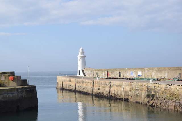
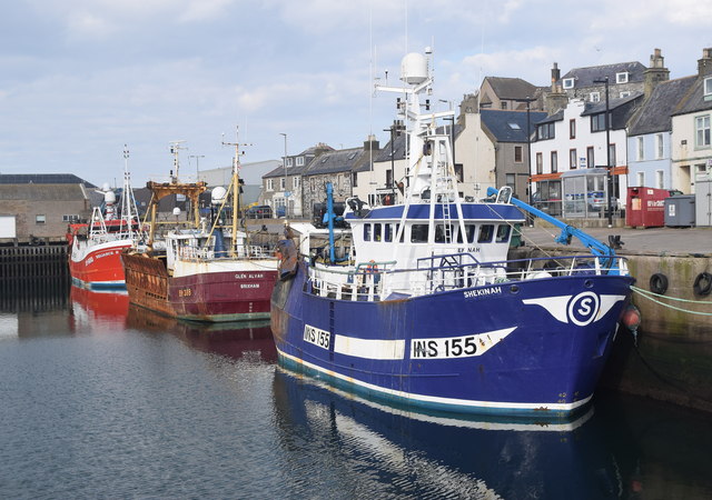
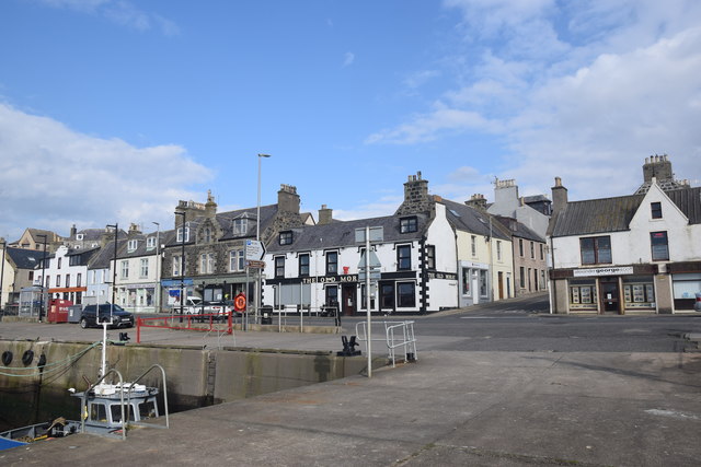
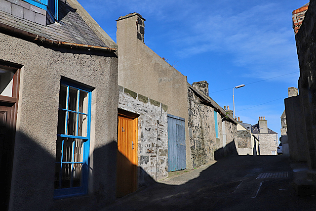
Horn's Brae Images

Images are sourced within 2km of 57.668731/-2.5044492 or Grid Reference NJ7064. Thanks to Geograph Open Source API. All images are credited.

Mouse-ear Hawkweed Hawkweeds, Hawksbeards and Hawkbits all have dandelion-like flowers and are notoriously difficult to tell apart. This is the exception, instantly recognisable because its flowers are lemon-yellow, while all the others are more canary-yellow.
Mouse-ear Hawkweed
Hawkweeds, Hawksbeards and Hawkbits all have dandelion-like flowers and are notoriously difficult to tell apart. This is the exception, instantly recognisable because its flowers are lemon-yellow, while all the others are more canary-yellow.
Loch Craig In the foreground is the sea wall of the Tarlair open-air swimming pool. Loch craig is the sea inlet offshore. The ship is Petronordic, port of registry Nassau, which is a shuttle tanker, gross tonnage 54865.
Loch Craig
In the foreground is the sea wall of the Tarlair open-air swimming pool. Loch craig is the sea inlet offshore. The ship is Petronordic, port of registry Nassau, which is a shuttle tanker, gross tonnage 54865.
Tarlair Lido, 2022 The monochrome emphasises the current state of disrepair of the pavilion, but that is set to change, as funding has been secured and listed building consent given for its refurbishment starting in 2022.
The Friends of Tarlair <span class="nowrap"><a title="http://friendsoftarlair.co.uk/" rel="nofollow ugc noopener" href="http://friendsoftarlair.co.uk/">Link</a><img style="margin-left:2px;" alt="External link" title="External link - shift click to open in new window" src="https://s1.geograph.org.uk/img/external.png" width="10" height="10"/></span> are working towards making this a vibrant leisure destination once again. The Category A Listed facility deserves nothing less.
Tarlair Lido, 2022
The monochrome emphasises the current state of disrepair of the pavilion, but that is set to change, as funding has been secured and listed building consent given for its refurbishment starting in 2022. The Friends of Tarlair LinkExternal link are working towards making this a vibrant leisure destination once again. The Category A Listed facility deserves nothing less.
Natural sloping slabs at Tarlair At the entrance to the lido.
Natural sloping slabs at Tarlair
At the entrance to the lido.
The road to Tarlair Looking towards Macduff. The building to the right of the road is the Well of Tarlair. It dates from c.1800. The chalybeate waters enjoyed considerable popularity for their medicinal and health giving properties in the NE during the 18th and 19th centuries.
The road to Tarlair
Looking towards Macduff. The building to the right of the road is the Well of Tarlair. It dates from c.1800. The chalybeate waters enjoyed considerable popularity for their medicinal and health giving properties in the NE during the 18th and 19th centuries.
Threading the needle View through the naatural arch known locally as the Needle's Eye
Threading the needle
View through the naatural arch known locally as the Needle's Eye
Stagecoach Bluebird Macduff Bus Depot
Macduff: a view over the harbour Looking over the harbour from the grassy hilltop to the south, where an anchor is ... anchored, by the <a href="https://www.geograph.org.uk/photo/451242">NJ7064 : Macduff: parish church</a>.
Macduff: a view over the harbour
Looking over the harbour from the grassy hilltop to the south, where an anchor is ... anchored, by the NJ7064 : Macduff: parish church.
View towards Macduff from Banff beach Macduff parish kirk is prominent on the hill with the unusual war memorial tower to the right.
View towards Macduff from Banff beach
Macduff parish kirk is prominent on the hill with the unusual war memorial tower to the right.
Macduff parish kirk Built 1805 (remodelled 1865) on a dramatic hilltop site overlooking Macduff harbour.  B-listed (LB37616): <span class="nowrap"><a title="http://portal.historicenvironment.scot/designation/LB37616" rel="nofollow ugc noopener" href="http://portal.historicenvironment.scot/designation/LB37616">Link</a><img style="margin-left:2px;" alt="External link" title="External link - shift click to open in new window" src="https://s1.geograph.org.uk/img/external.png" width="10" height="10"/></span> .
Macduff parish kirk
Built 1805 (remodelled 1865) on a dramatic hilltop site overlooking Macduff harbour. B-listed (LB37616): LinkExternal link .
Macduff war memorial An unusual and striking war memorial tower erected in 1920 and B-listed (LB37681):  <span class="nowrap"><a title="http://portal.historicenvironment.scot/designation/LB37631" rel="nofollow ugc noopener" href="http://portal.historicenvironment.scot/designation/LB37631">Link</a><img style="margin-left:2px;" alt="External link" title="External link - shift click to open in new window" src="https://s1.geograph.org.uk/img/external.png" width="10" height="10"/></span> .
Macduff war memorial
An unusual and striking war memorial tower erected in 1920 and B-listed (LB37681): LinkExternal link .
View of Macduff harbour from Church Street
Macduff town hall, 17 Shore Street The Scottish baronial town hall facing the harbour was designed by Aberdeen architects Pirie and Clyne in 1884 and is B-listed (LB37634): <span class="nowrap"><a title="http://portal.historicenvironment.scot/designation/LB37634" rel="nofollow ugc noopener" href="http://portal.historicenvironment.scot/designation/LB37634">Link</a><img style="margin-left:2px;" alt="External link" title="External link - shift click to open in new window" src="https://s1.geograph.org.uk/img/external.png" width="10" height="10"/></span> . Next door is the former Clydesdale Bank and agent's house, also B-listed (LB37635): <span class="nowrap"><a title="http://portal.historicenvironment.scot/designation/LB37635" rel="nofollow ugc noopener" href="http://portal.historicenvironment.scot/designation/LB37635">Link</a><img style="margin-left:2px;" alt="External link" title="External link - shift click to open in new window" src="https://s1.geograph.org.uk/img/external.png" width="10" height="10"/></span> .
Macduff town hall, 17 Shore Street
The Scottish baronial town hall facing the harbour was designed by Aberdeen architects Pirie and Clyne in 1884 and is B-listed (LB37634): LinkExternal link . Next door is the former Clydesdale Bank and agent's house, also B-listed (LB37635): LinkExternal link .
Macduff harbour entrance and lighthouse The lighthouse dates from 1903 (Canmore record 81477: <span class="nowrap"><a title="https://canmore.org.uk/site/81447/macduff-harbour-entrance-lighthouse" rel="nofollow ugc noopener" href="https://canmore.org.uk/site/81447/macduff-harbour-entrance-lighthouse">Link</a><img style="margin-left:2px;" alt="External link" title="External link - shift click to open in new window" src="https://s1.geograph.org.uk/img/external.png" width="10" height="10"/></span> ).
Macduff harbour entrance and lighthouse
The lighthouse dates from 1903 (Canmore record 81477: LinkExternal link ).
Macduff harbour The harbour at Macduff, with its ocean-going trawlers, has a totally different feel to the gentrified Banff marina on the other side of the River Deveron estuary.  Here we see the smartly turned out Shekinah (registered to INV = Inverness) and the Reliance II (BF = Banff) sandwiching a rather rusty visitor from afar; the Glen Alvah from BM = Brixham (Devon).
Macduff harbour
The harbour at Macduff, with its ocean-going trawlers, has a totally different feel to the gentrified Banff marina on the other side of the River Deveron estuary. Here we see the smartly turned out Shekinah (registered to INV = Inverness) and the Reliance II (BF = Banff) sandwiching a rather rusty visitor from afar; the Glen Alvah from BM = Brixham (Devon).
Harbourside buildings, Macduff Most prominent is the Old Moray Inn.
Harbourside buildings, Macduff
Most prominent is the Old Moray Inn.
The Old Moray Inn, Macduff Next door is a chandler and the harbour master's office.
The Old Moray Inn, Macduff
Next door is a chandler and the harbour master's office.
School Lane School Lane climbs in both direction from its intersection with Duff Street. This is looking up the eastern part of it from near the corner of Duff Street.
School Lane
School Lane climbs in both direction from its intersection with Duff Street. This is looking up the eastern part of it from near the corner of Duff Street.
Show me another place!

Horn's Brae is located at Grid Ref: NJ7064 (Lat: 57.668731, Lng: -2.5044492)

Unitary Authority: Aberdeenshire

Police Authority: North East

What 3 Words

///vented.column.widest. Near Macduff, Aberdeenshire

Related Wikis

Nearby Amenities

Located within 500m of 57.668731,-2.5044492
Macduff Pier
Man Made: lighthouse
Seamark Light 1 Character: Fl
Seamark Light 1 Colour: green
Seamark Light 1 Group: 2
Seamark Light 1 Height: 12
Seamark Light 1 Period: 6
Seamark Light 1 Sector End: 115
Seamark Light 1 Sector Start: 40
Seamark Light 1 Sequence: 1+(1),1+(3)
Seamark Light 2 Character: Fl
Seamark Light 2 Colour: white
Seamark Light 2 Group: 2
Seamark Light 2 Height: 12
Seamark Light 2 Period: 6
Seamark Light 2 Range: 9
Seamark Light 2 Sector End: 174
Seamark Light 2 Sector Start: 115
Seamark Light 2 Sequence: 1+(1),1+(3)
Seamark Light 3 Character: Fl
Seamark Light 3 Colour: red
Seamark Light 3 Group: 2
Seamark Light 3 Height: 12
Seamark Light 3 Period: 6
Seamark Light 3 Range: 7
Seamark Light 3 Sector End: 210
Seamark Light 3 Sector Start: 174
Seamark Light 3 Sequence: 1+(1),1+(3)
Seamark Light Reference: A 3348
Seamark Type: light_minor
Source: US NGA Pub. 114. 2011-05-26.
Lat/Long: 57.6709383/-2.500036
The Knowes War Memorial
Heritage Operator: Historic Environment Scotland
Heritage Website: https://portal.historicenvironment.scot/designation/LB37631
Historic: monument
Listed Status: Category B
Monument: war_memorial
Start Date: 1920
Wikidata: Q17774778
Lat/Long: 57.6677425/-2.4967488
Macduff
Historic Railway: station
Railway: site
Wikidata: Q6723009
Wikipedia: en:Macduff railway station
Lat/Long: 57.6668622/-2.5042278
Middle Basin
Alt Name: Macduff Harbour
Harbour: yes
Seamark Harbour Category: fishing
Seamark Type: harbour
Vhf: 12
Lat/Long: 57.6711999/-2.4983069
Fuel
Operator: Gleaner
Source: survey
Lat/Long: 57.6671081/-2.50536
Barrier: bollard
Lat/Long: 57.6674561/-2.4976677
Recycling
Lat/Long: 57.666825/-2.4976487
Bus Stop
Fife Street
Bus: yes
Naptan AtcoCode: 630021611
Naptan Bearing: NE
Naptan CommonName: Fife Street
Naptan Indicator: opp 27
Naptan Landmark: Fife Street
Naptan NaptanCode: 23624583
Naptan Street: Fife Street
Naptan Verified: no
Public Transport: platform
Ref: 23624583
Lat/Long: 57.6668719/-2.4970455
Post Box
Post Box Type: wall
Ref: AB44 39D
Royal Cypher: GVIR
Royal Cypher Wikidata: Q33102169
Lat/Long: 57.667419/-2.4993331
Bus Stop
Union Road
Bus: yes
Naptan AtcoCode: 630021542
Naptan Bearing: SW
Naptan CommonName: Union Road
Naptan Indicator: SW bound
Naptan Landmark: Union Road
Naptan NaptanCode: 23624549
Naptan Street: Union Road
Naptan Verified: no
Public Transport: platform
Ref: 23624549
Lat/Long: 57.6684606/-2.5034707
Pub
The Old Moray
Lat/Long: 57.6705016/-2.4976379
Telephone
Booth: KX100
Covered: booth
Lat/Long: 57.6707871/-2.4977613
Bus Stop
Nicols Brae
Bench: yes
Bin: no
Bus: yes
Naptan AtcoCode: 630021572
Naptan Bearing: NE
Naptan CommonName: Nicols Brae
Naptan Indicator: NE bound
Naptan Landmark: Nicols Brae
Naptan NaptanCode: 23627879
Naptan Street: Shore Street
Naptan Verified: no
Public Transport: platform
Ref: 23627879
Shelter: yes
Tactile Paving: no
Lat/Long: 57.6707585/-2.4977655
Bus Stop
Union Road
Bus: yes
Naptan AtcoCode: 630021541
Naptan Bearing: NE
Naptan CommonName: Union Road
Naptan Indicator: NE bound
Naptan Landmark: Union Road
Naptan NaptanCode: 23627875
Naptan Street: Union Road
Naptan Verified: no
Public Transport: platform
Ref: 23627875
Lat/Long: 57.6685575/-2.5036542
Bus Stop
Hutcheon Street
Bench: no
Bin: no
Bus: yes
Naptan AtcoCode: 630021561
Naptan Bearing: NE
Naptan CommonName: Hutcheon Street
Naptan Indicator: opp
Naptan Landmark: Hutcheon Street
Naptan NaptanCode: 23627878
Naptan Street: Shore Street
Naptan Verified: no
Public Transport: platform
Ref: 23627878
Shelter: no
Tactile Paving: no
Lat/Long: 57.66958/-2.4994603
Bus Depot
Lat/Long: 57.66907/-2.502769
Bus Stop
Horns Brae
Bench: no
Bin: no
Bus: yes
Naptan AtcoCode: 630021551
Naptan Bearing: W
Naptan CommonName: Horns Brae
Naptan Indicator: at
Naptan Landmark: Horns Brae
Naptan NaptanCode: 23624569
Naptan Street: Union Road
Naptan Verified: no
Public Transport: platform
Ref: 23624569
Shelter: no
Tactile Paving: no
Lat/Long: 57.6690701/-2.5012864
Atm
Lat/Long: 57.67022/-2.497872
Bus Depot
Operator: Stagecoach
Lat/Long: 57.6687013/-2.5036327
Post Box
Collection Times: Mo-Fr 17:15; Sa 12:15
Note Collection Times: all the postboxes around Macduff say the last collection in Macduff is at the post office collection box at 16:00, but checked with the postmistress at the post office and the collection is definitely after 17:15 as stated on the box
Post Box Type: wall
Ref: AB44 46
Royal Cypher: no
Lat/Long: 57.6702383/-2.4968885
Power: pole
Lat/Long: 57.6655926/-2.4994996
Generator Method: photovoltaic
Generator Output Electricity: yes
Generator Source: solar
Generator Type: solar_photovoltaic_panel
Location: roof
Power: generator
Lat/Long: 57.6665681/-2.501286
Generator Method: photovoltaic
Generator Output Electricity: yes
Generator Source: solar
Generator Type: solar_photovoltaic_panel
Location: roof
Power: generator
Lat/Long: 57.6676297/-2.4977347
Generator Method: photovoltaic
Generator Output Electricity: yes
Generator Source: solar
Generator Type: solar_photovoltaic_panel
Location: roof
Power: generator
Lat/Long: 57.6674533/-2.5035954
Generator Method: photovoltaic
Generator Output Electricity: yes
Generator Source: solar
Generator Type: solar_photovoltaic_panel
Location: roof
Power: generator
Lat/Long: 57.6670817/-2.4993789
Bus Stop
Town Hall
Bus: yes
Naptan AtcoCode: 630021562
Naptan Bearing: SW
Naptan CommonName: Town Hall
Naptan Indicator: at
Naptan Landmark: Town Hall
Naptan NaptanCode: 23624576
Naptan Street: Shore Street
Naptan Verified: no
Public Transport: platform
Ref: 23624576
Lat/Long: 57.6697291/-2.4985503
West Basin
Alt Name: West Harbour
Harbour: yes
Lat/Long: 57.6700938/-2.4990443
Atm
Brand: NoteMachine
Brand Wikidata: Q104368525
Operator: NoteMachine
Operator Short: NMATM
Operator Wikidata: Q104368525
Lat/Long: 57.6699935/-2.4965781
Bench
Backrest: yes
Lat/Long: 57.6685919/-2.4963789
The data included in this document is from www.openstreetmap.org. The data is made available under ODbL.

Have you been to Horn's Brae?

Leave your review of Horn's Brae below (or comments, questions and feedback).