Cambo Sands

Beach in Fife

Scotland

Cambo Sands

Sand Martin nests There is a distinct stratum of softer sand in the bank at the top of the beach. Sand Martins have made their nests there.
Sand Martin nests Credit: Rob Burke

Cambo Sands is a stunning beach located in the East Neuk of Fife, Scotland. Situated within the picturesque village of Kingsbarns, this sandy haven stretches for approximately two miles along the rugged coastline. The beach is easily accessible, with a large car park provided just a short walk away.

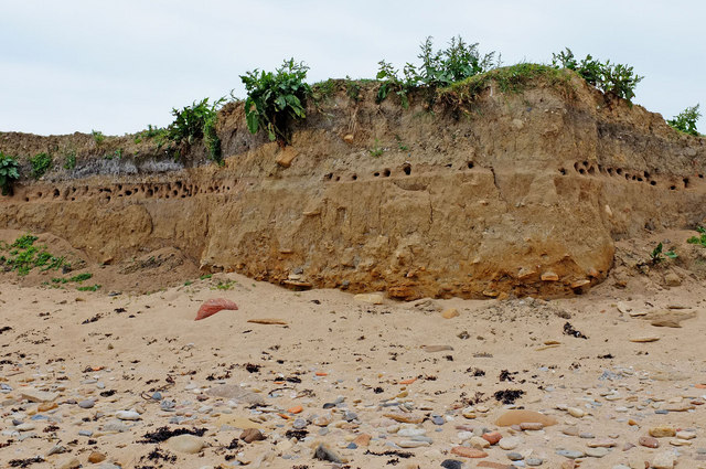
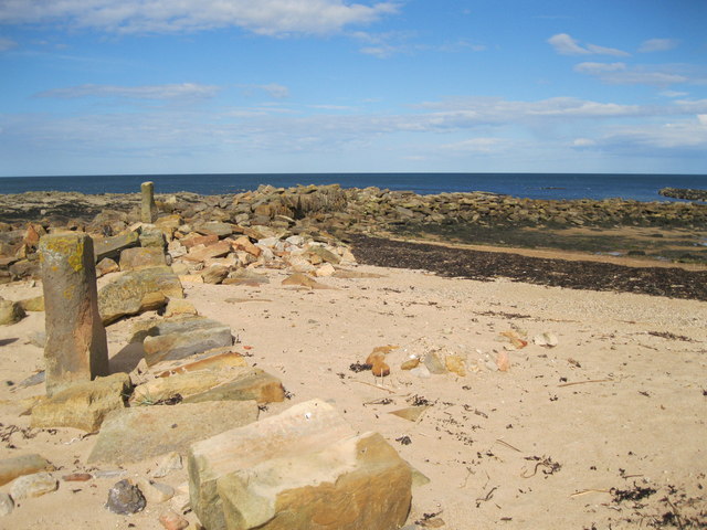
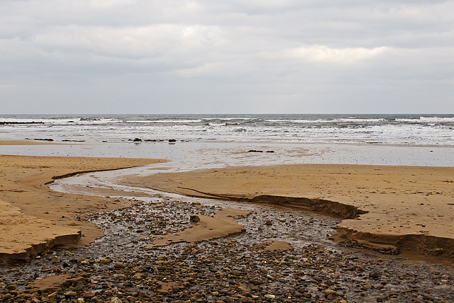
Cambo Sands boasts a wide expanse of golden sand, offering ample space for visitors to relax, play, and enjoy various activities. The beach is backed by rolling sand dunes, providing a natural barrier from the wind and creating a sense of tranquility. The dunes also offer fantastic opportunities for exploration and sandboarding.

The beach itself is known for its cleanliness and pristine condition, making it a popular destination for families and nature enthusiasts alike. Its crystal-clear waters are ideal for swimming, and lifeguards are present during the summer months to ensure the safety of beachgoers.

For those interested in wildlife, Cambo Sands offers a wealth of natural beauty. The beach is home to a variety of bird species, including oystercatchers and terns, and seals can often be spotted lounging on the nearby rocks.

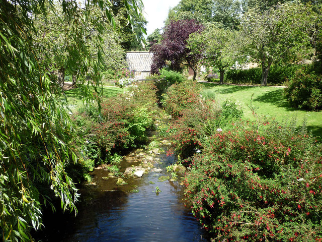
In addition to its natural wonders, Cambo Sands is also located near the Cambo Estate and Gardens, which offers visitors the opportunity to explore beautiful woodlands and stunning gardens, making it a great destination for a day out in nature.

Overall, Cambo Sands is a magnificent beach that offers stunning views, a peaceful atmosphere, and a range of activities for all to enjoy.

If you have any feedback on the listing, please let us know in the comments section below.

Cambo Sands Images

Images are sourced within 2km of 56.300302/-2.6403298 or Grid Reference NO6012. Thanks to Geograph Open Source API. All images are credited.

Sand Martin nests There is a distinct stratum of softer sand in the bank at the top of the beach. Sand Martins have made their nests there.
Sand Martin nests
There is a distinct stratum of softer sand in the bank at the top of the beach. Sand Martins have made their nests there.
Fife coastal path North from this point the coastal path runs along the edge of Kingsbarns Golf Links.
Fife coastal path
North from this point the coastal path runs along the edge of Kingsbarns Golf Links.
Kingsbarns Harbour The remains of the former harbour at Kingsbarns, on the East coast of Fife, are clearly visible. Records exist of a harbour in this location as early as the 16th century. The harbour has not been used for at least a hundred years.
Kingsbarns Harbour
The remains of the former harbour at Kingsbarns, on the East coast of Fife, are clearly visible. Records exist of a harbour in this location as early as the 16th century. The harbour has not been used for at least a hundred years.
Milestone, Cambo The milestone stands beside the A917.  

Milestones are the original roadside heritage features with many dating back hundreds of years and these historic items are under threat from highway developments.
Milestone, Cambo
The milestone stands beside the A917. Milestones are the original roadside heritage features with many dating back hundreds of years and these historic items are under threat from highway developments.
Milestone and bench mark, Cambo The milestone stands beside the A917 and it has an Ordnance Survey bench mark on it.  For a wider view of the milestone <a href="https://www.geograph.org.uk/photo/2776313">NO6010 : Milestone, Cambo</a> and for further information on the cut mark and others in the area <span class="nowrap"><a title="http://www.bench-marks.org.uk/bm38082" rel="nofollow ugc noopener" href="http://www.bench-marks.org.uk/bm38082">Link</a><img style="margin-left:2px;" alt="External link" title="External link - shift click to open in new window" src="https://s1.geograph.org.uk/img/external.png" width="10" height="10"/></span>
Milestone and bench mark, Cambo
The milestone stands beside the A917 and it has an Ordnance Survey bench mark on it. For a wider view of the milestone NO6010 : Milestone, Cambo and for further information on the cut mark and others in the area LinkExternal link
Milestone, Cambo Milestones did not come into general use until the Turnpike Act of 1766 made them compulsory on turnpike roads, these roads were built by private enterprise under licence from the Government and maintained by tolls on those who used them.  Before this Act milestones were put up occasionally, often as charitable acts and commemorations.   Many Turnpike Act stones still exist.  They are usually 2-3 ft high, with the initial letter or abbreviation of the nearest market town shown on two faces, and the distance from it.
Milestone, Cambo
Milestones did not come into general use until the Turnpike Act of 1766 made them compulsory on turnpike roads, these roads were built by private enterprise under licence from the Government and maintained by tolls on those who used them. Before this Act milestones were put up occasionally, often as charitable acts and commemorations. Many Turnpike Act stones still exist. They are usually 2-3 ft high, with the initial letter or abbreviation of the nearest market town shown on two faces, and the distance from it.
Golf links near Cambo Ness Kingsbarns golf course near Cambo Ness, viewed from the Fife coastal path.
Golf links near Cambo Ness
Kingsbarns golf course near Cambo Ness, viewed from the Fife coastal path.
Cambo Sands Cambo Sands, viewed along the course of a small burn (not marked on 1:50000 mapping) that flows for only 500 metres before merging with the North Sea.
Cambo Sands
Cambo Sands, viewed along the course of a small burn (not marked on 1:50000 mapping) that flows for only 500 metres before merging with the North Sea.
East Newhall farm Abandoned and falling apart, yet there is planning permission for conversion of these buildings into a micro-distillery for single malt whisky.
East Newhall farm
Abandoned and falling apart, yet there is planning permission for conversion of these buildings into a micro-distillery for single malt whisky.
East Newhall farm Seen from the west. The central tower, which makes this abandoned farm look rather like a small castle, was originally a doocot around which the steading was built.
East Newhall farm
Seen from the west. The central tower, which makes this abandoned farm look rather like a small castle, was originally a doocot around which the steading was built.
The Cambo burn flowing into the North Sea
The Fife Coastal Path With Cambo Ness in the background.
The Fife Coastal Path
With Cambo Ness in the background.
Cambo snowdrops The gardens at Cambo Estate are famed for their springtime shows of snowdrops.
Cambo snowdrops
The gardens at Cambo Estate are famed for their springtime shows of snowdrops.
Stone wall and snowdrops A secluded corner of Cambo estate.
Stone wall and snowdrops
A secluded corner of Cambo estate.
Cambo Walled Garden Whatever you look for in gardens, you are sure to find it in this iconic Victorian walled garden with a modern twist  -  inspirational planting schemes designed by Head Gardener, Elliott Forsyth, unusual plants (to see and buy), somewhere beautiful to while away an hour or two, an all seasons plantsman’s paradise,  woodland walks by a sparkling burn leading to the sea.
Cambo Walled Garden
Whatever you look for in gardens, you are sure to find it in this iconic Victorian walled garden with a modern twist - inspirational planting schemes designed by Head Gardener, Elliott Forsyth, unusual plants (to see and buy), somewhere beautiful to while away an hour or two, an all seasons plantsman’s paradise, woodland walks by a sparkling burn leading to the sea.
Oilseed Rape in field near Kingsbarns Seen from Cambo Gardens and looking out to sea. The word "rape" as applied to oilseed crops is derived from the Latin word rapum that means turnip. Today turnip rapes and the similar but more common swede rapes are grown for their oil and are widely recognised by their bright yellow flowers that can be seen from late April onwards.
Oilseed Rape in field near Kingsbarns
Seen from Cambo Gardens and looking out to sea. The word "rape" as applied to oilseed crops is derived from the Latin word rapum that means turnip. Today turnip rapes and the similar but more common swede rapes are grown for their oil and are widely recognised by their bright yellow flowers that can be seen from late April onwards.
Cambo Gardens Cambo Burn runs through the gardens
Cambo Gardens
Cambo Burn runs through the gardens
Fairies at the bottom of the garden At Cambo House it looks as though they may even have angels at the bottom of their garden. This is part of their annual 'Snowdrops by Starlight' display in Cambo Estate.
Fairies at the bottom of the garden
At Cambo House it looks as though they may even have angels at the bottom of their garden. This is part of their annual 'Snowdrops by Starlight' display in Cambo Estate.
Show me another place!

Cambo Sands is located at Grid Ref: NO6012 (Lat: 56.300302, Lng: -2.6403298)

Unitary Authority: Fife

Police Authority: Fife

What 3 Words

///roughness.scorecard.staple. Near Crail, Fife

Related Wikis

2017 Women's British Open

The 2017 Ricoh Women's British Open was played 3–6 August in Scotland at Kingsbarns Golf Links in Fife. It was the 41st Women's British Open, the 17th...

Kingsbarns Golf Links

Kingsbarns Golf Links is a seaside Scottish links golf course along 1.8 miles of shoreline near St Andrews, Scotland. It opened in 2000 and has been rated...
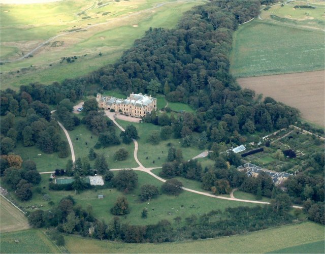
Cambo Estate

Cambo Estate lies close to the village of Kingsbarns in north-east Fife, Scotland. It is within the East Neuk, 10 kilometres (6.2 mi) south-east of St...

Kingsbarns

Kingsbarns is a village and parish in Scotland lies near the eastern coast of Fife, in an area known as the East Neuk, 6.5 miles (10.5 km) southeast of...

Nearby Amenities

Located within 500m of 56.300302,-2.6403298
Covered: no
Leisure: picnic_table
Lat/Long: 56.3035518/-2.6454649
Crossing
Crossing: unmarked
Crossing Island: no
Kerb: lowered
Tactile Paving: no
Lat/Long: 56.3022401/-2.6462636
Fast Food
The Cheesy Toast Shack
Drive Through: no
Lat/Long: 56.3032906/-2.6455338
Golf: pin
Lat/Long: 56.3024438/-2.6470433
Golf: pin
Lat/Long: 56.3017313/-2.646492
Golf: pin
Lat/Long: 56.2994882/-2.6432857
Golf: pin
Lat/Long: 56.2969582/-2.6390133
Golf: pin
Lat/Long: 56.2967978/-2.6359642
Golf: pin
Lat/Long: 56.2980054/-2.6449995
Golf: pin
Lat/Long: 56.2964031/-2.6416476
Golf: pin
Lat/Long: 56.2972783/-2.6348143
Golf: pin
Lat/Long: 56.2991966/-2.6425775
Golf: pin
Lat/Long: 56.3023262/-2.6444567
Golf: pin
Lat/Long: 56.2986201/-2.6446819
Covered: no
Leisure: picnic_table
Lat/Long: 56.3035121/-2.6456341
Covered: no
Leisure: picnic_table
Lat/Long: 56.3034274/-2.6455692
Information: board
Tourism: information
Lat/Long: 56.30315/-2.6449417
Information: map
Operator: Fife Coast and Countryside Trust
Tourism: information
Lat/Long: 56.3031341/-2.6448852
The data included in this document is from www.openstreetmap.org. The data is made available under ODbL.

Have you been to Cambo Sands?

Leave your review of Cambo Sands below (or comments, questions and feedback).