Weddel

Beach in Orkney

Scotland

Weddel

Moorland track, Flotta, Orkney Looking towards Switha.

The track was probably formerly used to access peat cutting areas.
Moorland track, Flotta, Orkney Credit: Claire Pegrum

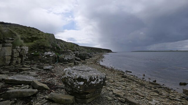
Weddel, Orkney (Beach) is a picturesque coastal area located in Orkney, Scotland. Situated on the eastern coast of Mainland Orkney, it offers stunning views of the North Sea and is renowned for its natural beauty and tranquility.

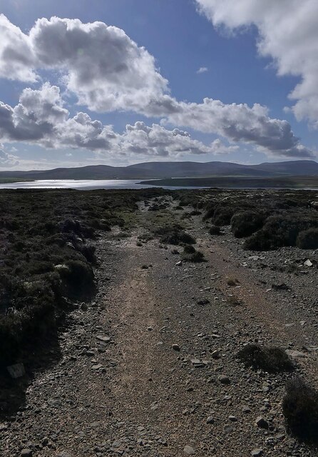
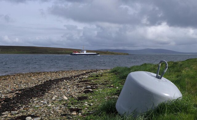
The beach features a long stretch of golden sand, making it an ideal spot for leisurely walks and sunbathing during the warmer months. The crystal-clear waters of the North Sea provide an excellent opportunity for swimming and water activities, although caution is advised due to the chilly temperatures.

The surrounding landscape is dominated by rugged cliffs, creating a dramatic backdrop for the beach. Visitors can enjoy breathtaking panoramic views of the coastline from the top of these cliffs, making it a popular spot for photographers and nature enthusiasts.

In addition to its natural beauty, Weddel beach is also home to a diverse range of wildlife. Seals and seabirds can often be spotted in the area, adding to the charm and allure of the beach.

Facilities at Weddel, Orkney (Beach) are limited but adequate. There is a small parking area nearby, allowing visitors to easily access the beach. However, it is recommended to bring food and drinks as there are no nearby cafes or restaurants. Public toilets are available for convenience.

Overall, Weddel, Orkney (Beach) offers a serene and picturesque coastal experience, providing visitors with a chance to relax, unwind, and immerse themselves in the natural beauty of Scotland's Orkney Islands.

If you have any feedback on the listing, please let us know in the comments section below.

Weddel Images

Images are sourced within 2km of 58.823697/-3.1447905 or Grid Reference ND3393. Thanks to Geograph Open Source API. All images are credited.

Moorland track, Flotta, Orkney Looking towards Switha.

The track was probably formerly used to access peat cutting areas.
Moorland track, Flotta, Orkney
Looking towards Switha. The track was probably formerly used to access peat cutting areas.
Triangulation pillar, West Hill, Flotta, Orkney The high ground to the left is on Hoy and the island to the right of centre is Cava with Orkney Mainland behind.
Triangulation pillar, West Hill, Flotta, Orkney
The high ground to the left is on Hoy and the island to the right of centre is Cava with Orkney Mainland behind.
Triangulation pillar and wind turbine, West Hill, Flotta, Orkney The wind turbine was made in Germany by Enercon, has a rated power of 2.3MW and became operational in 2010.  It is privately owned by an individual who says he will provide £100,000 to Flotta Community Council over its lifetime.
Triangulation pillar and wind turbine, West Hill, Flotta, Orkney
The wind turbine was made in Germany by Enercon, has a rated power of 2.3MW and became operational in 2010. It is privately owned by an individual who says he will provide £100,000 to Flotta Community Council over its lifetime.
Moorland track, Flotta, Orkney Looking towards Fara and Hoy beyond.

The track was probably formerly used to access peat cutting areas.
Moorland track, Flotta, Orkney
Looking towards Fara and Hoy beyond. The track was probably formerly used to access peat cutting areas.
Pier, Flotta, Orkney The ferry being loaded is the Hoy Head.  Since John submitted a similar Geograph eight years ago, <a href="https://www.geograph.org.uk/photo/4009684">ND3495 : Unloading at Flotta from the ferry 'Hoy Head'</a>, a new ferry waiting room has been built which can be seen in the distance just below the raised bow.
Pier, Flotta, Orkney
The ferry being loaded is the Hoy Head. Since John submitted a similar Geograph eight years ago, ND3495 : Unloading at Flotta from the ferry 'Hoy Head', a new ferry waiting room has been built which can be seen in the distance just below the raised bow.
Oystercatcher sculpture, Flotta, Orkney The oystercatchers are enjoying the view across Weddel Sound to Fara.

Since Matthew visited 14 years ago, <a href="https://www.geograph.org.uk/photo/882445">ND3494 : Oystercatchers on Flotta</a>, the chick has stopped riding its scooter and taken up the bagpipes.

This is one of several sculptures made of recycled materials which can be found on Flotta. See also <a href="https://www.geograph.org.uk/photo/7198657">ND3693 : Penny farthing sculpture, Flotta, Orkney</a> and <a href="https://www.geograph.org.uk/photo/1864035">ND3793 : Doodlebug</a>.
Oystercatcher sculpture, Flotta, Orkney
The oystercatchers are enjoying the view across Weddel Sound to Fara. Since Matthew visited 14 years ago, ND3494 : Oystercatchers on Flotta, the chick has stopped riding its scooter and taken up the bagpipes. This is one of several sculptures made of recycled materials which can be found on Flotta. See also ND3693 : Penny farthing sculpture, Flotta, Orkney and ND3793 : Doodlebug.
Weddel Sound, Flotta, Orkney Weddel Sound is the stretch of water between Flotta and Fara, an uninhabited island.  The ferry is Orkney Ferries' Hoy Head travelling between Hoy and Houton via Flotta.
Weddel Sound, Flotta, Orkney
Weddel Sound is the stretch of water between Flotta and Fara, an uninhabited island. The ferry is Orkney Ferries' Hoy Head travelling between Hoy and Houton via Flotta.
Coastline, Flotta, Orkney Looking across Weddel Sound towards Fara and the Hoy hills beyond.
Coastline, Flotta, Orkney
Looking across Weddel Sound towards Fara and the Hoy hills beyond.
Coastline, Flotta, Orkney Looking across Weddel Sound towards Fara and the Hoy hills beyond.
Coastline, Flotta, Orkney
Looking across Weddel Sound towards Fara and the Hoy hills beyond.
Subsea utility warning signs, Flotta, Orkney The signs warn of the subsea water main and electricity cable which run between Hoy and Flotta.
Subsea utility warning signs, Flotta, Orkney
The signs warn of the subsea water main and electricity cable which run between Hoy and Flotta.
Coastline, Flotta, Orkney Looking towards Ruff of Cantick on South Walls.
Coastline, Flotta, Orkney
Looking towards Ruff of Cantick on South Walls.
Barrage balloon mooring block and ring, Wharth, Flotta, Orkney This was one of many barrage balloon sites which protected the Scapa Flow naval anchorage during WWII.  The presence of barrage balloons meant enemy aircraft had to fly higher than they would have done otherwise and reduced the accuracy of their bombing.  The Orkney barrage balloons were operated and maintained by the specially formed 950 Squadron of the RAF which was based at Lyness on Hoy.
Barrage balloon mooring block and ring, Wharth, Flotta, Orkney
This was one of many barrage balloon sites which protected the Scapa Flow naval anchorage during WWII. The presence of barrage balloons meant enemy aircraft had to fly higher than they would have done otherwise and reduced the accuracy of their bombing. The Orkney barrage balloons were operated and maintained by the specially formed 950 Squadron of the RAF which was based at Lyness on Hoy.
Flotta roll-on roll-off Ferry arrives at the slip
Flotta roll-on roll-off
Ferry arrives at the slip
Flotta 2007, aerial With Hoy and South Walls underneath, and Switha to the right.
Flotta 2007, aerial
With Hoy and South Walls underneath, and Switha to the right.
Flotta oil terminal 2007, aerial
On board ferry from Houton to Lyness - view to Fara
Flotta; B9045 leading down to ferry terminal
Show me another place!

Weddel is located at Grid Ref: ND3393 (Lat: 58.823697, Lng: -3.1447905)

Unitary Authority: Orkney Islands

Police Authority: Highlands and Islands

What 3 Words

///sensibly.left.objective. Near Lyness, Orkney Islands

Nearby Locations

Weddel

Related Wikis

Crockness Martello tower

Crockness Martello Tower is a Martello Tower on Hoy, Orkney, Scotland. It was built during the Napoleonic Wars, at the same time as the Martello Tower...

Flotta

Flotta () is a small island in Orkney, Scotland, lying in Scapa Flow. The island is known for its large oil terminal and is linked by Orkney Ferries to...

Hackness Martello Tower and Battery

Hackness Martello Tower and Battery is a British Army barracks and museum located on the island of South Walls, in Orkney, Scotland. == History == The...

Fara, Orkney

Fara (, Old Norse: Færey ) is a small island in Orkney, Scotland, lying in Scapa Flow between the islands of Flotta and Hoy. It has been uninhabited since...

Nearby Amenities

Located within 500m of 58.823697,-3.1447905
Passing Place
Source: Bing
Lat/Long: 58.8235981/-3.1423045
The data included in this document is from www.openstreetmap.org. The data is made available under ODbL.

Have you been to Weddel?

Leave your review of Weddel below (or comments, questions and feedback).