The Cobb

Beach in Dorset

England

The Cobb

In a twist A  fine length of rope is neatly coiled on the harbour quay on The Cobb at Lyme Regis, awaiting use by the next vessel to berth.
Spanish Eyes III (E509) is a potter, built in 2001.
In a twist Credit: Marika Reinholds

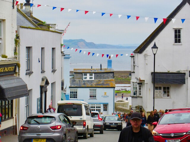
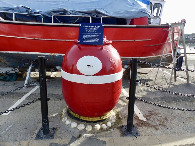
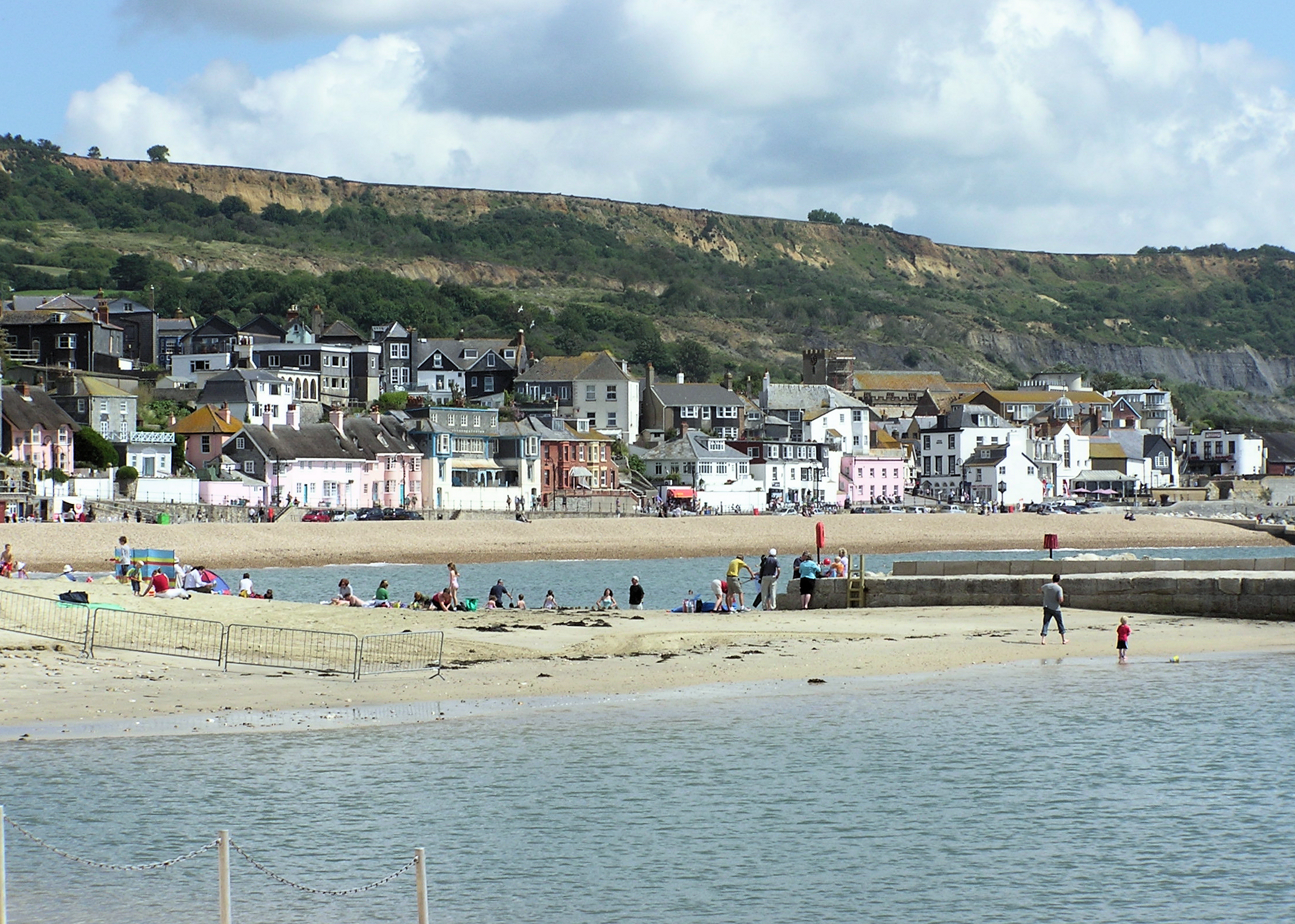
The Cobb, located in the town of Lyme Regis, Dorset, is a historic harbor wall and a popular beach destination. Spanning approximately 870 feet, it is a prominent feature of the town's coastline and has been attracting visitors for centuries.

Constructed in the 13th century, The Cobb serves as a protective barrier for the harbor against the powerful tides of the English Channel. The wall is made up of large, irregularly-shaped stones tightly packed together, giving it a unique and distinctive appearance. Over the years, it has undergone various renovations and repairs to maintain its structural integrity.

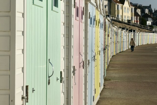
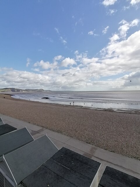
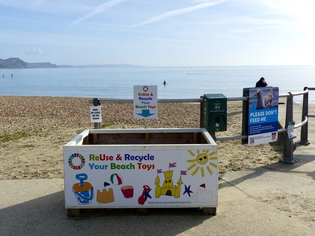
The Cobb offers visitors a picturesque setting, with stunning views of the sea and the town. The beach adjacent to The Cobb is a pebble beach, which makes it ideal for beachcombing and leisurely strolls. At low tide, visitors can explore the stretch of sandy beach that emerges, revealing fascinating rock formations and an abundance of marine life in the rock pools.

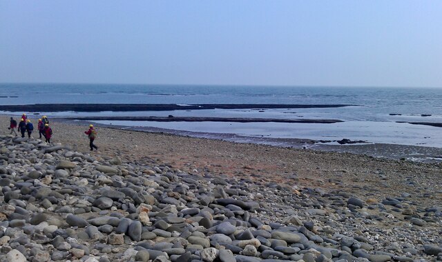
The area around The Cobb is steeped in history and has literary significance. It is famously featured in Jane Austen's novel, "Persuasion," and has been a source of inspiration for numerous artists and writers. The beach is also known for its fossil-rich cliffs, attracting fossil hunters from around the world who come in search of ammonites, belemnites, and other prehistoric treasures.

With its natural beauty, rich history, and recreational opportunities, The Cobb in Dorset is a must-visit destination for those seeking a unique coastal experience.

If you have any feedback on the listing, please let us know in the comments section below.

The Cobb Images

Images are sourced within 2km of 50.719817/-2.9378338 or Grid Reference SY3391. Thanks to Geograph Open Source API. All images are credited.

In a twist A  fine length of rope is neatly coiled on the harbour quay on The Cobb at Lyme Regis, awaiting use by the next vessel to berth.
Spanish Eyes III (E509) is a potter, built in 2001.
In a twist
A fine length of rope is neatly coiled on the harbour quay on The Cobb at Lyme Regis, awaiting use by the next vessel to berth. Spanish Eyes III (E509) is a potter, built in 2001.
Lower end of Broad Street - Lyme Regis The road turns left at the bottom into Church Street.  The town was very very crowded.  In the distance over Lyme Bay one can see Golden Cap, the highest point on the South West coast and the coastline stretching towards West Bay and Burton Bradstock and other coves on the Jurassic Coast.
Lower end of Broad Street - Lyme Regis
The road turns left at the bottom into Church Street. The town was very very crowded. In the distance over Lyme Bay one can see Golden Cap, the highest point on the South West coast and the coastline stretching towards West Bay and Burton Bradstock and other coves on the Jurassic Coast.
Riverside walk - Lyme Regis Not far from where one takes up the River Lim walk again from Coombe Street, there is a large handsome house which looks as if it may have originally been a commercial building such as some sort of mill
Riverside walk - Lyme Regis
Not far from where one takes up the River Lim walk again from Coombe Street, there is a large handsome house which looks as if it may have originally been a commercial building such as some sort of mill
The Ford, River Lim - Lyme Regis This ford is supposed to be the longest in the country.  It is situated near Jordan Flats.
The Ford, River Lim - Lyme Regis
This ford is supposed to be the longest in the country. It is situated near Jordan Flats.
Mill Green - Lyme Regis Prettily painted terraced houses winding up the hill from the river.
Mill Green - Lyme Regis
Prettily painted terraced houses winding up the hill from the river.
Monmouth Street, Lyme Regis - looking East Monmouth Street, Lyme Regis looking East towards the Church of St Michael the Archangel.
Monmouth Street, Lyme Regis - looking East
Monmouth Street, Lyme Regis looking East towards the Church of St Michael the Archangel.
Pastel beach huts Pretty beach huts line Cart Road in Lyme Regis, overlooking Lyme Bay.
The huts are available to rent via The Town Council, costing from £4.00 per day (low season) up to £1,700.00 for an annual pass (2022 rates).
Pastel beach huts
Pretty beach huts line Cart Road in Lyme Regis, overlooking Lyme Bay. The huts are available to rent via The Town Council, costing from £4.00 per day (low season) up to £1,700.00 for an annual pass (2022 rates).
Steam drifter Lydia Eva visits Lyme Regis YH89 Lydia Eva is in the harbour, by The Cobb in Lyme Regis, along with a film crew who were setting up for an evening filming session. The film being made is 'Wonka', a musical about the young Willy Wonka. It will star Timothee Chalamet, Olivia Coleman, Jim Carter, Matt Lucas and many others. It is due for release in 2023.
The Lydia Eva is the last surviving steam drifter from the herring fishing fleet based in Great Yarmouth in Norfolk.
Steam drifter Lydia Eva visits Lyme Regis
YH89 Lydia Eva is in the harbour, by The Cobb in Lyme Regis, along with a film crew who were setting up for an evening filming session. The film being made is 'Wonka', a musical about the young Willy Wonka. It will star Timothee Chalamet, Olivia Coleman, Jim Carter, Matt Lucas and many others. It is due for release in 2023. The Lydia Eva is the last surviving steam drifter from the herring fishing fleet based in Great Yarmouth in Norfolk.
Lyme Regis beach Lyme Regis beach on this peaceful Tuesday afternoon
Lyme Regis beach
Lyme Regis beach on this peaceful Tuesday afternoon
The Cobb (Lyme Regis) The Cobb in Lyme Regis on this peaceful Tuesday afternoon
The Cobb (Lyme Regis)
The Cobb in Lyme Regis on this peaceful Tuesday afternoon
Lyme Regis town centre Lyme Regis town centre on this peaceful Tuesday afternoon
Lyme Regis town centre
Lyme Regis town centre on this peaceful Tuesday afternoon
A juggling hare The sculpture is one of ten, which make up the sculpture trail through the Langmoor and Lister gardens in Lyme Regis. The sculpture is by Clare Trenchard.  See link for more information about the sculptures on display.
<span class="nowrap"><a title="https://lovelymeregis.co.uk/thingstodo/lyme_regis_sculpture_trail" rel="nofollow ugc noopener" href="https://lovelymeregis.co.uk/thingstodo/lyme_regis_sculpture_trail">Link</a><img style="margin-left:2px;" alt="External link" title="External link - shift click to open in new window" src="https://s1.geograph.org.uk/img/external.png" width="10" height="10"/></span>
A juggling hare
The sculpture is one of ten, which make up the sculpture trail through the Langmoor and Lister gardens in Lyme Regis. The sculpture is by Clare Trenchard. See link for more information about the sculptures on display. LinkExternal link
Monmouth Beach, Lyme Regis The South West Coast Path National Trail - 630 miles of superb coastal walking. From Minehead on the edge of the Exmoor National Park to the shores of Poole Harbour in Dorset. It is the longest of all Britain's National Trails.
Website: <span class="nowrap"><a title="http://www.southwestcoastpath.com/" rel="nofollow ugc noopener" href="http://www.southwestcoastpath.com/">Link</a><img style="margin-left:2px;" alt="External link" title="External link - shift click to open in new window" src="https://s1.geograph.org.uk/img/external.png" width="10" height="10"/></span>
Monmouth Beach, Lyme Regis
The South West Coast Path National Trail - 630 miles of superb coastal walking. From Minehead on the edge of the Exmoor National Park to the shores of Poole Harbour in Dorset. It is the longest of all Britain's National Trails. Website: LinkExternal link
Sea Mine collection box in Lyme Regis A sea mine from the Second World War is now a collection box. The Shipwrecked Mariners' Society provides financial support and practical assistance to merchant seafarers, fisherfolk and their dependants.

The sea mines were used to defend the British coast and harbours during the war. After the war, approximately 200 mine casings were donated to the society by the Admiralty for use as collection boxes. 60 of these currently survive at seaside towns around the country.

The text on the blue notice above the mine says 'This old Second World War Mine is placed here as a collecting box. Your donation will help us support the dependants of those lost at sea as well as sick, disabled and retired fishermen and mariners in need'.
Sea Mine collection box in Lyme Regis
A sea mine from the Second World War is now a collection box. The Shipwrecked Mariners' Society provides financial support and practical assistance to merchant seafarers, fisherfolk and their dependants. The sea mines were used to defend the British coast and harbours during the war. After the war, approximately 200 mine casings were donated to the society by the Admiralty for use as collection boxes. 60 of these currently survive at seaside towns around the country. The text on the blue notice above the mine says 'This old Second World War Mine is placed here as a collecting box. Your donation will help us support the dependants of those lost at sea as well as sick, disabled and retired fishermen and mariners in need'.
Bucket and spade recycling A very useful collection box has appeared near the life guards hut on the seafront at Lyme Regis. There is no indication as to which organisation or group is behind  this useful initiative but text at the bottom of the box says 'original idea by Ceci, design inspired by Erin and built by Kyle' so well done to them, whoever they may be.
Bucket and spade recycling
A very useful collection box has appeared near the life guards hut on the seafront at Lyme Regis. There is no indication as to which organisation or group is behind this useful initiative but text at the bottom of the box says 'original idea by Ceci, design inspired by Erin and built by Kyle' so well done to them, whoever they may be.
Cobb Gate Car Park, Lyme Regis Right on the sea front
Cobb Gate Car Park, Lyme Regis
Right on the sea front
Path down to the sea front, Lyme Regis The way of the South West Coast Path.
Path down to the sea front, Lyme Regis
The way of the South West Coast Path.
Mary Anning statue (1) A statue of the 19th century palaeontologist Mary Anning and her dog Tray was unveiled in her home town of Lyme Regis on 21 May 2022. She often did not get the credit and recognition she deserved for her discoveries and expertise due to her gender and low social status. 

This oversight was righted by a young Lyme Regis resident who initiated, along with her mother, a crowd funding appeal which raised in excess of £100,000 to commission the statue, which was sculpted by artist Denise Dutton.

Here is a link to the Mary Anning Rocks project. <span class="nowrap"><a title="https://www.maryanningrocks.co.uk/" rel="nofollow ugc noopener" href="https://www.maryanningrocks.co.uk/">Link</a><img style="margin-left:2px;" alt="External link" title="External link - shift click to open in new window" src="https://s1.geograph.org.uk/img/external.png" width="10" height="10"/></span>
Mary Anning statue (1)
A statue of the 19th century palaeontologist Mary Anning and her dog Tray was unveiled in her home town of Lyme Regis on 21 May 2022. She often did not get the credit and recognition she deserved for her discoveries and expertise due to her gender and low social status. This oversight was righted by a young Lyme Regis resident who initiated, along with her mother, a crowd funding appeal which raised in excess of £100,000 to commission the statue, which was sculpted by artist Denise Dutton. Here is a link to the Mary Anning Rocks project. LinkExternal link
Show me another place!

The Cobb is located at Grid Ref: SY3391 (Lat: 50.719817, Lng: -2.9378338)

Unitary Authority: Dorset

Police Authority: Dorset

What 3 Words

///cage.tiger.fatherly. Near Lyme Regis, Dorset

Related Wikis

Siege of Lyme Regis

The siege of Lyme Regis was an eight-week blockade during the First English Civil War. The port of Lyme Regis, in Dorset, was considered to be of strategic...
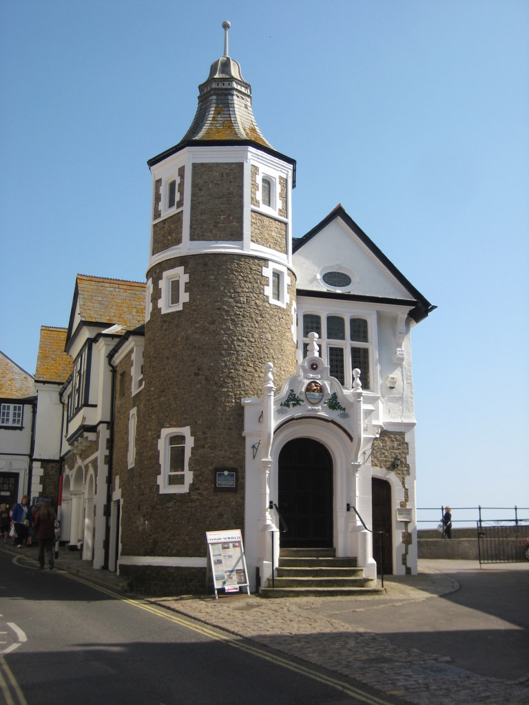
Lyme Regis

Lyme Regis is a town in west Dorset, England, 25 miles (40 km) west of Dorchester and east of Exeter. Sometimes dubbed the "Pearl of Dorset", it lies...
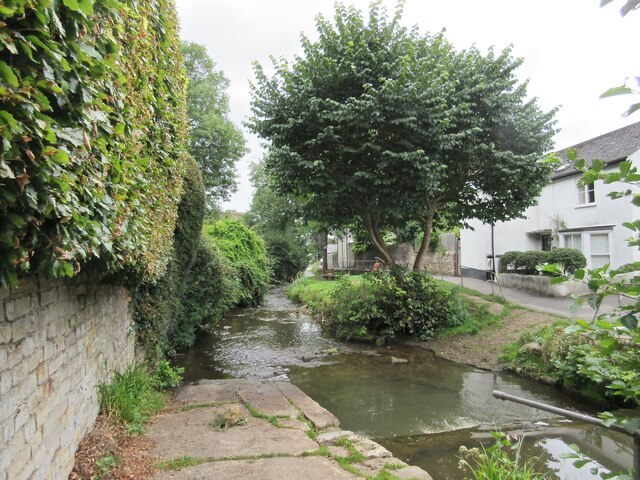
River Lym

The River Lym or River Lim is a short river, some 5 km (3.1 mi) in length, that flows through the Devon-Dorset border. It rises from multiple springs at...
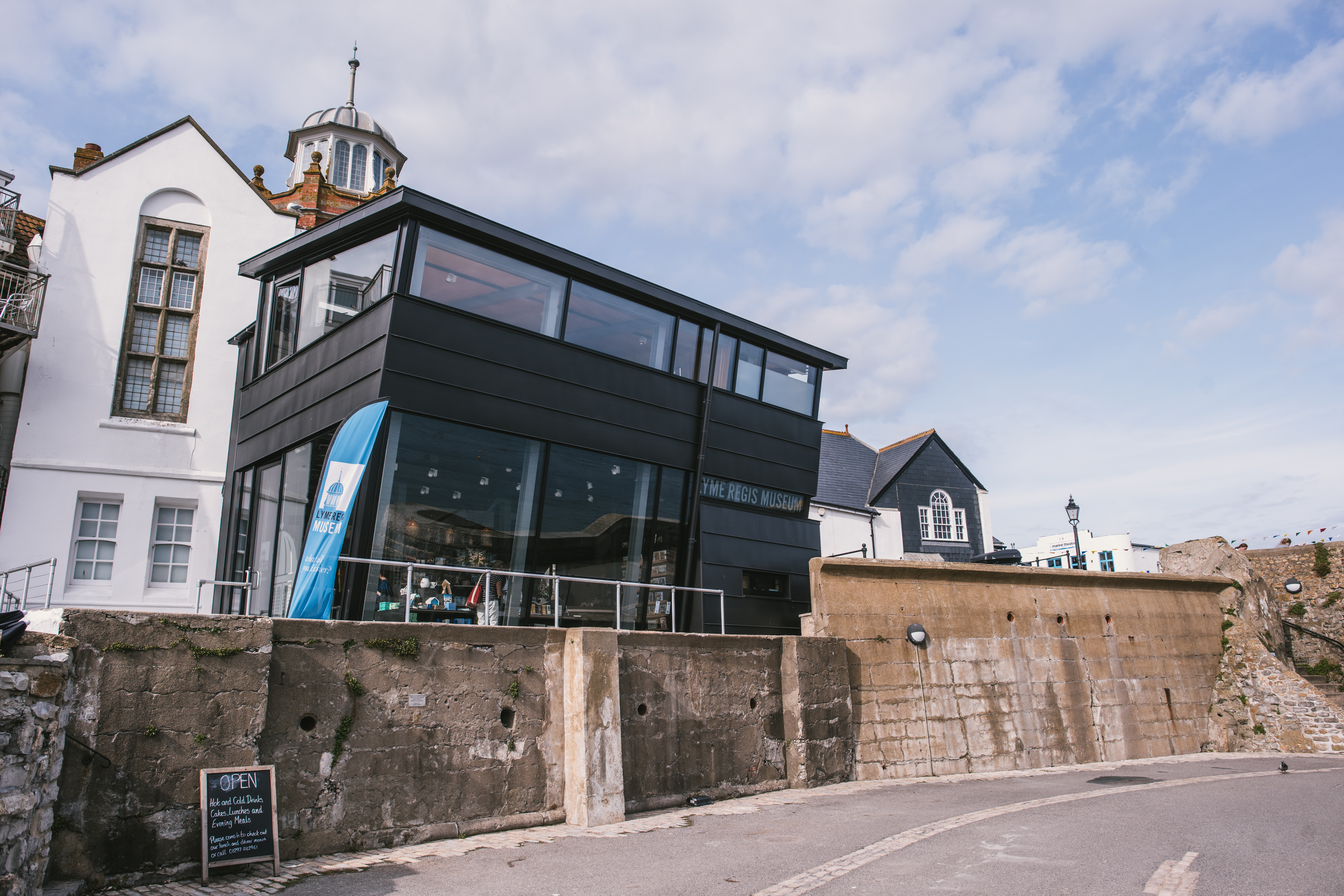
Lyme Regis Museum

Lyme Regis Philpot Museum is situated in the town of Lyme Regis on the Jurassic Coast in Dorset, England. It is a registered charity under English law...

Allhallows College

Allhallows College, previously known as Allhallows School, was a private public school for boys in Devon, in the west of England. Predominantly a boarding...

Lyme Regis Guildhall

Lyme Regis Guildhall is a municipal building in Bridge Street, Lyme Regis, Dorset, England. The building, which serves as the meeting place of Lyme Regis...

Dinosaurland Fossil Museum

Dinosaurland Fossil Museum (aka Dinosaurland) is a privately owned fossil museum in Lyme Regis, on the Jurassic Coast in Dorset, England. The museum is...

Monmouth Beach, Lyme Regis

Monmouth Beach is a pebble and rock beach stretching approximately 1 mile (1.6 km) westwards from the harbour at Lyme Regis, West Dorset to Pinhay Bay...

Nearby Amenities

Located within 500m of 50.719817,-2.9378338
Source: PGS
Lat/Long: 50.7193115/-2.9416442
Source: PGS
Lat/Long: 50.7196307/-2.9397252
Source: PGS
Lat/Long: 50.7209508/-2.937324
Source: PGS
Lat/Long: 50.7213008/-2.9375468
Bay Hotel
Tourism: hotel
Lat/Long: 50.7237084/-2.9359779
Restaurant
Harry's
Lat/Long: 50.7216414/-2.9386175
Cafe
Jane's cafe
Food: yes
Lat/Long: 50.7217161/-2.9386417
Leisure: slipway
Seamark Small Craft Facility Category: slipway
Seamark Type: small_craft_facility
Lat/Long: 50.7207007/-2.9384973
Barrier: kissing_gate
Lat/Long: 50.7216849/-2.9431447
Turning Circle
Lat/Long: 50.7236919/-2.9354629
Source: PGS
Lat/Long: 50.7196307/-2.9391903
Source: PGS
Lat/Long: 50.7211987/-2.9378259
Source: PGS
Lat/Long: 50.7217514/-2.9378354
Source: PGS
Lat/Long: 50.7219418/-2.9377604
Source: PGS
Lat/Long: 50.7221114/-2.9376575
Source: PGS
Lat/Long: 50.7225914/-2.937104
Source: PGS
Lat/Long: 50.7227163/-2.936946
Source: PGS
Lat/Long: 50.7231613/-2.9362353
Source: PGS
Lat/Long: 50.7236209/-2.9348133
Bench
Lat/Long: 50.7210704/-2.9416705
Tourism: picnic_site
Lat/Long: 50.7233116/-2.9420371
Defibrillator
Emergency: defibrillator
Indoor: no
Opening Hours: 24/7
Ref GB The Circuit: 4A9F4F1A-D06F-488D-89B7-AD9F0117734F
Lat/Long: 50.7196187/-2.9369112
Defibrillator
Brand: HeartSafe
Check Date: 2024-04-02
Defibrillator Location: Performance Area, Jubilee Pavilion (side wall), Marine Parade
Emergency: defibrillator
Indoor: no
Postal Code: DT7 3JE
Ref: 1052
Ref GB The Circuit: 30CBA24B-BAB6-4DEA-A4E5-AD9500F4AC75
Lat/Long: 50.7233637/-2.9368276
Seamark Light Category: rear
Seamark Light Character: F
Seamark Light Colour: green
Seamark Light Height: 8
Seamark Light Range: 9
Seamark Light Reference: A 0284.1
Seamark Type: light_minor
Source: US NGA Pub. 114. 2015
Lat/Long: 50.7203364/-2.9388914
Historic: cannon
Lat/Long: 50.7205747/-2.9371437
Historic: cannon
Lat/Long: 50.7203862/-2.9369814
Historic: cannon
Lat/Long: 50.720213/-2.9368111
Seamark Rock Water Level: covers
Seamark Type: rock
Lat/Long: 50.7183423/-2.937153
Seamark Rock Water Level: covers
Seamark Type: rock
Lat/Long: 50.7180604/-2.9377914
Seamark Rock Water Level: covers
Seamark Type: rock
Lat/Long: 50.7187295/-2.9367614
Seamark Rock Water Level: covers
Seamark Type: rock
Lat/Long: 50.7183423/-2.937153
Seamark Rock Water Level: covers
Seamark Type: rock
Lat/Long: 50.7180604/-2.9377914
Seamark Rock Water Level: covers
Seamark Type: rock
Lat/Long: 50.7187295/-2.9367614
Seamark Light 1 Category: front
Seamark Light 1 Character: Oc
Seamark Light 1 Colour: white
Seamark Light 1 Height: 6
Seamark Light 1 Period: 8
Seamark Light 1 Range: 9
Seamark Light 1 Sector End: 284
Seamark Light 1 Sector Start: 104
Seamark Light 2 Category: front
Seamark Light 2 Character: Oc
Seamark Light 2 Colour: red
Seamark Light 2 Height: 6
Seamark Light 2 Period: 8
Seamark Light 2 Range: 7
Seamark Light 2 Sector End: 104
Seamark Light 2 Sector Start: 284
Seamark Light Reference: A 0284
Seamark Name: Lyme Regis Range
Seamark Type: light_major
Source: US NGA Pub. 114. (2020)
Lat/Long: 50.7198833/-2.9361833
Bar
Ocean View Bar and Restaurant
Addr City: Lyme Regis
Addr Housename: The Bay Apartments
Addr Postcode: DT7 3JQ
Addr Street: Marine Parade
Fhrs Id: 995723
Source Addr: FSA Food Hygiene Rating Scheme open data
Lat/Long: 50.7237238/-2.9359826
Life Ring
Emergency: life_ring
Lat/Long: 50.7198027/-2.9364891
Life Ring
Emergency: life_ring
Lat/Long: 50.7201228/-2.9367071
Waste Basket
Lat/Long: 50.7192508/-2.9373837
Life Ring
Emergency: life_ring
Lat/Long: 50.7198031/-2.9367569
Bench
Backrest: yes
Check Date: 2024-04-02
Material: wood
Lat/Long: 50.7203612/-2.9388833
Access: private
Barrier: chain
Lat/Long: 50.7203415/-2.9395467
Waste Basket
Check Date: 2024-04-02
Lat/Long: 50.723645/-2.93548
Life Ring
Check Date: 2024-04-02
Emergency: life_ring
Lat/Long: 50.7236348/-2.93549
Playground: trampoline
Lat/Long: 50.7225969/-2.937573
Bench
Backrest: yes
Check Date: 2024-04-02
Material: wood
Lat/Long: 50.7203391/-2.9388685
Bench
Backrest: yes
Check Date: 2024-04-02
Material: wood
Lat/Long: 50.720312/-2.9388592
RNLI
Description: Gift shop in the lifeboat station
Operator: Royal National Lifeboat Institution
Shop: gift
Lat/Long: 50.7204786/-2.9390225
Fire Hydrant
Emergency: fire_hydrant
Fire Hydrant Type: underground
Lat/Long: 50.72353/-2.9363617
Elevator
Description: "Lift to upper level only"
Lat/Long: 50.7235831/-2.9363517
Clock
Display: analog
Note: A plaque next to it states "This clock was erected by public subscription to the memory of those associated with this town who laid down their lives in the 1939-1945 war"
Support: wall_mounted
Lat/Long: 50.7232952/-2.9369228
Ice Cream
The Ice Cream Place
Lat/Long: 50.7213757/-2.9386595
Cafe
The Old Bonded Store
Cuisine: sandwich;tea;cake;local;coffee_shop
Lat/Long: 50.7211345/-2.9392528
Addr Street: Marine Parade
Shop: books
Lat/Long: 50.7210848/-2.9392767
Motorcycle Parking
Lat/Long: 50.7200293/-2.9401338
Generator Method: photovoltaic
Generator Output Electricity: yes
Generator Source: solar
Generator Type: solar_photovoltaic_panel
Location: roof
Power: generator
Lat/Long: 50.7211642/-2.9389373
Generator Method: photovoltaic
Generator Output Electricity: yes
Generator Source: solar
Generator Type: solar_photovoltaic_panel
Location: roof
Power: generator
Lat/Long: 50.7211676/-2.9390392
Generator Method: photovoltaic
Generator Output Electricity: yes
Generator Source: solar
Generator Type: solar_photovoltaic_panel
Location: roof
Power: generator
Lat/Long: 50.722127/-2.9392913
Generator Method: photovoltaic
Generator Output Electricity: yes
Generator Source: solar
Generator Type: solar_photovoltaic_panel
Location: roof
Power: generator
Lat/Long: 50.7227756/-2.9410281
Generator Method: photovoltaic
Generator Output Electricity: yes
Generator Source: solar
Generator Type: solar_photovoltaic_panel
Location: roof
Power: generator
Lat/Long: 50.7227892/-2.9406445
Generator Method: photovoltaic
Generator Output Electricity: yes
Generator Source: solar
Generator Type: solar_photovoltaic_panel
Location: roof
Power: generator
Lat/Long: 50.7223155/-2.9415229
Generator Method: photovoltaic
Generator Output Electricity: yes
Generator Source: solar
Generator Type: solar_photovoltaic_panel
Location: roof
Power: generator
Lat/Long: 50.7222722/-2.9421023
Generator Method: photovoltaic
Generator Output Electricity: yes
Generator Source: solar
Generator Type: solar_photovoltaic_panel
Location: roof
Power: generator
Lat/Long: 50.7222781/-2.9421466
Generator Method: photovoltaic
Generator Output Electricity: yes
Generator Source: solar
Generator Type: solar_photovoltaic_panel
Location: roof
Power: generator
Lat/Long: 50.7220243/-2.9423886
Direction: SSE
Generator Method: photovoltaic
Generator Output Electricity: yes
Generator Solar Modules: 12
Generator Source: solar
Generator Type: solar_photovoltaic_panel
Location: roof
Power: generator
Lat/Long: 50.722772/-2.9410365
Direction: 125
Generator Method: photovoltaic
Generator Output Electricity: yes
Generator Solar Modules: 12
Generator Source: solar
Generator Type: solar_photovoltaic_panel
Location: roof
Power: generator
Lat/Long: 50.7221185/-2.9393142
Direction: ESE
Generator Method: photovoltaic
Generator Output Electricity: yes
Generator Solar Modules: 6
Generator Source: solar
Generator Type: solar_photovoltaic_panel
Location: roof
Power: generator
Lat/Long: 50.7211695/-2.9390399
Direction: SSW
Generator Method: photovoltaic
Generator Output Electricity: yes
Generator Solar Modules: 15
Generator Source: solar
Generator Type: solar_photovoltaic_panel
Location: roof
Power: generator
Lat/Long: 50.7211691/-2.9389333
Seamark Beacon Lateral Category: port
Seamark Beacon Lateral Colour: red
Seamark Beacon Lateral Shape: stake
Seamark Beacon Lateral System: iala-a
Seamark Source: webcam
Seamark Topmark Colour: red
Seamark Topmark Shape: cylinder
Seamark Type: beacon_lateral
Lat/Long: 50.7215802/-2.9369833
Seamark Beacon Lateral Category: port
Seamark Beacon Lateral Colour: red
Seamark Beacon Lateral Shape: stake
Seamark Beacon Lateral System: iala-a
Seamark Source: webcam
Seamark Topmark Colour: red
Seamark Topmark Shape: cylinder
Seamark Type: beacon_lateral
Lat/Long: 50.7191481/-2.9343112
Yes
Barrier: chain
Emergency: yes
Lat/Long: 50.7204537/-2.9388225
Post Box
Collection Times: Mo-Fr 09:00; Sa 07:00
Operator: Royal Mail
Operator Wikidata: Q638098
Post Box Type: pillar
Ref: DT7 31D
Ref GB Uprn: 10015335613
Royal Cypher: EIIR
Royal Cypher Wikidata: Q33102113
Lat/Long: 50.7208241/-2.9393721
Admiral Sir George Somers
Historic: monument
Lat/Long: 50.7232425/-2.9377545
Waste Basket
Survey Date: 2023-04-29
Lat/Long: 50.7202315/-2.9388259
Fire Hydrant
Emergency: fire_hydrant
Fire Hydrant Type: underground
Survey Date: 2023-04-29
Lat/Long: 50.7221545/-2.9402962
Life Ring
Emergency: life_ring
Survey Date: 2023-04-29
Lat/Long: 50.719952/-2.9387299
Life Ring
Emergency: life_ring
Survey Date: 2023-04-29
Lat/Long: 50.7204137/-2.9388208
Defibrillator
Defibrillator Location: On the wall of the lifeboat building
Emergency: defibrillator
Indoor: no
Ref GB The Circuit: F78F4CF7-4564-439C-BD2E-AD9F0121E17A
Survey Date: 2023-04-29
Lat/Long: 50.7204332/-2.9389163
Waste Basket
Survey Date: 2023-04-29
Lat/Long: 50.7237678/-2.9402486
Fire Hydrant
Emergency: fire_hydrant
Fire Hydrant Type: underground
Survey Date: 2023-04-29
Lat/Long: 50.7215091/-2.9401466
The data included in this document is from www.openstreetmap.org. The data is made available under ODbL.

Have you been to The Cobb?

Leave your review of The Cobb below (or comments, questions and feedback).