Gutterby Spa

Beach in Cumberland Copeland

England

Gutterby Spa

Track to Gutterby from beach This track cuts into the dunes in the top right of the grid square  and is clearly identifiable and indeed is part of the Cumbria Coastal Way!
Track to Gutterby from beach Credit: Simon Pudsey

Gutterby Spa, located in Cumberland, is a stunning beach renowned for its natural beauty and tranquil atmosphere. Situated on the northwest coast of England, this hidden gem attracts visitors with its picturesque surroundings and pristine sandy shores.

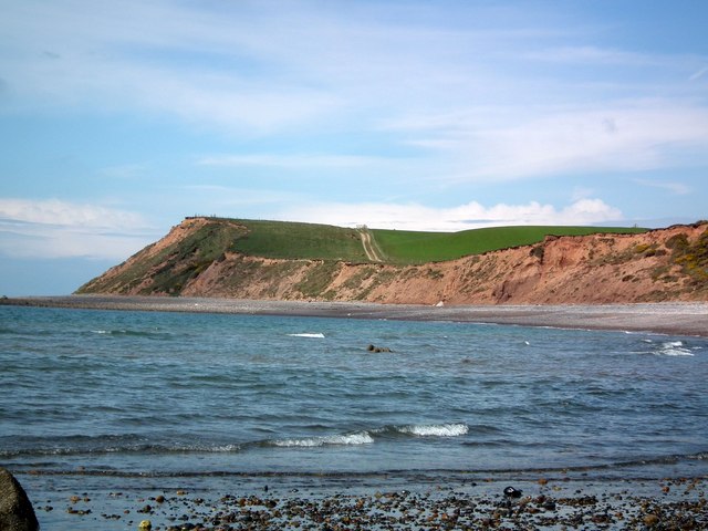
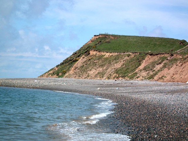
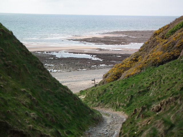
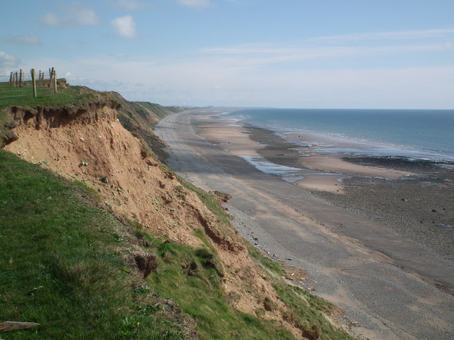
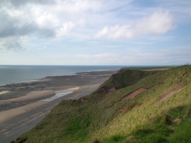
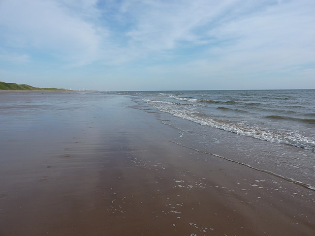
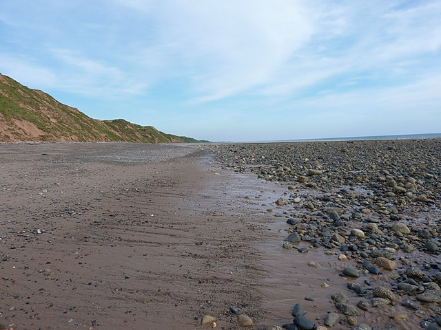
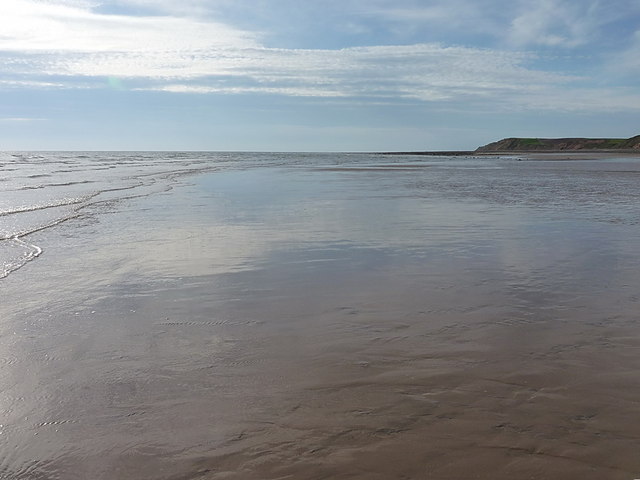
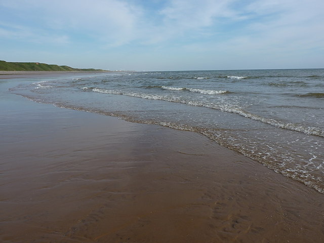
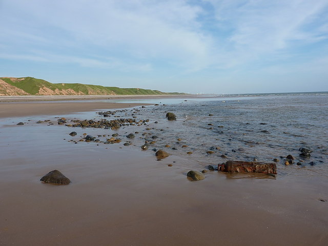
The beach itself stretches for approximately one mile, providing ample space for sunbathers, picnickers, and beachcombers to enjoy the serene environment. The golden sand is soft and inviting, making it an ideal spot for relaxation and unwinding. The crystal-clear waters of the Irish Sea lap gently against the shore, creating a soothing soundtrack for visitors.

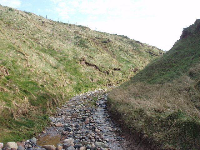
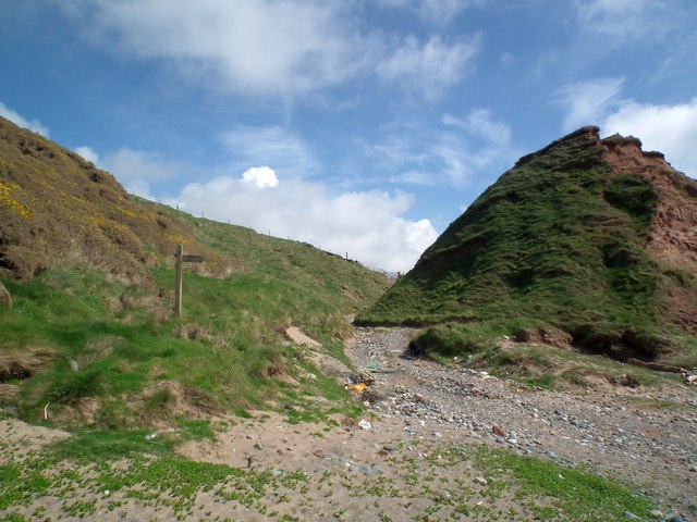
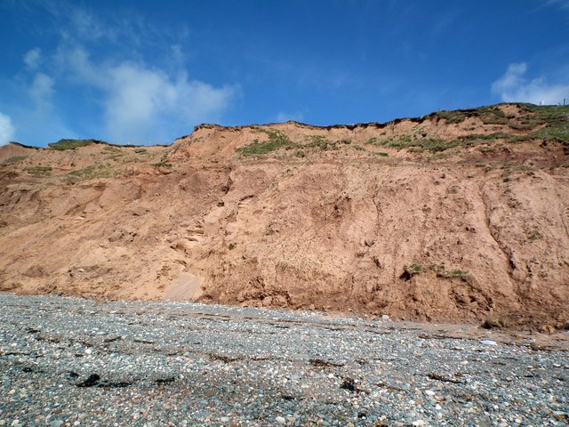
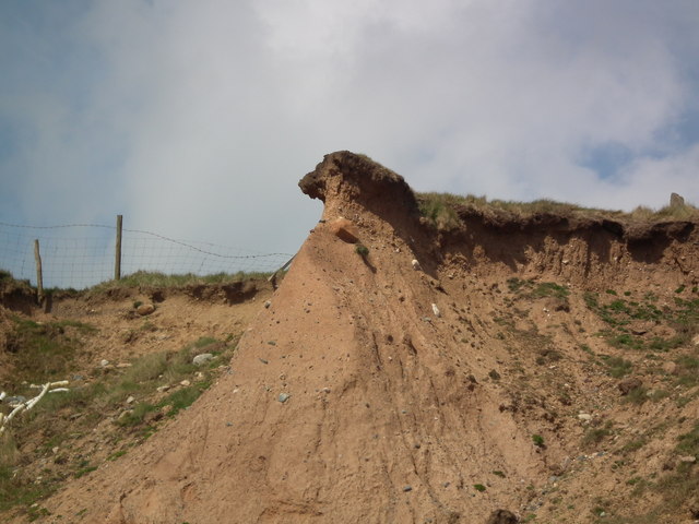
Gutterby Spa is also a popular destination for nature enthusiasts. The beach is surrounded by breathtaking cliffs, displaying an impressive geological formation that has been sculpted by thousands of years of erosion. These cliffs are home to a diverse range of wildlife, including nesting seabirds, making it a fantastic location for birdwatching.

For those seeking adventure, Gutterby Spa offers a range of water-based activities. Visitors can try their hand at surfing, kayaking, or paddleboarding, taking advantage of the consistent wave conditions and calm sea, perfect for beginners and experienced water sports enthusiasts alike.

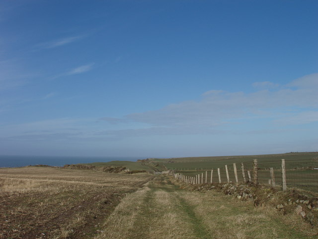
Facilities at Gutterby Spa include parking, public toilets, and a nearby café where visitors can grab a bite to eat or a refreshing drink. The beach is easily accessible, with a short walk from the car park to the shoreline.

Overall, Gutterby Spa in Cumberland is a haven of tranquility, boasting stunning natural scenery, a peaceful atmosphere, and a variety of activities to suit all tastes. It is a place where visitors can escape the hustle and bustle of everyday life and immerse themselves in the beauty of nature.

If you have any feedback on the listing, please let us know in the comments section below.

Gutterby Spa Images

Images are sourced within 2km of 54.244796/-3.380568 or Grid Reference SD1084. Thanks to Geograph Open Source API. All images are credited.

Track to Gutterby from beach This track cuts into the dunes in the top right of the grid square  and is clearly identifiable and indeed is part of the Cumbria Coastal Way!
Track to Gutterby from beach
This track cuts into the dunes in the top right of the grid square and is clearly identifiable and indeed is part of the Cumbria Coastal Way!
Track along top of Annaside banks
Cliffs near Bog Hole The pebbles section of the Cumbria Coastal way will shortly end. The picture shows the Way continuing over the cliffs along a farm track.
Cliffs near Bog Hole
The pebbles section of the Cumbria Coastal way will shortly end. The picture shows the Way continuing over the cliffs along a farm track.
Cumbria Coastal Way finally leaves the beach After miles of pebbles the CCW heads inland. Gutterby is straight ahead. CCW is to the left over the cliffs.
Cumbria Coastal Way finally leaves the beach
After miles of pebbles the CCW heads inland. Gutterby is straight ahead. CCW is to the left over the cliffs.
A closer view of the cliffs near Bog Hole The erosion of the cliffs on this stretch of the Cumbria Coastal Way makes any attempt at climbing them a very dangerous proposition.
A closer view of the cliffs near Bog Hole
The erosion of the cliffs on this stretch of the Cumbria Coastal Way makes any attempt at climbing them a very dangerous proposition.
Badly eroded cliffs The footpath is over the cliffs.
Badly eroded cliffs
The footpath is over the cliffs.
The Cumbria Coastal Way Looking down from the cliff top to the beach.
The Cumbria Coastal Way
Looking down from the cliff top to the beach.
Public Footpath at Gutterby From the junction with the Cumbria Coastal Way the footpath follows a farm track to Gutterby. Black Combe is in the background.
Public Footpath at Gutterby
From the junction with the Cumbria Coastal Way the footpath follows a farm track to Gutterby. Black Combe is in the background.
Cliff top view looking South Erosion and barbed wire fencing (sheep are grazed on the more accessible cliff sections) means that a cliff top walk is not advisable.
Cliff top view looking South
Erosion and barbed wire fencing (sheep are grazed on the more accessible cliff sections) means that a cliff top walk is not advisable.
Precarious cliffs The cliffs here are little more than large sand hills and all are subject to erosion. This one is about to fall into the sea.
Precarious cliffs
The cliffs here are little more than large sand hills and all are subject to erosion. This one is about to fall into the sea.
Cliff at Gutterby looking North From the top of the cliffs looking down to the coast.
Cliff at Gutterby looking North
From the top of the cliffs looking down to the coast.
Low tide just south of Gutterby Spa Normal low tide opens up this small area of sand just southwest of Gutterby Farm.
Low tide just south of Gutterby Spa
Normal low tide opens up this small area of sand just southwest of Gutterby Farm.
NW along the shore near Gutterby Spa A mixture of sand and shingle, with occasional substantial boulders, does not make for easy walking.
NW along the shore near Gutterby Spa
A mixture of sand and shingle, with occasional substantial boulders, does not make for easy walking.
SE along the shore at Gutterby Spa Low tide reveals a fair expanse of beach, but it's mostly shingle and large boulders.
SE along the shore at Gutterby Spa
Low tide reveals a fair expanse of beach, but it's mostly shingle and large boulders.
NW view at low tide near Gutterby Spa
SE on the beach at Gutterby Spa
Ripples in the sand at Gutterby Spa Looking SE towards the turbines of <a href="https://www.geograph.org.uk/photo/4012049">SD1379 : Haverigg Windfarm</a>, about 3 miles away.
Ripples in the sand at Gutterby Spa
Looking SE towards the turbines of SD1379 : Haverigg Windfarm, about 3 miles away.
Looking SE towards Silecroft Along the shore near low tide, with the turbines of <a href="https://www.geograph.org.uk/photo/4012049">SD1379 : Haverigg Windfarm</a> in the distance, about 3 miles away.
Looking SE towards Silecroft
Along the shore near low tide, with the turbines of SD1379 : Haverigg Windfarm in the distance, about 3 miles away.
Show me another place!

Gutterby Spa is located at Grid Ref: SD1084 (Lat: 54.244796, Lng: -3.380568)

Administrative County: Cumbria

District: Copeland

Police Authority: Cumbria

What 3 Words

///repeating.broccoli.gossiping. Near Haverigg, Cumbria

Related Wikis

Whitbeck, Cumbria

Whitbeck is a hamlet and former civil parish, now in the parish of Whicham, in the Copeland district, in the county of Cumbria, England. It was called...

Annaside

Annaside is a hamlet in Cumbria, England. It is located on the coast by the Irish Sea, about a 1+1⁄2 miles (2+1⁄2 km) south-west of Bootle and 7 miles...

Whicham

Whicham is a hamlet and civil parish in Copeland, Cumbria, England. At the 2011 census the parish had a population of 382. The parish includes the villages...

Black Combe

Black Combe is a fell in the south-west corner of the Lake District National Park, England, just 4 miles (6.4 km) from the Irish Sea. It lies near the...

Nearby Amenities

Located within 500m of 54.244796,-3.380568
Source: PGS
Lat/Long: 54.2481789/-3.3849987
Source: PGS
Lat/Long: 54.2479657/-3.3847256
Source: PGS
Lat/Long: 54.2476738/-3.3841996
Source: PGS
Lat/Long: 54.2472984/-3.3835343
Source: PGS
Lat/Long: 54.246761/-3.3828082
Created By: almien_coastlines
Source: PGS
Lat/Long: 54.2463114/-3.3820318
Created By: almien_coastlines
Source: PGS
Lat/Long: 54.2459396/-3.3816192
Created By: almien_coastlines
Source: PGS
Lat/Long: 54.2453146/-3.3807418
Created By: almien_coastlines
Source: PGS
Lat/Long: 54.244976/-3.3804686
Created By: almien_coastlines
Source: PGS
Lat/Long: 54.2445801/-3.3800012
Created By: almien_coastlines
Source: PGS
Lat/Long: 54.2443207/-3.3795115
Created By: almien_coastlines
Source: PGS
Lat/Long: 54.2435713/-3.3785068
Created By: almien_coastlines
Source: PGS
Lat/Long: 54.243307/-3.3781925
Created By: almien_coastlines
Source: PGS
Lat/Long: 54.2429418/-3.377676
Created By: almien_coastlines
Source: PGS
Lat/Long: 54.2426118/-3.3772615
Created By: almien_coastlines
Source: PGS
Lat/Long: 54.2421935/-3.3767666
Source: PGS
Lat/Long: 54.2418283/-3.3763578
Power: pole
Lat/Long: 54.2479022/-3.3759568
The data included in this document is from www.openstreetmap.org. The data is made available under ODbL.

Have you been to Gutterby Spa?

Leave your review of Gutterby Spa below (or comments, questions and feedback).