Boatdraught

Beach in Kirkcudbrightshire

Scotland

Boatdraught

Landscape north of the A75
Landscape north of the A75 Credit: Eirian Evans

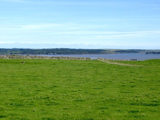
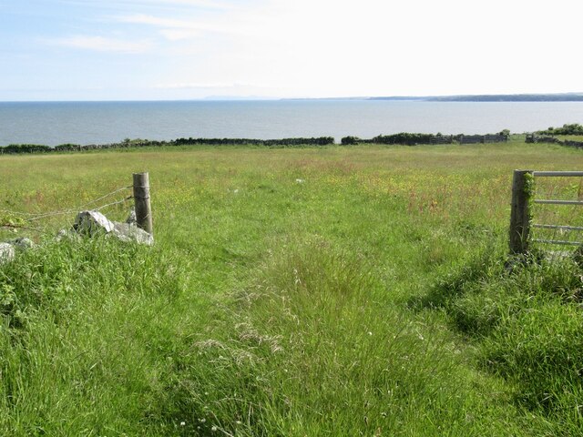
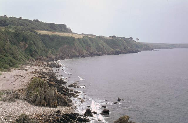
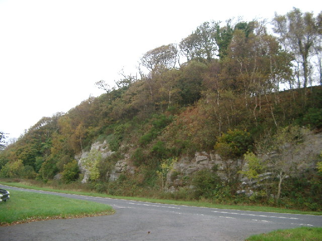
Boatdraught Beach is a picturesque coastal area located in Kirkcudbrightshire, Scotland. With its stunning views and tranquil atmosphere, it is a popular destination for locals and tourists alike. The beach stretches for approximately 2 miles along the Solway Firth, providing ample space for visitors to relax, take long walks, or engage in various recreational activities.

One of the notable features of Boatdraught Beach is its soft golden sand, which is ideal for sunbathing and building sandcastles. The beach is also known for its clean and clear waters, making it a great spot for swimming and paddling. During low tide, the expansive sandbanks are exposed, creating a unique landscape that is perfect for exploring and discovering marine life.

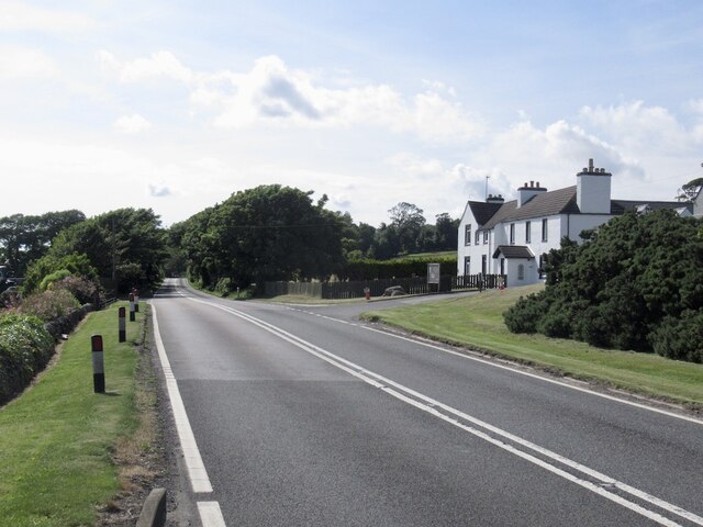
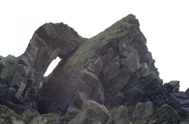
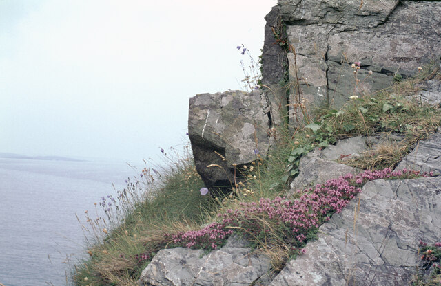
The beach is surrounded by rolling hills and lush green fields, creating a beautiful backdrop for visitors to enjoy. There are several walking trails that lead from the beach, allowing visitors to explore the surrounding countryside and take in the breathtaking views.

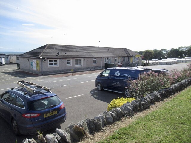
Facilities at Boatdraught Beach are minimal but sufficient. There is a small car park available for visitors, as well as public toilets for convenience. However, it is important to note that there are no lifeguards on duty, so caution should be exercised when swimming or engaging in water activities.

Overall, Boatdraught Beach offers a peaceful and scenic escape for those seeking a day of relaxation and natural beauty. Its stunning coastal setting and picturesque surroundings make it an idyllic destination for nature lovers and beach enthusiasts.

If you have any feedback on the listing, please let us know in the comments section below.

Boatdraught Images

Images are sourced within 2km of 54.839787/-4.2815858 or Grid Reference NX5351. Thanks to Geograph Open Source API. All images are credited.

Landscape north of the A75
Stubble field at Mossyard
Cliff-McCulloch Memorial on Cairny Hill Memorial to members of the Cliff-McCulloch family. The inscription reads:
Sacred | to the memory of | Janet McCulloch Cliff-McCulloch | the wife of | E. A. Cliff-McCulloch, | who died at Kirkclaugh, on the 28th March 1911, | in her 59th year. | "A woman greatly beloved." | And of her husband | Edward Adam Cliff-McCulloch | who died at Carlisle on the 31st August 1915, | in his 64th year, | and of their third son | Walter Alexander Cliff-McCulloch | Lieutenant, Royal Irish Rifles, | killed in action in France on the 27th February 1916 | and buried in the British Cemetery Vermelles, | aged 29 years. | And of their grand-son | Alexander Peter Cliff-McCulloch | Sgt. Air Gunner killed night 31st May - 1st June 1944 | on flying operations over North Sea, | aged 28 [y]ear[s]. | And of their eldest son | Willian Edward Clif[f]-McCulloch | father of Alexander P[e]ter | D[ie]d 1[3?]th Oct. 1957, [ag]ed 76 years.
Cliff-McCulloch Memorial on Cairny Hill
Memorial to members of the Cliff-McCulloch family. The inscription reads: Sacred | to the memory of | Janet McCulloch Cliff-McCulloch | the wife of | E. A. Cliff-McCulloch, | who died at Kirkclaugh, on the 28th March 1911, | in her 59th year. | "A woman greatly beloved." | And of her husband | Edward Adam Cliff-McCulloch | who died at Carlisle on the 31st August 1915, | in his 64th year, | and of their third son | Walter Alexander Cliff-McCulloch | Lieutenant, Royal Irish Rifles, | killed in action in France on the 27th February 1916 | and buried in the British Cemetery Vermelles, | aged 29 years. | And of their grand-son | Alexander Peter Cliff-McCulloch | Sgt. Air Gunner killed night 31st May - 1st June 1944 | on flying operations over North Sea, | aged 28 [y]ear[s]. | And of their eldest son | Willian Edward Clif[f]-McCulloch | father of Alexander P[e]ter | D[ie]d 1[3?]th Oct. 1957, [ag]ed 76 years.
Fields, Newton
Fields, Newton
Field near Newton
Field near Newton
Auchinlarie Holiday Park
A75, Auchenlarie
A75, Auchenlarie
Field, Ravenshall
Field, Ravenshall
Ravenshall Point Looking ESE along the shoreline of Wigtown Bay.
Ravenshall Point
Looking ESE along the shoreline of Wigtown Bay.
Rocks at Ravenshall Point The grid reference and direction are approximate.
Rocks at Ravenshall Point
The grid reference and direction are approximate.
Rocks at Ravenshall Point The coastline at Borness Point, south of Kirkcudbright, is seen on the left.
Rocks at Ravenshall Point
The coastline at Borness Point, south of Kirkcudbright, is seen on the left.
Rocks at Ravenshall Point A fine geological specimen! If I am given the technical details, I will happily include them.
Rocks at Ravenshall Point
A fine geological specimen! If I am given the technical details, I will happily include them.
View from Garvellan Rocks inland, Fleet Bay Fleet Bay rocky headland
View from Garvellan Rocks inland, Fleet Bay
Fleet Bay rocky headland
Horses at Mossyard Bay Autumn arrives at Mossyard Bay - not many boats moored now.
Horses at Mossyard Bay
Autumn arrives at Mossyard Bay - not many boats moored now.
Low Tide at Newton Farm Bay
Road cutting, Barholm Wood looking across the A75 at the Heughs of Barholm
Road cutting, Barholm Wood
looking across the A75 at the Heughs of Barholm
Tombolo at Mossyard Mossyard beach is at the South Western point of Fleet Bay where it meets Wigtown Bay. This photograph shows the wonderful tombolo (the sand bar) which links Garvellan Rocks to the mainland. It is usually exposed even at high tide. Cairnharrow is the high point in the distance.
Tombolo at Mossyard
Mossyard beach is at the South Western point of Fleet Bay where it meets Wigtown Bay. This photograph shows the wonderful tombolo (the sand bar) which links Garvellan Rocks to the mainland. It is usually exposed even at high tide. Cairnharrow is the high point in the distance.
Auchenlarie beach Looking SE along the coast from Auchenlarie towards the entrance to Fleet Bay. The small beach and inlet here, typical of this stretch of coastline, made this area popular with smugglers in the 18th century.Walter Scott's character Dirk Hatteraick is based on the real life smuggler Captain Yawkins who had a storage cave in the cliff face just below the point where this photograph was taken.
Auchenlarie beach
Looking SE along the coast from Auchenlarie towards the entrance to Fleet Bay. The small beach and inlet here, typical of this stretch of coastline, made this area popular with smugglers in the 18th century.Walter Scott's character Dirk Hatteraick is based on the real life smuggler Captain Yawkins who had a storage cave in the cliff face just below the point where this photograph was taken.
Show me another place!

Boatdraught is located at Grid Ref: NX5351 (Lat: 54.839787, Lng: -4.2815858)

Unitary Authority: Dumfries and Galloway

Police Authority: Dumfries and Galloway

What 3 Words

///annotated.nursery.fillings. Near Whithorn, Dumfries & Galloway

Nearby Locations

Boatdraught

Related Wikis

Barholm Castle

Barholm Castle is a tower house located 5 miles (8.0 km) south-west of Gatehouse of Fleet, in Kirkcudbrightshire, Galloway, Scotland. The tower dates back...

Ravenshall Wood

Ravenshall Wood is a Site of Special Scientific Interest, located 5 kilometres east of Creetown in the historic county of Kirkcudbrightshire, Dumfries...
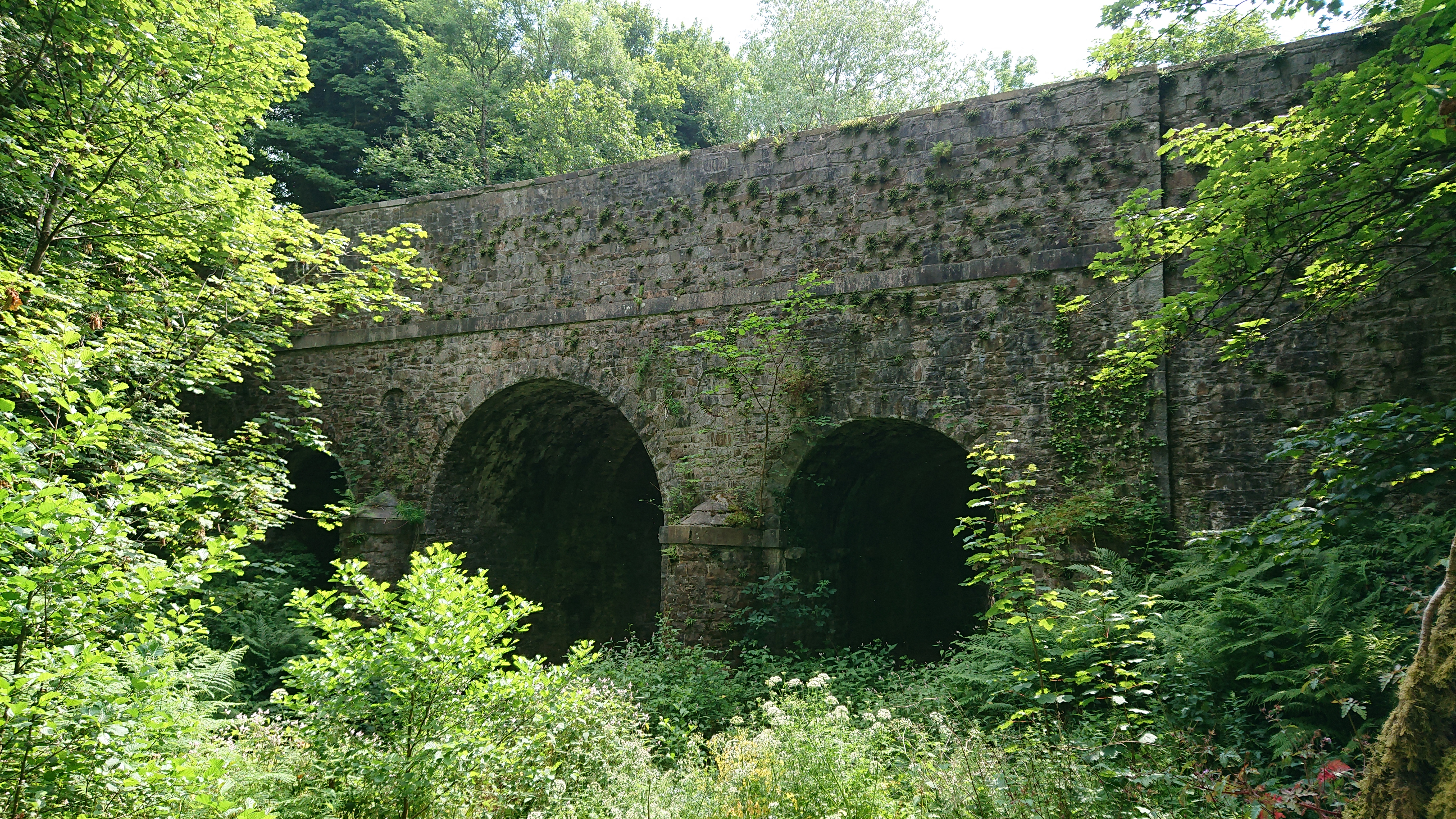
Kirkdale Bridge

Kirkdale Bridge is a bridge over the Kirkdale Burn in the parish of Kirkmabreck, between Gatehouse of Fleet and Creetown in Dumfries and Galloway, Scotland...

Cairnholy

Cairnholy (or Cairn Holy) is the site of two Neolithic chambered tombs of the Clyde type. It is located 4 kilometres east of the village of Carsluith in...

Nearby Amenities

Located within 500m of 54.839787,-4.2815858
Bus Stop
Holiday Park
Naptan AtcoCode: 680000919333
Naptan Bearing: W
Naptan BusStopType: CUS
Naptan CommonName: Holiday Park
Naptan Indicator: at Park
Naptan Landmark: Auchenlarie
Naptan NaptanCode: 34235295
Naptan Notes: none
Naptan Street: A75
Naptan Verified: no
Source: naptan_import
Lat/Long: 54.8437656/-4.2799749
Bus Stop
Holiday Park
Naptan AtcoCode: 680000919444
Naptan Bearing: E
Naptan BusStopType: CUS
Naptan CommonName: Holiday Park
Naptan Indicator: opp Park
Naptan Landmark: Auchenlarie
Naptan NaptanCode: 34235294
Naptan Notes: none
Naptan Street: A75
Naptan Verified: no
Source: naptan_import
Lat/Long: 54.8438966/-4.281135
Turning Circle
Lat/Long: 54.8422302/-4.2757213
Turning Circle
Lat/Long: 54.8421919/-4.2763426
Turning Circle
Lat/Long: 54.8424874/-4.276934
Turning Circle
Lat/Long: 54.842548/-4.2763184
Turning Circle
Lat/Long: 54.842155/-4.2769059
Turning Circle
Lat/Long: 54.8421653/-4.2774638
Leisure: playground
Lat/Long: 54.8424812/-4.2755762
Power: pole
Lat/Long: 54.8417586/-4.2755172
Leisure: swimming_pool
Lat/Long: 54.8406724/-4.275278
Fast Food
Lat/Long: 54.8407307/-4.2762223
The Brothers
Natural: rock
Lat/Long: 54.8415711/-4.2853138
The data included in this document is from www.openstreetmap.org. The data is made available under ODbL.

Have you been to Boatdraught?

Leave your review of Boatdraught below (or comments, questions and feedback).