Barricane Beach

Beach in Devon North Devon

England

Barricane Beach

Woolacombe : Coastal Scenery Looking across the coast of Woolacombe.
Woolacombe : Coastal Scenery Credit: Lewis Clarke

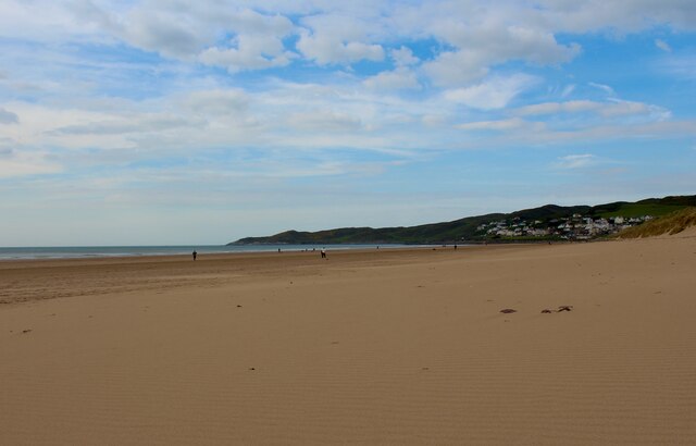
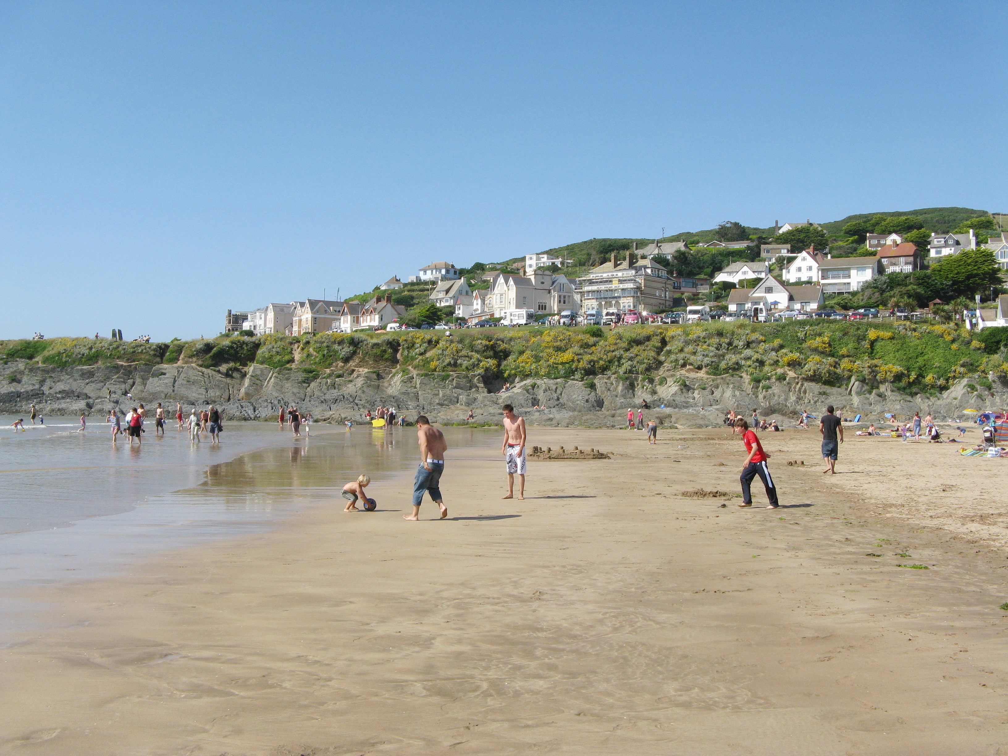
Barricane Beach is a picturesque sandy beach located in North Devon, England. Situated between the popular seaside towns of Woolacombe and Mortehoe, this hidden gem offers a tranquil and idyllic setting for visitors to enjoy.

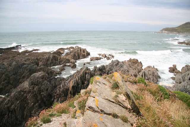
The beach is renowned for its unique and beautiful rock formations, which line the shores and provide a stunning backdrop. These rocks are composed of a variety of minerals, including limestone, quartzite, and shale, resulting in vibrant colors and patterns that add to the beach's charm.

Barricane Beach is particularly famous for its seashells. It is known as one of the best places in the country to find exotic seashells, which wash up on the shore from the Atlantic Ocean. Many visitors enjoy collecting these shells as souvenirs or for decorative purposes.

The beach also offers fantastic opportunities for swimming and sunbathing. The waters here are relatively calm and clear, making it a safe and inviting spot for a refreshing dip. Lifeguards are present during the summer months to ensure the safety of beachgoers.

There is a small café located just above the beach, known for its delicious Sri Lankan cuisine. The café provides a unique dining experience, allowing visitors to enjoy authentic dishes while taking in the breathtaking views.

Overall, Barricane Beach is a charming and unspoiled destination, perfect for those seeking a peaceful and natural beach experience. Its stunning scenery, seashells, and convenient amenities make it a must-visit spot along the North Devon coastline.

If you have any feedback on the listing, please let us know in the comments section below.

Barricane Beach Images

Images are sourced within 2km of 51.176154/-4.2133517 or Grid Reference SS4544. Thanks to Geograph Open Source API. All images are credited.

Woolacombe : Coastal Scenery Looking across the coast of Woolacombe.
Woolacombe : Coastal Scenery
Looking across the coast of Woolacombe.
Woolacombe : Coastal Scenery A bench with a view across the coast of Woolacombe.
Woolacombe : Coastal Scenery
A bench with a view across the coast of Woolacombe.
Woolacombe : Coastal Scenery Lots of sea foam forms between the rocks.
Woolacombe : Coastal Scenery
Lots of sea foam forms between the rocks.
Woolacombe : Coastal Scenery Looking across the coastline.
Woolacombe : Coastal Scenery
Looking across the coastline.
Woolacombe : Coastal Scenery A man and his dog at the coast.
Woolacombe : Coastal Scenery
A man and his dog at the coast.
Beach Road and Royal Hotel View over the middle section of Beach Road and a side-on view of the infamous Royal Hotel (formerly the Combes Hotel) with a black Mk3 Seat Ibiza in the foreground
Beach Road and Royal Hotel
View over the middle section of Beach Road and a side-on view of the infamous Royal Hotel (formerly the Combes Hotel) with a black Mk3 Seat Ibiza in the foreground
Woolacombe Beach The South West Coast Path National Trail - 630 miles of superb coastal walking. From Minehead on the edge of the Exmoor National Park to the shores of Poole Harbour in Dorset. It is the longest of all Britain's National Trails.
Website: <span class="nowrap"><a title="http://www.southwestcoastpath.com/" rel="nofollow ugc noopener" href="http://www.southwestcoastpath.com/">Link</a><img style="margin-left:2px;" alt="External link" title="External link - shift click to open in new window" src="https://s1.geograph.org.uk/img/external.png" width="10" height="10"/></span>
Woolacombe Beach
The South West Coast Path National Trail - 630 miles of superb coastal walking. From Minehead on the edge of the Exmoor National Park to the shores of Poole Harbour in Dorset. It is the longest of all Britain's National Trails. Website: LinkExternal link
Woolacombe : Coastal Scenery Looking out to sea from Woolacombe.
Woolacombe : Coastal Scenery
Looking out to sea from Woolacombe.
Woolacombe : Coastal Scenery Looking across the coastline and sandy beach.
Woolacombe : Coastal Scenery
Looking across the coastline and sandy beach.
Woolacombe : Woolacombe Sands Looking across the sandy beach in North Devon.
Woolacombe : Woolacombe Sands
Looking across the sandy beach in North Devon.
Woolacombe : Coastal Rocks Looking towards rocks at Woolacombe Sands.
Woolacombe : Coastal Rocks
Looking towards rocks at Woolacombe Sands.
Woolacombe : Coastal Scenery The rocks at Woolacombe Sand in North Devon.
Woolacombe : Coastal Scenery
The rocks at Woolacombe Sand in North Devon.
Woolacombe : Coastal Scenery Rocks on the Woolacombe coastline.
Woolacombe : Coastal Scenery
Rocks on the Woolacombe coastline.
Woolacombe : Woolacombe Sands Looking across the sandy beach on a pleasant evening.
Woolacombe : Woolacombe Sands
Looking across the sandy beach on a pleasant evening.
Footpath from Twitchen House to Barricane Beach and the Watersmeet Hotel
Path above Barricane Beach to caravan site at Twitchen House
Show me another place!

Barricane Beach is located at Grid Ref: SS4544 (Lat: 51.176154, Lng: -4.2133517)

Administrative County: Devon

District: North Devon

Police Authority: Devon and Cornwall

What 3 Words

///breeze.longer.quintet. Near Ilfracombe, Devon

Related Wikis

Woolacombe

Woolacombe () is a seaside resort on the coast of North Devon, England, which lies at the mouth of a valley (or "combe") in the parish of Mortehoe. The...

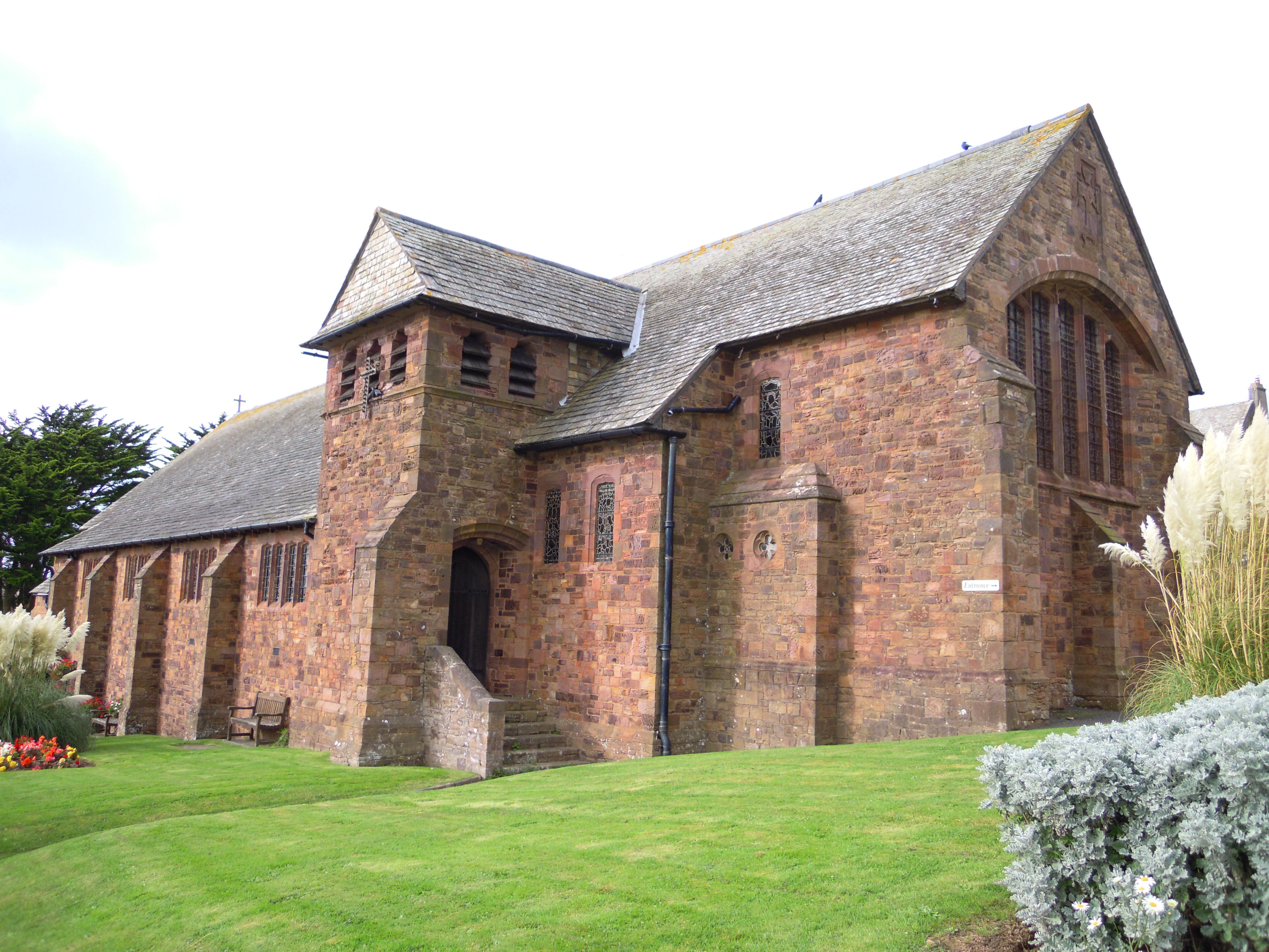
Church of St Sabinus, Woolacombe

The Church of St Sabinus is the Church of England parish church for in Woolacombe, Devon. It is the only church in the United Kingdom that is dedicated...

St Mary's Church, Mortehoe

St Mary's Church, Mortehoe, is a Grade I listed Church of England church in Mortehoe, Devon, England, whose origins date back to the Norman Conquest. It...
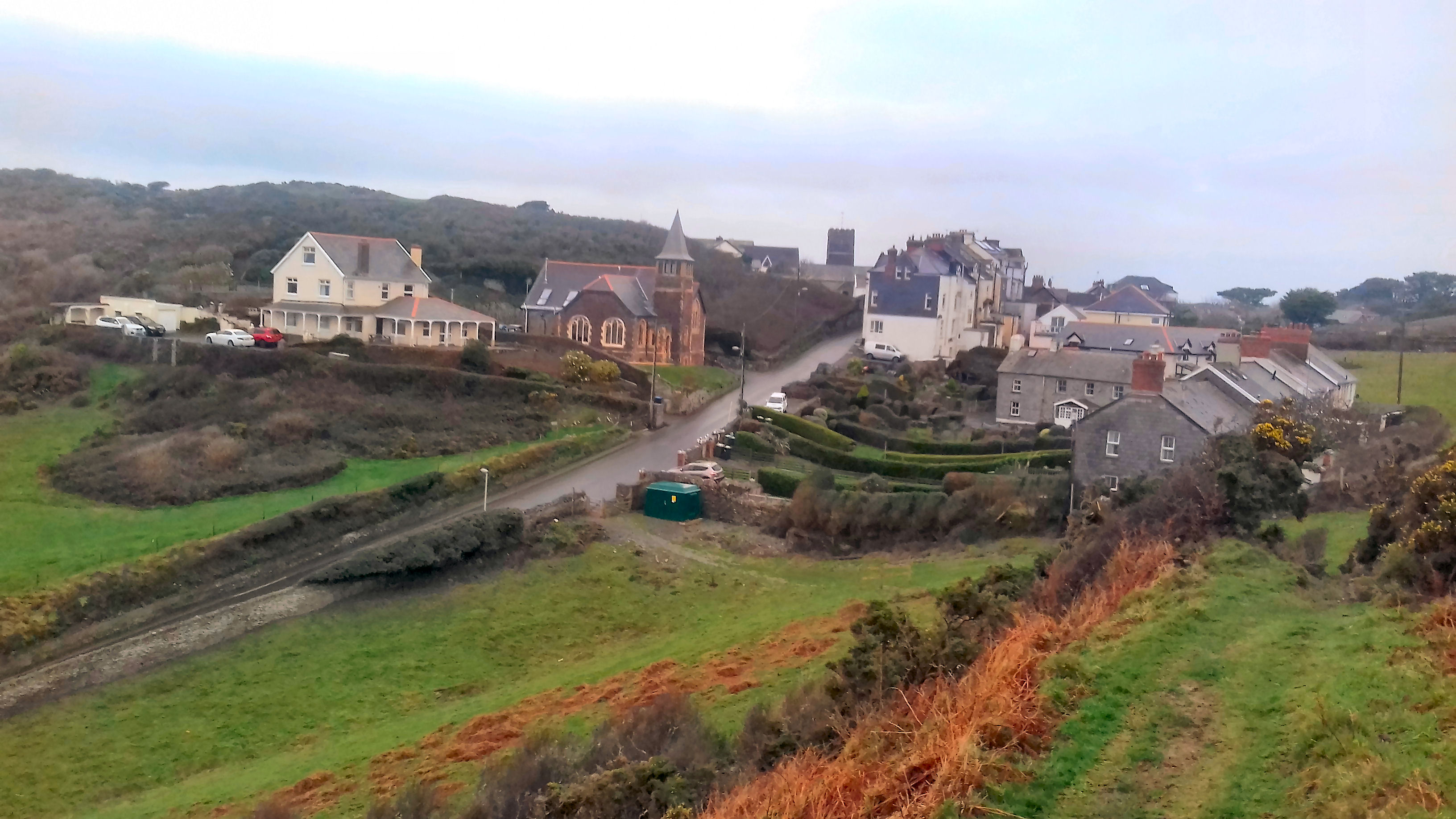
Mortehoe

Mortehoe () is a village and former manor on the north coast of Devon, England. It lies 10 miles north-west of Barnstaple, near Woolacombe and Lee Bay...

Morte Point

Morte Point is a peninsula on the north west coast of Devon, England, belonging to the National Trust. To the east is the village of Mortehoe and to the...

Morte Bay

Morte Bay is a bay on the northwest coast of Devon in southwest England. It stretches from Whiting Hole about 500m north of Baggy Point in the south to...

Bull Point Lighthouse

Bull Point Lighthouse is a lighthouse on Bull Point, about one mile (1.6 km) north of the village of Mortehoe, on the northern coast of Devon, England...

Mortehoe and Woolacombe railway station

Mortehoe and Woolacombe railway station was a station on the London and South Western Railway Ilfracombe Branch Line between Barnstaple and Ilfracombe...

Nearby Amenities

Located within 500m of 51.176154,-4.2133517
Source: PGS
Lat/Long: 51.1735211/-4.2121053
Source: PGS
Lat/Long: 51.1726883/-4.2107948
Created By: dmgroom_coastlines
Source: PGS
Lat/Long: 51.1726671/-4.2100764
Source: PGS
Lat/Long: 51.1727593/-4.2098796
Toilets
Lat/Long: 51.1729095/-4.2098518
Woolacombe
Is In: Devon, England, UK
Place: village
Wikidata: Q542671
Lat/Long: 51.1723083/-4.2106539
Woolacombe Memorial
Historic: memorial
Inscription: This memorial is dedicated to those thousands of soldiers whose preparations on the sands of Woolacombe and Saunton in the months preceding D-Day carried them to glorious victory on the sands of Normandy.
Memorial: war_memorial
Lat/Long: 51.1733252/-4.2115834
Cafe
Beachcomber
Lat/Long: 51.1727576/-4.2092588
Parade House
Tourism: hotel
Lat/Long: 51.1732818/-4.2094177
Restaurant
The Boardwalk
Cuisine: regional
Lat/Long: 51.1731756/-4.2089449
Bench
Lat/Long: 51.1769284/-4.2137474
Bench
Lat/Long: 51.1771522/-4.2135409
Bench
Lat/Long: 51.1770513/-4.2134309
Grunta Pool
Place: locality
Lat/Long: 51.1801536/-4.2159923
Bench
Lat/Long: 51.1775523/-4.2128462
Post Box
Brand: Royal Mail
Brand Wikidata: Q638098
Collection Times: Mo-Fr 09:00; Sa 07:00
Operator: Royal Mail
Operator Wikidata: Q638098
Post Box Type: wall
Ref: EX34 52
Royal Cypher: GR
Royal Cypher Wikidata: Q33102273
Source: survey
Lat/Long: 51.1789755/-4.2100073
Cafe
Lat/Long: 51.1761746/-4.2127002
Combesgate view
Name En: Combesgate view
Tourism: viewpoint
Lat/Long: 51.1782764/-4.2070354
Bus Stop
Bus: yes
Public Transport: platform
Lat/Long: 51.174083/-4.211127
Post Box
Post Box Type: wall
Lat/Long: 51.173907/-4.210741
Bench
Lat/Long: 51.1801045/-4.2121589
Bench
Lat/Long: 51.1781973/-4.2100624
Bench
Lat/Long: 51.1780931/-4.210248
Bench
Lat/Long: 51.1779988/-4.2104457
Bench
Lat/Long: 51.1779245/-4.2106424
Bench
Lat/Long: 51.1778565/-4.210809
Bench
Lat/Long: 51.1783015/-4.209928
Bench
Lat/Long: 51.1784295/-4.2098358
Bus Stop
Watersmeet Hotel
Bus: yes
Public Transport: platform
Route Ref: 31
Shelter: yes
Lat/Long: 51.1789283/-4.2096565
Generator Method: photovoltaic
Generator Output Electricity: yes
Generator Source: solar
Generator Type: solar_photovoltaic_panel
Location: roof
Power: generator
Lat/Long: 51.1790096/-4.2109296
Generator Method: photovoltaic
Generator Output Electricity: yes
Generator Source: solar
Generator Type: solar_photovoltaic_panel
Location: roof
Power: generator
Lat/Long: 51.1789381/-4.2109456
Generator Method: photovoltaic
Generator Output Electricity: yes
Generator Source: solar
Generator Type: solar_photovoltaic_panel
Location: roof
Power: generator
Lat/Long: 51.1789575/-4.2110328
Generator Method: photovoltaic
Generator Output Electricity: yes
Generator Source: solar
Generator Type: solar_photovoltaic_panel
Location: roof
Power: generator
Lat/Long: 51.1797775/-4.2099988
Bench
Source: survey;gps
Lat/Long: 51.1787944/-4.2099094
Bench
Source: survey;gps
Lat/Long: 51.1787797/-4.2098759
Bench
Source: survey;gps
Lat/Long: 51.1787536/-4.2098498
Bench
Source: survey;gps
Lat/Long: 51.1775409/-4.2117883
Bench
Source: survey;gps
Lat/Long: 51.1771402/-4.2126104
Addr Housename: The White House
Lat/Long: 51.1761935/-4.2121397
Chichester House
Addr Housename: Chichester House
Tourism: apartment
Lat/Long: 51.1759632/-4.2121384
Woolacombe Coast and Countryside
Board Type: nature
Information: board
Tourism: information
Lat/Long: 51.1735631/-4.2118333
Bench
Source: survey;gps
Lat/Long: 51.1733294/-4.2117856
Bench
Source: survey;gps
Lat/Long: 51.1732028/-4.2116703
Bench
Source: survey;gps
Lat/Long: 51.1730388/-4.2110393
Bench
Source: survey;gps
Lat/Long: 51.173075/-4.2113893
Bench
Source: survey;gps
Lat/Long: 51.1729884/-4.2108227
The data included in this document is from www.openstreetmap.org. The data is made available under ODbL.

Have you been to Barricane Beach?

Leave your review of Barricane Beach below (or comments, questions and feedback).