Bowen Craigs
Beach in Ayrshire
Scotland
Bowen Craigs

Bowen Craigs, located in Ayrshire, Scotland, is a beautiful beach that stretches along the Ayrshire coast. It is a popular destination for locals and tourists alike, offering stunning views and a peaceful atmosphere.
The beach is known for its golden sand and crystal-clear waters, making it an ideal spot for sunbathing, picnicking, and leisurely walks. Bowen Craigs is surrounded by rugged cliffs and rock formations, adding to its natural charm.
The beach is easily accessible, with a car park nearby and a well-maintained path leading to the shore. It is also wheelchair accessible, allowing everyone to enjoy its beauty.
Bowen Craigs is a haven for wildlife enthusiasts, as it is home to a variety of bird species, including gulls, cormorants, and oystercatchers. Seals can sometimes be spotted lounging on the rocks, adding to the area's natural biodiversity.
The beach is relatively quiet and peaceful, making it a great place to escape the hustle and bustle of city life. It is perfect for those seeking tranquility and relaxation.
Visitors can explore the nearby coastal trails, which offer breathtaking views of the surrounding countryside and sea. There are also several picnic areas and benches scattered along the beach, providing a perfect spot to enjoy a packed lunch while taking in the scenery.
Overall, Bowen Craigs in Ayrshire is a hidden gem on Scotland's coast, offering a serene and picturesque setting for beachgoers and nature enthusiasts to enjoy.
If you have any feedback on the listing, please let us know in the comments section below.
Bowen Craigs Images
Images are sourced within 2km of 55.781565/-4.8611759 or Grid Reference NS2057. Thanks to Geograph Open Source API. All images are credited.


Bowen Craigs is located at Grid Ref: NS2057 (Lat: 55.781565, Lng: -4.8611759)
Unitary Authority: North Ayrshire
Police Authority: Ayrshire
What 3 Words
///divider.contained.dreamer. Near Largs, North Ayrshire
Nearby Locations
Related Wikis

Battle of Largs
The Battle of Largs (2 October 1263) was a battle between the kingdoms of Norway and Scotland, on the Firth of Clyde near Largs, Scotland. The conflict...
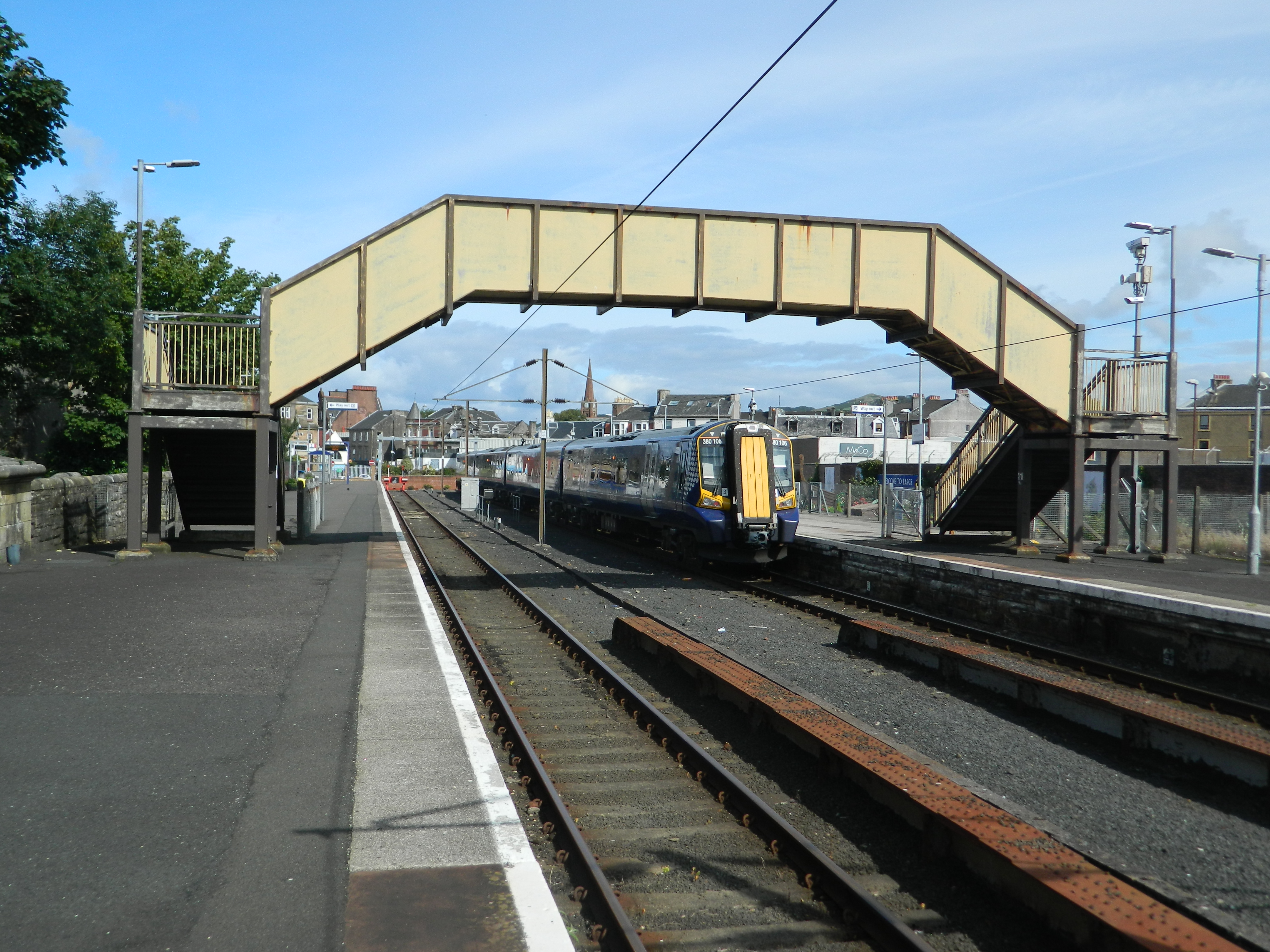
Largs railway station
Largs railway station is a railway station in the town of Largs, North Ayrshire, Scotland. The station is managed by ScotRail and is owned by Network Rail...

Clark Memorial Church
The Clark Memorial Church is an active place of worship for the Church of Scotland in Largs, North Ayrshire, Scotland. It was designed by William Kerr...
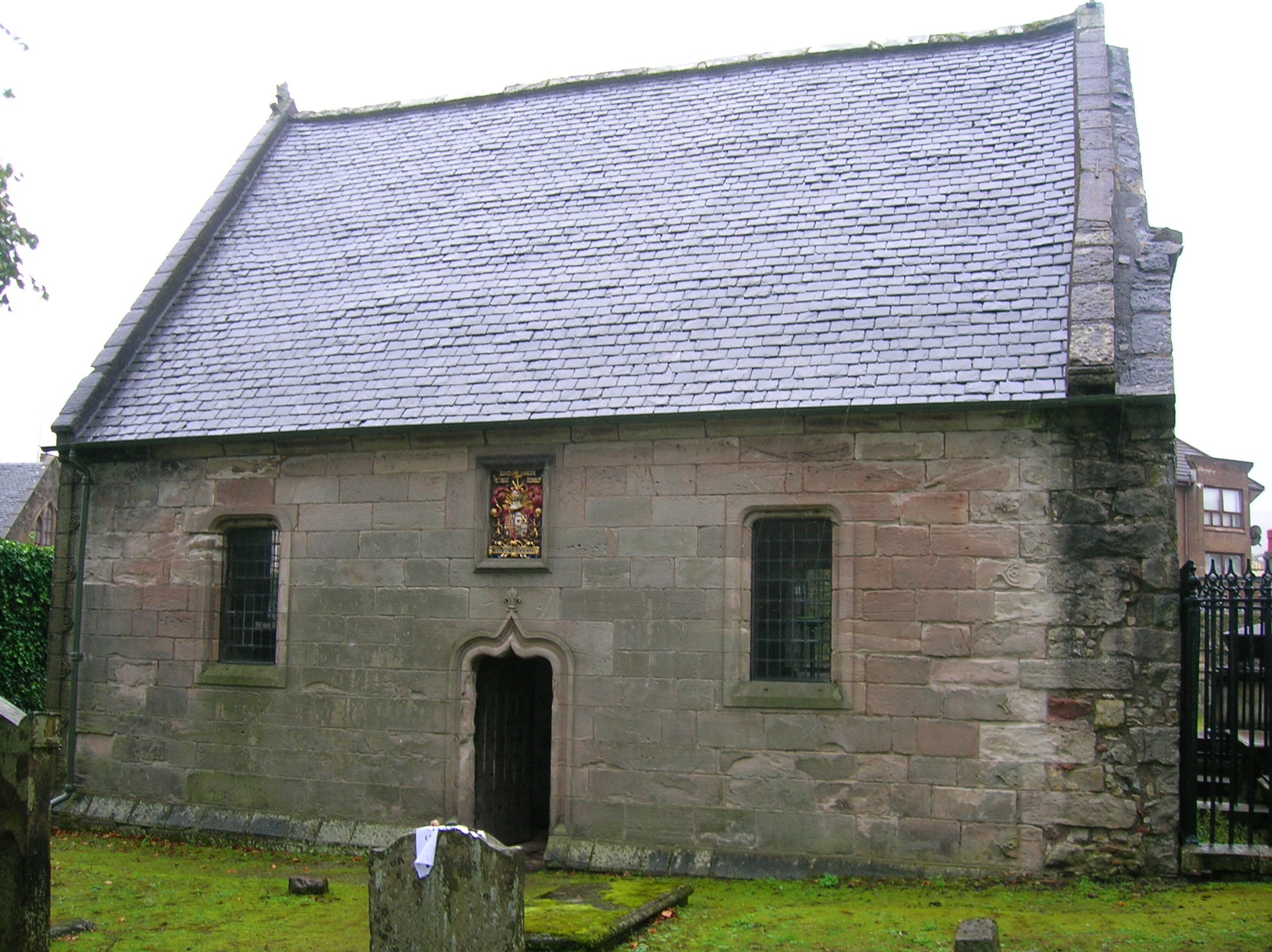
Skelmorlie Aisle
The Skelmorlie Aisle of Largs Old Kirk is the remains of a church in the town of Largs, Ayrshire, Scotland. == History == The majority of the kirk (church...
Nearby Amenities
Located within 500m of 55.781565,-4.8611759Have you been to Bowen Craigs?
Leave your review of Bowen Craigs below (or comments, questions and feedback).