Northcott Mouth Beach

Beach in Cornwall

England

Northcott Mouth Beach

Car Park at Sandy Mouth Viewed from up on the hills, looking down onto the car park at Sandy Mouth.
Car Park at Sandy Mouth Credit: Oscar Taylor

Northcott Mouth Beach is a picturesque sandy beach located in the county of Cornwall, England. Situated on the rugged North Cornish coast, it is a popular destination for locals and tourists alike. The beach is approximately 1.5 miles north of Bude, a well-known seaside town.

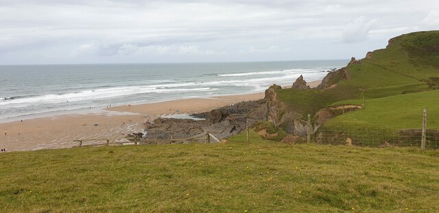
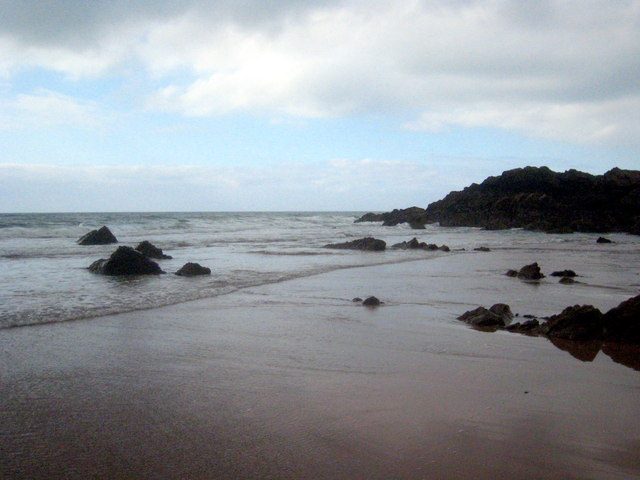
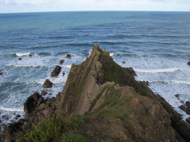
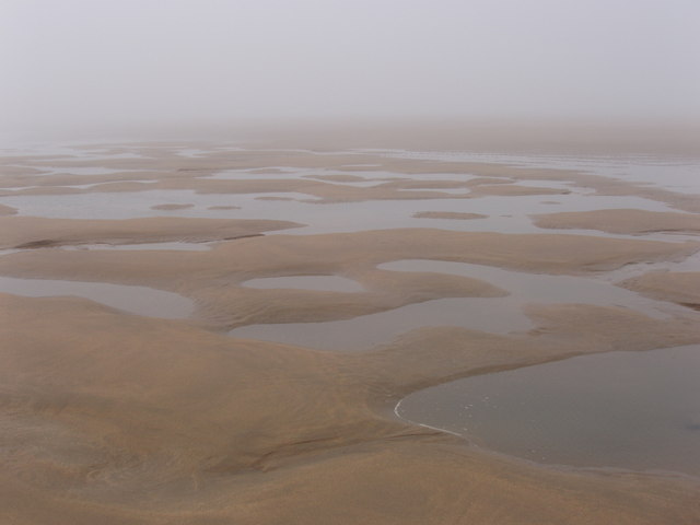
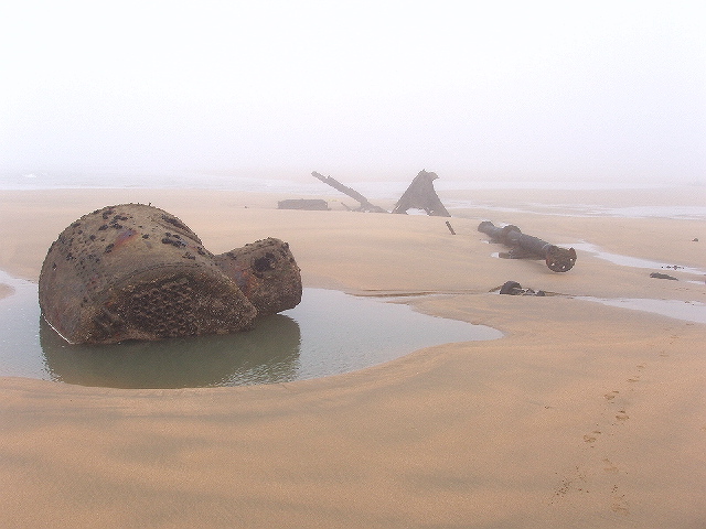
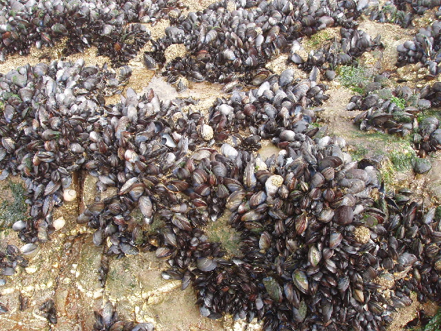
Northcott Mouth Beach offers stunning views of the Atlantic Ocean, with its golden sands stretching for over half a mile at low tide. The beach is surrounded by towering cliffs and rock formations, creating a dramatic backdrop. Visitors can enjoy exploring the rock pools that emerge at low tide, where an array of marine life can be discovered.

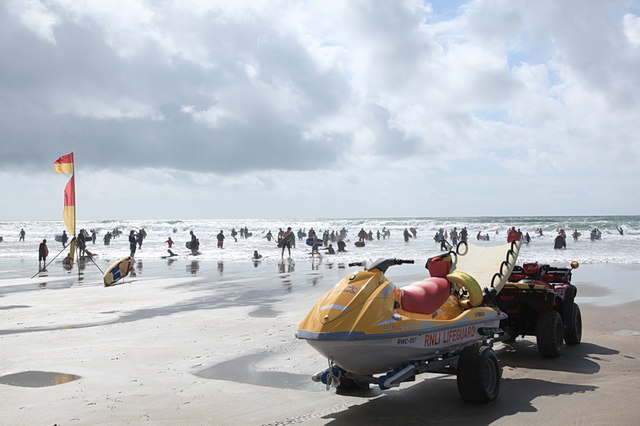
The beach is known for its excellent surfing conditions, attracting surfers of all levels. The waves here are suitable for both beginners and more experienced surfers, making it a great spot to catch some waves. Lifeguards are present during peak season to ensure the safety of beachgoers.

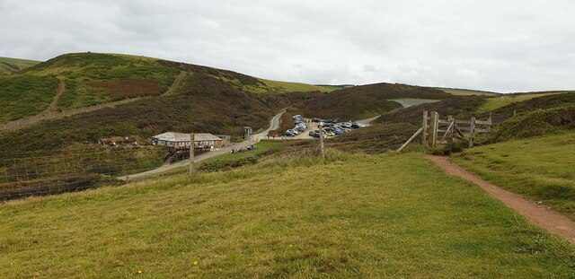
Facilities at Northcott Mouth Beach are limited, but there is a car park nearby, offering convenient access. There are also public toilets available for visitors. The beach is dog-friendly, allowing furry friends to enjoy a run along the shoreline.

The surrounding area offers scenic coastal walks, with the South West Coast Path passing through Northcott Mouth Beach. This allows visitors to explore the stunning cliffs and countryside of North Cornwall.

Overall, Northcott Mouth Beach is a beautiful and unspoiled location, offering a mix of natural beauty, water sports, and a peaceful atmosphere for all who visit.

If you have any feedback on the listing, please let us know in the comments section below.

Northcott Mouth Beach Images

Images are sourced within 2km of 50.846066/-4.5570492 or Grid Reference SS2008. Thanks to Geograph Open Source API. All images are credited.

Car Park at Sandy Mouth Viewed from up on the hills, looking down onto the car park at Sandy Mouth.
Car Park at Sandy Mouth
Viewed from up on the hills, looking down onto the car park at Sandy Mouth.
Sandy Mouth Beach The beach at Sandy Mouth from the cliff.
Sandy Mouth Beach
The beach at Sandy Mouth from the cliff.
Surfing, Bude Bay Enjoying the surf under the watchful eyes of RNLI Lifeguards.
Surfing, Bude Bay
Enjoying the surf under the watchful eyes of RNLI Lifeguards.
Rocks at Wrangle Point Only accessible at low tide.
Rocks at Wrangle Point
Only accessible at low tide.
Compass Point Rocky outcrop of Compass Point
Compass Point
Rocky outcrop of Compass Point
Low tide at Northcott Mouth The tide has turned and is starting to come in.
Low tide at Northcott Mouth
The tide has turned and is starting to come in.
How to remember a grid reference, Bude beach Finding myself without paper and pen, I improvised!
There is a vast expanse of flat sand at low tide.
How to remember a grid reference, Bude beach
Finding myself without paper and pen, I improvised! There is a vast expanse of flat sand at low tide.
Sandy Mouth on a misty day This is a strip of sand below cliffs. Much of the country was basking in sunshine, but this part of the North Cornish coast was misty - it cleared in the afternoon.
Sandy Mouth on a misty day
This is a strip of sand below cliffs. Much of the country was basking in sunshine, but this part of the North Cornish coast was misty - it cleared in the afternoon.
Shipwreck remains at Menachurch Point Walking down the beach in the mist we suddenly came across these rusting iron remains of a ship. As we walked on we saw the prop shaft, then the boiler, laid out along the sand.
Shipwreck remains at Menachurch Point
Walking down the beach in the mist we suddenly came across these rusting iron remains of a ship. As we walked on we saw the prop shaft, then the boiler, laid out along the sand.
Beach and Wrangle Point in mist at low tide Beyond this point is Crooklets Beach. We had walked in the mist from Sandy Mouth seeing no one, and just a few footprints, but round this point there were surfers and others on the beach.
Beach and Wrangle Point in mist at low tide
Beyond this point is Crooklets Beach. We had walked in the mist from Sandy Mouth seeing no one, and just a few footprints, but round this point there were surfers and others on the beach.
Boiler and propeller shaft of wreck, Menachurch Point This wreck can be seen at very low tides - this was spring tide of a new moon in April. We bought a tide table from the Inn on the Green pub the night before to make sure we would be able to walk from Sandy Mouth to Bude on the beach. Pity about the mist!
Boiler and propeller shaft of wreck, Menachurch Point
This wreck can be seen at very low tides - this was spring tide of a new moon in April. We bought a tide table from the Inn on the Green pub the night before to make sure we would be able to walk from Sandy Mouth to Bude on the beach. Pity about the mist!
Mussels near Menachurch Point On rocks at low tide.
Mussels near Menachurch Point
On rocks at low tide.
Rocks near the Wrangles
Low tide sand north of Crookletts
Walking Beyond Wrangle Point As the tide falls people can walk around the rocks at Wrangle Point onto a huge expanse of sandy beach to the north.
Walking Beyond Wrangle Point
As the tide falls people can walk around the rocks at Wrangle Point onto a huge expanse of sandy beach to the north.
Low Tide Strand Looking south towards the entrance to Bude Haven and the rocks beyond.
Low Tide Strand
Looking south towards the entrance to Bude Haven and the rocks beyond.
Beach and rocks west of Barrel Rock at low tide.
Mussels on Barrel Rock The marker on the eponymous Barrel Rock warns sailors of the presence of these rocks at the entrance to Bude Haven.
Mussels on Barrel Rock
The marker on the eponymous Barrel Rock warns sailors of the presence of these rocks at the entrance to Bude Haven.
Show me another place!

Northcott Mouth Beach is located at Grid Ref: SS2008 (Lat: 50.846066, Lng: -4.5570492)

Unitary Authority: Cornwall

Police Authority: Devon and Cornwall

What 3 Words

///shunning.resurgent.sublime. Near Flexbury, Cornwall

Related Wikis

Maer, Cornwall

Maer is a coastal hamlet in north Cornwall, England, United Kingdom. It is situated one mile (1.6 km) northeast of Bude at grid reference SS 205 075 in...

Maer Lake

Maer Lake is a nature reserve adjacent to Bude, in Cornwall, England. It is a wetland meadow with open water, and is an important site for over-wintering...

Duckpool to Furzey Cove

Duckpool to Furzey Cove is a coastal Geological Conservation Review site and Site of Special Scientific Interest (SSSI) in north Cornwall, England, UK...

Northcott, Cornwall

Northcott is a hamlet in Cornwall, England. Northcott is north of Bude and on the coast close to Northcott Mouth. == References ==

Bude Sea Pool

Bude Sea Pool is a partially man-made tidal swimming pool or lido in the rocks at Summerleaze Beach, Bude, Cornwall. == History == In 1930, The Thynne...

Flexbury

Flexbury is a village about 0.8 miles from Bude, in the civil parish of Bude–Stratton, north Cornwall, England. Described as a hamlet in 1887, residential...

Sandymouth Beach

Sandymouth is a beach three miles (5 km) north of Bude in Cornwall, England, United Kingdom. == Topography == The area is formed from cliffs and rock formations...

River Strat

The River Strat is a river in the northernmost part of Cornwall in southwest England. The Strat flows for 12.7 miles (20.4 km) to the sea at Bude, having...

Related Videos

Coastal erosion forces iconic landmark to be moved not once but twice! Nostalgic walk

In this week's video we explore Bude, on the North coast of Cornwall near the Devon border. We have three fascinating stories to ...

BUDE | Exploring the holiday seaside town of Bude Cornwall

Bude is a holiday seaside town in north Cornwall, England, situated near the border between Cornwall and Devon and is ...

Is it worth visiting Bude? A circular walk around Bude and Bude Canal

Join us as we walk along the vast, beautiful beach on a crisp, sunny day in February. Did you know that there is a half tide marker ...

Bude-Cornwall holiday part 1 (Away resorts)

Thanks for watching our trip to Cornwall, we spent 5 days in Bude and it was absolutely beautiful. We loved every second of it and ...

Nearby Amenities

Located within 500m of 50.846066,-4.5570492
Source: PGS
Lat/Long: 50.8486229/-4.5550381
Source: PGS
Lat/Long: 50.8496964/-4.5559228
WW2 Pillbox (remains of)
Building: bunker
Bunker Type: pillbox
Military: bunker
Lat/Long: 50.8485926/-4.5536352
Northcott Mouth beach
Natural: beach
Lat/Long: 50.8482639/-4.555924
Smooth Rock
Natural: cliff
Lat/Long: 50.8451964/-4.5551793
Vinegar Cove
Natural: beach
Surface: pebblestone
Lat/Long: 50.8441655/-4.5565557
Pearce's Cove
Natural: beach
Surface: pebblestone
Lat/Long: 50.8436315/-4.5566492
Furzy Cove
Access: foot
Natural: beach
Surface: pebblestone
Lat/Long: 50.8423096/-4.5569518
Waste Basket
Survey Date: 2023-11-25
Waste: dog_excrement
Lat/Long: 50.848021/-4.5546169
Life Ring
Emergency: life_ring
Survey Date: 2023-11-25
Waste: dog_excrement
Lat/Long: 50.8482185/-4.5546053
Bench
Backrest: no
Survey Date: 2023-11-25
Lat/Long: 50.8494575/-4.555193
The data included in this document is from www.openstreetmap.org. The data is made available under ODbL.

Have you been to Northcott Mouth Beach?

Leave your review of Northcott Mouth Beach below (or comments, questions and feedback).