Broad Sands

Beach in Ayrshire

Scotland

Broad Sands

Turnberry Lighthouse and castle ruins Viewed on a lovely late-January afternoon. Turnberry Castle, shown on both sides of the lighthouse, is the birth-place of Robert the Bruce.
Turnberry Lighthouse and castle ruins Credit: Mary and Angus Hogg

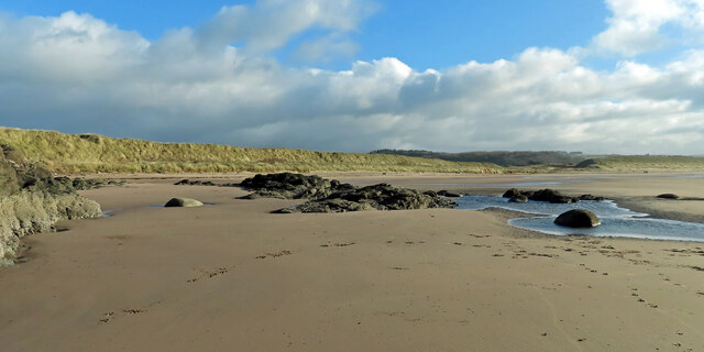
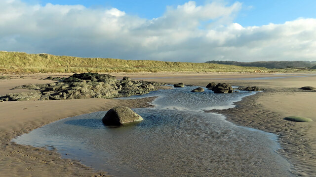
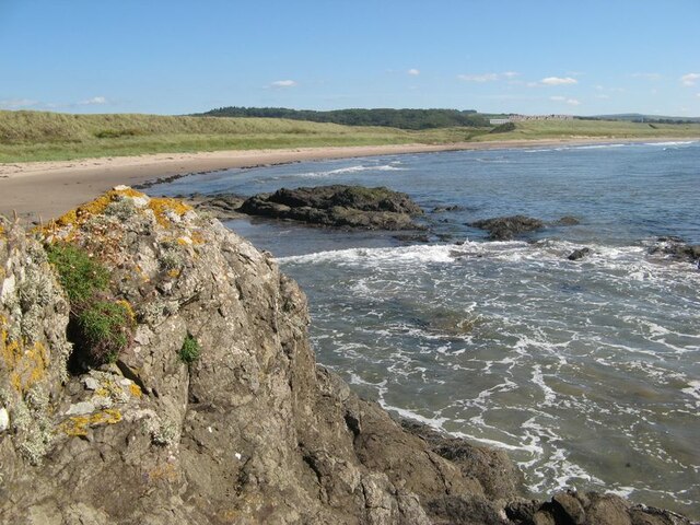
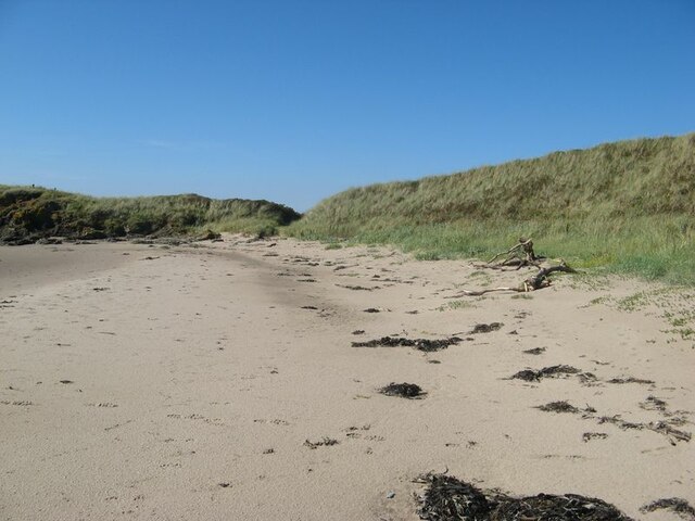
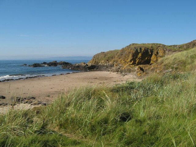
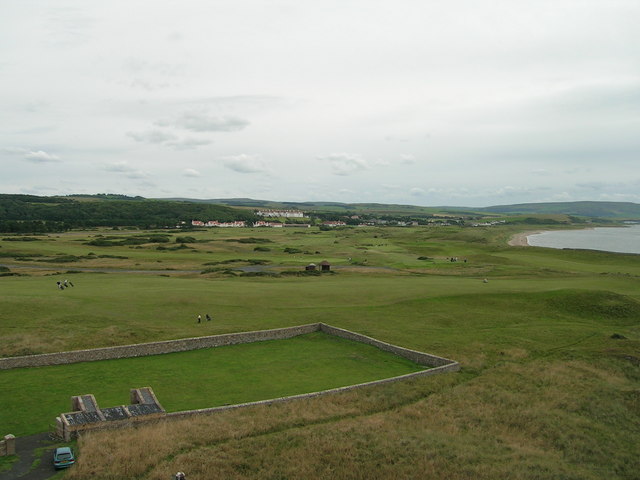
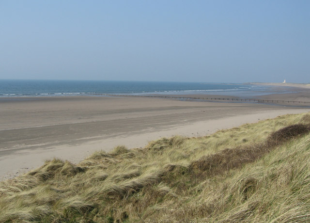
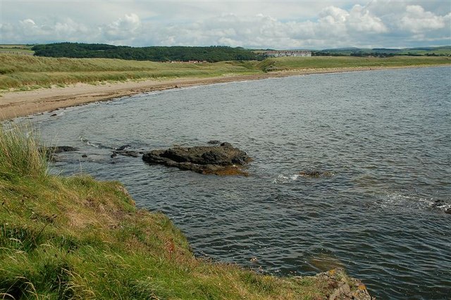
Broad Sands is a picturesque beach located on the southwest coast of Scotland, in the region of Ayrshire. It stretches along the Firth of Clyde, offering breathtaking views of the Isle of Arran and the Ailsa Craig. This sandy beach is renowned for its tranquil and unspoiled beauty, attracting both locals and tourists alike.

With its long stretch of golden sand, Broad Sands provides ample space for sunbathing, beach games, and leisurely walks. The beach is backed by rolling sand dunes, which not only add to its scenic charm but also provide a natural barrier from the wind. The dunes are home to a diverse range of plant and animal species, making it a haven for nature enthusiasts.

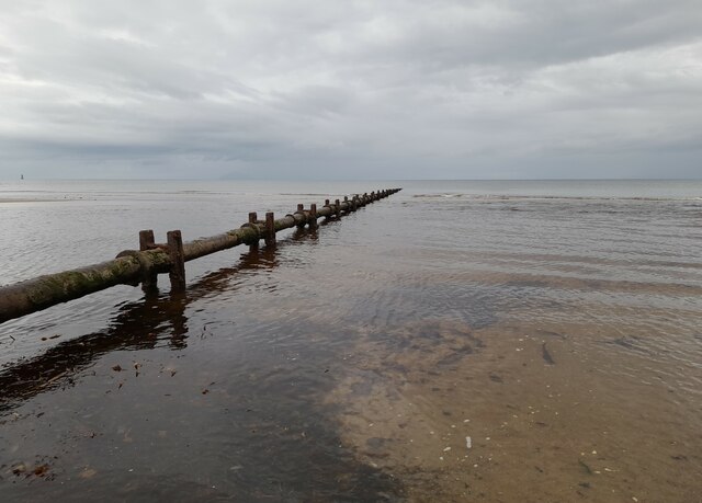
The clear waters of the Firth of Clyde at Broad Sands are popular among swimmers, who can enjoy a refreshing dip in the sea during the warmer months. The beach is also a hotspot for water sports enthusiasts, with activities such as surfing, kayaking, and paddleboarding regularly enjoyed by visitors.

Broad Sands is well-equipped with facilities to ensure visitors have a comfortable and enjoyable experience. There are public toilets, ample parking spaces, and a nearby café where beachgoers can grab a bite to eat or enjoy a hot beverage.

The beach is easily accessible, located just off the A719 road, and is within close proximity to the town of Ayr. Its idyllic setting, stunning views, and range of activities make Broad Sands a popular destination for those seeking a relaxing day out by the sea in Ayrshire.

If you have any feedback on the listing, please let us know in the comments section below.
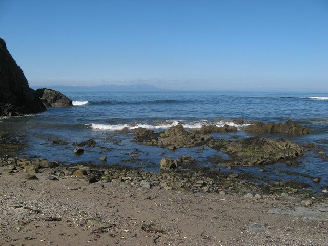
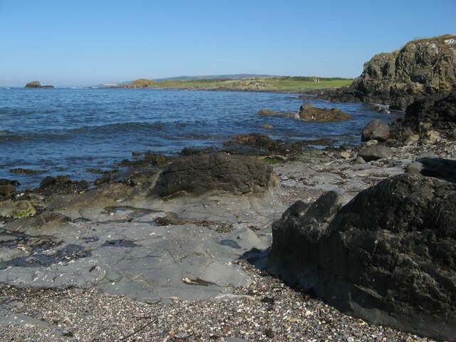
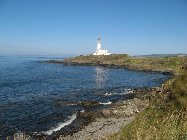
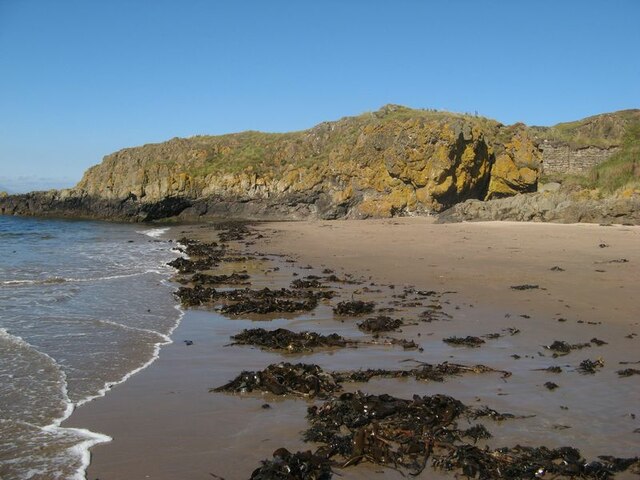
Broad Sands Images

Images are sourced within 2km of 55.326634/-4.8417821 or Grid Reference NS1907. Thanks to Geograph Open Source API. All images are credited.

Turnberry Lighthouse and castle ruins Viewed on a lovely late-January afternoon. Turnberry Castle, shown on both sides of the lighthouse, is the birth-place of Robert the Bruce.
Turnberry Lighthouse and castle ruins
Viewed on a lovely late-January afternoon. Turnberry Castle, shown on both sides of the lighthouse, is the birth-place of Robert the Bruce.
Turnberry Bay view The northern end of Turnberry Bay viewed with the tide well out on a lovely late-January afternoon.
Turnberry Bay view
The northern end of Turnberry Bay viewed with the tide well out on a lovely late-January afternoon.
Low tide at Turnberry Bay The tide reveals a large expanse of firm sand and wide empty spaces. The Ayrshire Coastal Path follows the shoreline here before crossing the golf course a little further north.
Low tide at Turnberry Bay
The tide reveals a large expanse of firm sand and wide empty spaces. The Ayrshire Coastal Path follows the shoreline here before crossing the golf course a little further north.
Old sewage outfall pipe, Turnberry Old sewage outfall pipe, Turnberry.
Old sewage outfall pipe, Turnberry
Old sewage outfall pipe, Turnberry.
Turnberry Castle headland The ruins of the castle situated upon a headland comprising two generations of basaltic rock - the Devonian Carrick Volcanic Formation, which is also intruded by a Palaeogene dyke. Altogether, this is a fine site for a defensive structure with good visibility from the sea, and for the subsequent lighthouse.
Turnberry Castle headland
The ruins of the castle situated upon a headland comprising two generations of basaltic rock - the Devonian Carrick Volcanic Formation, which is also intruded by a Palaeogene dyke. Altogether, this is a fine site for a defensive structure with good visibility from the sea, and for the subsequent lighthouse.
View from Castle Port Castle Port is a small inlet to the east of Turnberry Castle, which is situated on top of crags seen to rise from the sea at the left of the image. A fine view of Arran is seen on the distant horizon.
View from Castle Port
Castle Port is a small inlet to the east of Turnberry Castle, which is situated on top of crags seen to rise from the sea at the left of the image. A fine view of Arran is seen on the distant horizon.
View to Cross Ports The rocky summit of Turnberry Point drops to a gentle shore with the even grass of the golf course. In the distance the rocky shore starts again in the area called Cross Ports, which also has an offshore stack clearly seen in the image.
View to Cross Ports
The rocky summit of Turnberry Point drops to a gentle shore with the even grass of the golf course. In the distance the rocky shore starts again in the area called Cross Ports, which also has an offshore stack clearly seen in the image.
Turnberry Lighthouse Seen from the north side of Turnberry Point.
Turnberry Lighthouse
Seen from the north side of Turnberry Point.
Turnberry Point Turnberry Point seen across Lochan Port with a notable landing of kelp ripped up by recent rough weather.
Turnberry Point
Turnberry Point seen across Lochan Port with a notable landing of kelp ripped up by recent rough weather.
Turnberry Bay The wide sweep of the fine bay with its dunes which drop down to admit a small burn to drain through to the sea.
Turnberry Bay
The wide sweep of the fine bay with its dunes which drop down to admit a small burn to drain through to the sea.
Sand dunes A fine stretch of sand with cast-up trees and seaweed in front of the dunes.
Sand dunes
A fine stretch of sand with cast-up trees and seaweed in front of the dunes.
Turnberry Point Looking from the dunes over Lochan Port to the lichen-encrusted rocks of Turnberry Point.
Turnberry Point
Looking from the dunes over Lochan Port to the lichen-encrusted rocks of Turnberry Point.
Turnberry Lighthouse Built on the ruins of Turnberry Castle on the edge of Turnberry Golf Course
Turnberry Lighthouse
Built on the ruins of Turnberry Castle on the edge of Turnberry Golf Course
Turnberry Golf Course Turnberry Hotel and the Championship 'Ailsa' golf course, one of the three courses at Turnberry. The walled area is part of the Lighthouse property.
Turnberry Golf Course
Turnberry Hotel and the Championship 'Ailsa' golf course, one of the three courses at Turnberry. The walled area is part of the Lighthouse property.
Turnberry  Golf Course, Lighthouse and Ailsa Craig Facing South West
Turnberry Golf Course, Lighthouse and Ailsa Craig
Facing South West
Turnberry Point lighthouse Turnberry Point with Mochrum Hill in background, taken from PS Waverley
Turnberry Point lighthouse
Turnberry Point with Mochrum Hill in background, taken from PS Waverley
Turnberry Dunes Turnberry lighthouse in the distance. Milton Burn outflow in middle distance.
Turnberry Dunes
Turnberry lighthouse in the distance. Milton Burn outflow in middle distance.
Turnberry Bay Viewed from Turnberry Point, with Turnberry Hotel <a href="https://www.geograph.org.uk/gridref/NS2005">NS2005</a> in the background. For a winter view, see <a href="https://www.geograph.org.uk/photo/5273413">NS1906 : Turnberry Bay</a>
Turnberry Bay
Viewed from Turnberry Point, with Turnberry Hotel NS2005 in the background. For a winter view, see NS1906 : Turnberry Bay
Show me another place!

Broad Sands is located at Grid Ref: NS1907 (Lat: 55.326634, Lng: -4.8417821)

Unitary Authority: South Ayrshire

Police Authority: Ayrshire

What 3 Words

///canyons.playback.silver. Near Girvan, South Ayrshire

Related Wikis

Nearby Amenities

Located within 500m of 55.326634,-4.8417821
Turnberry Lighthouse
Seamark Light Character: Fl
Seamark Light Colour: white
Seamark Light Height: 29
Seamark Light Period: 15
Seamark Light Range: 24
Seamark Light Reference: A 4580
Seamark Light Sequence: 0.4+(14.6)
Seamark Name: Turnberry
Seamark Type: light_major
Source: US NGA Pub. 114. 2011-05-26.
Lat/Long: 55.3258738/-4.8445314
Golf: pin
Lat/Long: 55.3250575/-4.8439328
Golf: pin
Lat/Long: 55.3288398/-4.8391532
Golf: pin
Lat/Long: 55.32608/-4.8390678
Golf: pin
Lat/Long: 55.3238881/-4.8363636
Golf: pin
Lat/Long: 55.3247058/-4.843045
Golf: pin
Lat/Long: 55.3225309/-4.8414357
Golf: pin
Lat/Long: 55.3235294/-4.845426
Golf: pin
Lat/Long: 55.3291061/-4.8356143
Golf: pin
Lat/Long: 55.3283783/-4.8362163
Golf: pin
Lat/Long: 55.3271319/-4.8354656
The data included in this document is from www.openstreetmap.org. The data is made available under ODbL.

Have you been to Broad Sands?

Leave your review of Broad Sands below (or comments, questions and feedback).