Albion Sands

Beach in Pembrokeshire

Wales

Albion Sands

Evening at Martin's Haven
Evening at Martin's Haven Credit: Stefan Czapski

The requested URL returned error: 429 Too Many Requests

If you have any feedback on the listing, please let us know in the comments section below.
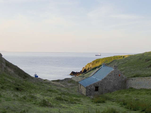
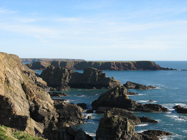
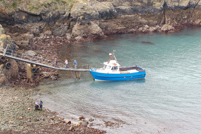
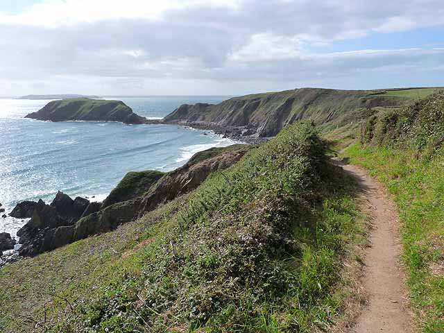
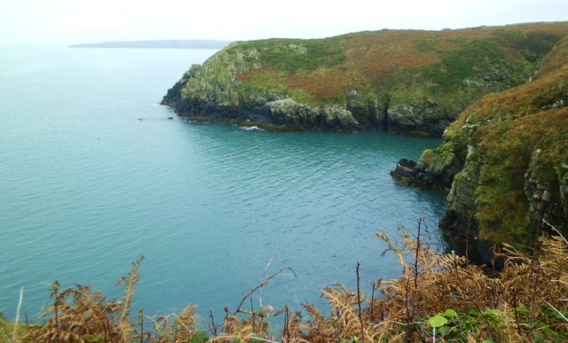
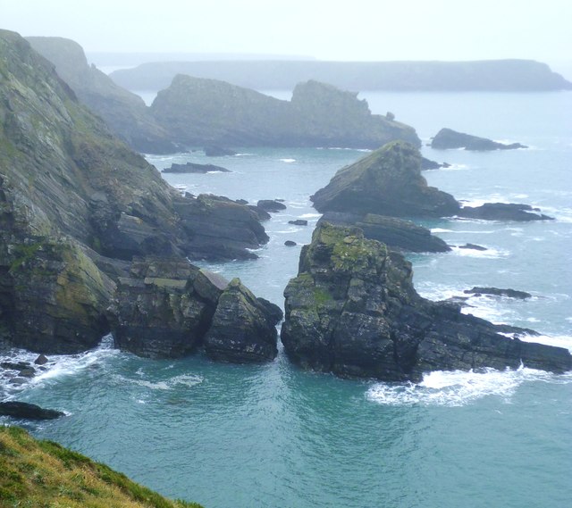
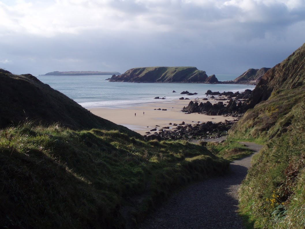
Albion Sands Images

Images are sourced within 2km of 51.721487/-5.2287671 or Grid Reference SM7707. Thanks to Geograph Open Source API. All images are credited.

Evening at Martin's Haven
Gateholm Island Gateholm is a tidal island, i.e. cut off at high tide but not at low tide. However from this perspective it seems that it would be difficult to climb to its plateau (about 40m high) even when access from Marloes Sands is easy.
Gateholm Island
Gateholm is a tidal island, i.e. cut off at high tide but not at low tide. However from this perspective it seems that it would be difficult to climb to its plateau (about 40m high) even when access from Marloes Sands is easy.
The Pembrokeshire coast south of Martin's Haven The flat-topped land in the middle distance is Gateholm Island (and this photo suggests that a few earlier photos in the square have been wrongly located, though the evidence is not strong enough to suggest a change). The more distant (and rather higher) land is the peninsula leading to St Anne's Head.
The Pembrokeshire coast south of Martin's Haven
The flat-topped land in the middle distance is Gateholm Island (and this photo suggests that a few earlier photos in the square have been wrongly located, though the evidence is not strong enough to suggest a change). The more distant (and rather higher) land is the peninsula leading to St Anne's Head.
Marloes sands in summer
Skomer ferry arrives back at Martin's Haven
The path from Marloes Sands The building on the right is the Youth Hostel <a href="https://www.geograph.org.uk/gridref/SM7708">SM7708</a>.
The path from Marloes Sands
The building on the right is the Youth Hostel SM7708.
Gateholm Island The Pembrokeshire Coast Path traverses the cliff top at the western end of Marloes Sands. Ahead is the tidal Gateholm Island. Skokholm Island <a href="https://www.geograph.org.uk/gridref/SM7305">SM7305</a> lies on the horizon.
Gateholm Island
The Pembrokeshire Coast Path traverses the cliff top at the western end of Marloes Sands. Ahead is the tidal Gateholm Island. Skokholm Island SM7305 lies on the horizon.
Marloes Sands The magnificent beach of Marloes Sands seen from the clifftop Pembrokeshire Coast Path.
Marloes Sands
The magnificent beach of Marloes Sands seen from the clifftop Pembrokeshire Coast Path.
Marloes Sands Youth Hostel The upper floor of the near building is the "Hayloft" - warden's quarters - as occupied by me on a couple of occasions in the distant past.
Marloes Sands Youth Hostel
The upper floor of the near building is the "Hayloft" - warden's quarters - as occupied by me on a couple of occasions in the distant past.
The courtyard of Marloes Sands Youth Hostel Manned by volunteer wardens.
The courtyard of Marloes Sands Youth Hostel
Manned by volunteer wardens.
Marloes Sands The magnificent beach at Marloes Sands. The Pembrokeshire Coast Path, a 186mile (299 km) long national trail, can be seen on the cliff top ahead.
Marloes Sands
The magnificent beach at Marloes Sands. The Pembrokeshire Coast Path, a 186mile (299 km) long national trail, can be seen on the cliff top ahead.
Marloes Sands The sandy beach of Marloes Sands is pierced by many outcrops of rock.
Marloes Sands
The sandy beach of Marloes Sands is pierced by many outcrops of rock.
Marloes Sands The sandy beach of Marloes Sands is pierced by many outcrops of rock.
Marloes Sands
The sandy beach of Marloes Sands is pierced by many outcrops of rock.
Marloes Sands The sandy beach of Marloes Sands is pierced by many outcrops of rock.
Marloes Sands
The sandy beach of Marloes Sands is pierced by many outcrops of rock.
Green Mire Cottage Standing beside the main access path to Marloes Sands.
Green Mire Cottage
Standing beside the main access path to Marloes Sands.
Straw bales, Marloes Court Farm
The coast at High Point The view from the coast path east of Martins Haven.
The coast at High Point
The view from the coast path east of Martins Haven.
Rocky coast towards Rainy Rock A rocky and inhospitable stretch of coastline on the south side of the Marloes peninsula. Rainy Rock is the big double topped block in the middle distance, whilst Gateholme Island is on the horizon.
Rocky coast towards Rainy Rock
A rocky and inhospitable stretch of coastline on the south side of the Marloes peninsula. Rainy Rock is the big double topped block in the middle distance, whilst Gateholme Island is on the horizon.
Show me another place!

Albion Sands is located at Grid Ref: SM7707 (Lat: 51.721487, Lng: -5.2287671)

Unitary Authority: Pembrokeshire

Police Authority: Dyfed Powys

What 3 Words

///official.squaring.tunes. Near Dale, Pembrokeshire

Related Wikis

Gateholm

Gateholm or Gateholm Island is a small tidal island off the south west coast of Pembrokeshire, in the community of Marloes and St Brides, in the south...

Marloes Mere

Marloes Mere is a Site of Special Scientific Interest (or SSSI) in Pembrokeshire, South Wales. It has been designated as a Site of Special Scientific Interest...

Marloes Sands

Marloes Sands (Welsh: Traeth Marloes) is an approx. 1.5 kilometres (0.93 mi) long remote sandy beach in Pembrokeshire, Wales, near the village of Marloes...

Martin's Haven

Martin's Haven is a small bay in Pembrokeshire, Wales, UK, on the Dale Peninsula, with views across St Bride's Bay towards St David's. Its shingle beach...

Nearby Amenities

Located within 500m of 51.721487,-5.2287671
Access: yes
Barrier: kissing_gate
Bicycle: no
Foot: yes
Goods: no
Hgv: no
Horse: no
Motor Vehicle: no
Motorcar: no
Motorcycle: no
Vehicle: no
Lat/Long: 51.7249813/-5.2307683
Ford: yes
Lat/Long: 51.7255795/-5.2313038
The data included in this document is from www.openstreetmap.org. The data is made available under ODbL.

Have you been to Albion Sands?

Leave your review of Albion Sands below (or comments, questions and feedback).