An Doirlinn

Beach in Argyllshire

Scotland

An Doirlinn

Kintyre Peninsula The evening sun on the west coast of the Kintyre peninsula.  Taken from the B8024 near Creag Stars.
Kintyre Peninsula Credit: Peter Jeffery

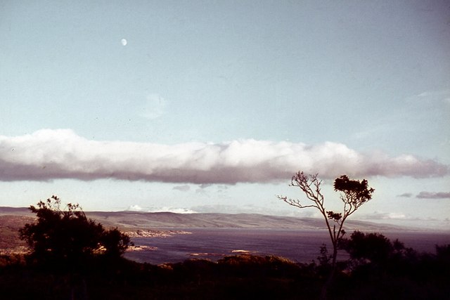
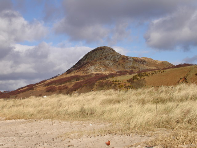
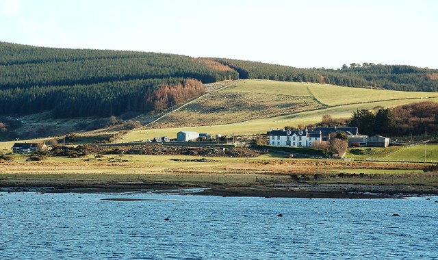
An Doirlinn, located in Argyllshire, Scotland, is a picturesque beach that offers visitors a breathtaking natural beauty. With its stunning landscapes and tranquil surroundings, it is a popular destination for both locals and tourists seeking a peaceful retreat.

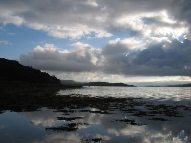
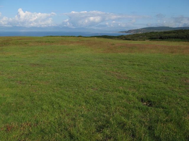
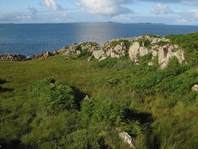
Situated on the west coast of Scotland, An Doirlinn boasts expansive sandy stretches bordered by rocky outcrops and clear blue waters. Its pristine shoreline stretches for approximately 1 kilometer, providing ample space for leisurely walks, picnics, or simply basking in the sun. The beach is backed by rolling green hills, adding to its charm and making it a perfect spot for nature enthusiasts.

The beach is relatively secluded, creating a sense of serenity and tranquility for visitors. Its remote location and lack of commercial development contribute to its unspoiled nature, making it an ideal destination for those seeking a peaceful escape from the bustling city life.

An Doirlinn offers stunning views of the surrounding area, including the nearby islands of Jura and Islay. On a clear day, visitors can witness breathtaking sunsets, creating a magical atmosphere and providing ample opportunities for photography enthusiasts.

The beach is also known for its diverse wildlife, making it a haven for birdwatchers. Seals can often be seen lounging on the rocky shores, adding to the beauty and uniqueness of the area.

Overall, An Doirlinn in Argyllshire is a hidden gem that offers visitors a serene and idyllic beach experience, surrounded by stunning natural landscapes and abundant wildlife.

If you have any feedback on the listing, please let us know in the comments section below.

An Doirlinn Images

Images are sourced within 2km of 55.764611/-5.5962415 or Grid Reference NR7458. Thanks to Geograph Open Source API. All images are credited.

Kintyre Peninsula The evening sun on the west coast of the Kintyre peninsula.  Taken from the B8024 near Creag Stars.
Kintyre Peninsula
The evening sun on the west coast of the Kintyre peninsula. Taken from the B8024 near Creag Stars.
Entry to Ardpatrick House
New Trees at Ardpatrick Dunskeig on the Kintyre peninsula can clearly be seen from here.
New Trees at Ardpatrick
Dunskeig on the Kintyre peninsula can clearly be seen from here.
Bothy at Ardpatrick Point The bothy paintwork has weathered since <a href="https://www.geograph.org.uk/photo/1599462">NR7357 : Bothy at Ardpatrick Point</a> but was not locked. See <a href="https://www.geograph.org.uk/photo/5037484">NR7357 : Bothy at Ardpatrick Point</a> for view of the interior.
Bothy at Ardpatrick Point
The bothy paintwork has weathered since NR7357 : Bothy at Ardpatrick Point but was not locked. See NR7357 : Bothy at Ardpatrick Point for view of the interior.
Bothy at Ardpatrick Point The bothy was unlocked when I visited. A good viewpoint for seabird watching and a useful logbook.
Bothy at Ardpatrick Point
The bothy was unlocked when I visited. A good viewpoint for seabird watching and a useful logbook.
West Loch Tarbert from Achadh-Chaorann The view across West Loch Tarbert with the prominent hill of Dun Skeig on the Kintyre peninsula from the mouth of the small tidal bay of Achadh-Chaorann. The tip of Rubha a' Bharra Ruaidh is just visible at the opposite shore of the bay.
West Loch Tarbert from Achadh-Chaorann
The view across West Loch Tarbert with the prominent hill of Dun Skeig on the Kintyre peninsula from the mouth of the small tidal bay of Achadh-Chaorann. The tip of Rubha a' Bharra Ruaidh is just visible at the opposite shore of the bay.
Point House The derelict and roofless isolation of Point House commands fine views to the north-east along West Loch Tarbert.
Point House
The derelict and roofless isolation of Point House commands fine views to the north-east along West Loch Tarbert.
Eilean Tràighe Excellent occurrence of bright yellow-coloured wracks on shallows on the landward side of Eilean Tràighe.
Eilean Tràighe
Excellent occurrence of bright yellow-coloured wracks on shallows on the landward side of Eilean Tràighe.
Folded rock outcrops A wonderful exposure of tilted and folded Dalradian schists. The structural trend of these rocks which were metamorphosed and deformed during the Caledonian mountain-building leaves its imprint on the entire landscape, controlling the orientation of the loch shores and hilly ridges.
Folded rock outcrops
A wonderful exposure of tilted and folded Dalradian schists. The structural trend of these rocks which were metamorphosed and deformed during the Caledonian mountain-building leaves its imprint on the entire landscape, controlling the orientation of the loch shores and hilly ridges.
End of the island Rather confused rock outcrops and offshore reefs mark the end of Eilean Tràighe, which is not strictly an island as it has a rarely-flooded tombolo inland. I was very frustrated by the failure of the clouds to break and illuminate the scene, waiting in the end nearly 30 minutes. However, this time was well-spent in watching seals and a family of otters playing on the reef in the middle of the image. So many people have submitted images of this scene from the deck of passing ferries to Islay that I was determined to submit an image from the island instead. The boat had passed about 45 minutes previously, while I was walking from my car.
End of the island
Rather confused rock outcrops and offshore reefs mark the end of Eilean Tràighe, which is not strictly an island as it has a rarely-flooded tombolo inland. I was very frustrated by the failure of the clouds to break and illuminate the scene, waiting in the end nearly 30 minutes. However, this time was well-spent in watching seals and a family of otters playing on the reef in the middle of the image. So many people have submitted images of this scene from the deck of passing ferries to Islay that I was determined to submit an image from the island instead. The boat had passed about 45 minutes previously, while I was walking from my car.
Beach platform with boulders A scattering of large erratic boulders on the shallow beach platform remain dry at high tide and sustain a brightly-coloured population of Caloplaca lichens.
Beach platform with boulders
A scattering of large erratic boulders on the shallow beach platform remain dry at high tide and sustain a brightly-coloured population of Caloplaca lichens.
An Doirlinn A wonderful intertidal area covered in an abundance of Knotted Wrack and Bladder Wrack forming a tombolo with Eilean Tràighe. It is difficult to tell where the water begins in the low morning light with strong reflections. The manicured fields of Ardpatrick form a green backdrop.
An Doirlinn
A wonderful intertidal area covered in an abundance of Knotted Wrack and Bladder Wrack forming a tombolo with Eilean Tràighe. It is difficult to tell where the water begins in the low morning light with strong reflections. The manicured fields of Ardpatrick form a green backdrop.
Reflected clouds Reflections in the shallow intertidal waters of An Doirlinn, the view taking in Gigha on the horizon. I live for mornings like this, notwithstanding the frustration of a cloudy start!
Reflected clouds
Reflections in the shallow intertidal waters of An Doirlinn, the view taking in Gigha on the horizon. I live for mornings like this, notwithstanding the frustration of a cloudy start!
West Loch Tarbert Morning light over West Loch Tarbert. If you cannot beat the clouds, make a picture of them!
West Loch Tarbert
Morning light over West Loch Tarbert. If you cannot beat the clouds, make a picture of them!
Cows guarding the path On the way out the cows had gone as far as the old jetty, so I made a detour on the beach as I didn't know what they would think of my geograph assistant Madog; on the way back they were awaiting our return at the gate!
Cows guarding the path
On the way out the cows had gone as far as the old jetty, so I made a detour on the beach as I didn't know what they would think of my geograph assistant Madog; on the way back they were awaiting our return at the gate!
View over improved pasture A view from Point House over pasture with Jura and its line of clouds on the horizon. The pastures of Ardpatrick are very well tended.
View over improved pasture
A view from Point House over pasture with Jura and its line of clouds on the horizon. The pastures of Ardpatrick are very well tended.
Improvements at Point House Point House is a well-covered subject! Here is agricultural work in progress on the headland.
Improvements at Point House
Point House is a well-covered subject! Here is agricultural work in progress on the headland.
Outcrops above Ardpatrick Point My assistant Madog is playing hide and seek in the bracken in this little valley running down towards Ardpatrick Point. A strong reflection from the sea of brightly-illuminated clouds makes a curious flare in the image.
Outcrops above Ardpatrick Point
My assistant Madog is playing hide and seek in the bracken in this little valley running down towards Ardpatrick Point. A strong reflection from the sea of brightly-illuminated clouds makes a curious flare in the image.
Show me another place!

An Doirlinn is located at Grid Ref: NR7458 (Lat: 55.764611, Lng: -5.5962415)

Unitary Authority: Argyll and Bute

Police Authority: Argyll and West Dunbartonshire

What 3 Words

///reference.stocks.hormones. Near Tarbert, Argyll & Bute

Related Wikis

Ardpatrick House

Ardpatrick House is a category-B-listed 18th-century country house in Ardpatrick, South Knapdale, Argyll and Bute, Scotland. == History == A fortified...

Ardpatrick, Argyll

Ardpatrick (Scottish Gaelic: Àird Phàdraig) is a village at the southwestern extremity of the Knapdale, Argyll, Scotland. The village is built along the...

Dun Skeig

Dun Skeig is an oval Iron Age dun (fort) complex which is perched atop a rocky outcropping about 40 metres (130 ft) above sea level overlooking West Loch...

Clachan, Kintyre

Clachan is a small village in North Kintyre, Argyll & Bute, Scotland. Clachan is the site of an old church, which was the principal church for the North...

Loup House

Loup House is a manor house north of Clachan on the Kintyre peninsula of Argyll, Scotland. The estate was once home to the chiefs of Clan MacAlister, and...

Balinakill House

Balinakill House is a Victorian manor house to the east of the village of Clachan, Kintyre, Argyll and Bute, Scotland. The house was built by Sir William...

Kilcalmonell

The parish of Kilcalmonell is situated in Argyll and Bute, Scotland. It extends from Clachan, in Kintyre to Kilberry, in Knapdale. == References == W....
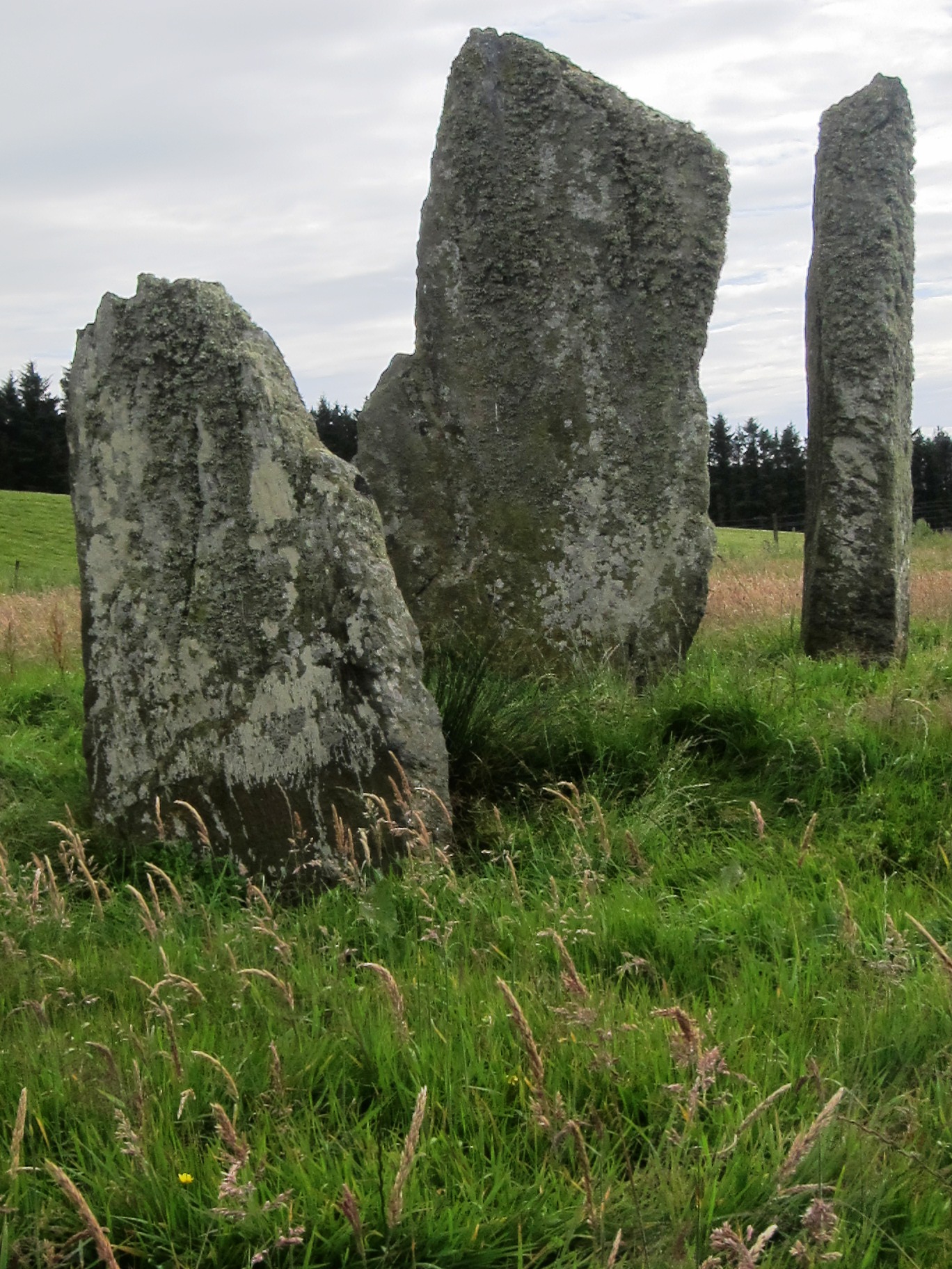
Ballochroy

Ballochroy is a megalithic site in Kintyre on the Argyll peninsula in Scotland. It consists of three vertical stones, side by side, aligned with various...

Nearby Amenities

Located within 500m of 55.764611,-5.5962415
The data included in this document is from www.openstreetmap.org. The data is made available under ODbL.

Have you been to An Doirlinn?

Leave your review of An Doirlinn below (or comments, questions and feedback).