An Taor-geal

Beach in Inverness-shire

Scotland

An Taor-geal

House at Laggan
House at Laggan Credit: Steven Brown

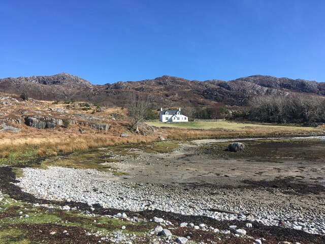
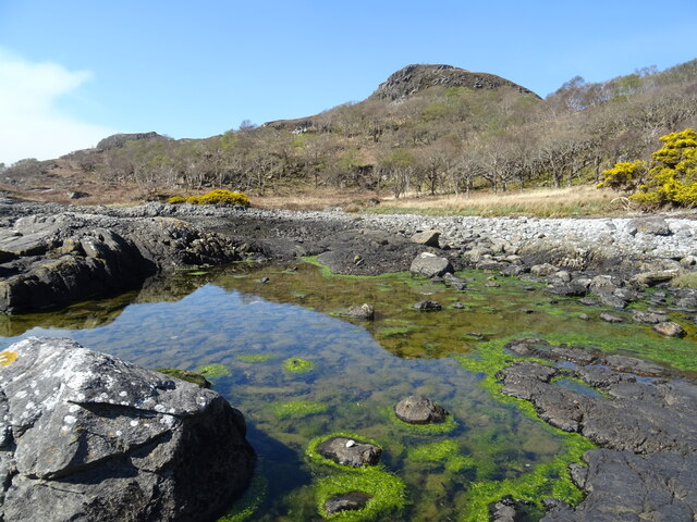
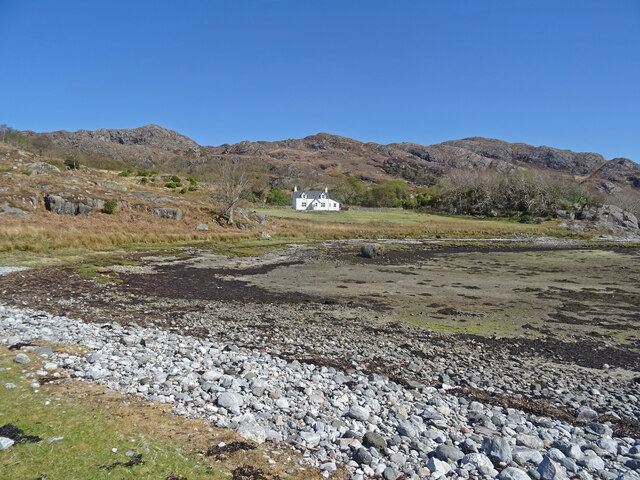
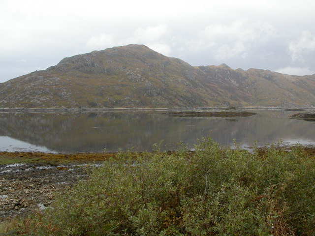
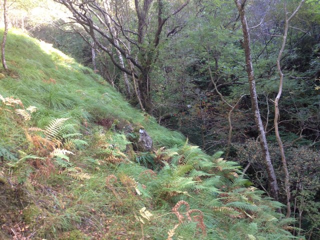
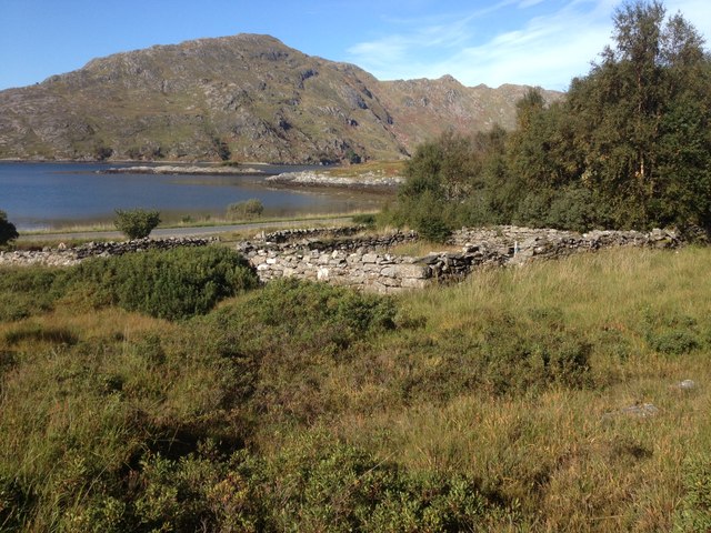
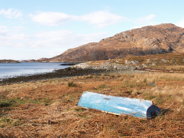
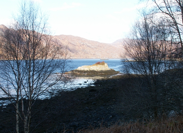
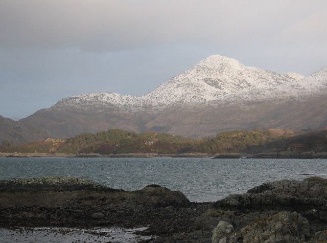
An Taor-geal, located in Inverness-shire on the west coast of Scotland, is a picturesque beach renowned for its natural beauty and serene atmosphere. Stretching over a mile long, this pristine sandy beach is nestled between rolling hills and the crystal-clear waters of the Atlantic Ocean, providing visitors with a breathtaking panorama.

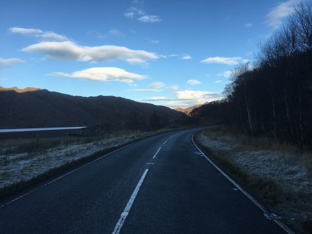
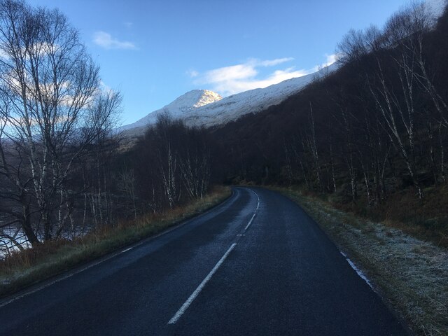
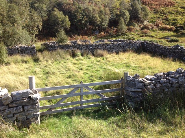
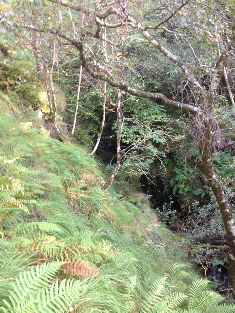
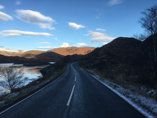
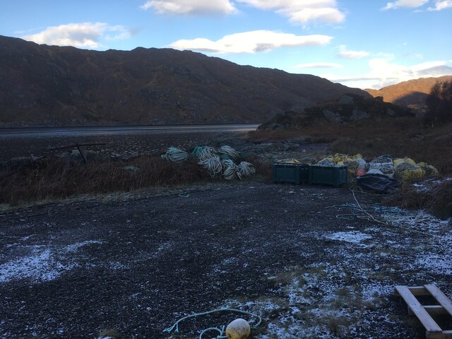
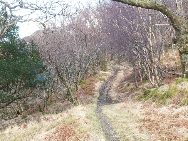
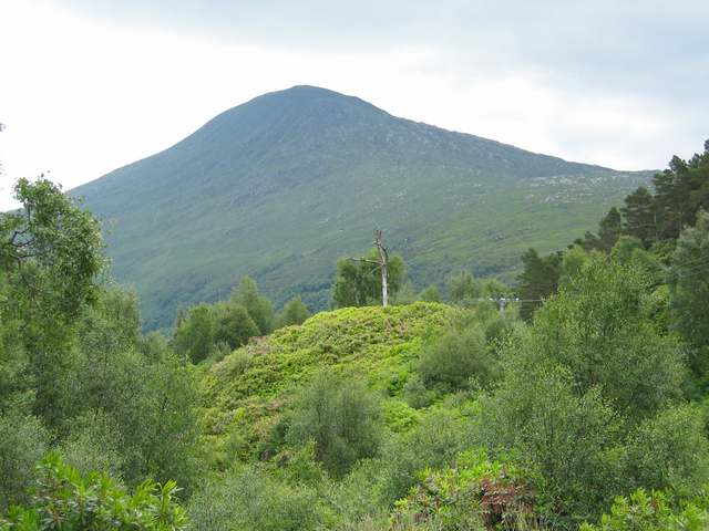
One of the unique features of An Taor-geal is its remote location, offering a sense of tranquility and seclusion. The beach is accessible via a scenic coastal trail, which adds to the allure of the area. As visitors make their way to the beach, they are treated to stunning views of the rugged coastline, dramatic cliffs, and lush greenery that characterizes the region.

Once at the beach, visitors are greeted by soft golden sand that is perfect for leisurely walks or sunbathing. The clear waters of the Atlantic Ocean are relatively calm, providing an ideal environment for swimming, kayaking, and other water activities. The beach also boasts a diverse array of marine life, making it a popular spot for snorkeling and diving enthusiasts.

An Taor-geal is particularly renowned for its wildlife sightings. Seals, dolphins, and a variety of sea birds can often be spotted in the vicinity, adding to the natural charm of the area. The beach is also a great location for birdwatching, as the surrounding hills and cliffs provide nesting grounds for various species.

Overall, An Taor-geal is a hidden gem on the west coast of Scotland, offering visitors a pristine and serene beach experience. Its remote location, stunning scenery, and abundance of wildlife make it a must-visit destination for nature lovers and those seeking a peaceful retreat.

If you have any feedback on the listing, please let us know in the comments section below.

An Taor-geal Images

Images are sourced within 2km of 56.853483/-5.7163856 or Grid Reference NM7379. Thanks to Geograph Open Source API. All images are credited.

House at Laggan
House at Laggan
A861 near Alisary
A861 near Alisary
A861 near Roshven
A861 near Roshven
Jetty on Loch Ailort
Ardnish Coastal Scenery Lovely coastal scenery on the Ardnish peninsula near Laggan. Great for a potter about and beachcoming on a warm spring day.
Ardnish Coastal Scenery
Lovely coastal scenery on the Ardnish peninsula near Laggan. Great for a potter about and beachcoming on a warm spring day.
Digital Detox Laggan cottage on the Ardnish peninsula, available for weekly rent from the estate, and described as 'one of the most remote/best off-grid holiday or digital detox cottages in the UK'.
Certainly it is stunning scenery around and the cottage is only accessible really by boat - it is a hard walk otherwise.
Details:-
<span class="nowrap"><a title="https://www.ardnish.org/laggan/" rel="nofollow ugc noopener" href="https://www.ardnish.org/laggan/">Link</a><img style="margin-left:2px;" alt="External link" title="External link - shift click to open in new window" src="https://s1.geograph.org.uk/img/external.png" width="10" height="10"/></span>
Digital Detox
Laggan cottage on the Ardnish peninsula, available for weekly rent from the estate, and described as 'one of the most remote/best off-grid holiday or digital detox cottages in the UK'. Certainly it is stunning scenery around and the cottage is only accessible really by boat - it is a hard walk otherwise. Details:- LinkExternal link
Loch Ailort and south flank of Cruach an Aonaich
A brace of English Springer Spaniels near Roishven Straining on their leashes, this pair of Spaniels will soon be loosed to enjoy the freedom of Loch Ailort.
A brace of English Springer Spaniels near Roishven
Straining on their leashes, this pair of Spaniels will soon be loosed to enjoy the freedom of Loch Ailort.
Small stream near Alisary
Sheep pen near Alisary
Stream running in a gorge near Alisary
The western slopes of An Stac Looking out to Loch Ailort
The western slopes of An Stac
Looking out to Loch Ailort
A861 towards Lochailort
Fish farming materials beside the A861
Post road to Glen Uig Up until the mid 1960's this was the mail route and only land route from Kinlochailort to Glen Uig. Mails arrived on the train at Kinlochailort and were then taken on horseback by the postie out to Glen Uig and I think the return journey was done the next day. Looking East from Alisary and up towards Bealach Breac where the path reached it highest point at around 130mts before dropping down to sea level at Inverailort.
Post road to Glen Uig
Up until the mid 1960's this was the mail route and only land route from Kinlochailort to Glen Uig. Mails arrived on the train at Kinlochailort and were then taken on horseback by the postie out to Glen Uig and I think the return journey was done the next day. Looking East from Alisary and up towards Bealach Breac where the path reached it highest point at around 130mts before dropping down to sea level at Inverailort.
Blue boat by Alisary Looking out across this square from the east edge towards Cruich an Aonaich on Ardnish across Lochailort. Eilean Buidhe is on the left of shot.
Blue boat by Alisary
Looking out across this square from the east edge towards Cruich an Aonaich on Ardnish across Lochailort. Eilean Buidhe is on the left of shot.
By Roshven Fairly typical view of Loch Ailort shoreline with birches and small rocky tidal islands. Looking up the loch towards Kinlochailort from near Roshven farm.
By Roshven
Fairly typical view of Loch Ailort shoreline with birches and small rocky tidal islands. Looking up the loch towards Kinlochailort from near Roshven farm.
Show me another place!

An Taor-geal is located at Grid Ref: NM7379 (Lat: 56.853483, Lng: -5.7163856)

Unitary Authority: Highland

Police Authority: Highlands and Islands

What 3 Words

///snap.microchip.boxing. Near Arisaig, Highland

Related Wikis

Loch Ailort

Loch Ailort ( lokh EYE-lərt; Scottish Gaelic: Loch Ailleart) is a sea loch in Morar, Lochaber, Highland, Scotland. Loch Ailort is a shallow, V-shaped...

Alisary

Alisary is a tiny settlement in Highland, Scotland.

An Stac

An Stac is the name of a 814 m mountain in the Northwest Highlands, Scotland, on the shore of Loch Ailort on the west coast of Lochaber. A steep-sided...

Rois-bheinn

Rois-bheinn is the joint highest hill in the Scottish region of Moidart, a title it shares with its neighbour Beinn Odhar Bheag, whose summit has the same...

Nearby Amenities

Located within 500m of 56.853483,-5.7163856
Source: PGS
Lat/Long: 56.8503779/-5.7123049
Source: PGS
Lat/Long: 56.8502973/-5.7130227
Source: PGS
Lat/Long: 56.8503869/-5.7130057
Source: PGS
Lat/Long: 56.8504421/-5.71296
Source: PGS
Lat/Long: 56.8507789/-5.7120723
Source: PGS
Lat/Long: 56.8505973/-5.7120243
Source: PGS
Lat/Long: 56.8504302/-5.7121825
Source: PGS
Lat/Long: 56.8518889/-5.7238033
Source: PGS
Lat/Long: 56.8512654/-5.723541
Source: PGS
Lat/Long: 56.8509872/-5.721128
Created By: dmgroom_coastlines
Source: PGS
Lat/Long: 56.851148/-5.720195
Created By: dmgroom_coastlines
Source: PGS
Lat/Long: 56.851435/-5.718813
Created By: dmgroom_coastlines
Source: PGS
Lat/Long: 56.851568/-5.71859
Created By: dmgroom_coastlines
Source: PGS
Lat/Long: 56.85209/-5.71816
Created By: dmgroom_coastlines
Source: PGS
Lat/Long: 56.852867/-5.717749
Created By: dmgroom_coastlines
Source: PGS
Lat/Long: 56.853389/-5.717319
Created By: dmgroom_coastlines
Source: PGS
Lat/Long: 56.853521/-5.717094
Created By: dmgroom_coastlines
Source: PGS
Lat/Long: 56.853655/-5.716871
Created By: dmgroom_coastlines
Source: PGS
Lat/Long: 56.853787/-5.716646
Created By: dmgroom_coastlines
Source: PGS
Lat/Long: 56.854063/-5.715731
Created By: dmgroom_coastlines
Source: PGS
Lat/Long: 56.854212/-5.714807
Created By: dmgroom_coastlines
Source: PGS
Lat/Long: 56.854463/-5.715059
Created By: dmgroom_coastlines
Source: PGS
Lat/Long: 56.854708/-5.715545
Created By: dmgroom_coastlines
Source: PGS
Lat/Long: 56.854954/-5.71603
Created By: dmgroom_coastlines
Source: PGS
Lat/Long: 56.855721/-5.716086
The data included in this document is from www.openstreetmap.org. The data is made available under ODbL.

Have you been to An Taor-geal?

Leave your review of An Taor-geal below (or comments, questions and feedback).