Lesceave Por

Beach in Cornwall

England

Lesceave Por

OS Cut Mark: Germoe, Larkspur Cottage <span class="nowrap"><a title="https://www.bench-marks.org.uk/bm85462" rel="nofollow ugc noopener" href="https://www.bench-marks.org.uk/bm85462">Link</a><img style="margin-left:2px;" alt="External link" title="External link - shift click to open in new window" src="https://s1.geograph.org.uk/img/external.png" width="10" height="10"/></span>
OS Cut Mark: Germoe, Larkspur Cottage Credit: thejackrustles

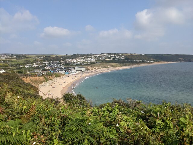
Lesceave Por, located in Cornwall, is a picturesque beach renowned for its natural beauty and tranquility. Nestled along the rugged coastline, this hidden gem offers an idyllic escape from the hustle and bustle of everyday life.

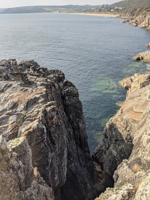
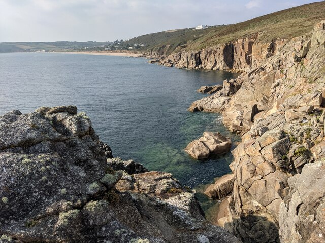
The beach is characterized by its golden sands and crystal-clear waters, creating a stunning contrast against the dramatic cliffs that frame the shoreline. Lesceave Por is relatively secluded, making it a perfect spot for those seeking a peaceful retreat. The absence of crowds and noise allows visitors to immerse themselves in the serene atmosphere and appreciate the unspoiled beauty of their surroundings.

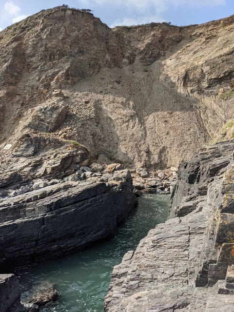
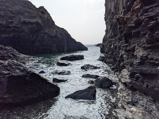
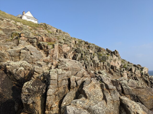
The beach is also known for its impressive rock formations, which have been shaped by the relentless crashing waves over centuries. These geological wonders provide a stunning backdrop for nature enthusiasts and photographers alike. During low tide, visitors can explore the rock pools, discovering a fascinating array of marine life, including colorful anemones and small fish.

Lesceave Por offers excellent opportunities for outdoor activities. The calm waters make it an ideal spot for swimming and snorkeling, while the strong ocean currents attract experienced surfers. The beach is also a popular destination for hikers, who can enjoy breathtaking coastal walks along the cliff paths, providing stunning panoramas of the Atlantic Ocean.

Facilities at Lesceave Por are limited, adding to its unspoiled charm. Visitors should come prepared with food, drinks, and beach essentials. There are no lifeguards on duty, so caution should be exercised when entering the water.

In conclusion, Lesceave Por is a hidden gem in Cornwall, offering a peaceful and unspoiled coastal experience. Its natural beauty, stunning rock formations, and various outdoor activities make it a must-visit destination for nature lovers and those seeking a tranquil beach escape.

If you have any feedback on the listing, please let us know in the comments section below.
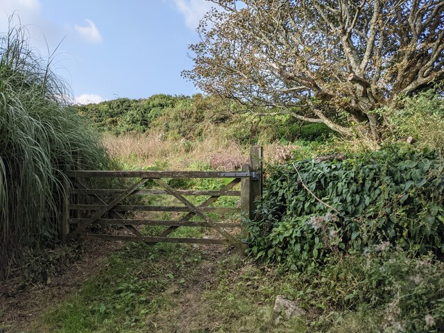
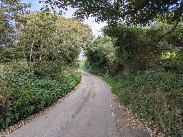
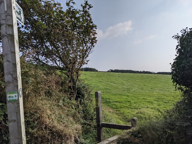
Lesceave Por Images

Images are sourced within 2km of 50.09739/-5.3755211 or Grid Reference SW5827. Thanks to Geograph Open Source API. All images are credited.

OS Cut Mark: Germoe, Larkspur Cottage <span class="nowrap"><a title="https://www.bench-marks.org.uk/bm85462" rel="nofollow ugc noopener" href="https://www.bench-marks.org.uk/bm85462">Link</a><img style="margin-left:2px;" alt="External link" title="External link - shift click to open in new window" src="https://s1.geograph.org.uk/img/external.png" width="10" height="10"/></span>
OS Cut Mark: Germoe, Larkspur Cottage
Coastal rocks near Pestreath Cove
The Coast Path near Pestreath Cove The path just passes through the corner of this square.
The Coast Path near Pestreath Cove
The path just passes through the corner of this square.
A hidden archway at Hoe Point This is a complex area of channels and stacks, not often accessed except by fishermen.
A hidden archway at Hoe Point
This is a complex area of channels and stacks, not often accessed except by fishermen.
The entrance to the zawn at Hoe Point The red rope and steel staples in the rock are an aid for the fishermen's access to the water.
The entrance to the zawn at Hoe Point
The red rope and steel staples in the rock are an aid for the fishermen's access to the water.
Narrow zawn, crumbling cliff At Hoe Point.
Narrow zawn, crumbling cliff
At Hoe Point.
Looking out along the channel An interesting zawn in the rocks, used somehow by fishermen.
Looking out along the channel
An interesting zawn in the rocks, used somehow by fishermen.
Shattered rocks at Hoe Point
Looking past Little Castle Towards Praa Sands.
Looking past Little Castle
Towards Praa Sands.
The Coast Path above Sydney Cove
Looking over Praa Sands The vegetation on the Coast Path restricts the view from this area considerably.
Looking over Praa Sands
The vegetation on the Coast Path restricts the view from this area considerably.
The lane above Praa Sands
Overgrown land near Lesceave Farm
The lane to Hendra
The lane to Hendra
Footpath off the lane to Hendra
A narrow zawn at Rinsey Head
Looking up towards Rinsey Head house
The cliffs on Rinsey Head
Show me another place!

Lesceave Por is located at Grid Ref: SW5827 (Lat: 50.09739, Lng: -5.3755211)

Unitary Authority: Cornwall

Police Authority: Devon and Cornwall

What 3 Words

///monkey.adults.aviators. Near Germoe, Cornwall

Related Wikis

Rinsey

Rinsey (Cornish: Rynnji) is a hamlet in Cornwall, England, United Kingdom. It is located off the main A394 road between Helston and Penzance in the civil...

Wheal Prosper, Rinsey

Wheal Prosper was a tin mine in Cornwall, England, a short distance from the hamlet of Rinsey and about 2.5 miles (4 km) west of Porthleven. The ruined...

Praa Sands

Praa Sands (Cornish: Poll an Wragh = Salt Pool of the Wrasse), (formerly Prah Sands) commonly pronounced pray or prah, is a white-sand beach and coastal...
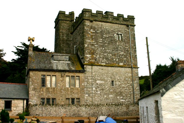
Pengersick Castle

Pengersick Castle is a fortified manor house located between the villages of Germoe and Praa Sands in Cornwall, England. The tower house, which is in the...

Nearby Amenities

Located within 500m of 50.09739,-5.3755211
Source: PGS
Lat/Long: 50.0992722/-5.3809898
Source: PGS
Lat/Long: 50.0989426/-5.3798933
Source: PGS
Lat/Long: 50.0985221/-5.378844
Source: PGS
Lat/Long: 50.0983652/-5.3781423
Created By: almien_coastlines
Source: PGS
Lat/Long: 50.097585/-5.376196
Created By: almien_coastlines
Source: PGS
Lat/Long: 50.097349/-5.375187
Source: PGS
Lat/Long: 50.0969763/-5.3748305
Source: PGS
Lat/Long: 50.0969405/-5.3748564
WW2 Gun Emplacement
Building: bunker
Bunker Type: gun_emplacement
Military: bunker
Lat/Long: 50.097072/-5.3733187
Man Made: mineshaft
Lat/Long: 50.0972308/-5.3736593
Waste Basket
Survey Date: 2022-09-04
Lat/Long: 50.1001596/-5.3783971
Life Ring
Emergency: life_ring
Survey Date: 2022-09-04
Lat/Long: 50.0993902/-5.377492
Fire Hydrant
Emergency: fire_hydrant
Fire Hydrant Type: underground
Survey Date: 2022-09-04
Lat/Long: 50.1003251/-5.3784277
Hendra Beach
Lifeguard: no
Natural: beach
Supervised: no
Lat/Long: 50.09879/-5.3781736
The data included in this document is from www.openstreetmap.org. The data is made available under ODbL.

Have you been to Lesceave Por?

Leave your review of Lesceave Por below (or comments, questions and feedback).