Cairidh Mhòr

Beach in Argyllshire

Scotland

Cairidh Mhòr

Barren view of north Jura Very rugged landscape. Further up the hill to the west, you could see the hills of the Isle of Mull peeping out from the top of the cascade of hills shown in the centre.
Barren view of north Jura Credit: Richard Murchie

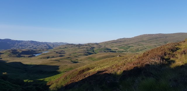
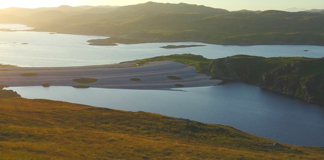
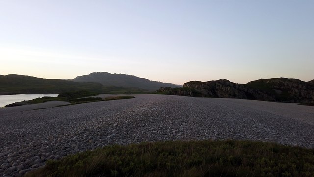
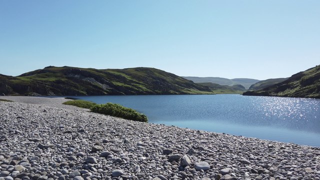
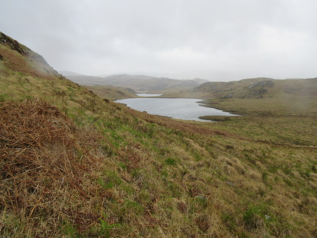
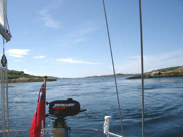
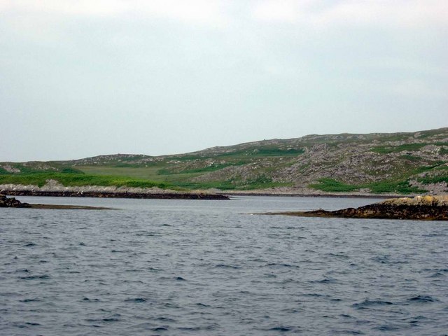
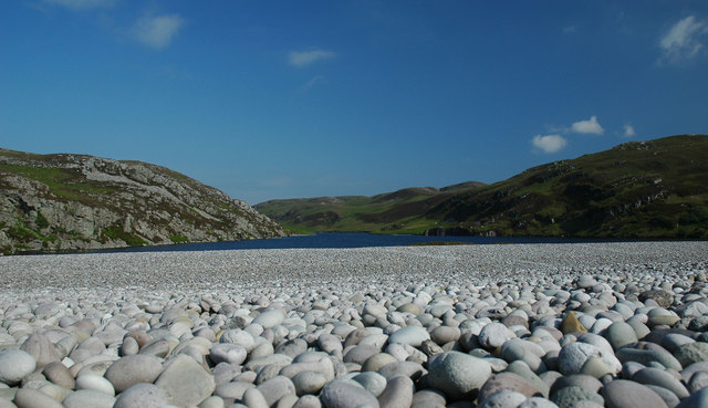
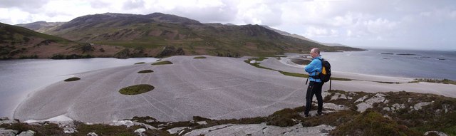
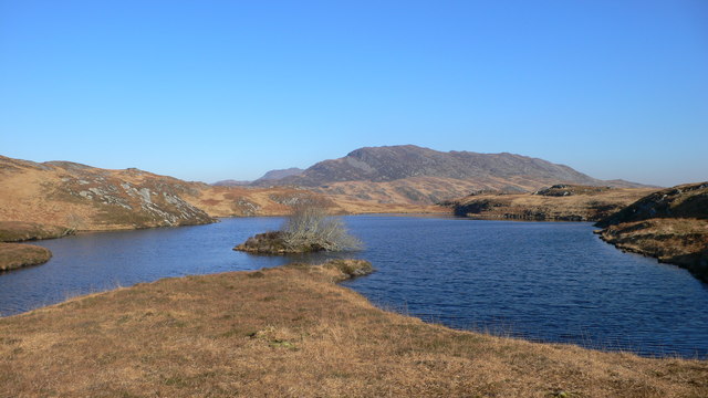
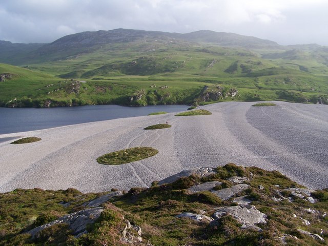
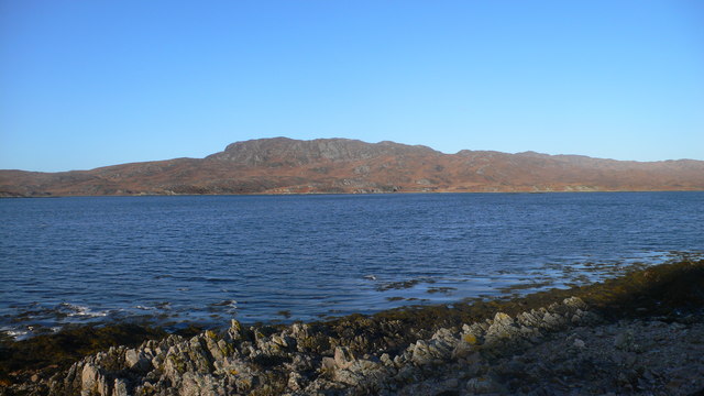
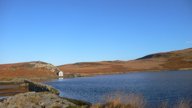
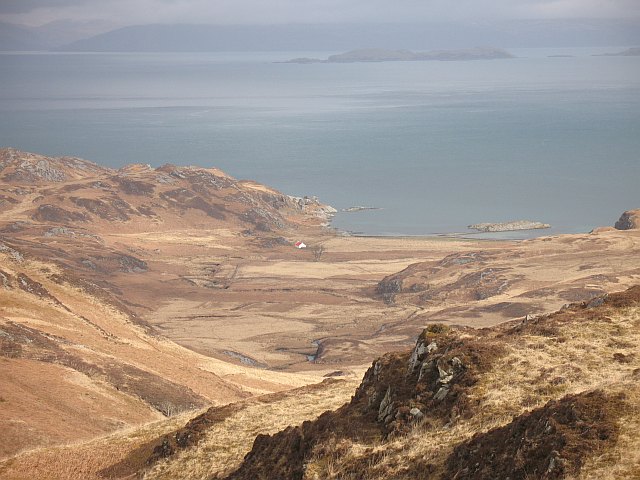
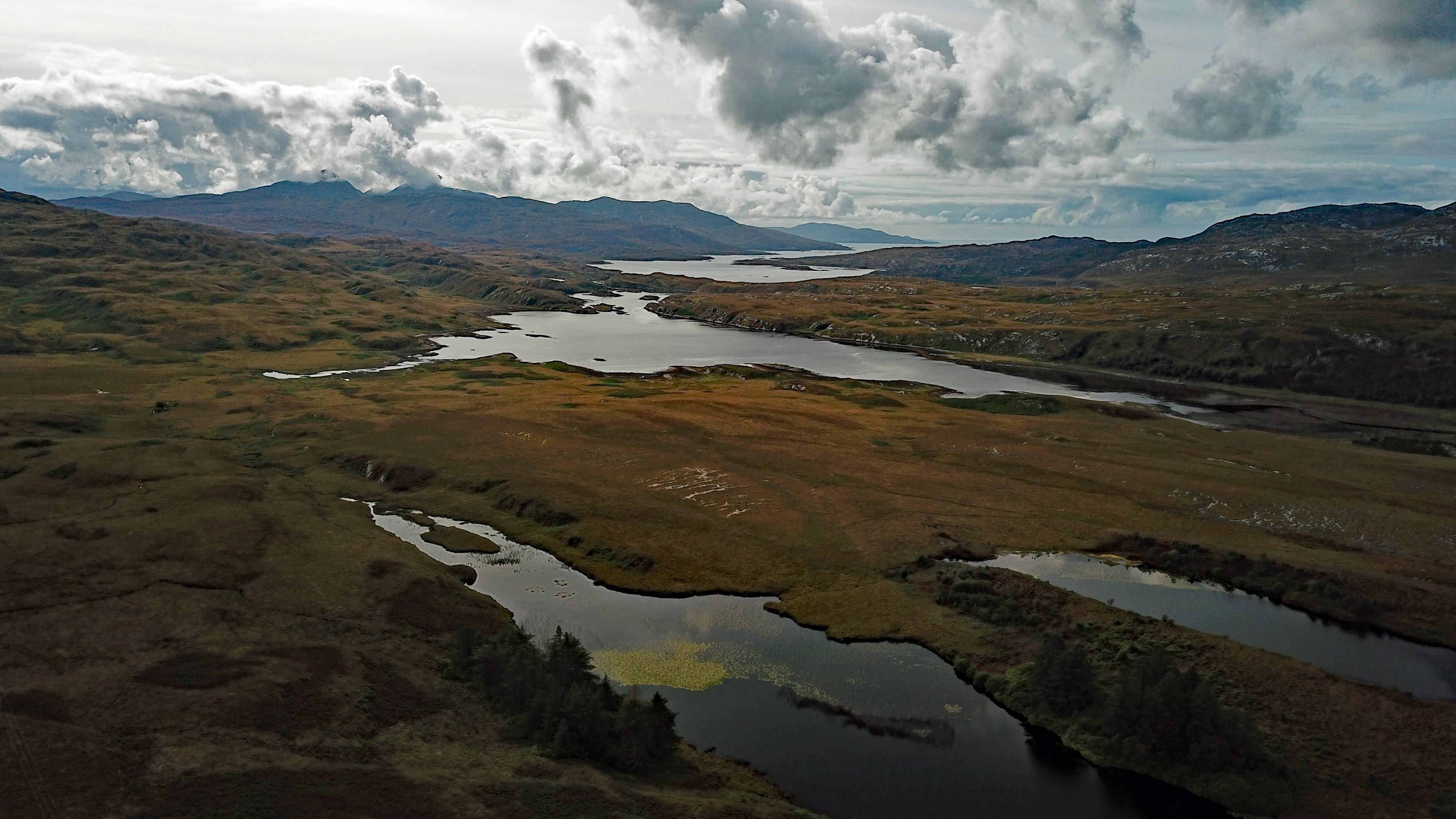
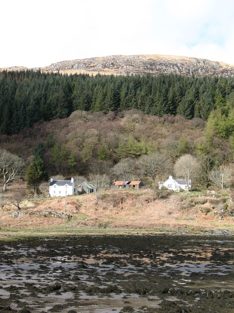
Cairidh Mhòr is a stunning beach located in Argyllshire, Scotland. This beautiful stretch of coastline offers visitors a picturesque setting with its golden sandy beach, clear blue waters, and rugged cliffs. The beach is surrounded by rolling hills and lush greenery, providing a peaceful and scenic backdrop for those looking to relax and unwind.

Cairidh Mhòr is a popular destination for beach-goers, offering ample space for sunbathing, picnicking, and enjoying water activities such as swimming, snorkeling, and kayaking. The beach is also known for its excellent surfing conditions, attracting surfers of all skill levels.

In addition to its natural beauty, Cairidh Mhòr is home to a diverse range of wildlife, including seabirds, seals, and occasionally even dolphins and whales. Birdwatchers will delight in the opportunity to spot rare species along the coastline.

Visitors to Cairidh Mhòr can also explore the nearby village of Argyllshire, where they can find charming shops, cafes, and restaurants serving up fresh seafood and local delicacies. Overall, Cairidh Mhòr is a hidden gem on the west coast of Scotland, offering visitors a tranquil and scenic escape from the hustle and bustle of everyday life.

If you have any feedback on the listing, please let us know in the comments section below.
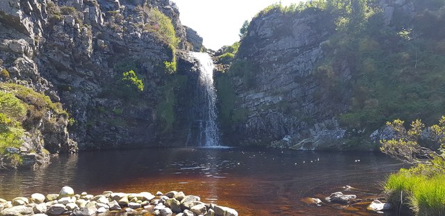
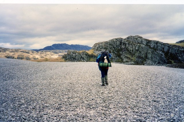
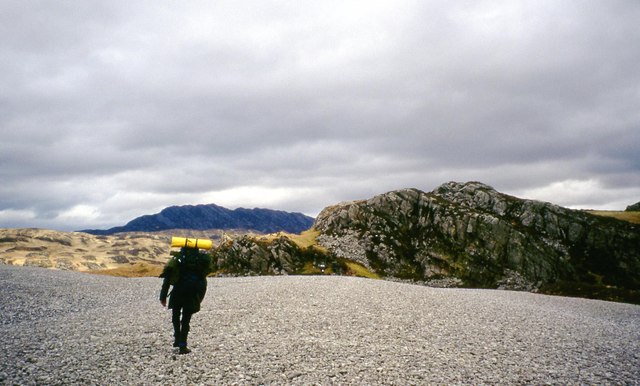
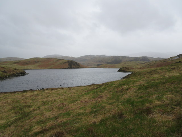
Cairidh Mhòr Images

Images are sourced within 2km of 55.957078/-5.9177357 or Grid Reference NR5580. Thanks to Geograph Open Source API. All images are credited.

Barren view of north Jura Very rugged landscape. Further up the hill to the west, you could see the hills of the Isle of Mull peeping out from the top of the cascade of hills shown in the centre.
Barren view of north Jura
Very rugged landscape. Further up the hill to the west, you could see the hills of the Isle of Mull peeping out from the top of the cascade of hills shown in the centre.
Raised beach A raised beach flanked by the sea (Loch Tarbert) and the fresh-water body of water Lochan Maol an t-Sornaich.
Raised beach
A raised beach flanked by the sea (Loch Tarbert) and the fresh-water body of water Lochan Maol an t-Sornaich.
Raised beach A raised beach at late evening. In the background, you can see the hill named Cruib - which resides on the northern half of Jura.
Raised beach
A raised beach at late evening. In the background, you can see the hill named Cruib - which resides on the northern half of Jura.
Lochan Maol an t-Sornaich from raised beach Looking out towards Lochan Maol an t-Sornaich from the raised beach that we camped on. This was in the mid-morning.
Lochan Maol an t-Sornaich from raised beach
Looking out towards Lochan Maol an t-Sornaich from the raised beach that we camped on. This was in the mid-morning.
Waterfall near raised beach After wild camping on the raised beach nearby we thought that we wouldn't see another person for quite some time; however, this man on a powerboat travelled from the inner section of Loch Tarbet, and then rowed ashore on a dinghy. Initially bemused by his intentions, we quickly realised that he was using an industrial trimmer to clear a path through head-high ferns surrounding the waterfall.
Waterfall near raised beach
After wild camping on the raised beach nearby we thought that we wouldn't see another person for quite some time; however, this man on a powerboat travelled from the inner section of Loch Tarbet, and then rowed ashore on a dinghy. Initially bemused by his intentions, we quickly realised that he was using an industrial trimmer to clear a path through head-high ferns surrounding the waterfall.
Crossing a raised beach at Loch Tarbert, Jura
Raised beach, Loch Tarbert
Rainy day at Lochana Tana This is the southern lochan of twin lochans (both known as Lochana Tana). It is a fishing loch and even has a boat house towards the far end.
Rainy day at Lochana Tana
This is the southern lochan of twin lochans (both known as Lochana Tana). It is a fishing loch and even has a boat house towards the far end.
Lochana Tana (north) A wet day at Lochana Tana - both of the lochans can be seen.
Lochana Tana (north)
A wet day at Lochana Tana - both of the lochans can be seen.
Cumhann Mor, Loch Tarbert, Jura The Cumhann Mor, or Big Strait, connects outer Loch Tarbert to the middle loch.  Careful pilotage is required.   See also the geograph of the Little Strait, Chumhainn Bhig (note the variations in Gaelic spelling).
Cumhann Mor, Loch Tarbert, Jura
The Cumhann Mor, or Big Strait, connects outer Loch Tarbert to the middle loch. Careful pilotage is required. See also the geograph of the Little Strait, Chumhainn Bhig (note the variations in Gaelic spelling).
Skerries in Middle Loch Tarbert Eilean Ard on the right, Eilean Dubh a Chumhain Mhoir on the left.
Skerries in Middle Loch Tarbert
Eilean Ard on the right, Eilean Dubh a Chumhain Mhoir on the left.
Maol an t-Sornaich Loch at top of West Loch Tarbert Raised beach
Maol an t-Sornaich
Loch at top of West Loch Tarbert Raised beach
Raised beaches The raised beach tiers separating Lochan Maol an t-Sornaich (left) from the sea.  The lochan is 18m above sea level.
Raised beaches
The raised beach tiers separating Lochan Maol an t-Sornaich (left) from the sea. The lochan is 18m above sea level.
Lochan with Cruib in the background
Heading East Above Loch Tarbert Following an 'agrocat' track down towards Garbh Uisge, with Cruib in the background
Heading East Above Loch Tarbert
Following an 'agrocat' track down towards Garbh Uisge, with Cruib in the background
Raised Beach at Loch Tarbert Jura A spectacular sight in this remote landscape.
Raised Beach at Loch Tarbert Jura
A spectacular sight in this remote landscape.
Looking north across Loch Tarbert with Cruib above the north shore
Lochan and hut at Cairidh Mhor
Show me another place!

Cairidh Mhòr is located at Grid Ref: NR5580 (Lat: 55.957078, Lng: -5.9177357)

Unitary Authority: Argyll and Bute

Police Authority: Argyll and West Dunbartonshire

What 3 Words

///moth.schooling.quote. Near Craighouse, Argyll & Bute

Related Wikis

Battle of the Western Isles

The Battle of the Western Isles was a series of conflicts in 1585 and 1586 on the islands of Jura, Islay, Mull and Tiree, Scotland as well as the peninsula...

Loch Tarbert, Jura

Loch Tarbert is a sea loch on the west coast of Jura, an island in Scotland. As the name Tarbert suggests, it comes close to cutting the island in half...

Lagg, Jura

Lagg is a hamlet on Lagg Bay, on the east coast of the island of Jura, in the council area of Argyll and Bute, Scotland. It is on the A846 8 miles (13...

Tarbert, Jura

Tarbert is a hamlet on Tarbert Bay, on the east coast of the island of Jura, in the council area of Argyll and Bute, Scotland. The Tarbert estate is owned...

Nearby Amenities

Located within 500m of 55.957078,-5.9177357
Cnoc Rubh' a' Choire
Ele: 60
Natural: peak
Lat/Long: 55.9552004/-5.924663
The data included in this document is from www.openstreetmap.org. The data is made available under ODbL.

Have you been to Cairidh Mhòr?

Leave your review of Cairidh Mhòr below (or comments, questions and feedback).