Tràigh Cill Mhic Eòg'hainn

Beach in Argyllshire

Scotland

Tràigh Cill Mhic Eòg'hainn

Eilean Chormaic, Port Uisken
Eilean Chormaic, Port Uisken Credit: Steven Brown

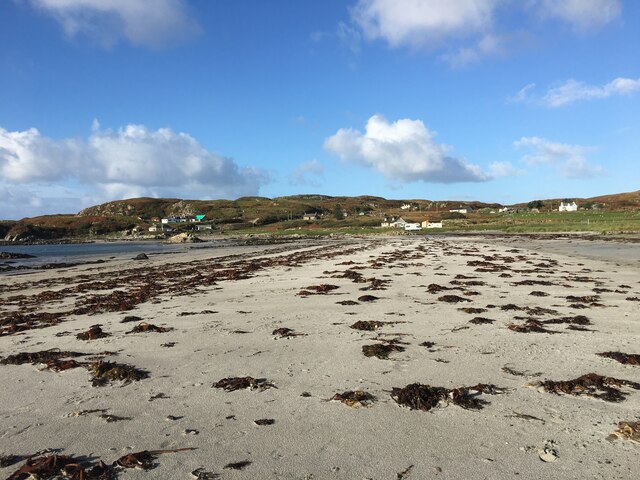
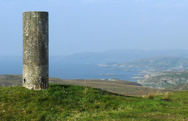
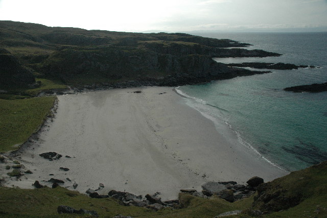
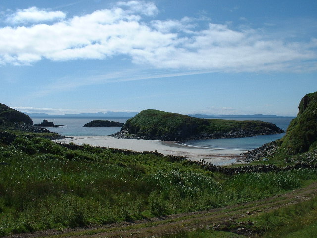
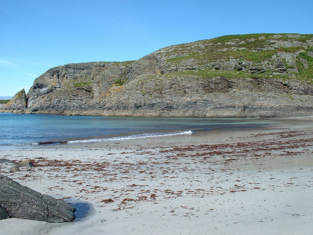
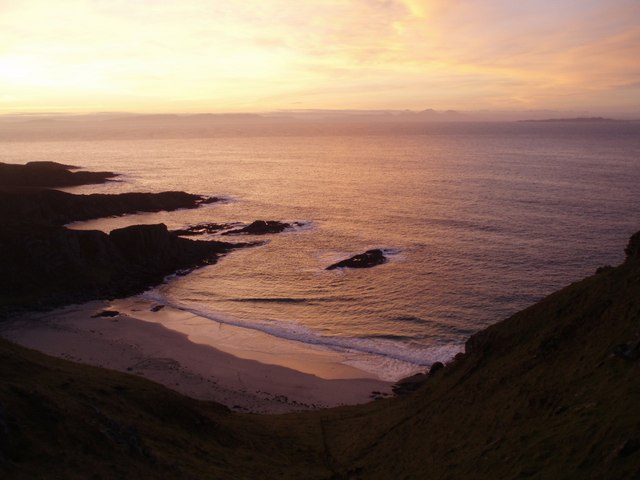
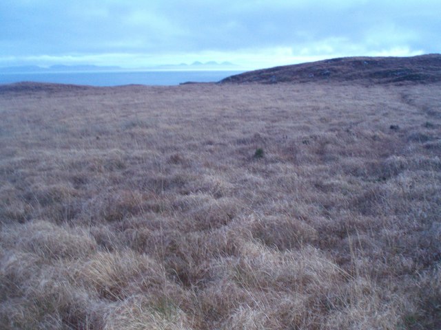
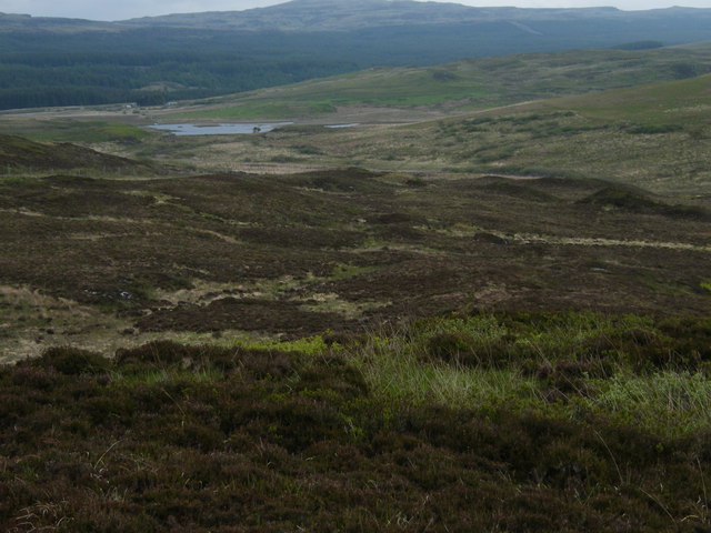
Tràigh Cill Mhic Eòg'hainn, also known as Kilvickeon Beach, is a stunning coastal gem located in Argyllshire, Scotland. Positioned on the western coast of the Isle of Mull, this secluded beach offers visitors a tranquil and picturesque retreat.

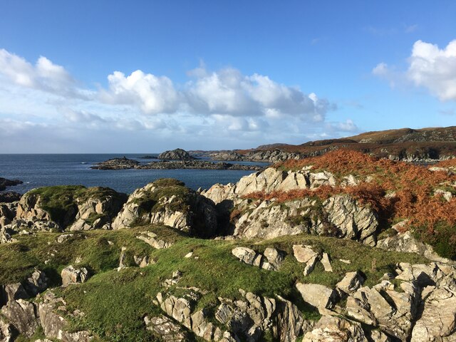
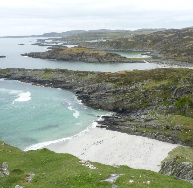
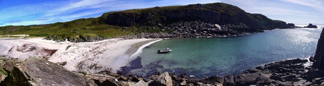
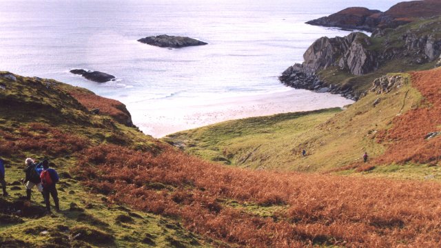
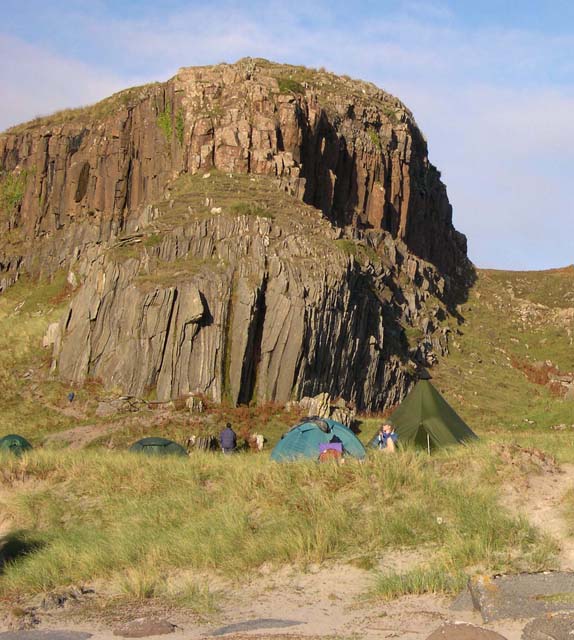
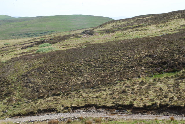
With its soft, golden sands stretching for over half a mile, Tràigh Cill Mhic Eòg'hainn boasts breathtaking views of the Atlantic Ocean. The beach is backed by rolling green hills, adding to its natural beauty and creating a sense of serenity. The crystal-clear waters provide a refreshing spot for swimming, while the surrounding cliffs offer opportunities for hiking and birdwatching.

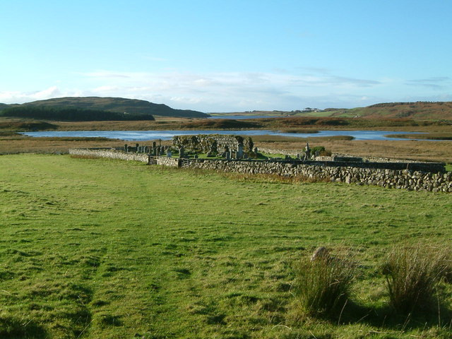
Tràigh Cill Mhic Eòg'hainn is also known for its rich wildlife. Seals can often be spotted basking on nearby rocks, and dolphins occasionally make appearances offshore. Bird enthusiasts will be delighted by the variety of seabirds that call this area home, including puffins, guillemots, and razorbills.

Access to Tràigh Cill Mhic Eòg'hainn is relatively easy, with a small car park located nearby, making it convenient for visitors to explore. The beach is popular among locals and tourists alike, yet it maintains a peaceful atmosphere due to its remote location.

Whether you're seeking a quiet spot to relax, an opportunity to immerse yourself in nature, or a picturesque backdrop for photography, Tràigh Cill Mhic Eòg'hainn is a destination that will not disappoint. Its unspoiled beauty and natural charm make it a must-visit beach in Argyllshire.

If you have any feedback on the listing, please let us know in the comments section below.

Tràigh Cill Mhic Eòg'hainn Images

Images are sourced within 2km of 56.290551/-6.1861913 or Grid Reference NM4118. Thanks to Geograph Open Source API. All images are credited.

Eilean Chormaic, Port Uisken
Beach at Uisken
Beach at Uisken
Dun a' Gheird, Mull The name is probably a corruption of Dun nan Geard (Fort of the Guard). It is a well-preserved galleried dun with spectacular views west across the south coast of the Ross of Mull and south to Colonsay, Islay and Jura. At the time of our visit, however, we could only imagine such views!

For more information, visit <span class="nowrap"><a title="http://www.scotlandsplaces.gov.uk/record/rcahms/21974/dun-gheird-mull/rcahms" rel="nofollow ugc noopener" href="http://www.scotlandsplaces.gov.uk/record/rcahms/21974/dun-gheird-mull/rcahms">Link</a><img style="margin-left:2px;" alt="External link" title="External link - shift click to open in new window" src="https://s1.geograph.org.uk/img/external.png" width="10" height="10"/></span>
Dun a' Gheird, Mull
The name is probably a corruption of Dun nan Geard (Fort of the Guard). It is a well-preserved galleried dun with spectacular views west across the south coast of the Ross of Mull and south to Colonsay, Islay and Jura. At the time of our visit, however, we could only imagine such views! For more information, visit LinkExternal link
View south-west from Dun a' Gheird, Mull The south coast of the Ross of Mull is dotted with rocky islets and many attractive beaches, like this one.
View south-west from Dun a' Gheird, Mull
The south coast of the Ross of Mull is dotted with rocky islets and many attractive beaches, like this one.
Triangulation pillar, Maol na Sgùrra, Isle of Mull Looking along the southern coastline of the Ross of Mull.
Triangulation pillar, Maol na Sgùrra, Isle of Mull
Looking along the southern coastline of the Ross of Mull.
Looking east from Garbh Eilean One of many beautiful and undisturbed beaches on the Ross of Mull
Looking east from Garbh Eilean
One of many beautiful and undisturbed beaches on the Ross of Mull
Track in what remains of Scoor Forest
Tràigh Bhàn na Sgùrra One of a series of sandy coves on the south coast of the Ross of Mull
Tràigh Bhàn na Sgùrra
One of a series of sandy coves on the south coast of the Ross of Mull
Loch Assapol from Scoor House The sunset from behind Scoor House, looking NW across the fields to Loch Assapol with the Treshnish Islands beyond.
Loch Assapol from Scoor House
The sunset from behind Scoor House, looking NW across the fields to Loch Assapol with the Treshnish Islands beyond.
Traigh Bhan na Sgurra Early morning at Scoor Beach with the tide out.
Traigh Bhan na Sgurra
Early morning at Scoor Beach with the tide out.
Garbh Eilean and  Kilvickeon Beach, Mull Garbh Eilean is a tidal island on a beautiful beach. The grid line runs right down the middle of Garbh Eilean, so the left-hand side as seen here is actually in <a href="https://www.geograph.org.uk/gridref/NM4118">NM4118</a>. The islands of Jura and Islay are visible on the horizon.
Garbh Eilean and Kilvickeon Beach, Mull
Garbh Eilean is a tidal island on a beautiful beach. The grid line runs right down the middle of Garbh Eilean, so the left-hand side as seen here is actually in NM4118. The islands of Jura and Islay are visible on the horizon.
Kilvickeon Beach, Isle of Mull This is the beach in the North-East corner of the square - the photo is taken from NM409186 looking West. For a panoramic view of this beach, see adjoining grid square <a href="https://www.geograph.org.uk/gridref/NM4118">NM4118</a>.
Kilvickeon Beach, Isle of Mull
This is the beach in the North-East corner of the square - the photo is taken from NM409186 looking West. For a panoramic view of this beach, see adjoining grid square NM4118.
Sunrise, South Mull Looking over Traigh Bhan na Sgurra beach towards the distant Paps of Jura on the penultimate day of 2007.
Sunrise, South Mull
Looking over Traigh Bhan na Sgurra beach towards the distant Paps of Jura on the penultimate day of 2007.
Tussocks and Bog You can't see the bog in the photo but it was certainly all around, and typical tussocky Mull terrain - ankle turning at every step.
After a day spent on the dramatic south coast of Mull it seemed an anti-climax to walk across this ground, but at least the views to Jura made up for it.
Tussocks and Bog
You can't see the bog in the photo but it was certainly all around, and typical tussocky Mull terrain - ankle turning at every step. After a day spent on the dramatic south coast of Mull it seemed an anti-climax to walk across this ground, but at least the views to Jura made up for it.
Old church on shore of Loch Assapol, Mull
Rocky knoll on the Ross of Mull This is a distinctive knoll at Traigh Bhan na Sgurra.
Rocky knoll on the Ross of Mull
This is a distinctive knoll at Traigh Bhan na Sgurra.
Cnoc Mòr, L.Assapol, Mull Heather moorland in the foreground, but bracken and grass on Cnoc Mòr in the distance.
Cnoc Mòr, L.Assapol, Mull
Heather moorland in the foreground, but bracken and grass on Cnoc Mòr in the distance.
View over hillside towards Loch Assapol
Show me another place!

Tràigh Cill Mhic Eòg'hainn is located at Grid Ref: NM4118 (Lat: 56.290551, Lng: -6.1861913)

Unitary Authority: Argyll and Bute

Police Authority: Argyll and West Dunbartonshire

What 3 Words

///intrigued.unit.sized. Near Fionnphort, Argyll & Bute

Related Wikis

Uisken

Uisken (Scottish Gaelic: Uisgean, meaning "water-bay") is a settlement on a sandy bay on the Ross of Mull in the south of the Isle of Mull, on the west...

Shiaba

Shiaba (Scottish Gaelic: Siaba) is a ruined township located on the southwestern peninsula of the Isle of Mull, Scotland. It lies about 8 km to the east...

Ardalanish

Ardalanish (Scottish Gaelic: Àird Dealanais) is a village on the Isle of Mull in Argyll and Bute, Scotland. It is now an organic farm and weaving mill...

Bunessan

Bunessan (Scottish Gaelic: Bun Easain) is a small village on the Ross of Mull in the south-west of the Isle of Mull, off the west coast of Scotland. The...

Knocknafenaig

Knocknafenaig (Scottish Gaelic: Cnoc na Fennaig) is a ruined township on the Isle of Mull, Scotland. Located in the south-western portion of the island...

Ardtun

Ardtun (Scottish Gaelic: Àird Tunna) is a settlement on the Isle of Mull, in Argyll and Bute, Scotland. Ardtun is within the parish of Kilfinichen and...

Knockan

Knockan (Scottish Gaelic: An Cnocan) is a township of six crofts in the community of Ardtun, in the south of the Isle of Mull off the west coast of Scotland...

Suidhe

Suidhe (Scottish Gaelic: Suidhe) is a ruined township located on the southwestern peninsula of the Isle of Mull, Scotland. It lies just over 1 km to the...

Nearby Amenities

Located within 500m of 56.290551,-6.1861913
Created By: dmgroom_coastlines
Source: PGS
Lat/Long: 56.28912/-6.19308
Source: PGS
Lat/Long: 56.288607/-6.1934035
Created By: dmgroom_coastlines
Source: PGS
Lat/Long: 56.28694/-6.18172
Created By: dmgroom_coastlines
Source: PGS
Lat/Long: 56.28707/-6.18194
Created By: dmgroom_coastlines
Source: PGS
Lat/Long: 56.28733/-6.18193
Created By: dmgroom_coastlines
Source: PGS
Lat/Long: 56.28783/-6.18166
Created By: dmgroom_coastlines
Source: PGS
Lat/Long: 56.28771/-6.18213
Source: PGS
Lat/Long: 56.2878502/-6.1821973
Source: PGS
Lat/Long: 56.2884439/-6.1828775
Created By: dmgroom_coastlines
Source: PGS
Lat/Long: 56.28851/-6.18345
Source: PGS
Lat/Long: 56.2886428/-6.1834547
Source: PGS
Lat/Long: 56.2890221/-6.1835148
Created By: dmgroom_coastlines
Source: PGS
Lat/Long: 56.28917/-6.18409
Source: PGS
Lat/Long: 56.2894431/-6.1841928
Source: PGS
Lat/Long: 56.2895639/-6.1846241
Created By: dmgroom_coastlines
Source: PGS
Lat/Long: 56.28818/-6.18555
Created By: dmgroom_coastlines
Source: PGS
Lat/Long: 56.28805/-6.18579
Created By: dmgroom_coastlines
Source: PGS
Lat/Long: 56.28793/-6.18603
Created By: dmgroom_coastlines
Source: PGS
Lat/Long: 56.28768/-6.18604
Created By: dmgroom_coastlines
Source: PGS
Lat/Long: 56.28716/-6.18608
Created By: dmgroom_coastlines
Source: PGS
Lat/Long: 56.2864/-6.18637
Created By: dmgroom_coastlines
Source: PGS
Lat/Long: 56.28655/-6.18728
Created By: dmgroom_coastlines
Source: PGS
Lat/Long: 56.28656/-6.18774
Created By: dmgroom_coastlines
Source: PGS
Lat/Long: 56.28644/-6.18798
Created By: dmgroom_coastlines
Source: PGS
Lat/Long: 56.28632/-6.18822
Created By: dmgroom_coastlines
Source: PGS
Lat/Long: 56.28633/-6.18868
Created By: dmgroom_coastlines
Source: PGS
Lat/Long: 56.28646/-6.1889
Created By: dmgroom_coastlines
Source: PGS
Lat/Long: 56.28659/-6.18912
Created By: dmgroom_coastlines
Source: PGS
Lat/Long: 56.28673/-6.18934
Created By: dmgroom_coastlines
Source: PGS
Lat/Long: 56.28775/-6.18926
Source: PGS
Lat/Long: 56.2881813/-6.1887987
Source: PGS
Lat/Long: 56.2882903/-6.1885037
Created By: dmgroom_coastlines
Source: PGS
Lat/Long: 56.289/-6.18779
Created By: dmgroom_coastlines
Source: PGS
Lat/Long: 56.2895/-6.18729
Created By: dmgroom_coastlines
Source: PGS
Lat/Long: 56.28973/-6.18681
Source: PGS
Lat/Long: 56.290469/-6.1849696
Source: PGS
Lat/Long: 56.2911395/-6.1861122
Source: PGS
Lat/Long: 56.2913693/-6.1875649
Created By: dmgroom_coastlines
Source: PGS
Lat/Long: 56.29079/-6.18789
Created By: dmgroom_coastlines
Source: PGS
Lat/Long: 56.29029/-6.18816
Created By: dmgroom_coastlines
Source: PGS
Lat/Long: 56.29016/-6.18839
Created By: dmgroom_coastlines
Source: PGS
Lat/Long: 56.29004/-6.18863
Created By: dmgroom_coastlines
Source: PGS
Lat/Long: 56.28992/-6.18888
Created By: dmgroom_coastlines
Source: PGS
Lat/Long: 56.28993/-6.18933
Created By: dmgroom_coastlines
Source: PGS
Lat/Long: 56.28994/-6.18979
Created By: dmgroom_coastlines
Source: PGS
Lat/Long: 56.28973/-6.19211
Created By: dmgroom_coastlines
Source: PGS
Lat/Long: 56.2895/-6.19305
The data included in this document is from www.openstreetmap.org. The data is made available under ODbL.

Have you been to Tràigh Cill Mhic Eòg'hainn?

Leave your review of Tràigh Cill Mhic Eòg'hainn below (or comments, questions and feedback).