Tràigh Mhòr

Beach in Argyllshire

Scotland

Tràigh Mhòr

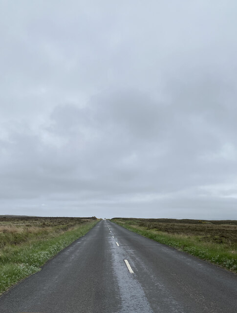
A846 near Duich Farm
A846 near Duich Farm Credit: thejackrustles

Tràigh Mhòr, located in Argyllshire, Scotland, is a stunning beach that offers visitors a picturesque and serene coastal experience. With its pristine sandy shores and crystal-clear turquoise waters, this beach attracts tourists and locals alike.

Stretching over a kilometer in length, Tràigh Mhòr provides ample space for visitors to relax, unwind, and soak up the natural beauty of the surrounding landscape. The beach is nestled between rolling green hills and dramatic cliffs, creating a breathtaking backdrop that adds to its allure.

The beach's clean and well-maintained environment makes it an ideal spot for families, couples, and nature enthusiasts. During low tide, the expansive sandy beach becomes a haven for beachcombers, who can search for seashells or enjoy leisurely strolls along the shoreline. The calm and shallow waters of Tràigh Mhòr also make it suitable for swimming, paddling, and other water sports.

The beach is accessible via a short walk from the nearby car park, making it easily reachable for visitors of all ages. There are also picnic areas available, allowing visitors to enjoy a meal while taking in the stunning coastal views.

Tràigh Mhòr is not only a beautiful beach but also a place of ecological significance. It is home to a variety of plant and animal species, including migratory birds, seals, and other marine life. It is important for visitors to respect the natural habitat and adhere to any conservation guidelines in place.

Overall, Tràigh Mhòr in Argyllshire offers a tranquil and idyllic seaside experience, showcasing the breathtaking beauty of Scotland's coastal scenery.

If you have any feedback on the listing, please let us know in the comments section below.

Tràigh Mhòr Images

Images are sourced within 2km of 55.705914/-6.2921386 or Grid Reference NR3054. Thanks to Geograph Open Source API. All images are credited.

A846 near Duich Farm
Moorlands views
Moorlands views
A846, Islay
A846, Islay
Peat workings alongside A846 There is much evidence of peat working alongside the A846 south of Bowmore; linear steps that are the tell-tale sign of the diggings can be seen in the image. Many of the peat workings will be abandoned but new work is still going on in places and at other locations on Islay.
Peat workings alongside A846
There is much evidence of peat working alongside the A846 south of Bowmore; linear steps that are the tell-tale sign of the diggings can be seen in the image. Many of the peat workings will be abandoned but new work is still going on in places and at other locations on Islay.
Big Strand This very long beach runs down from just over the hill from Bowmore, past the airport a distance of about 5 miles.
Big Strand
This very long beach runs down from just over the hill from Bowmore, past the airport a distance of about 5 miles.
Loch Airigh Dhaibhaidh With water lilies and the Paps of Jura.
Loch Airigh Dhaibhaidh
With water lilies and the Paps of Jura.
Rushy pasture at Duich Farm The Duich River passes in front of the gorse, and the Paps of Jura are 25km in the distance.
Rushy pasture at Duich Farm
The Duich River passes in front of the gorse, and the Paps of Jura are 25km in the distance.
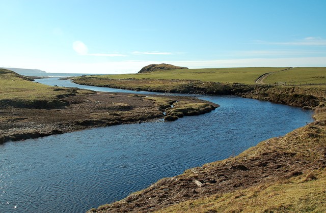
The Duich River At Duich Farm, heading for Laggan Bay via the Laggan River.
The Duich River
At Duich Farm, heading for Laggan Bay via the Laggan River.
The Duich River At Duich Farm. Bordered by grazing, Gorse and Willows.
The Duich River
At Duich Farm. Bordered by grazing, Gorse and Willows.
Loch Dubh, near Glenegedale With some of Islay's higher ground, Beinn Bhàn and Beinn Uraraidh about 8km to the east.
Loch Dubh, near Glenegedale
With some of Islay's higher ground, Beinn Bhàn and Beinn Uraraidh about 8km to the east.
Moorland south of Duich Farm Looking northeast to the Paps of Jura 25km away.
Moorland south of Duich Farm
Looking northeast to the Paps of Jura 25km away.
Old Milestone by the A846, opposite Loch Dubh, Kidalton and Oa Parish By the A846, in parish of Kildalton and Oa (Islay District), opposite Loch Dubh, on wide verge, West side of road.

Surveyed

Milestone Society National ID: AB_IPEBM06
Old Milestone by the A846, opposite Loch Dubh, Kidalton and Oa Parish
By the A846, in parish of Kildalton and Oa (Islay District), opposite Loch Dubh, on wide verge, West side of road. Surveyed Milestone Society National ID: AB_IPEBM06
Old Milestone by the A846, north of Duich Farm, Killarow and Kilmeny parish Stone post by the A846, in parish of Killarow & Kilmeny (Islay District), on long straight, north of Duich Farm, on verge, West side of road.

Inscription not recorded.

Surveyed

Milestone Society National ID: AB_IPEBM07
Old Milestone by the A846, north of Duich Farm, Killarow and Kilmeny parish
Stone post by the A846, in parish of Killarow & Kilmeny (Islay District), on long straight, north of Duich Farm, on verge, West side of road. Inscription not recorded. Surveyed Milestone Society National ID: AB_IPEBM07
A846 Port Ellen to Bowmore road (Through van windscreen)
A846 Port Ellen to Bowmore road
(Through van windscreen)
A846 Port Ellen to Bowmore road View South
A846 Port Ellen to Bowmore road
View South
A846 Port Ellen to Bowmore road View North
A846 Port Ellen to Bowmore road
View North
A846 Port Ellen to Bowmore road View North
WWII building from RAF airfield at left
A846 Port Ellen to Bowmore road
View North WWII building from RAF airfield at left
A846 Port Ellen to Bowmore road (Through van windscreen)
A846 Port Ellen to Bowmore road
(Through van windscreen)
Show me another place!

Tràigh Mhòr is located at Grid Ref: NR3054 (Lat: 55.705914, Lng: -6.2921386)

Unitary Authority: Argyll and Bute

Police Authority: Argyll and West Dunbartonshire

What 3 Words

///basher.kind.lyrics. Near Bowmore, Argyll & Bute

Nearby Locations

Cruach Mhòr Tràigh Mhòr

Related Wikis

River Laggan

The River Laggan is a small river on the Scottish island of Islay. Having gathered the waters of the Kilennan River, Barr River and Duich River / Torra...

Eilean na Muice Duibhe

Eilean na Muice Duibhe, also known as Duich Moss, is an area of low-level blanket mire on the island of Islay, off the west coast of Scotland. Located...

Islay Airport

Islay Airport (IATA: ILY, ICAO: EGPI) (also known as Glenegedale Airport) (Scottish Gaelic: Port-adhair Ìle) is located 4.5 nautical miles (8.3 kilometres...

Machrie golf course

The Machrie Golf Course, or "The Machrie Links", is located on Islay, in Scotland. The word "machrie" is a corruption of the Scottish Gaelic machair, which...

Have you been to Tràigh Mhòr?

Leave your review of Tràigh Mhòr below (or comments, questions and feedback).