Littleworth
Settlement in Oxfordshire South Oxfordshire
England
Littleworth

Littleworth is a small, picturesque village located in the county of Oxfordshire, England. Situated approximately 5 miles northeast of the historic city of Oxford, Littleworth is surrounded by beautiful countryside and offers a tranquil escape from the hustle and bustle of city life.
The village itself is characterized by its traditional stone-built cottages, some dating back to the 17th century, which add to its charm and historic appeal. It has a close-knit community, fostering a friendly and welcoming atmosphere for both residents and visitors alike.
Littleworth benefits from its proximity to Oxford, allowing residents easy access to a wide range of amenities and services. The village is well-served by public transportation, with regular bus routes connecting it to nearby towns and villages.
In terms of recreational activities, Littleworth offers ample opportunities for outdoor enthusiasts. The surrounding countryside provides scenic walking and cycling routes, allowing residents to explore the natural beauty of the area. Additionally, the village boasts several local parks and green spaces, perfect for picnics or leisurely strolls.
The village also has a strong sense of community spirit, with various events and activities organized throughout the year. These include village fairs, local sports tournaments, and social gatherings, which further enhance the community bond.
Overall, Littleworth is a charming and idyllic village that offers a peaceful countryside lifestyle while maintaining close proximity to the amenities of Oxford. Its rich history, natural beauty, and strong community make it an appealing place to live or visit.
If you have any feedback on the listing, please let us know in the comments section below.
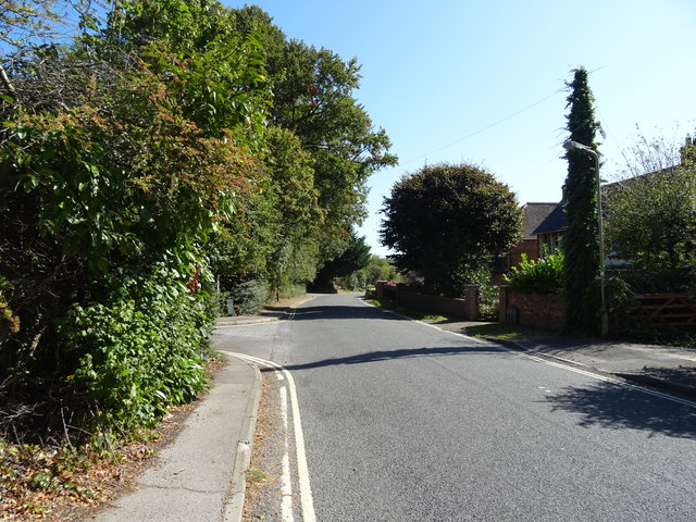
Littleworth Images
Images are sourced within 2km of 51.743915/-1.150625 or Grid Reference SP5805. Thanks to Geograph Open Source API. All images are credited.


Littleworth is located at Grid Ref: SP5805 (Lat: 51.743915, Lng: -1.150625)
Administrative County: Oxfordshire
District: South Oxfordshire
Police Authority: Thames Valley
What 3 Words
///headstone.burglars.offshore. Near Wheatley, Oxfordshire
Nearby Locations
Related Wikis

Littleworth, South Oxfordshire
Littleworth is a hamlet in South Oxfordshire, about 4+1⁄2 miles (7 km) east of Oxford, England. It is in Wheatley civil parish, immediately west of Wheatley...
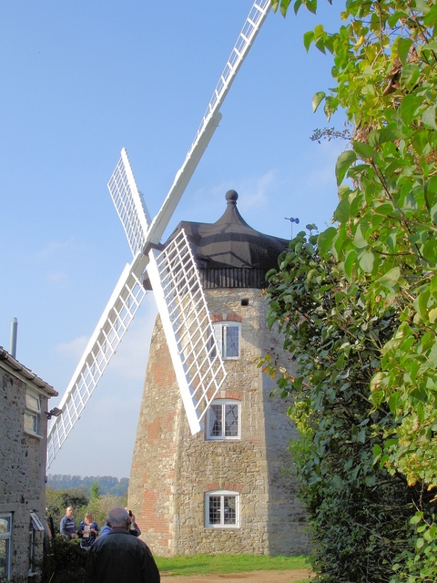
Wheatley Windmill, Wheatley, Oxfordshire
Wheatley Windmill is an 18th-century tower mill at grid reference SP 589 053 between the hamlet of Littleworth and Wheatley in Oxfordshire, England. The...
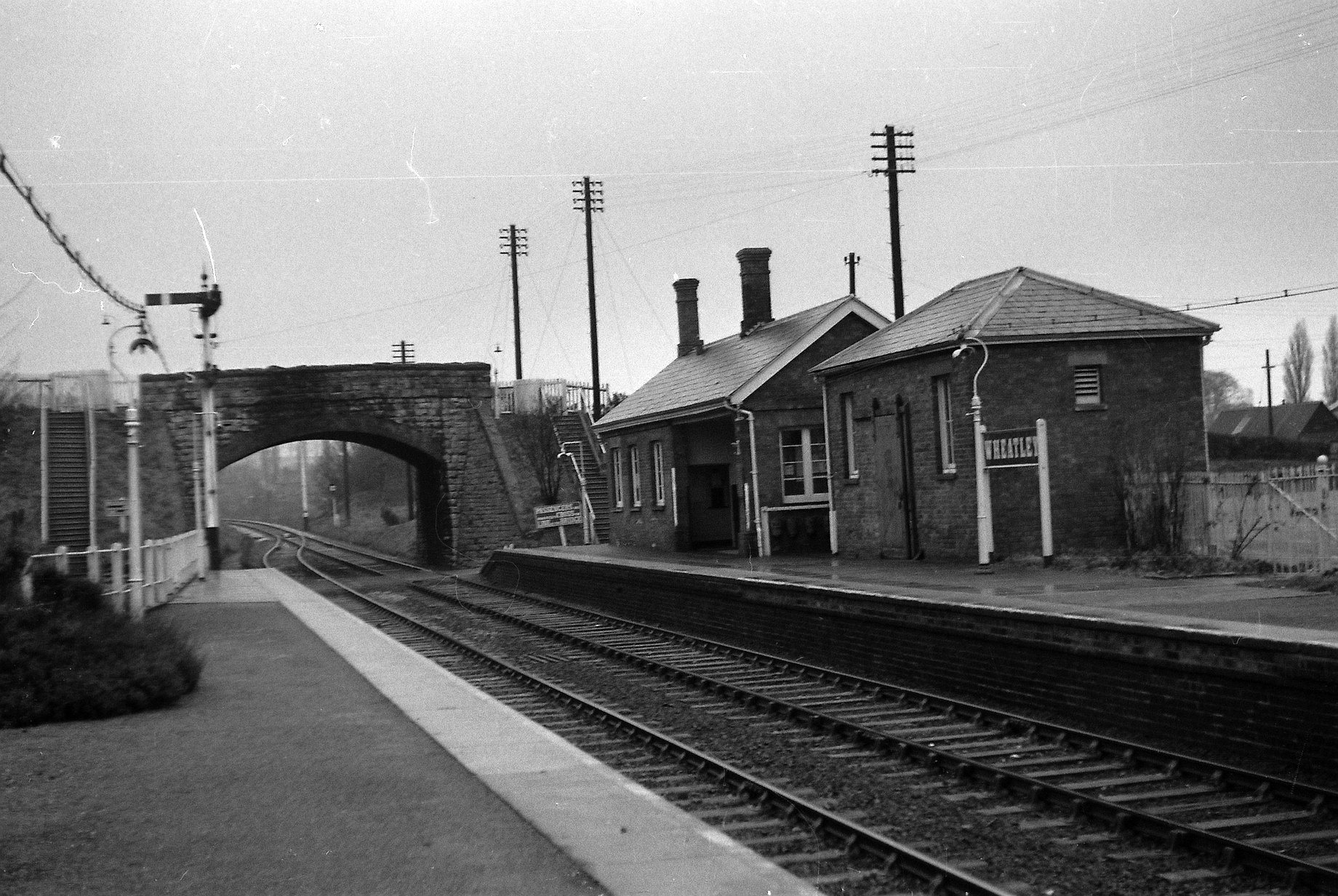
Wheatley railway station
Wheatley railway station was on the Wycombe Railway and served the village of Wheatley in Oxfordshire. It was opened in 1864 as part of an extension from...
Wheatley, Oxfordshire
Wheatley is a village and civil parish in Oxfordshire, about 5 miles (8 km) east of Oxford. The parish includes the hamlet of Littleworth, which is immediately...
Headington Rural District
Headington was a rural district in Oxfordshire, England from 1894 to 1932, based on the Headington rural sanitary district. It covered an area to the east...

St Mary the Virgin, Wheatley
The Church of St Mary the Virgin is a parish church in Wheatley, Oxfordshire, in the Church of England Diocese of Oxford. The church was designed by George...

Shotover Park
Shotover Park (also called Shotover House) is an 18th-century country house and park near Wheatley, Oxfordshire, England. The house, garden and parkland...
Bullingdon Rural District
Bullingdon Rural District was a rural district in Oxfordshire, England from 1932 to 1974, covering an area to the south-east of the city of Oxford. The...
Nearby Amenities
Located within 500m of 51.743915,-1.150625Have you been to Littleworth?
Leave your review of Littleworth below (or comments, questions and feedback).