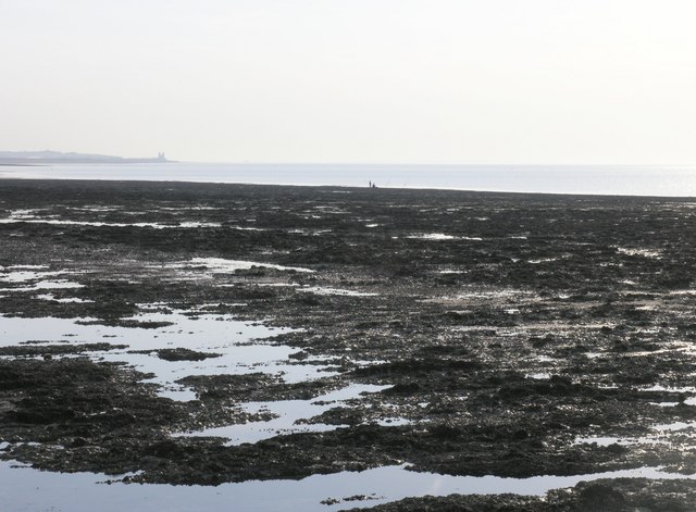
Epple Bay
Bay in Kent Thanet
England
Epple Bay

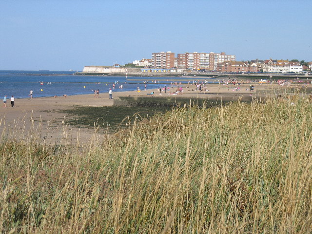
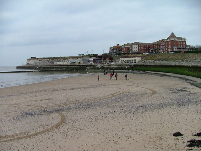
Epple Bay is a picturesque bay located along the coast of Kent, England. Situated between the popular seaside towns of Margate and Birchington, this bay offers stunning views of the English Channel and boasts a long stretch of sandy beach.
The bay is known for its natural beauty and is a popular destination for both locals and tourists alike. The sandy beach is perfect for sunbathing, picnicking, and sandcastle building. The clear waters also provide opportunities for swimming and other water activities during the summer months.
Epple Bay is surrounded by a mix of residential areas and holiday homes, making it a vibrant and lively place to visit. There are a number of amenities and facilities available nearby, including cafes, restaurants, and shops, ensuring visitors have everything they need for a comfortable stay.
In addition to its natural attractions, Epple Bay is also rich in history. The bay was once a landing site for smugglers during the 18th century, and remnants of this fascinating past can still be seen today. Visitors can explore the nearby cliffs and caves where smugglers used to hide their illicit goods, adding an element of adventure to their visit.
Overall, Epple Bay is a charming and picturesque bay that offers a perfect blend of natural beauty, recreational activities, and historical intrigue. Whether you are seeking relaxation on the sandy beach or looking to explore the area's fascinating history, this bay has something to offer for everyone.
If you have any feedback on the listing, please let us know in the comments section below.
Epple Bay Images
Images are sourced within 2km of 51.382168/1.3138485 or Grid Reference TR3070. Thanks to Geograph Open Source API. All images are credited.


Epple Bay is located at Grid Ref: TR3070 (Lat: 51.382168, Lng: 1.3138485)
Administrative County: Kent
District: Thanet
Police Authority: Kent
What 3 Words
///logbook.panning.easygoing. Near Birchington-on-Sea, Kent
Nearby Locations
Related Wikis

King Ethelbert School
King Ethelbert School is a mixed secondary school located in Birchington-on-Sea, Kent, England. A wide variety of subjects are available at GCSE level...
Birchington-on-Sea
Birchington-on-Sea is a village in the Thanet district in Kent, England, with a population of 9,961. The village forms part of the civil parish of Birchington...
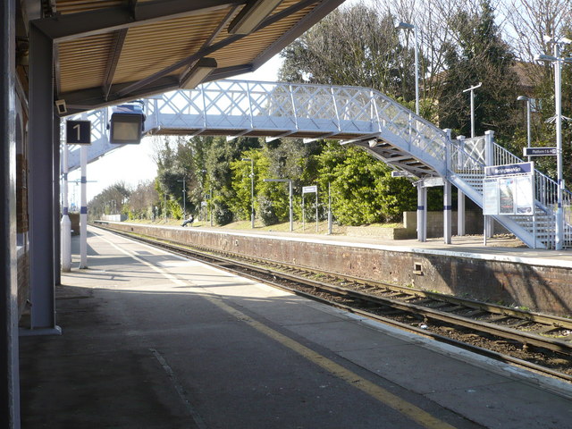
Birchington-on-Sea railway station
Birchington-on-Sea railway station is on the Chatham Main Line in England, serving the village of Birchington-on-Sea, Kent. It is 70 miles 56 chains (113...
Ursuline College, Westgate-on-Sea
Ursuline College (formerly Ursuline Convent School) is a Catholic comprehensive secondary school with academy status, located in Westgate-on-Sea, in north...
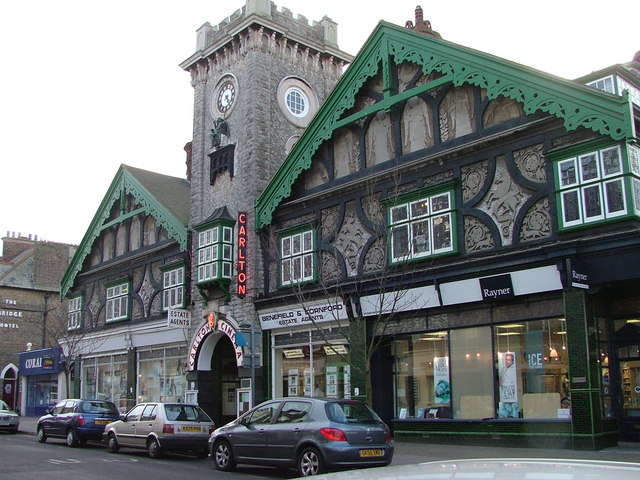
Carlton Cinema, Westgate-on-Sea
The Carlton Cinema, in Westgate-on-Sea, Kent, England dates from 1910. The extension of the railway into East Kent in 1871 led to the creation of a number...
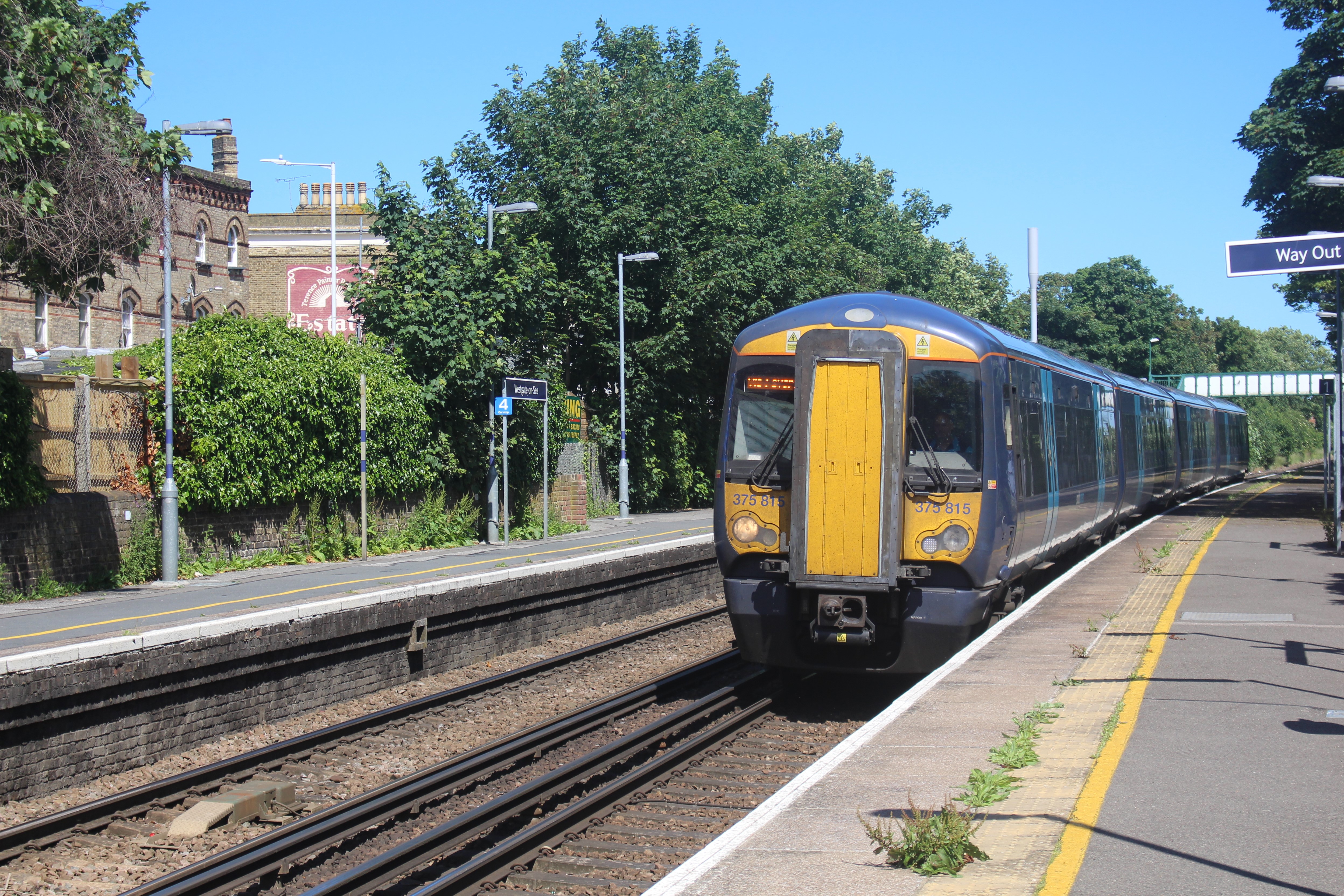
Westgate-on-Sea railway station
Westgate-on-Sea railway station is on the Chatham Main Line in England, serving the town of Westgate-on-Sea, Kent. It is 72 miles 35 chains (116.6 km)...
Westgate-on-Sea
Westgate-on-Sea is a seaside town and civil parish on the north-east coast of Kent, England. It is within the Thanet local government district and borders...

Powell-Cotton Museum
The Powell-Cotton Museum is situated in Quex Park, Birchington, Kent and houses the diverse personal collections of hunter and explorer Percy Powell-Cotton...
Nearby Amenities
Located within 500m of 51.382168,1.3138485Have you been to Epple Bay?
Leave your review of Epple Bay below (or comments, questions and feedback).