St Mary's Bay

Bay in Kent

England

St Mary's Bay

Footpath to Swigshole This is a view of St Mary’s Marshes on the Hoo Peninsula. The footpath to Swigshole follows the fence to the left of field drain as far as TQ811781 where the choice it to turn right for Swigshole or left for Allhallows.
Footpath to Swigshole Credit: Glyn Baker

St Mary's Bay is a picturesque coastal village situated on the southeast coast of England, in the county of Kent. It lies between the popular seaside towns of Dymchurch and New Romney, and is part of the larger Romney Marsh area. The bay is named after the nearby village of St Mary in the Marsh.

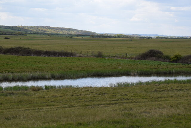
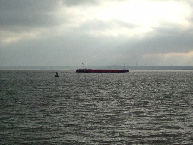
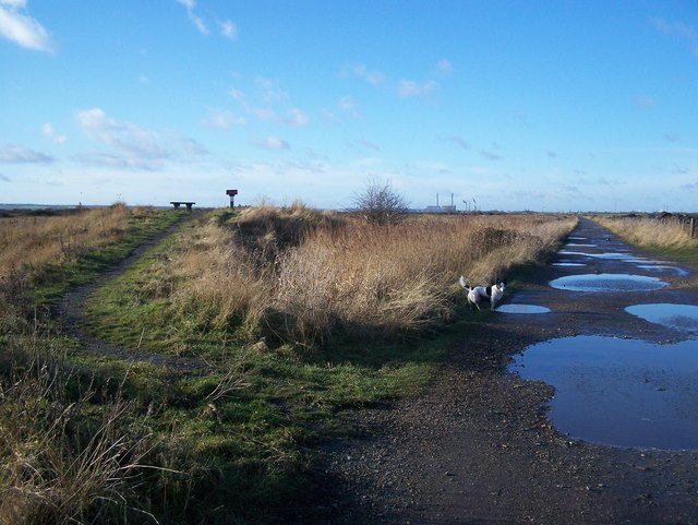
The bay is known for its long stretch of sandy beach, which is a major attraction for both locals and tourists. The beach is backed by low sand dunes and offers stunning views of the English Channel. It is a popular spot for sunbathing, picnicking, and building sandcastles, as well as for taking long walks along the shoreline.

St Mary's Bay also offers a range of recreational activities for visitors. The bay is well-known for its excellent fishing opportunities, attracting anglers from near and far. Additionally, the bay is a great place for water sports enthusiasts, with activities such as kiteboarding, jet skiing, and paddleboarding being popular choices.

The village itself is relatively small, with a close-knit community. It offers a range of amenities, including a few shops, cafes, and seaside pubs, providing visitors with everything they need for a pleasant stay. The bay is also home to a caravan park, providing accommodation options for those who wish to stay longer.

Overall, St Mary's Bay is a charming coastal destination that offers natural beauty, recreational opportunities, and a peaceful atmosphere. It is a place where visitors can enjoy the tranquility of the sea and the charm of a traditional English seaside village.

If you have any feedback on the listing, please let us know in the comments section below.

St Mary's Bay Images

Images are sourced within 2km of 51.482105/0.58136339 or Grid Reference TQ7979. Thanks to Geograph Open Source API. All images are credited.

Footpath to Swigshole This is a view of St Mary’s Marshes on the Hoo Peninsula. The footpath to Swigshole follows the fence to the left of field drain as far as TQ811781 where the choice it to turn right for Swigshole or left for Allhallows.
Footpath to Swigshole
This is a view of St Mary’s Marshes on the Hoo Peninsula. The footpath to Swigshole follows the fence to the left of field drain as far as TQ811781 where the choice it to turn right for Swigshole or left for Allhallows.
St Marys Sea Wall This is the sea wall on the Kent bank of the Thames north of the St Marys Marshes. The Picture is looking towards the coryton Oil refinery on the Essex side of the river
St Marys Sea Wall
This is the sea wall on the Kent bank of the Thames north of the St Marys Marshes. The Picture is looking towards the coryton Oil refinery on the Essex side of the river
Footpath & Confused Geographer This is a photo of the footpath that runs along the sea wall on the Kent bank of the Thames. You can see a stile to the left of the gate and a confused geographer, who has a realisation that he may have got a grid ref wrong in the past. Just coz a landmark is on a map don't mean it is still there!!!
Footpath & Confused Geographer
This is a photo of the footpath that runs along the sea wall on the Kent bank of the Thames. You can see a stile to the left of the gate and a confused geographer, who has a realisation that he may have got a grid ref wrong in the past. Just coz a landmark is on a map don't mean it is still there!!!
Allhallows Footpath This is the footpath from Swigshole to Allhallows the 3m spot height is a few  metres beyond the gate.
Allhallows Footpath
This is the footpath from Swigshole to Allhallows the 3m spot height is a few metres beyond the gate.
Fleet within St Mary's Marshes Looking South-east wards. Dyke follows all along the sea wall, draining the marshes into the River Thames.
Water Tower on Ratcliffe Highway <a href="https://www.geograph.org.uk/photo/1015210">TQ8277 : Water Tower and O2 Signal Mast</a>seen in background on far left.
Fleet within St Mary's Marshes
Looking South-east wards. Dyke follows all along the sea wall, draining the marshes into the River Thames. Water Tower on Ratcliffe Highway TQ8277 : Water Tower and O2 Signal Mastseen in background on far left.
Fleet in St Mary's Marshes, Westwards Dyke follows along the sea wall draining the Marshes into the River Thames.
The buildings seen on the left are part of an abandoned army camp in marshes.
Fleet in St Mary's Marshes, Westwards
Dyke follows along the sea wall draining the Marshes into the River Thames. The buildings seen on the left are part of an abandoned army camp in marshes.
Footpaths in St Mary's Marshes Path No.RS4 is on Sea Wall (in background) it follows the coastline from Allhallows and leads left to St Mary's Bay. Footpath No.RS19 leads from sea wall over stile and through farmland and marshes. Note; sign should face the other way or towards the sea wall.
Footpaths in St Mary's Marshes
Path No.RS4 is on Sea Wall (in background) it follows the coastline from Allhallows and leads left to St Mary's Bay. Footpath No.RS19 leads from sea wall over stile and through farmland and marshes. Note; sign should face the other way or towards the sea wall.
Fleet in St Mary's Marshes Dyke follows Sea Wall around draining the marshes into the River Thames.
As seen from land bridge over fleet. Allhallows seen in background on far right.
Fleet in St Mary's Marshes
Dyke follows Sea Wall around draining the marshes into the River Thames. As seen from land bridge over fleet. Allhallows seen in background on far right.
Almost flooded footpath Path No.RS19 leads through St Mary's Marshes to Sea Wall on River Thames. Dyke beside footpath is at maximum limit due to heavy rains over last week and snow melt adding to the problem.
Almost flooded footpath
Path No.RS19 leads through St Mary's Marshes to Sea Wall on River Thames. Dyke beside footpath is at maximum limit due to heavy rains over last week and snow melt adding to the problem.
Flooded Footpath Path No.RS19 leads through St Mary's Marshes to Sea Wall on River Thames. Dyke beside footpath (on other side of fence) is over maximum limit due to heavy rains over last week and snow melt adding to the problem. Wellies are needed here !!!
Flooded Footpath
Path No.RS19 leads through St Mary's Marshes to Sea Wall on River Thames. Dyke beside footpath (on other side of fence) is over maximum limit due to heavy rains over last week and snow melt adding to the problem. Wellies are needed here !!!
Flooded Footpath and stile Path No.RS19 leads through St Mary's Marshes to Sea Wall on River Thames. Dyke beside footpath (on other side of fence) is over maximum limit due to heavy rains over last week and snow melt adding to the problem. Wellies are needed now !!!
Flooded Footpath and stile
Path No.RS19 leads through St Mary's Marshes to Sea Wall on River Thames. Dyke beside footpath (on other side of fence) is over maximum limit due to heavy rains over last week and snow melt adding to the problem. Wellies are needed now !!!
Footpath junction Path from Coombe Farm Lane passes Coombe House, and then comes downhill to this point. A path then leads right to Allhallows, via the Dagnam Saltings. Also a path leads right to Swigshole Farm, alongside the St Mary's Marshes (seen in background). The marshes are currently flooded due to winter rains and snow melt, therefore no animals (cattle or sheep) in these fields, but plenty of waders and other seabirds.
Footpath junction
Path from Coombe Farm Lane passes Coombe House, and then comes downhill to this point. A path then leads right to Allhallows, via the Dagnam Saltings. Also a path leads right to Swigshole Farm, alongside the St Mary's Marshes (seen in background). The marshes are currently flooded due to winter rains and snow melt, therefore no animals (cattle or sheep) in these fields, but plenty of waders and other seabirds.
View north-east over St Mary's Marshes The Southend conurbation is across the water.
View north-east over St Mary's Marshes
The Southend conurbation is across the water.
St Mary's Marshes A view across the marshes from the sea wall in the north eastern area of the marsh - looking south west. Beyond the borrow-dyke and the marsh the woods on Northward Hill (which make up the RSPB's High Halstow National Nature Reserve) can be seen.
St Mary's Marshes
A view across the marshes from the sea wall in the north eastern area of the marsh - looking south west. Beyond the borrow-dyke and the marsh the woods on Northward Hill (which make up the RSPB's High Halstow National Nature Reserve) can be seen.
View along the sea wall path To the north of St Mary's Marshes. Ahead is the deep-water container port of Thames Gateway on the Essex side of the estuary. The storage tanks are the remains of the oil refinery at Shellhaven, also in Essex.
View along the sea wall path
To the north of St Mary's Marshes. Ahead is the deep-water container port of Thames Gateway on the Essex side of the estuary. The storage tanks are the remains of the oil refinery at Shellhaven, also in Essex.
Due South From Canvey Island In this view due south from Canvey Island the Kent bank of the Thames between Egypt Bay to the east & St Mary’s Bay to the west can be seen in the distance. The south bank of the river in the middle of the picture would be about TQ787792. TQ7880 is to the ships port side.
Due South From Canvey Island
In this view due south from Canvey Island the Kent bank of the Thames between Egypt Bay to the east & St Mary’s Bay to the west can be seen in the distance. The south bank of the river in the middle of the picture would be about TQ787792. TQ7880 is to the ships port side.
Thames estuary coast line By St Mary's Marshes.
Thames estuary coast line
By St Mary's Marshes.
Cows at St Mary's Marshes
Show me another place!

St Mary's Bay is located at Grid Ref: TQ7979 (Lat: 51.482105, Lng: 0.58136339)

Unitary Authority: Medway

Police Authority: Kent

What 3 Words

///blaring.gratitude.elaborate. Near Allhallows, Kent

Nearby Locations

West Point St Mary's Bay

Related Wikis

South Thames Estuary and Marshes

South Thames Estuary and Marshes is a 5,289-hectare (13,070-acre) biological Site of Special Scientific Interest which stretches between Gravesend and...

Thames Estuary

The Thames Estuary is where the River Thames meets the waters of the North Sea, in the south-east of Great Britain. == Limits == An estuary can be defined...

River Thames

The River Thames ( TEMZ), known alternatively in parts as the River Isis, is a river that flows through southern England including London. At 215 miles...

St Mary Hoo

St Mary Hoo is a village and civil parish in Kent, England. It is on the Hoo Peninsula in the borough of Medway. According to the 2001 census it had...

Nearby Amenities

Located within 500m of 51.482105,0.58136339
St Mary's Bay
Natural: bay
Source: npe
Lat/Long: 51.4824869/0.5817494
The data included in this document is from www.openstreetmap.org. The data is made available under ODbL.

Have you been to St Mary's Bay?

Leave your review of St Mary's Bay below (or comments, questions and feedback).