Whitecliff Bay

Bay in Hampshire

England

Whitecliff Bay

Culver Down Monument The monument on Culver Down in memory of Charles Anderson Pelham Earl of Yarborough
Culver Down Monument Credit: Steven Muster

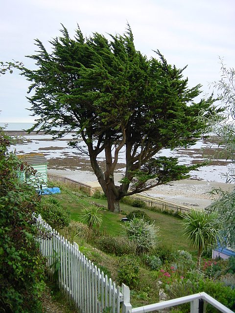
Whitecliff Bay is a picturesque coastal area located on the Isle of Wight in Hampshire, England. It is known for its stunning natural beauty and tranquil atmosphere, making it a popular destination for both locals and tourists.

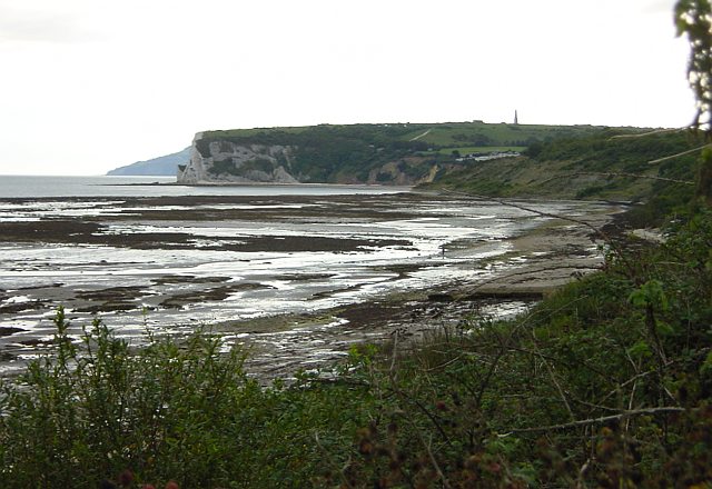
The bay is situated on the eastern side of the island, between the towns of Bembridge and Sandown. It boasts a wide sandy beach that stretches for approximately one mile, offering visitors ample space to relax and enjoy the sun. The beach is also a favorite spot for water-based activities such as swimming, paddleboarding, and sailing.

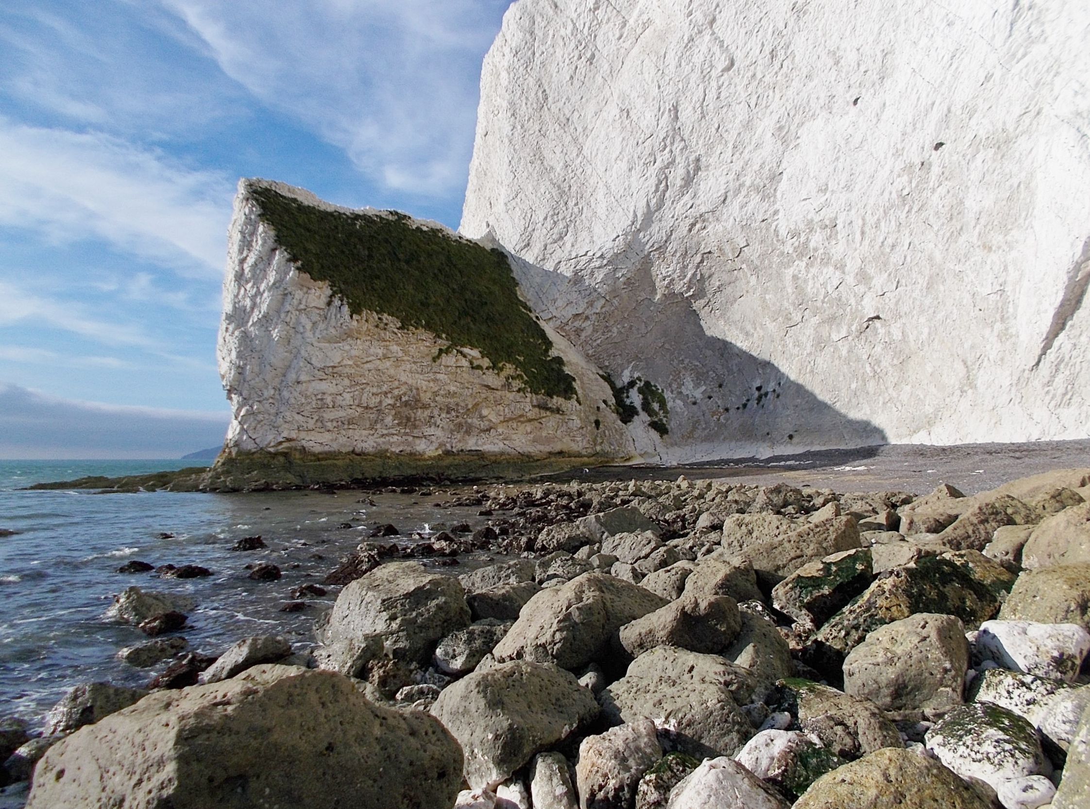
The bay is surrounded by rolling green hills and cliffs, providing breathtaking views of the English Channel. The cliffs are made up of chalk, which is a distinctive feature of the area and adds to its charm. Walking along the cliff paths is a popular pastime, allowing visitors to explore the surrounding countryside and observe the diverse wildlife that inhabits the area.

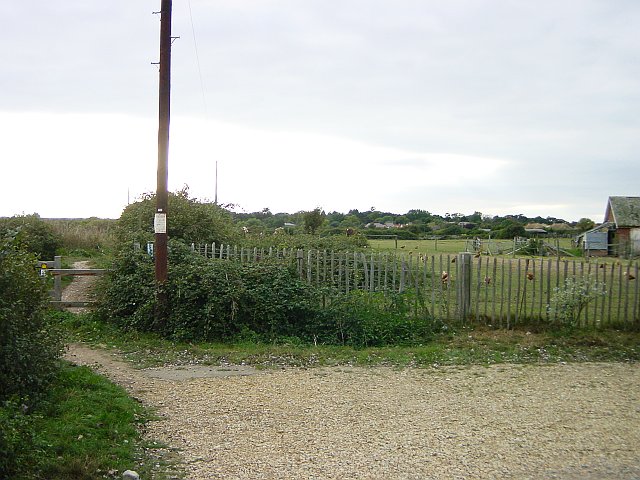
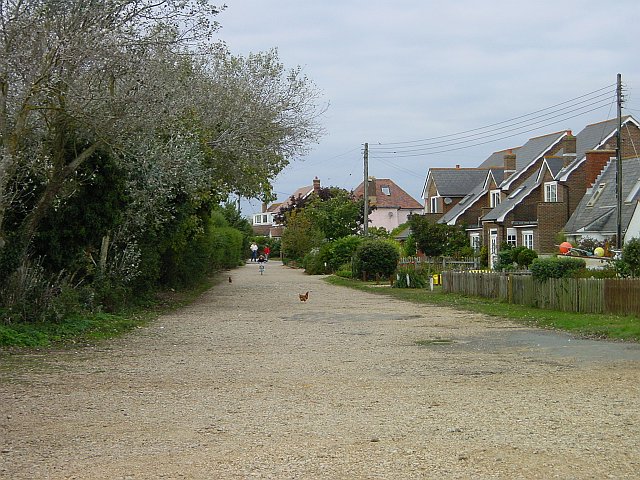
Whitecliff Bay is also home to a holiday park, which offers a range of accommodation options including caravan and camping facilities. The park provides various amenities such as a restaurant, bar, and entertainment facilities, ensuring that visitors have everything they need for a comfortable stay.

In summary, Whitecliff Bay in Hampshire is a scenic coastal area that offers a beautiful sandy beach, stunning cliffs, and a range of outdoor activities. It is a haven for nature lovers and provides a peaceful retreat for those seeking relaxation and tranquility.

If you have any feedback on the listing, please let us know in the comments section below.

Whitecliff Bay Images

Images are sourced within 2km of 50.671973/-1.0852192 or Grid Reference SZ6486. Thanks to Geograph Open Source API. All images are credited.

Culver Down Monument The monument on Culver Down in memory of Charles Anderson Pelham Earl of Yarborough
Culver Down Monument
The monument on Culver Down in memory of Charles Anderson Pelham Earl of Yarborough
The view from Culver Down (of Sandown Bay) This one of many footpaths from the top of Culver Down
The view from Culver Down (of Sandown Bay)
This one of many footpaths from the top of Culver Down
Charolais Bull on Culver Down Looking NNE, Portsmouth in the distance across the Solent.
Charolais Bull on Culver Down
Looking NNE, Portsmouth in the distance across the Solent.
Glider approaching Bembridge Airfield From Bembridge Down. The north west end of the air strip (on the left) lies in SZ6287. The Spinnaker Tower in Portsmouth can be seen on the right-hand edge of the picture.
Glider approaching Bembridge Airfield
From Bembridge Down. The north west end of the air strip (on the left) lies in SZ6287. The Spinnaker Tower in Portsmouth can be seen on the right-hand edge of the picture.
Foreland Beach The weed covered rock pools visible at low tide are in the subject square, the nearer ones marked on the map as Black Rock Ledge while the further line is Long Ledge. Beyond them, across Whitecliff Bay is Culver Down with its monument <a href="https://www.geograph.org.uk/photo/13226">SZ6385 : Culver Down Monument</a>.
Foreland Beach
The weed covered rock pools visible at low tide are in the subject square, the nearer ones marked on the map as Black Rock Ledge while the further line is Long Ledge. Beyond them, across Whitecliff Bay is Culver Down with its monument SZ6385 : Culver Down Monument.
Beach Hut Garden Some of the beach huts between the coastal path and the foreshore have very elaborate gardens. Looking SE from the coastal path near the Crab & Lobster pub.
Beach Hut Garden
Some of the beach huts between the coastal path and the foreshore have very elaborate gardens. Looking SE from the coastal path near the Crab & Lobster pub.
Chicken Farm at Foreland Fields The Coastal Path heading SW for Sandown from Bembridge skirts a poultry farm at this point.
Chicken Farm at Foreland Fields
The Coastal Path heading SW for Sandown from Bembridge skirts a poultry farm at this point.
Forelands Field Road A couple of stray hens from the poultry farm <a href="https://www.geograph.org.uk/photo/61589">SZ6587 : Chicken Farm at Foreland Fields</a> wander around on this unadopted road which runs down to the coastal path.
Forelands Field Road
A couple of stray hens from the poultry farm SZ6587 : Chicken Farm at Foreland Fields wander around on this unadopted road which runs down to the coastal path.
Bembridge Windmill This restored windmill stands at an altitude of 35m above the low lying marshlands of the River Yar to its west.(National Trust site)
Bembridge Windmill
This restored windmill stands at an altitude of 35m above the low lying marshlands of the River Yar to its west.(National Trust site)
Whitecliff Bay and Black Rock, near Bembridge Photograph taken from viewpoint at Culver Down looking north east towards Bembridge Foreland
Whitecliff Bay and Black Rock, near Bembridge
Photograph taken from viewpoint at Culver Down looking north east towards Bembridge Foreland
Sunrise Over Culver Cliff Sunrise over Culvercliff at approx 06:00
Sunrise Over Culver Cliff
Sunrise over Culvercliff at approx 06:00
The view from within Taken from inside Bembridge Windmill
The view from within
Taken from inside Bembridge Windmill
Fields near Bembridge Farm Grassland fields and hedge near Bembridge Farm, looking south towards the monument on Culver Down
Fields near Bembridge Farm
Grassland fields and hedge near Bembridge Farm, looking south towards the monument on Culver Down
Cowslips on Culver Down In May the eastern-most end of Culver Down is covered in Cowslips. As you approach from Sandown Bay in the south-west you spot single plants and small clumps of flowers but as you reach the end of the Down above the chalk cliff there is carpet of bright yellow flowers. Looking North is Whitecliff Bay, to the west and south nothing but the sea far below with occasional boats (the QE2 on this particular day).
Cowslips on Culver Down
In May the eastern-most end of Culver Down is covered in Cowslips. As you approach from Sandown Bay in the south-west you spot single plants and small clumps of flowers but as you reach the end of the Down above the chalk cliff there is carpet of bright yellow flowers. Looking North is Whitecliff Bay, to the west and south nothing but the sea far below with occasional boats (the QE2 on this particular day).
Armada Beacon Armada Beacon on Culver Down with Spithead in the background.
Armada Beacon
Armada Beacon on Culver Down with Spithead in the background.
Culver Down Panoramic shot of Culver Down taken from the Eastern end of Whitecliff Bay. Far right of shot on the skyline is the Culver Down monument and far left of shot shows the cliff face of Culver Down with a recent rock slide at its base.
Culver Down
Panoramic shot of Culver Down taken from the Eastern end of Whitecliff Bay. Far right of shot on the skyline is the Culver Down monument and far left of shot shows the cliff face of Culver Down with a recent rock slide at its base.
Steyne Cross This crossroads is now a mini roundabout although the difference is immaterial given the way the traffic behaves.  This is looking south west towards the wall and stable block of Steyne House (left).  This is effectively the western extremity of Bembridge.
Steyne Cross
This crossroads is now a mini roundabout although the difference is immaterial given the way the traffic behaves. This is looking south west towards the wall and stable block of Steyne House (left). This is effectively the western extremity of Bembridge.
Bembridge Ledge The extreme eastern end of the Isle Of Wight.  Although taken 10 minutes after low tide, the sand between the two final sections of rock was not uncovered and would have made for a risky paddle.  The last bit of land, Bembridge Ledge, extends from the left hand side to the centre horizon of the photo.  As you would expect, lots of rock pools and slippery seaweed.
Bembridge Ledge
The extreme eastern end of the Isle Of Wight. Although taken 10 minutes after low tide, the sand between the two final sections of rock was not uncovered and would have made for a risky paddle. The last bit of land, Bembridge Ledge, extends from the left hand side to the centre horizon of the photo. As you would expect, lots of rock pools and slippery seaweed.
Show me another place!

Whitecliff Bay is located at Grid Ref: SZ6486 (Lat: 50.671973, Lng: -1.0852192)

Unitary Authority: Isle of Wight

Police Authority: Hampshire

What 3 Words

///ballooned.outline.majoring. Near Bembridge, Isle of Wight

Related Wikis

Bembridge School And Cliffs SSSI

Bembridge School And Cliffs SSSI (grid reference ST647869) is a 12.58 hectare geological Site of Special Scientific Interest near Bembridge on the Isle...
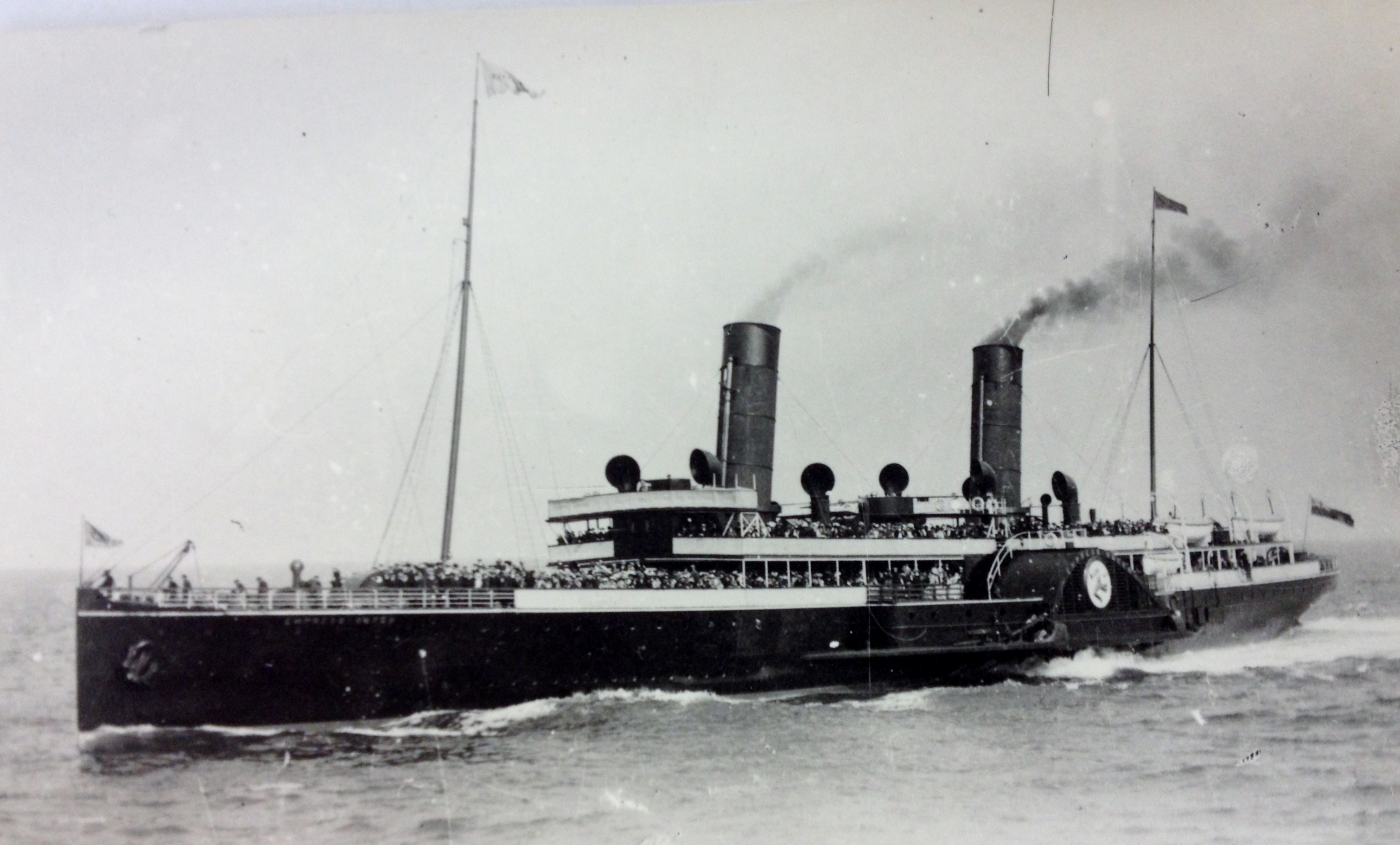
SS Empress Queen

SS Empress Queen was a steel-hulled paddle steamer, the last of her type ordered by the Isle of Man Steam Packet Company. The Admiralty chartered her in...
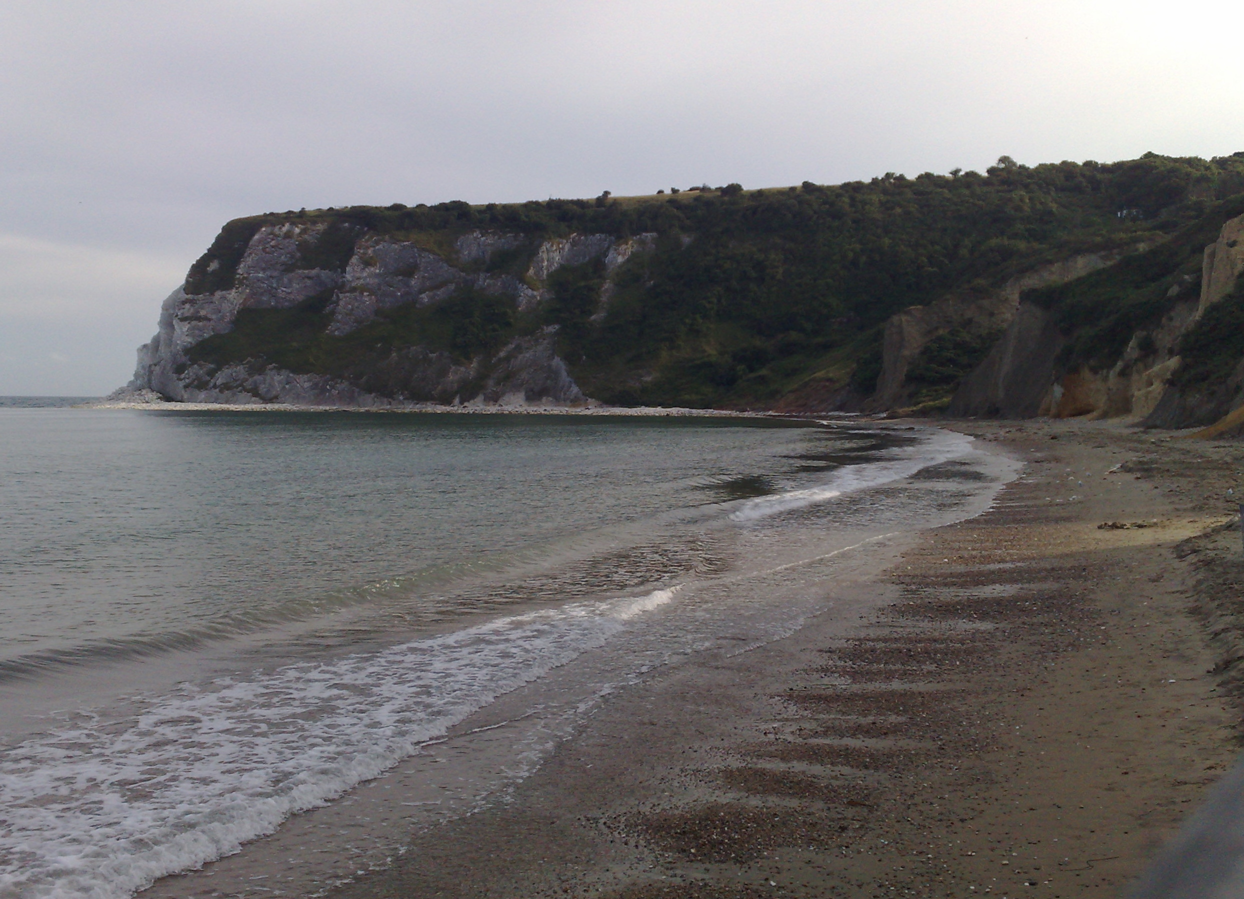
Whitecliff Bay

Whitecliff Bay is a sandy bay near Foreland which is the easternmost point of the Isle of Wight, England, about two miles south-west of Bembridge and just...

Steynewood Battery

Steynewood Battery (map reference SZ641869) is a battery located between Bembridge and Whitecliff Bay on the Isle of Wight, England. It is one of the many...

Culver Battery

Culver Battery is a former coastal artillery battery on Culver Down, on the eastern side of the Isle of Wight, England. The fortification is one of several...

Redcliff Battery

Redcliff Battery (map reference SZ638855) is a battery located to the west of the Culver Cliffs and east of Yaverland on the Isle of Wight, England. It...

Horseshoe Bay, Isle of Wight

Horseshoe Bay is a small bay on the south-east coast of the Isle of Wight, England. It lies at the east end of the headland of Culver Down. It faces south...

Whitecliff Bay and Bembridge Ledges

Whitecliff Bay and Bembridge Ledges is a 131.6-hectare (325-acre) Site of Special Scientific Interest that lies around the coastline of the easternmost...

Nearby Amenities

Located within 500m of 50.671973,-1.0852192
Whitecliff Bay
Natural: bay
Lat/Long: 50.6708198/-1.0904676
Noexit: yes
Lat/Long: 50.6753566/-1.0887274
The data included in this document is from www.openstreetmap.org. The data is made available under ODbL.

Have you been to Whitecliff Bay?

Leave your review of Whitecliff Bay below (or comments, questions and feedback).