Priory Bay

Bay in Hampshire

England

Priory Bay

St Helens Seafront The remains of St Helens church is painted white to act as a prominent marker for navigation from seaward
St Helens Seafront Credit: Steve Rigg

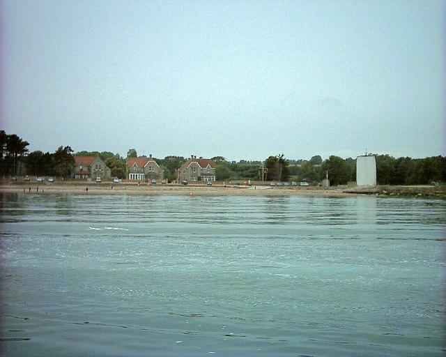
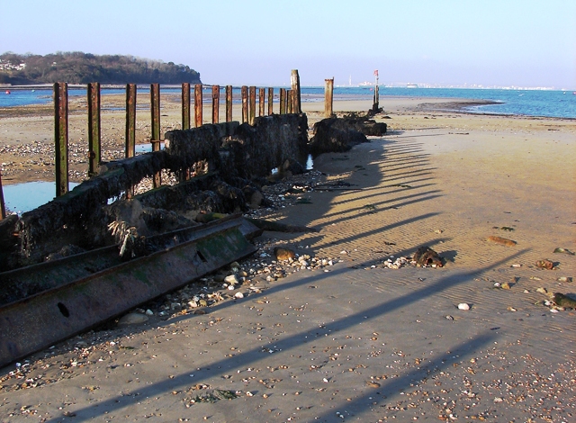
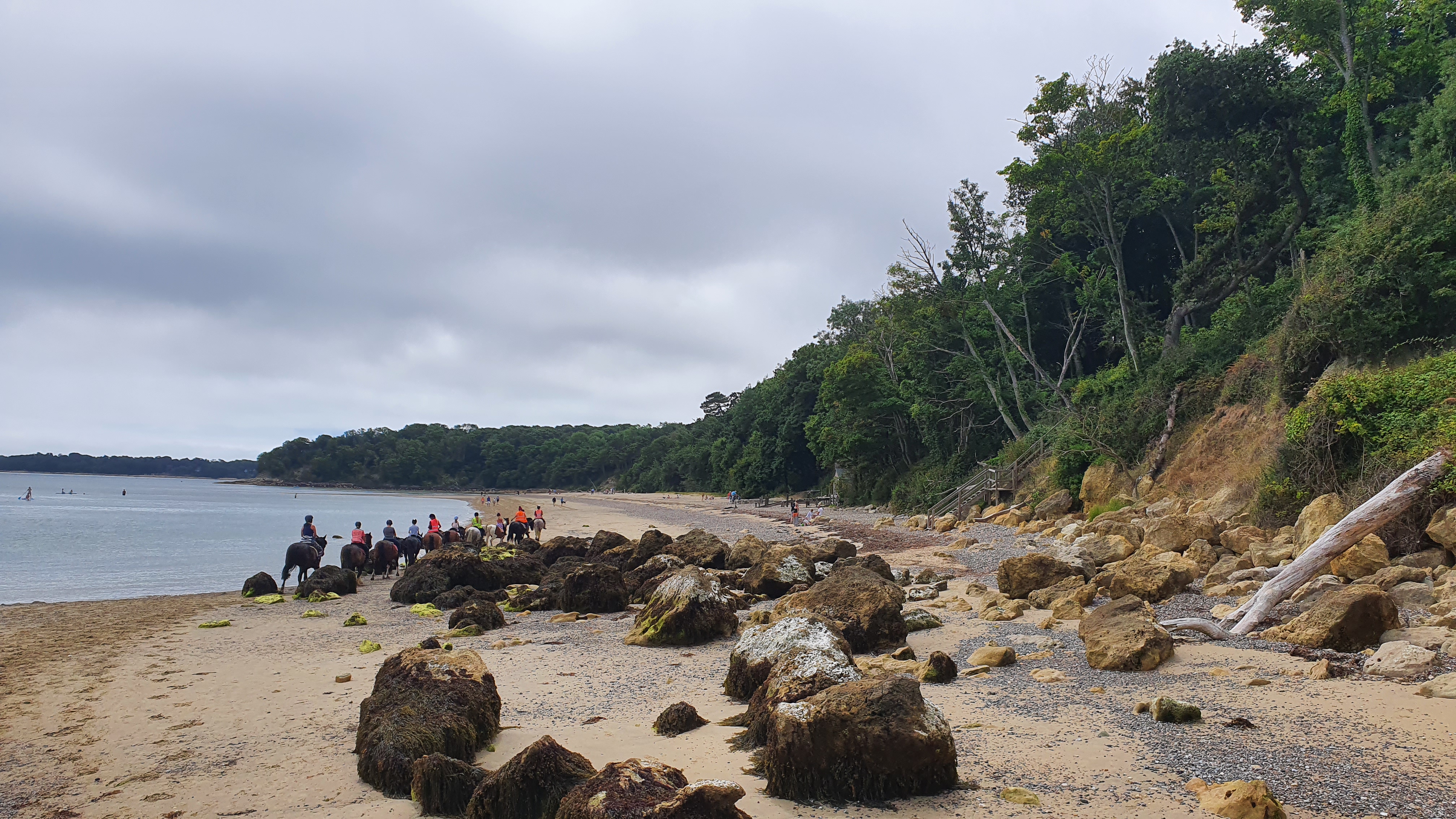
Priory Bay is a picturesque bay located on the Isle of Wight, off the southern coast of England in Hampshire. This beautiful stretch of coastline spans approximately 2 miles and is known for its stunning sandy beach and crystal-clear waters.

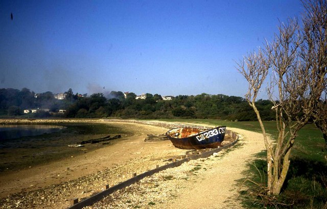
The bay is well-known for its tranquil and secluded atmosphere, making it a popular destination for those seeking relaxation and solitude. Surrounded by lush greenery and rolling hills, Priory Bay offers visitors a peaceful and scenic retreat away from the hustle and bustle of everyday life.

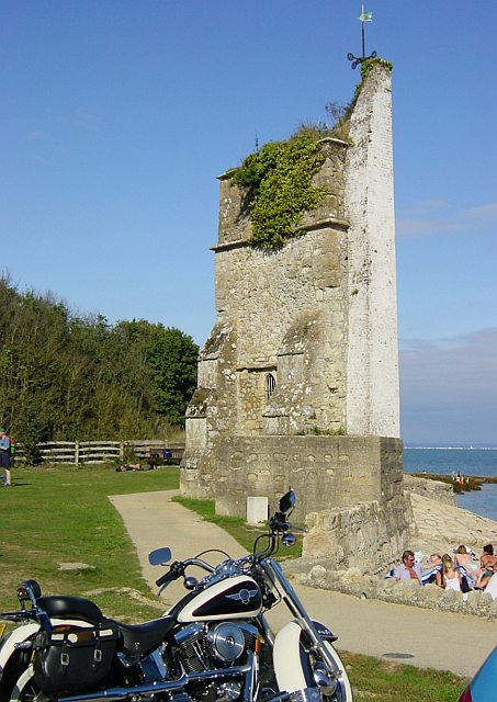
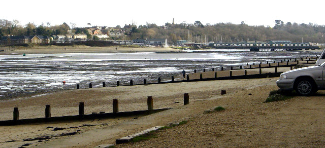
The beach at Priory Bay is a hidden gem, boasting fine golden sand and shallow waters, making it perfect for families with children. It also offers fantastic opportunities for swimming, sunbathing, and picnicking. The bay is flanked by towering cliffs, adding to its natural beauty and providing a sheltered spot from winds.

The bay is also home to the impressive Priory Bay Hotel, a historic country house hotel that offers luxurious accommodation and excellent dining options. The hotel is set within extensive grounds and offers breathtaking views of the bay and its surroundings.

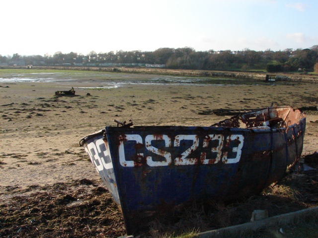
Nature enthusiasts will appreciate the diverse wildlife found in and around Priory Bay. The area is home to a variety of bird species, including oystercatchers and little egrets, making it a popular spot for birdwatching. The bay is also a designated Special Area of Conservation, protecting its unique flora and fauna.

Overall, Priory Bay in Hampshire is a hidden coastal gem, offering visitors a serene and idyllic escape with its stunning beach, scenic views, and rich biodiversity.

If you have any feedback on the listing, please let us know in the comments section below.

Priory Bay Images

Images are sourced within 2km of 50.709701/-1.0970053 or Grid Reference SZ6390. Thanks to Geograph Open Source API. All images are credited.

St Helens Seafront The remains of St Helens church is painted white to act as a prominent marker for navigation from seaward
St Helens Seafront
The remains of St Helens church is painted white to act as a prominent marker for navigation from seaward
St Helen's Church Built in the 12th century by the monks of the Cluniac Priory, the church was destroyed in 1720 by "a great wave" and only the tower remains. The seaward side is painted white as a marker for shipping - see <a href="https://www.geograph.org.uk/photo/20630">SZ6389 : St Helens Seafront</a>
St Helen's Church
Built in the 12th century by the monks of the Cluniac Priory, the church was destroyed in 1720 by "a great wave" and only the tower remains. The seaward side is painted white as a marker for shipping - see SZ6389 : St Helens Seafront
Tidal estuary, St Helens, Bembridge This shows part of the passage from Bembridge harbour to the sea. The photograph is an up river view of the foreshore, looking south south east, and taken from the north shore of "The Duver".
Tidal estuary, St Helens, Bembridge
This shows part of the passage from Bembridge harbour to the sea. The photograph is an up river view of the foreshore, looking south south east, and taken from the north shore of "The Duver".
Entrance to St Helens school air raid shelter For further info on St Helens see.

<span class="nowrap"><a title="http://www.netguides.co.uk/wight/context/helen.html" rel="nofollow ugc noopener" href="http://www.netguides.co.uk/wight/context/helen.html">Link</a><img style="margin-left:2px;" alt="External link" title="External link - shift click to open in new window" src="https://s1.geograph.org.uk/img/external.png" width="10" height="10"/></span>
Entrance to St Helens school air raid shelter
For further info on St Helens see. LinkExternal link
Bembridge Harbour Causeway The Causeway (at low tide) with the mill pond beyond for the old tidal mill.
Bembridge Harbour Causeway
The Causeway (at low tide) with the mill pond beyond for the old tidal mill.
Breakwater at Bembridge Point The eastern side to the entrance to Bembridge Harbour which is on the left. Portsmouth on the horizon with the Spinnaker Tower visible between the last two posts.
Breakwater at Bembridge Point
The eastern side to the entrance to Bembridge Harbour which is on the left. Portsmouth on the horizon with the Spinnaker Tower visible between the last two posts.
St Helen's Fort The fort is accessible on foot by a causeway on only one or two extra low tides a year - an annual walk out and around the fort is arranged each summer. It was recently advertised for sale and a condition of occupation is that you do not call on the fire service or expect to have your rubbish collected!  More info here: <span class="nowrap"><a title="http://www.bembridge.com/article.asp?ID1=9&ID2=21&ID3=261" rel="nofollow ugc noopener" href="http://www.bembridge.com/article.asp?ID1=9&ID2=21&ID3=261">Link</a><img style="margin-left:2px;" alt="External link" title="External link - shift click to open in new window" src="https://s1.geograph.org.uk/img/external.png" width="10" height="10"/></span>
St Helen's Fort
The fort is accessible on foot by a causeway on only one or two extra low tides a year - an annual walk out and around the fort is arranged each summer. It was recently advertised for sale and a condition of occupation is that you do not call on the fire service or expect to have your rubbish collected! More info here: LinkExternal link
Nodes Point holiday camp Looking south to Bembridge Point
Nodes Point holiday camp
Looking south to Bembridge Point
Bembridge Harbour The 1940s map lists this as Brading Harbour.
Bembridge Harbour
The 1940s map lists this as Brading Harbour.
Dredging at Buoy 4A At Low water springs a local licensee is permitted to dredge sand from Bembridge sandbanks. This shows the scoop (just south of buoy 4A) and St Helens Fort. A dump truck arrives regularly at the scoop to be loaded. Taken at about 07:30 from the adjacent shoreline
Dredging at Buoy 4A
At Low water springs a local licensee is permitted to dredge sand from Bembridge sandbanks. This shows the scoop (just south of buoy 4A) and St Helens Fort. A dump truck arrives regularly at the scoop to be loaded. Taken at about 07:30 from the adjacent shoreline
Cream tea at St Helens The perfect spot for a peaceful afternoon. The ruined St Helen's church is painted white as a navigation aid.
Cream tea at St Helens
The perfect spot for a peaceful afternoon. The ruined St Helen's church is painted white as a navigation aid.
The Causeway at St Helens With Bembridge Harbour to the left and St Helens village behind.
The Causeway at St Helens
With Bembridge Harbour to the left and St Helens village behind.
Abandoned boat near The Causeway at St Helens
Eddlington Road, St. Helens
St. Helens: trig point alongside path This trig point is 49m above sea level and is seen next to a path north from The Green, St. Helens, just before it comes out on Eddington Road, the B3330 towards Ryde.
St. Helens: trig point alongside path
This trig point is 49m above sea level and is seen next to a path north from The Green, St. Helens, just before it comes out on Eddington Road, the B3330 towards Ryde.
St. Helens: sea glimpse from the B3330 Looking east towards the sea on Eddington Road, the B3330 from Ryde and Seaview.
St. Helens: sea glimpse from the B3330
Looking east towards the sea on Eddington Road, the B3330 from Ryde and Seaview.
Bembridge point Lovely little harbour. Tricky but interesting navigation to get in, especially if the tide is not at its highest.
Bembridge point
Lovely little harbour. Tricky but interesting navigation to get in, especially if the tide is not at its highest.
Seamark at St. Helens This odd structure is a Seamark, erected in 1703.  The right hand side is the remains of St.Helens church which dated from the 12th Century. The church was demolished except for the remains of the tower, which was incorporated into the white painted Seamark. Sailors used to take stones from the remains of the church to scrub the decks with, hence the expression 'holystoning the deck.'
Seamark at St. Helens
This odd structure is a Seamark, erected in 1703. The right hand side is the remains of St.Helens church which dated from the 12th Century. The church was demolished except for the remains of the tower, which was incorporated into the white painted Seamark. Sailors used to take stones from the remains of the church to scrub the decks with, hence the expression 'holystoning the deck.'
Show me another place!

Priory Bay is located at Grid Ref: SZ6390 (Lat: 50.709701, Lng: -1.0970053)

Unitary Authority: Isle of Wight

Police Authority: Hampshire

What 3 Words

///edicts.mingles.reshape. Near Seaview, Isle of Wight

Related Wikis

Priory Bay

Priory Bay is a small privately owned bay on the northeast coast of the Isle of Wight, England. It lies 3⁄4 mile (1.2 km) to the east of Nettlestone village...

Priory Woods

Priory Woods (grid reference SZ635900) is a 2.94 hectare geological Site of Special Scientific Interest near the town of Bembridge, Isle of Wight, notified...

Nodes Point Battery

Nodes Point Battery (map reference SZ635898) is a battery located at Nodes Point on the Isle of Wight. It is one of the many Palmerston Forts built on...
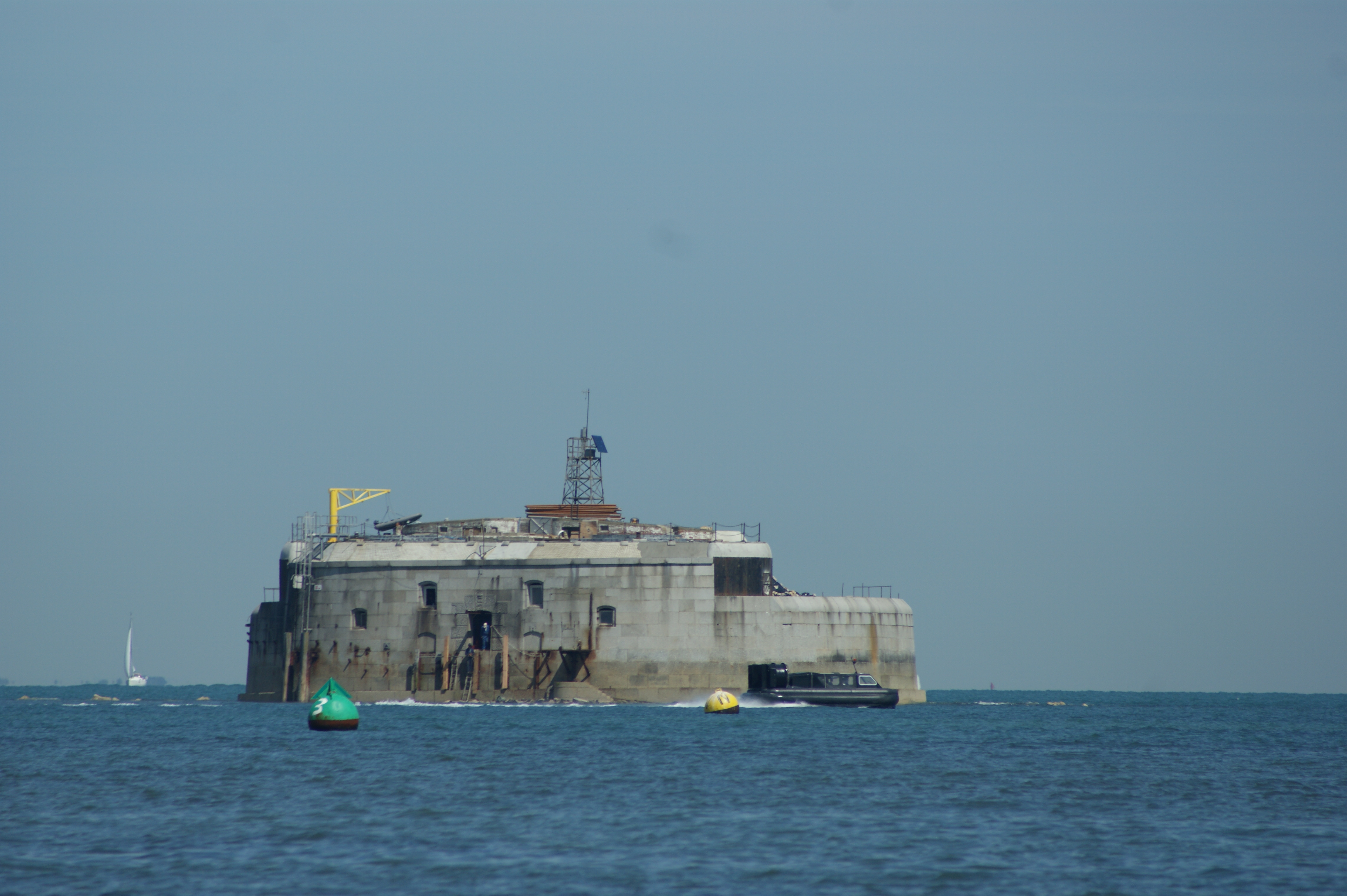
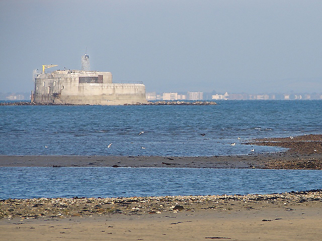
St Helens Fort

St Helens Fort is a sea fort in the Solent close to the Isle of Wight, one of the Palmerston Forts near Portsmouth. It was built as a result of the Royal...

Nearby Amenities

Located within 500m of 50.709701,-1.0970053
Priory Bay
Natural: bay
Lat/Long: 50.7092003/-1.0999324
Seamark Buoy Special Purpose Category: yachting
Seamark Buoy Special Purpose Colour: yellow
Seamark Buoy Special Purpose Shape: spherical
Seamark Type: buoy_special_purpose
Lat/Long: 50.7089945/-1.0901678
Seamark Buoy Special Purpose Category: yachting
Seamark Buoy Special Purpose Colour: yellow
Seamark Buoy Special Purpose Shape: spherical
Seamark Name: Patch
Seamark Type: buoy_special_purpose
Lat/Long: 50.706946/-1.0974902
The data included in this document is from www.openstreetmap.org. The data is made available under ODbL.

Have you been to Priory Bay?

Leave your review of Priory Bay below (or comments, questions and feedback).