Littlemore

Settlement in Oxfordshire Oxford

England

Littlemore

Plastic wrapped hay bales on the river meadow
Plastic wrapped hay bales on the river meadow Credit: Steve Daniels

Littlemore is a village located in Oxfordshire, England, approximately two miles southeast of the city of Oxford. It is a small and quaint village with a population of around 5,000 residents. The village is known for its historic buildings, including the Church of St Mary and St Nicholas, which dates back to the 12th century.

Littlemore is surrounded by beautiful countryside, making it a popular destination for nature lovers and outdoor enthusiasts. The village also has a number of amenities, including shops, pubs, and restaurants, providing residents with everything they need for day-to-day living.

One of the most famous residents of Littlemore was the renowned author and poet, J.R.R. Tolkien, who lived in the village for a period of time. Today, there are plaques and markers around the village commemorating his time there.

Overall, Littlemore is a charming village with a rich history and a strong sense of community. It offers a peaceful and picturesque setting for residents and visitors alike.

If you have any feedback on the listing, please let us know in the comments section below.
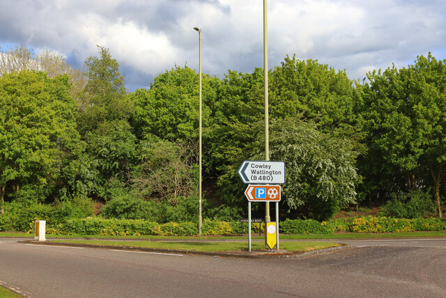
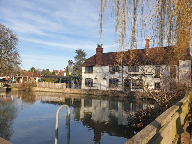
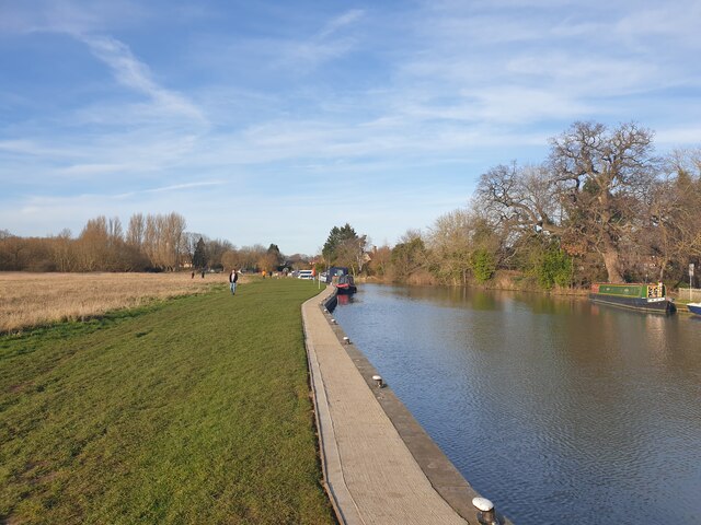
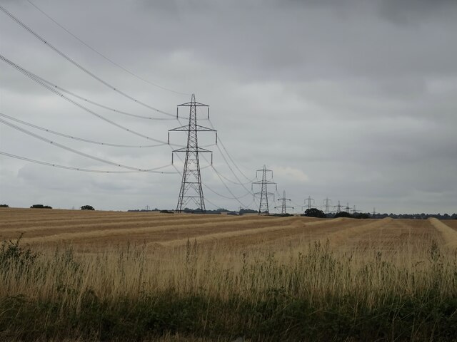
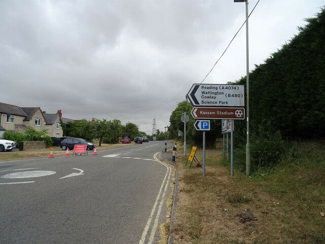
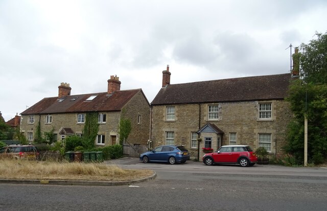
Littlemore Images

Images are sourced within 2km of 51.721734/-1.222326 or Grid Reference SP5302. Thanks to Geograph Open Source API. All images are credited.

Plastic wrapped hay bales on the river meadow
The Kassam Stadium The Kassam Stadium is the home of Oxford United.
The Kassam Stadium
The Kassam Stadium is the home of Oxford United.
St Mary's, Iffley
St Mary's, Iffley
Sandford-on-Thames Houses by the River Thames.
Sandford-on-Thames
Houses by the River Thames.
Grenoble Way Road near Oxford.
Grenoble Way
Road near Oxford.
Power Lines Looking south from Sandford Lane.
Power Lines
Looking south from Sandford Lane.
The Kings Arms at Sandford Lock The Kings Arms at Sandford Lock, on the River Thames just south of Oxford.
The Kings Arms at Sandford Lock
The Kings Arms at Sandford Lock, on the River Thames just south of Oxford.
The Kings Arms and Sandford Lock The Kings Arms, with Sandford Lock in the foreground, on the River Thames just south of Oxford.
The Kings Arms and Sandford Lock
The Kings Arms, with Sandford Lock in the foreground, on the River Thames just south of Oxford.
The Kings Arms and Sandford Lock The Kings Arms, with Sandford Lock to the right, on the River Thames just south of Oxford.
The Kings Arms and Sandford Lock
The Kings Arms, with Sandford Lock to the right, on the River Thames just south of Oxford.
Looking upstream from Sandford Lock Looking upstream from Sandford Lock, on the River Thames just south of Oxford.
Looking upstream from Sandford Lock
Looking upstream from Sandford Lock, on the River Thames just south of Oxford.
Harvested crop field and power lines, Sandford-on-Thames
A4074, Sandford-on-Thames Towards Oxford.
A4074, Sandford-on-Thames
Towards Oxford.
The Catherine Wheel, Sandford-on-Thames On Henley Road.
See <a href="https://www.geograph.org.uk/photo/7247930">SP5301 : Sign for the Catherine Wheel, Sandford-on-Thames</a> for sign.
The Catherine Wheel, Sandford-on-Thames
Sign for the Catherine Wheel, Sandford-on-Thames See <a href="https://www.geograph.org.uk/photo/7247929">SP5301 : The Catherine Wheel, Sandford-on-Thames</a> for context.
Sign for the Catherine Wheel, Sandford-on-Thames
Road junction on Henley Road, Sandford-on-Thames
Cottages on Henley Road, Sandford-on-Thames
Henley Road, Sandford-on-Thames
A4074 towards Oxford From the bridge on Sandford Road.
A4074 towards Oxford
From the bridge on Sandford Road.
Show me another place!

Littlemore is located at Grid Ref: SP5302 (Lat: 51.721734, Lng: -1.222326)

Administrative County: Oxfordshire

District: Oxford

Police Authority: Thames Valley

What 3 Words

///mini.itself.camps. Near Cowley, Oxfordshire

Nearby Locations

Littlemore Littlemore

Related Wikis

Oxford Academy, Oxfordshire

The Oxford Academy is a coeducational secondary school and sixth form located in Littlemore, Oxford, England. Formerly Peers School, it was re-opened as...

Littlemore

Littlemore is a district and civil parish in Oxford, England. The civil parish includes part of Rose Hill. It is about 2+1⁄2 miles (4 km) southeast of...

Littlemore railway station

Littlemore railway station was on the Wycombe Railway and served Littlemore in Oxfordshire. Littlemore was then a village but is now a suburb of Oxford...
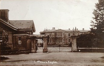
Littlemore Hospital

Littlemore Hospital was a mental health facility on Sandford Road in Littlemore, Oxfordshire. == History == The hospital, which was designed by Robert...

Nearby Amenities

Located within 500m of 51.721734,-1.222326
Mini Roundabout
Direction: clockwise
Lat/Long: 51.7253565/-1.2197072
Turning Circle
Turning Circle: knuckle
Lat/Long: 51.7210702/-1.2280124
Littlemore
Is In: Oxfordshire, England, UK
Place: suburb
Wikidata: Q2594237
Lat/Long: 51.7215188/-1.2244863
Bus Stop
Long Lane
Bus: yes
Bus Routes: 16A
Direction: W
Frequency: 0
Journeys: 6
Naptan AtcoCode: 340000958OPP
Naptan Bearing: W
Naptan BusStopType: CUS
Naptan CommonName: Long Lane
Naptan Indicator: Opp Sheldon Way
Naptan Landmark: Sheldon Way
Naptan NaptanCode: oxfatjdj
Naptan PlusbusZoneRef: OXFD
Naptan Street: Long Lane
Note: NAPTAN node in wrong place, and erroneously marked CUS
Public Transport: platform
Source: naptan_import;photograph
Lat/Long: 51.7249461/-1.218135
Mini Roundabout
Direction: clockwise
Lat/Long: 51.7212975/-1.2239928
Littlemore
Historic Railway: station
Railway: site
Lat/Long: 51.7188705/-1.2254717
Access: no
Barrier: bollard
Bollard: removable
Lat/Long: 51.7186044/-1.2262653
Minchery Farm
Is In: Oxfordshire, England, UK
Place: neighbourhood
Source Name: local knowledge
Lat/Long: 51.7194029/-1.2182714
Barrier: cycle_barrier
Source: Bing;local_knowledge
Lat/Long: 51.7250688/-1.2241049
Mini Roundabout
Direction: clockwise
Lat/Long: 51.7253876/-1.2203595
Barrier: bollard
Lat/Long: 51.7240273/-1.2206326
Turning Circle
Turning Circle: y-head
Lat/Long: 51.7220866/-1.2202835
Turning Circle
Turning Circle: hammer
Lat/Long: 51.7239189/-1.2197329
Turning Circle
Turning Circle: circle
Lat/Long: 51.7194949/-1.2189523
Turning Circle
Turning Circle: circle
Lat/Long: 51.7188631/-1.2182708
Turning Circle
Turning Circle: hammer
Lat/Long: 51.7178923/-1.2212148
Post Office
Littlemore Post Office
Addr Country: GB
Addr Postcode: OX4 4LD
Brand: Post Office
Brand Wikidata: Q1783168
Contact Website: https://www.postoffice.co.uk/branch-finder/1481371/littlemore
Ref Pol Id: 2772
Lat/Long: 51.7239249/-1.2205959
Post Box
Collection Times: Mo-Fr 17:15; Sa 12:00
Ref: OX4 756
Source: photograph
Lat/Long: 51.7241277/-1.227995
Bus Stop
Long Lane
Bus: yes
Bus Routes: 16A
Direction: E
Frequency: 0
Journeys: 6
Naptan AtcoCode: 340000958OSW
Naptan Bearing: E
Naptan CommonName: Long Lane
Naptan Indicator: Sheldon Way Corner
Naptan Landmark: Sheldon Way
Naptan NaptanCode: oxfadwgt
Naptan PlusbusZoneRef: OXFD
Naptan Street: Long Lane
Public Transport: platform
Source: naptan_import;photograph
Lat/Long: 51.724777/-1.2172777
Post Box
Collection Times: Mo-Fr 17:15; Sa 12:00
Ref: OX4 124
Royal Cypher: EIIR
Royal Cypher Wikidata: Q33102113
Source: photograph;local knowledge
Lat/Long: 51.7239036/-1.2207247
Bicycle Parking
Bicycle Parking: stands
Capacity: 10
Check Date: 2023-11-27
Covered: no
Source: photograph
Lat/Long: 51.7238717/-1.2207676
Post Box
Collection Times: Mo-Fr 17:00; Sa 11:30
Ref: OX4 720
Source: photograph
Lat/Long: 51.7193681/-1.2175661
Restaurant
The Anglo-Asian Restaurant
Cuisine: indian
Old Name: The Blue Mile
Source: photograph
Was Amenity: pub
Website: http://anglo-asian-oxford.co.uk/
Lat/Long: 51.722591/-1.221147
Crossing
Crossing: zebra
Crossing Island: no
Crossing Ref: zebra
Lat/Long: 51.720613/-1.2248736
Shop: convenience
Lat/Long: 51.7208148/-1.2200387
Barrier: cycle_barrier
Lat/Long: 51.7250309/-1.2242586
Barrier: bollard
Lat/Long: 51.7247215/-1.2245249
Barrier: cycle_barrier
Lat/Long: 51.720152/-1.2163289
Traffic Calming: choker
Lat/Long: 51.7252672/-1.2203831
Bus Stop
Littlemore Shops
Bus: yes
Naptan AtcoCode: 340001240LNG
Naptan Bearing: S
Naptan CommonName: Littlemore Shops
Naptan Indicator: Long Lane corner
Naptan Landmark: Bypass Bridge
Naptan NaptanCode: oxfajdmd
Naptan PlusbusZoneRef: OXFD
Naptan Street: Cowley Road
Public Transport: platform
Route Ref: 116;115
Shelter: no
Source: gps_survey;naptan_import
Lat/Long: 51.7249789/-1.2203884
Bus Stop
Littlemore Shops
Bus: yes
Naptan AtcoCode: 340001240NEW
Naptan Bearing: N
Naptan CommonName: Littlemore Shops
Naptan Indicator: Newman Road corner
Naptan Landmark: Bypass Bridge
Naptan NaptanCode: oxfajdma
Naptan PlusbusZoneRef: OXFD
Naptan Street: Cowley Road
Public Transport: platform
Route Ref: 116;115
Source: gps_survey;naptan_import
Lat/Long: 51.7249094/-1.2205383
Bench
Source: gps_survey
Lat/Long: 51.7250059/-1.2203521
Addr Housenumber: 54
Addr Street: Cowley Road
Lat/Long: 51.72461/-1.2202508
Addr Housenumber: 68
Addr Street: Cowley Road
Lat/Long: 51.7250783/-1.2197591
Addr Housenumber: 13
Note: remove this tag and the interpolated way when road resurveyed - too many houses suggest an 'a' somewhere in the middle.
Lat/Long: 51.7252844/-1.2186247
Addr Housenumber: 55
Note: remove this tag and the interpolated way when road resurveyed - too many houses suggest an 'a' somewhere in the middle.
Lat/Long: 51.7247935/-1.2169991
Traffic Calming: choker
Lat/Long: 51.7245479/-1.220554
Barrier: bollard
Lat/Long: 51.7233287/-1.2222696
Barrier: bollard
Lat/Long: 51.7232084/-1.2238571
Bicycle Parking
Capacity: 10
Source: gps_survey
Lat/Long: 51.7206438/-1.2199724
Bicycle Parking
Capacity: 14
Source: gps_survey
Lat/Long: 51.7207635/-1.2203043
Bus Stop
Dudgeon Drive
Bench: yes
Bin: yes
Bus: yes
Naptan AtcoCode: 340000022DDC
Naptan Bearing: N
Naptan CommonName: Dudgeon Drive
Naptan Indicator: Corner
Naptan Landmark: Dudgeon Drive
Naptan NaptanCode: oxfatmgt
Naptan PlusbusZoneRef: OXFD
Naptan Street: Oxford Road
Public Transport: platform
Shelter: yes
Source: naptan_import
Tactile Paving: no
Lat/Long: 51.722165/-1.2240377
Bus Stop
The George PH
Bench: yes
Bin: no
Bus: yes
Naptan AtcoCode: 340000022GEO
Naptan Bearing: NE
Naptan CommonName: The George PH
Naptan Indicator: Opposite
Naptan Landmark: The George
Naptan NaptanCode: oxfamjda
Naptan PlusbusZoneRef: OXFD
Naptan Street: Sandford Road
Naptan Verified: no
Public Transport: platform
Route Ref: 106;116
Shelter: yes
Source: naptan_import
Tactile Paving: no
Lat/Long: 51.720841/-1.2247158
Bus Stop
The George PH
Bus: yes
Naptan AtcoCode: 340000022OUT
Naptan Bearing: SW
Naptan CommonName: The George PH
Naptan Indicator: Outside
Naptan Landmark: The George
Naptan NaptanCode: oxfatmgw
Naptan Street: Sandford Road
Public Transport: platform
Source: naptan_import
Lat/Long: 51.7204019/-1.2250949
Bus Stop
Minchery Farm
Bus: yes
Naptan AtcoCode: 340001235OPP
Naptan Bearing: NW
Naptan CommonName: Carpenter Close
Naptan Indicator: Corner
Naptan Landmark: Priory Road
Naptan NaptanCode: oxfajdpa
Naptan PlusbusZoneRef: OXFD
Naptan Street: St Nicholas Road
Public Transport: platform
Source: naptan_import
Lat/Long: 51.7192777/-1.2176691
Bus Stop
Minchery Farm Shops
Bench: no
Bin: no
Bus: yes
Naptan AtcoCode: 340001236CNR
Naptan Bearing: SE
Naptan CommonName: Minchery Farm Shops
Naptan Indicator: Giles Road Corner
Naptan Landmark: Giles Road
Naptan NaptanCode: oxfajdmw
Naptan PlusbusZoneRef: OXFD
Naptan Street: St Nicholas Road
Public Transport: platform
Shelter: no
Source: naptan_import
Tactile Paving: no
Lat/Long: 51.7206549/-1.2206131
Bus Stop
Minchery Farm Shops
Bus: yes
Naptan AtcoCode: 340001236OPP
Naptan Bearing: NW
Naptan CommonName: Minchery Farm Shops
Naptan Indicator: Opposite Giles Road
Naptan Landmark: Giles Road
Naptan NaptanCode: oxfajdmt
Naptan PlusbusZoneRef: OXFD
Naptan Street: St Nicholas Road
Public Transport: platform
Shelter: yes
Source: naptan_import
Lat/Long: 51.7205752/-1.2206131
Bus Stop
Minchery Road
Bus: yes
Naptan AtcoCode: 340001237LKF
Naptan Bearing: SE
Naptan CommonName: Minchery Road
Naptan Indicator: Opposite Lakefield Road
Naptan Landmark: Minchery Road
Naptan NaptanCode: oxfajdmp
Naptan Street: Minchery Road
Naptan Verified: no
Public Transport: platform
Source: naptan_import
Lat/Long: 51.7185763/-1.2192625
Bus Stop
Catholic Church
Bus: yes
Naptan AtcoCode: 340001244CNR
Naptan Bearing: S
Naptan CommonName: Catholic Church
Naptan Indicator: Corner
Naptan Landmark: St Nicholas Road
Naptan NaptanCode: oxfajdat
Naptan PlusbusZoneRef: OXFD
Naptan Street: Cowley Road
Naptan Verified: no
Public Transport: platform
Source: naptan_import
Lat/Long: 51.7219544/-1.2218708
Bus Stop
Catholic Church
Bus: yes
Naptan AtcoCode: 340001244OPS
Naptan Bearing: NE
Naptan CommonName: Catholic Church
Naptan Indicator: Opposite
Naptan Landmark: St Nicholas Road
Naptan NaptanCode: oxfajdjp
Naptan PlusbusZoneRef: OXFD
Naptan Street: Cowley Road
Naptan Verified: no
Public Transport: platform
Source: naptan_import
Lat/Long: 51.7218848/-1.2222194
Post Box
Check Date: 2021-12-14
Collection Times: Mo-Fr 17:00; Sa 11:30
Ref: OX4 739
Royal Cypher: GVIR
Royal Cypher Wikidata: Q33102169
Source: streetlevel imagery;local knowledge
Lat/Long: 51.7228402/-1.2238661
Post Box
Collection Times: Mo-Fr 17:00; Sa 11:30
Ref: OX4 348
Lat/Long: 51.7205505/-1.2260396
Source: Bing
Lat/Long: 51.7230103/-1.2219809
Source: Bing
Lat/Long: 51.722872/-1.2219895
Source: Bing
Lat/Long: 51.7228082/-1.2219895
Waste Basket
Check Date: 2023-12-13
Source: Bing;local_knowledge
Lat/Long: 51.7213035/-1.2221887
Bench
Backrest: yes
Check Date: 2023-12-13
Seats: 2
Source: Bing;local_knowledge
Lat/Long: 51.7213141/-1.222204
Turning Circle
Turning Circle: circle
Lat/Long: 51.7222553/-1.2272481
Turning Circle
Turning Circle: circle
Lat/Long: 51.7213884/-1.2260533
Library
Littlemore Library
Email: littlemore.library@oxfordshire.gov.uk
Opening Hours: Mo 14:00-18:00; Tu 14:00-16:30; Th 09:30-12:30,14:00-16:30; Fr 09:30-12:30; Sa 09:30-13:30
Phone: +44 1865 714309
Wikidata: Q55112967
Lat/Long: 51.7225871/-1.2158025
Fast Food
Lat/Long: 51.720723/-1.2198845
Turning Circle
Lat/Long: 51.7216973/-1.2180002
Bicycle Parking
Lat/Long: 51.7227047/-1.2160469
Bicycle Parking
Lat/Long: 51.7228158/-1.216363
Fast Food
Littlemore Fish Bar
Cuisine: fish_and_chips
Source: local_knowledge
Lat/Long: 51.7249905/-1.2198643
Parking
Access: customers
Capacity: 50
Maxstay: 4 hours
Operator: The Oxford Academy, Littlemore Rugby Club
Park Ride: no
Parking: surface
Supervised: yes
Surface: asphalt
Lat/Long: 51.7211535/-1.216621
Bicycle Parking
Bicycle Parking: stands
Capacity: 4
Lat/Long: 51.7206364/-1.2258419
Direction: 170
Fixme: survey for panel count
Generator Location: roof
Generator Method: photovoltaic
Generator Output Electricity: yes
Generator Solar Modules: 12
Generator Source: solar
Generator Type: solar_photovoltaic_panel
Power: generator
Lat/Long: 51.725398/-1.2260926
Turning Loop
Lat/Long: 51.7202123/-1.2244574
Place Of Worship
Building: chapel
Denomination: roman_catholic
Religion: christian
Lat/Long: 51.7221629/-1.2209851
Entrance: yes
Lat/Long: 51.7221939/-1.2151509
Bench
Lat/Long: 51.7203607/-1.2251506
Bench
Lat/Long: 51.720433/-1.225331
Bench
Lat/Long: 51.7211667/-1.2239342
Waste Basket
Lat/Long: 51.7211563/-1.2239496
Waste Basket
Lat/Long: 51.720374/-1.2251325
Leisure: picnic_table
Lat/Long: 51.7224869/-1.2246933
Waste Basket
Lat/Long: 51.7220269/-1.2261021
Bench
Backrest: yes
Lat/Long: 51.7226128/-1.2247341
Bench
Lat/Long: 51.7229809/-1.2246964
Bench
Lat/Long: 51.7220602/-1.2261182
Waste Basket
Lat/Long: 51.7221234/-1.2254235
Waste Basket
Lat/Long: 51.7243589/-1.2232912
Bench
Backrest: yes
Lat/Long: 51.7243381/-1.2230659
Leisure: picnic_table
Lat/Long: 51.7224216/-1.2262579
Bench
Lat/Long: 51.7221399/-1.2253538
Shelter
Lat/Long: 51.7225877/-1.2263985
Waste Basket
Lat/Long: 51.7243373/-1.2231128
Bench
Backrest: yes
Lat/Long: 51.7242916/-1.2234253
Waste Basket
Lat/Long: 51.72188/-1.2222766
Crossing
Crossing: uncontrolled
Crossing Island: yes
Lat/Long: 51.7254988/-1.2235937
Public Bookcase
Fixme: check exact location
Public Bookcase Type: wooden_cabinet
Lat/Long: 51.7198428/-1.2161725
Crossing
Crossing: unmarked
Tactile Paving: yes
Lat/Long: 51.7244757/-1.2233583
Direction: 185
Generator Method: photovoltaic
Generator Output Electricity: yes
Generator Solar Modules: 1512
Generator Source: solar
Generator Type: solar_photovoltaic_panel
Location: roof
Power: generator
Lat/Long: 51.7181135/-1.2183861
Direction: 145
Generator Method: photovoltaic
Generator Output Electricity: yes
Generator Solar Modules: 6
Generator Source: solar
Generator Type: solar_photovoltaic_panel
Location: roof
Power: generator
Lat/Long: 51.7190402/-1.2182976
Direction: 240
Fixme: survey for panel count
Generator Method: photovoltaic
Generator Output Electricity: yes
Generator Solar Modules: 7
Generator Source: solar
Generator Type: solar_photovoltaic_panel
Location: roof
Power: generator
Lat/Long: 51.7200024/-1.2181766
Direction: 240
Fixme: survey for panel count
Generator Method: photovoltaic
Generator Output Electricity: yes
Generator Solar Modules: 16
Generator Source: solar
Generator Type: solar_photovoltaic_panel
Location: roof
Power: generator
Lat/Long: 51.7189272/-1.2199599
Direction: 230
Fixme: survey for panel count
Generator Method: photovoltaic
Generator Output Electricity: yes
Generator Solar Modules: 10
Generator Source: solar
Generator Type: solar_photovoltaic_panel
Location: roof
Power: generator
Lat/Long: 51.7205931/-1.2171956
Turning Circle
Turning Circle: knuckle
Lat/Long: 51.7206368/-1.2222982
Turning Circle
Turning Circle: square
Lat/Long: 51.721143/-1.220965
Crossing
Crossing: unmarked
Lat/Long: 51.7212034/-1.224065
Traffic Calming: island
Lat/Long: 51.7214017/-1.2239757
Fixme: solar panels?
Lat/Long: 51.7199704/-1.223339
Fixme: solar panels?
Lat/Long: 51.7200226/-1.2224013
Direction: 125
Generator Method: photovoltaic
Generator Output Electricity: yes
Generator Solar Modules: 6
Generator Source: solar
Generator Type: solar_photovoltaic_panel
Location: roof
Power: generator
Lat/Long: 51.719845/-1.2228325
Direction: 125
Generator Method: photovoltaic
Generator Output Electricity: yes
Generator Solar Modules: 6
Generator Source: solar
Generator Type: solar_photovoltaic_panel
Location: roof
Power: generator
Lat/Long: 51.7198039/-1.2228812
Direction: 125
Generator Method: photovoltaic
Generator Output Electricity: yes
Generator Solar Modules: 4
Generator Source: solar
Generator Type: solar_photovoltaic_panel
Location: roof
Power: generator
Lat/Long: 51.7197677/-1.2229194
Direction: 125
Generator Method: photovoltaic
Generator Output Electricity: yes
Generator Solar Modules: 610
Generator Source: solar
Generator Type: solar_photovoltaic_panel
Location: roof
Power: generator
Lat/Long: 51.7196395/-1.2227286
Direction: 125
Generator Method: photovoltaic
Generator Output Electricity: yes
Generator Solar Modules: 610
Generator Source: solar
Generator Type: solar_photovoltaic_panel
Location: roof
Power: generator
Lat/Long: 51.7195569/-1.2228329
Direction: 125
Generator Method: photovoltaic
Generator Output Electricity: yes
Generator Solar Modules: 6
Generator Source: solar
Generator Type: solar_photovoltaic_panel
Location: roof
Power: generator
Lat/Long: 51.7201075/-1.2252096
Direction: 105
Fixme: survel for panel count
Generator Method: photovoltaic
Generator Output Electricity: yes
Generator Solar Modules: 8
Generator Source: solar
Generator Type: solar_photovoltaic_panel
Location: roof
Power: generator
Lat/Long: 51.723972/-1.2200174
Direction: 230
Generator Method: photovoltaic
Generator Output Electricity: yes
Generator Solar Modules: 10
Generator Source: solar
Generator Type: solar_photovoltaic_panel
Location: roof
Power: generator
Lat/Long: 51.7216984/-1.2294828
Turning Circle
Turning Circle: knuckle
Lat/Long: 51.721521/-1.2289126
Turning Circle
Turning Circle: knuckle
Lat/Long: 51.7208239/-1.2283303
Fixme: solar panels?
Lat/Long: 51.720142/-1.2267816
Direction: 180
Fixme: survey for panel count
Generator Method: photovoltaic
Generator Output Electricity: yes
Generator Solar Modules: 6
Generator Source: solar
Generator Type: solar_photovoltaic_panel
Location: roof
Power: generator
Lat/Long: 51.7229508/-1.2236781
Turning Circle
Turning Circle: knuckle
Lat/Long: 51.7238977/-1.2217751
Give Way
Direction: forward
Lat/Long: 51.7236845/-1.2239389
Direction: 230
Fixme: survey for panel count
Generator Method: photovoltaic
Generator Output Electricity: yes
Generator Solar Modules: 10
Generator Source: solar
Generator Type: solar_photovoltaic_panel
Location: roof
Power: generator
Lat/Long: 51.7211037/-1.2223763
Direction: 130
Generator Method: photovoltaic
Generator Output Electricity: yes
Generator Solar Modules: 6
Generator Source: solar
Generator Type: solar_photovoltaic_panel
Location: roof
Power: generator
Lat/Long: 51.7250275/-1.225526
Direction: 100
Generator Method: photovoltaic
Generator Output Electricity: yes
Generator Solar Modules: 18
Generator Source: solar
Generator Type: solar_photovoltaic_panel
Location: roof
Power: generator
Lat/Long: 51.7248796/-1.2213893
Direction: 190
Generator Method: photovoltaic
Generator Output Electricity: yes
Generator Solar Modules: 61
Generator Source: solar
Generator Type: solar_photovoltaic_panel
Location: roof
Power: generator
Lat/Long: 51.7249081/-1.2210667
Direction: 280
Generator Method: photovoltaic
Generator Output Electricity: yes
Generator Solar Modules: 39
Generator Source: solar
Generator Type: solar_photovoltaic_panel
Location: roof
Power: generator
Lat/Long: 51.7247826/-1.2208922
Direction: 185
Generator Method: photovoltaic
Generator Output Electricity: yes
Generator Solar Modules: 10
Generator Source: solar
Generator Type: solar_photovoltaic_panel
Location: roof
Power: generator
Lat/Long: 51.7249418/-1.2221547
Direction: 185
Generator Method: photovoltaic
Generator Output Electricity: yes
Generator Solar Modules: 4
Generator Source: solar
Generator Type: solar_photovoltaic_panel
Location: roof
Power: generator
Lat/Long: 51.7249564/-1.2229946
Direction: 185
Generator Method: photovoltaic
Generator Output Electricity: yes
Generator Solar Modules: 4
Generator Source: solar
Generator Type: solar_photovoltaic_panel
Location: roof
Power: generator
Lat/Long: 51.7249634/-1.2230866
Direction: 185
Generator Method: photovoltaic
Generator Output Electricity: yes
Generator Solar Modules: 4
Generator Source: solar
Generator Type: solar_photovoltaic_panel
Location: roof
Power: generator
Lat/Long: 51.7249742/-1.2231886
Direction: 175
Generator Method: photovoltaic
Generator Output Electricity: yes
Generator Solar Modules: 10
Generator Source: solar
Generator Type: solar_photovoltaic_panel
Location: roof
Power: generator
Lat/Long: 51.7256376/-1.2206668
Direction: 355
Generator Method: photovoltaic
Generator Output Electricity: yes
Generator Solar Modules: 4
Generator Source: solar
Generator Type: solar_photovoltaic_panel
Location: roof
Power: generator
Lat/Long: 51.7256898/-1.2206512
Generator Method: photovoltaic
Generator Output Electricity: yes
Generator Solar Modules: 4
Generator Source: solar
Generator Type: solar_photovoltaic_panel
Location: roof
Power: generator
Lat/Long: 51.7206822/-1.2237125
Artist Name: Josh Rose
Artwork Type: wood
Description: An abstract tree with history of Littlemore
Tourism: artwork
Lat/Long: 51.7252188/-1.2201497
Bench
Lat/Long: 51.7251817/-1.2202472
Defibrillator
Defibrillator Location: Just inside wall of church
Emergency: defibrillator
Indoor: no
Lat/Long: 51.7211784/-1.2237805
Information: board
Operator: St Mary and St Nicholas
Tourism: information
Lat/Long: 51.7212015/-1.223746
Advertising: board
Operator: Littlemore Parish Council
Support: street_furniture:transit_shelter
Lat/Long: 51.7208366/-1.2247034
Advertising: board
Operator: Littlemore Parish Council
Support: poles
Lat/Long: 51.7250926/-1.2200312
Advertising: board
Lat/Long: 51.7209502/-1.2193508
Addr Housenumber: 1
Addr Street: Morrell Crescent
Lat/Long: 51.7193554/-1.2282396
Addr Housenumber: 10
Addr Street: Morrell Crescent
Lat/Long: 51.7190954/-1.2276761
Waste Basket
Lat/Long: 51.7251165/-1.2202072
The data included in this document is from www.openstreetmap.org. The data is made available under ODbL.

Have you been to Littlemore?

Leave your review of Littlemore below (or comments, questions and feedback).