Bight of Niddister

Bay in Shetland

Scotland

Bight of Niddister

Ness of Hillwick Taken from the B9078 between Burnside and Eshaness, Shetland, I am looking across Sand Wick to the Ness of Hillswick. The Isle of Westerhouse is visible just off the Pund of Grevasand to the west of the Ness.
Ness of Hillwick Credit: Carroll Pierce

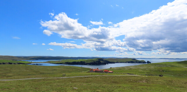
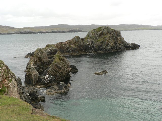
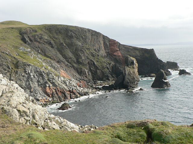
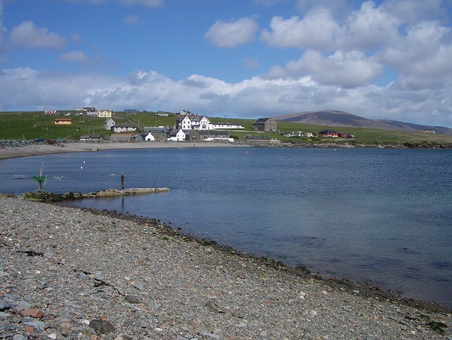
The Bight of Niddister is a picturesque bay located in the Shetland Islands, an archipelago in Scotland. Situated on the east coast of the mainland, this bay offers stunning natural beauty and a tranquil environment. The bay is nestled between the rugged cliffs of Noss Head and the sandy shores of Sound Gruney.

The Bight of Niddister is known for its pristine white sand beach, which stretches for approximately 1.5 kilometers. The beach is a popular spot for locals and visitors alike, offering opportunities for sunbathing, picnicking, and leisurely walks along the shore. The crystal-clear waters of the bay are ideal for swimming, paddling, and even snorkeling, as they are relatively calm and sheltered.

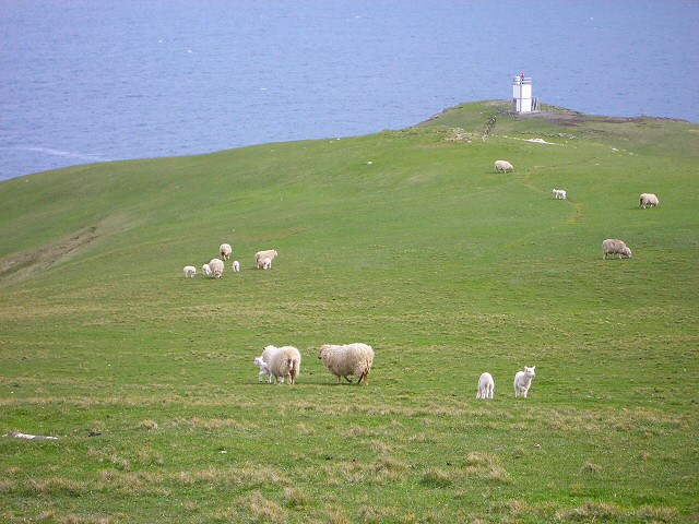
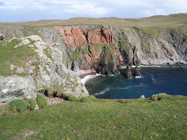
Surrounding the bay, visitors can admire the dramatic coastal landscape, characterized by steep cliffs and rocky outcrops. The cliffs of Noss Head, reaching heights of up to 180 meters, provide a breathtaking backdrop to the bay. The area is also home to a diverse range of seabirds, including puffins, guillemots, and razorbills, which nest in the cliffs and can often be spotted during the breeding season.

Access to the Bight of Niddister is relatively easy, with a nearby car park and a short walk down to the beach. The bay is a great place to escape the hustle and bustle of everyday life, offering a peaceful retreat in a stunning natural setting. Whether you are seeking relaxation or outdoor adventure, the Bight of Niddister is a must-visit destination for nature enthusiasts and beach lovers alike.

If you have any feedback on the listing, please let us know in the comments section below.

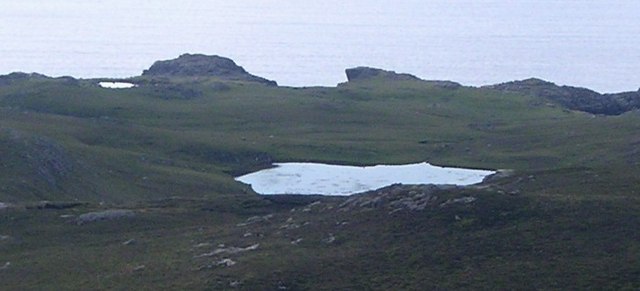
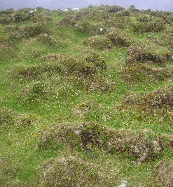
Bight of Niddister Images

Images are sourced within 2km of 60.462033/-1.4858917 or Grid Reference HU2875. Thanks to Geograph Open Source API. All images are credited.

Ness of Hillwick Taken from the B9078 between Burnside and Eshaness, Shetland, I am looking across Sand Wick to the Ness of Hillswick. The Isle of Westerhouse is visible just off the Pund of Grevasand to the west of the Ness.
Ness of Hillwick
Taken from the B9078 between Burnside and Eshaness, Shetland, I am looking across Sand Wick to the Ness of Hillswick. The Isle of Westerhouse is visible just off the Pund of Grevasand to the west of the Ness.
Hillswick Fire Station, Shetland With local retained firefighters the Hillswick Fire Station is little more than a large garage, just big enough to house the small appliance based on a large van.
Hillswick Fire Station, Shetland
With local retained firefighters the Hillswick Fire Station is little more than a large garage, just big enough to house the small appliance based on a large van.
Hillswick, Shetland Large traditionally built houses at Hillswick. In the background is Findlins House and Findlins Farm.
Hillswick, Shetland
Large traditionally built houses at Hillswick. In the background is Findlins House and Findlins Farm.
Hillswick, Shetland Houses at Hillswick, the large two storey house with mansard roof is called Laarsund.
Hillswick, Shetland
Houses at Hillswick, the large two storey house with mansard roof is called Laarsund.
St Magnus Bay Hotel, Hillswick, Shetland This hotel was built as a kit in Norway, dis-assembled and transported to Hillswick where it was constructed on its present site in 1900 by the North of Scotland, Orkney & Shetland Steam Navigation Co.. Sadly it is currently closed (April 2006) although the local community wish to see it opened again. For more information on Hillswick and surrounding area visit <span class="nowrap"><a title="http://www.undiscoveredscotland.co.uk/shetland/hillswick/index.html" rel="nofollow ugc noopener" href="http://www.undiscoveredscotland.co.uk/shetland/hillswick/index.html">Link</a><img style="margin-left:2px;" alt="External link" title="External link - shift click to open in new window" src="https://s1.geograph.org.uk/img/external.png" width="10" height="10"/></span>

UPDATE Oct 07: this hotel is now owned by a local couple and open every day - More information can be found at the official website <span class="nowrap"><a title="http://www.stmagnusbayhotel.co.uk" rel="nofollow ugc noopener" href="http://www.stmagnusbayhotel.co.uk">Link</a><img style="margin-left:2px;" alt="External link" title="External link - shift click to open in new window" src="https://s1.geograph.org.uk/img/external.png" width="10" height="10"/></span>
St Magnus Bay Hotel, Hillswick, Shetland
This hotel was built as a kit in Norway, dis-assembled and transported to Hillswick where it was constructed on its present site in 1900 by the North of Scotland, Orkney & Shetland Steam Navigation Co.. Sadly it is currently closed (April 2006) although the local community wish to see it opened again. For more information on Hillswick and surrounding area visit LinkExternal link UPDATE Oct 07: this hotel is now owned by a local couple and open every day - More information can be found at the official website LinkExternal link
Snapa Water Shallow weedy lochan.
Snapa Water
Shallow weedy lochan.
Weathered Peat West Mill loch of Hamar, peculiar weathered peat formation.
Weathered Peat
West Mill loch of Hamar, peculiar weathered peat formation.
The Quilse
The Quilse
Gordi Stack This is the stack seen edge on. From other directions it looks much wider. In the distance to the right are the Drongs - another dramatic rock formation. See <a href="https://www.geograph.org.uk/photo/550985">HU2675 : The Drongs</a> for an telephoto view.
Gordi Stack
This is the stack seen edge on. From other directions it looks much wider. In the distance to the right are the Drongs - another dramatic rock formation. See HU2675 : The Drongs for an telephoto view.
Cliffs and stack The view south from this point is spectacular.

(The stack and the point to the right lie in this grid square, while the cliff to the left is in <a href="https://www.geograph.org.uk/gridref/HU2775">HU2775</a>).
Cliffs and stack
The view south from this point is spectacular. (The stack and the point to the right lie in this grid square, while the cliff to the left is in HU2775).
The bay at Hillswick Looking across the bay with the main settlement on the far shore.
The bay at Hillswick
Looking across the bay with the main settlement on the far shore.
Sheep near Baa Taing Looking down the sheep pasture towards the lighthouse.
Sheep near Baa Taing
Looking down the sheep pasture towards the lighthouse.
Baa Taing light A rope handrail provides safe access to the light in bad weather. The headland is wide and flat, so the conditions that might require the safety rail defy imagination.
Baa Taing light
A rope handrail provides safe access to the light in bad weather. The headland is wide and flat, so the conditions that might require the safety rail defy imagination.
Lochan and cliffs Looking across the lochan at the south end of Hillswick Ness, backed by the cliffs above Queen Geos.
Lochan and cliffs
Looking across the lochan at the south end of Hillswick Ness, backed by the cliffs above Queen Geos.
Conflicting signs A waymarked stile gives access to the coast, while a "beware of the bull" sign warns of danger. We crossed through this field on a clockwise circuit of Ness of Hillswick without seeing any warning in the other direction (or a bull).
Conflicting signs
A waymarked stile gives access to the coast, while a "beware of the bull" sign warns of danger. We crossed through this field on a clockwise circuit of Ness of Hillswick without seeing any warning in the other direction (or a bull).
Opposite a red cliff Looking across the short turf of this promontory at a red cliff across the bay.
Opposite a red cliff
Looking across the short turf of this promontory at a red cliff across the bay.
Marsh marigolds Looking across a marshy area towards Hillswick. The marsh marigolds currently in flower will be succeeded by the yellow flags behind them, not yet in bud.
Marsh marigolds
Looking across a marshy area towards Hillswick. The marsh marigolds currently in flower will be succeeded by the yellow flags behind them, not yet in bud.
Eider ducks These large sea ducks are a common sight on northern coasts.
Eider ducks
These large sea ducks are a common sight on northern coasts.
Show me another place!

Bight of Niddister is located at Grid Ref: HU2875 (Lat: 60.462033, Lng: -1.4858917)

Unitary Authority: Shetland Islands

Police Authority: Highlands and Islands

What 3 Words

///barstool.cools.incorrect. Near Brae, Shetland Islands

Related Wikis

Hillswick

Hillswick is a small village in Northmavine, on the shore of the Atlantic Ocean and lies to the north-north west of Mainland, Shetland, the most northerly...

The Drongs

The Drongs are a group of sea stacks off the coast of Hillswick Ness, Northmavine, Shetland, Scotland. They lie to the west of the Isle of Westerhouse...

Gunnister

Gunnister is a small 'abandoned' village at the North-West Mainland in Shetland, Scotland. It is most commonly known for the Gunnister Man - the remains...

Punds Water

Punds Water is a freshwater loch near Mangaster in Northmavine, Shetland. It also gives its name to a nearby Neolithic heel-shaped cairn. == Heel-shaped... ==

Have you been to Bight of Niddister?

Leave your review of Bight of Niddister below (or comments, questions and feedback).