Crubba
Bay in Shetland
Scotland
Crubba

Crubba is a small bay located on the east coast of Shetland, an archipelago in Scotland. Nestled within the larger area of Bay of Quendale, Crubba offers a picturesque and tranquil setting for visitors and locals alike.
The bay is characterized by its stunning natural beauty, with rugged cliffs that overlook the North Sea. The surrounding landscape is dotted with heathland, grassy meadows, and scattered wildflowers, creating a vibrant and colorful atmosphere. The crystal-clear waters of the bay provide a habitat for a variety of marine life, making it a popular spot for fishing and wildlife enthusiasts.
Crubba is also known for its rich history and cultural significance. The bay was once a thriving fishing community, and remnants of traditional fishing huts, known as "booths," can still be seen along the shoreline. These booths were used by fishermen to store their equipment and shelter during their fishing expeditions.
Today, Crubba serves as a peaceful retreat for those seeking a break from the hustle and bustle of everyday life. Its quiet and serene atmosphere makes it an ideal spot for leisurely walks along the sandy beach or exploring the surrounding cliffs. Visitors can also enjoy birdwatching, as the bay is home to various seabirds such as puffins, shags, and fulmars.
In summary, Crubba is a hidden gem on the east coast of Shetland, offering a combination of natural beauty, rich history, and a peaceful ambiance that makes it an idyllic destination for nature lovers and those seeking tranquility.
If you have any feedback on the listing, please let us know in the comments section below.
Crubba Images
Images are sourced within 2km of 60.473895/-1.6109889 or Grid Reference HU2176. Thanks to Geograph Open Source API. All images are credited.


Crubba is located at Grid Ref: HU2176 (Lat: 60.473895, Lng: -1.6109889)
Unitary Authority: Shetland Islands
Police Authority: Highlands and Islands
What 3 Words
///slips.bookcases.louder. Near Brae, Shetland Islands
Nearby Locations
Related Wikis
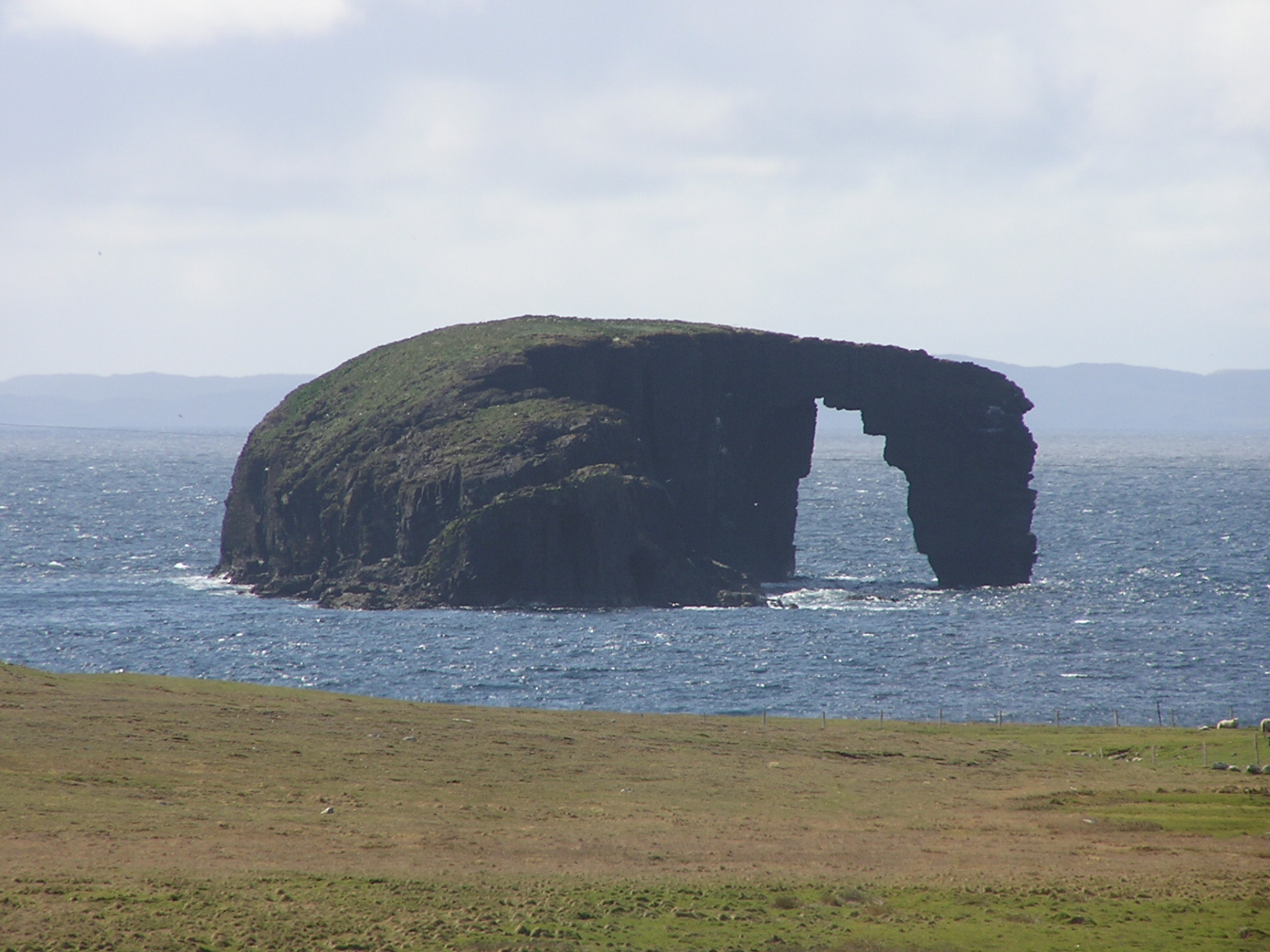
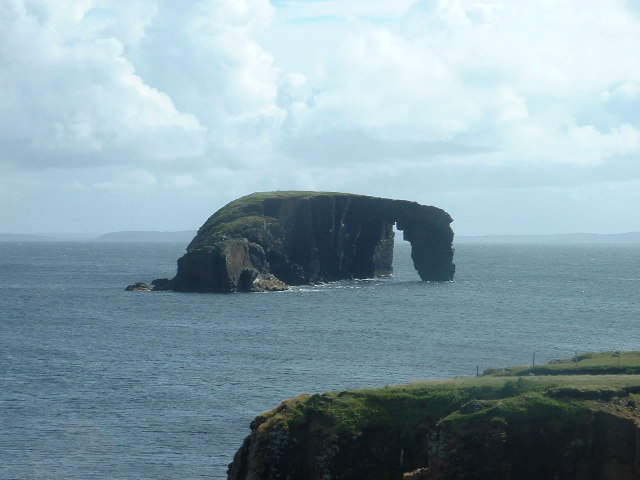
Dore Holm
The Dore Holm is a small uninhabited islet off the south coast of Esha Ness, located in the north-west of Mainland, Shetland, Scotland. Its natural arch...
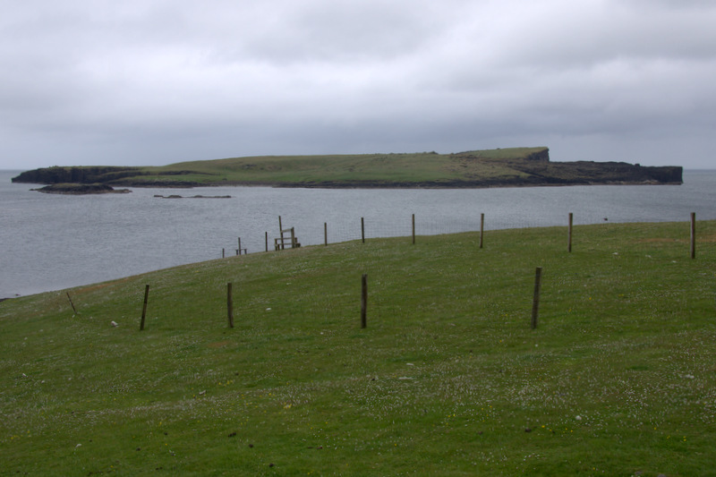
Isle of Stenness
The Isle of Stenness is one of the Shetland Islands, Scotland. It is off north west Mainland in the Northmavine. It sheltered the old fishing harbour at...

Calder's Geo
Calders Geo is an inlet in the western cliffs of Esha Ness in Northmavine on the Mainland, Shetland, Scotland. A cave on the north side of the geo has...

Tangwick Haa
Tangwick Haa is an historic house and museum in Esha Ness, Northmavine, Shetland. The building has two stories in a rectangular layout and along with the...

Esha Ness
Esha Ness, also spelled Eshaness, is a peninsula on the west coast of Northmavine, on the island of Mainland, Shetland, Scotland. Esha Ness Lighthouse...

Braehoulland
Braehoulland is a hamlet on Mainland, in Shetland, Scotland. Braehoulland is situated within the parish of Northmaven. Eshaness Community Centre is located...

Johnnie Notions
John Williamson (c. 1730 – c. 1803), more commonly known by the nickname Johnnie Notions (pronounced [ˌdʒoni ˈnoʃəns], JOH-nee-NOH-shəns) was a self-taught...

The Drongs
The Drongs are a group of sea stacks off the coast of Hillswick Ness, Northmavine, Shetland, Scotland. They lie to the west of the Isle of Westerhouse...
Nearby Amenities
Located within 500m of 60.473895,-1.6109889Have you been to Crubba?
Leave your review of Crubba below (or comments, questions and feedback).