Blue Hole

Bay in Shetland

Scotland

Blue Hole

Lower Thistles, Mid Walls Ready for the flood!  Or perhaps to go fishing.
Lower Thistles, Mid Walls Credit: Russel Wills

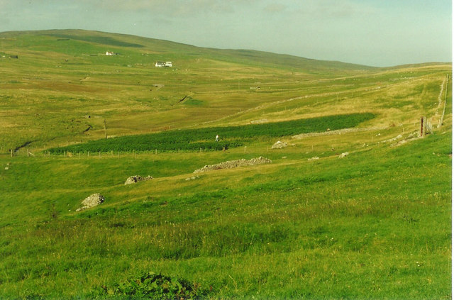
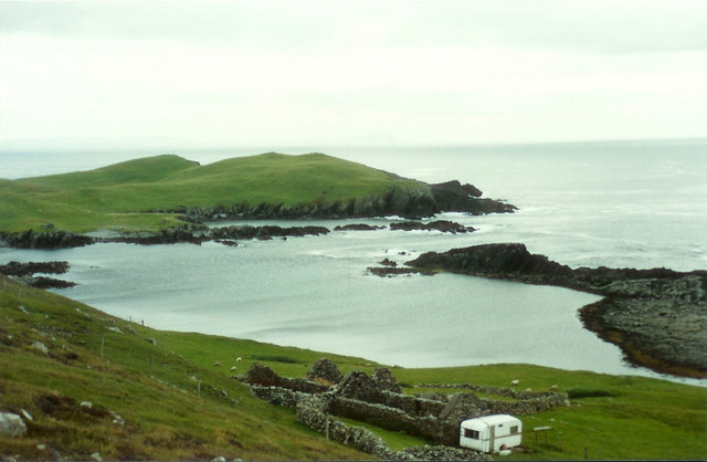
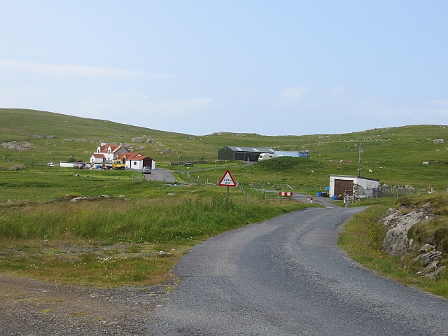
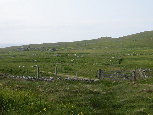
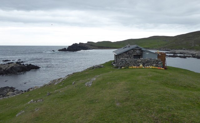
Blue Hole is a picturesque bay located on the west coast of the Shetland Islands, Scotland. Nestled between high cliffs and rugged coastline, it is known for its stunning beauty and tranquil atmosphere. The bay gets its name from the deep blue hue of the water, which is a result of the surrounding rock formations and the clarity of the sea.

The Blue Hole is a popular spot for both locals and tourists, who are drawn to its serene surroundings and abundant wildlife. The bay is home to a diverse range of marine species, including seals, otters, and a variety of seabirds. Visitors can often spot these creatures while taking leisurely walks along the sandy beach or exploring the rocky shoreline.

One of the main attractions of Blue Hole is the opportunity for diving and snorkeling. The crystal-clear waters reveal a fascinating underwater world, with colorful marine life and unique rock formations to explore. Experienced divers can venture deeper into the Blue Hole, where they can discover caves and tunnels that add to the allure of the site.

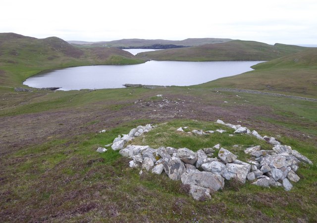
In addition to its natural wonders, Blue Hole also has historical significance. The bay was once used as a natural harbor for fishing boats, and remnants of old stone structures can still be seen along the shoreline. These remnants serve as a reminder of the bay's rich maritime heritage.

Overall, Blue Hole in Shetland is a captivating destination that offers visitors a chance to immerse themselves in the beauty of nature, explore the underwater realm, and appreciate the historical significance of the area.

If you have any feedback on the listing, please let us know in the comments section below.

Blue Hole Images

Images are sourced within 2km of 60.220219/-1.6519688 or Grid Reference HU1948. Thanks to Geograph Open Source API. All images are credited.

Lower Thistles, Mid Walls Ready for the flood!  Or perhaps to go fishing.
Lower Thistles, Mid Walls
Ready for the flood! Or perhaps to go fishing.
Da Leaans View of tattie rig (potato field) and worker at Da Leaans croft
Da Leaans
View of tattie rig (potato field) and worker at Da Leaans croft
Littlure Littlure with The Peak above the caravan and Uskies Geo beyond
Littlure
Littlure with The Peak above the caravan and Uskies Geo beyond
Annifirth A road end settlement.
Annifirth
A road end settlement.
Track to Footabrough, Mid Walls
Cairn on Dounawall Showing signs of recent collapse. A cairn on The Hamar is visible beyond.
Cairn on Dounawall
Showing signs of recent collapse. A cairn on The Hamar is visible beyond.
Cliffs at Littlure A fine section of coast for easy walking in late September.
Cliffs at Littlure
A fine section of coast for easy walking in late September.
Hill above Littlure A cairn sits at a good viewpoint along the hill above the fields of Littlure. Vaila Sound is visible in the distance.
Hill above Littlure
A cairn sits at a good viewpoint along the hill above the fields of Littlure. Vaila Sound is visible in the distance.
Cairn above Littlure A fine cairn on a small hill that commands a good view towards Walls and Vaila Sound.
Cairn above Littlure
A fine cairn on a small hill that commands a good view towards Walls and Vaila Sound.
Northern Loch of Littlure The unsurfaced road to Littlure passes beside the loch.
Northern Loch of Littlure
The unsurfaced road to Littlure passes beside the loch.
Ruined shed, Vesquoy, near Walls
Littlelure Camping Bod A delightful setting on a grassy knoll overlooking the Voe of Littlure.
A notice on the door suggests if you would like to camp here contact Bo or Henry at Muckleburgh View, Burrastow, Walls. The sunsets would be fabulous!
Littlelure Camping Bod
A delightful setting on a grassy knoll overlooking the Voe of Littlure. A notice on the door suggests if you would like to camp here contact Bo or Henry at Muckleburgh View, Burrastow, Walls. The sunsets would be fabulous!
Camping bod At Voe of Littlure. Foula on the horizon.
See  <a title="https://www.geograph.org.uk/photo/6180948" href="https://www.geograph.org.uk/photo/6180948">Link</a>
Camping bod
At Voe of Littlure. Foula on the horizon. See Link
A Norse or Click mill The wall or dam above it could be closed to increase the mill pond. The channel on the left is the mill lade which powered the horizontal paddle wheel to turn the upper mill stone directly. The lower mill stone was fixed.
A Norse or Click mill
The wall or dam above it could be closed to increase the mill pond. The channel on the left is the mill lade which powered the horizontal paddle wheel to turn the upper mill stone directly. The lower mill stone was fixed.
Stone structure above Loch of Quinnigeo With Wester Sound in the distance.
Stone structure above Loch of Quinnigeo
With Wester Sound in the distance.
Vesquoy Bungalows and assorted farm buildings.
Vesquoy
Bungalows and assorted farm buildings.
Northern Loch of Littlure The northern loch is the larger of the two Lochs of Littlure at the end of a track from Binnie Knowes on the road to Walls.
Northern Loch of Littlure
The northern loch is the larger of the two Lochs of Littlure at the end of a track from Binnie Knowes on the road to Walls.
Hogan Summit Cairn Bagged with Bob, Tricky and Tony.
Name: Hogan
Hill number: 103998
Height: 70m / 230ft
Area:22: Shetland Islands
Class: 0
Grid ref: HU207492 (est)
Drop: 32m
Col: 38m
Hogan Summit Cairn
Bagged with Bob, Tricky and Tony. Name: Hogan Hill number: 103998 Height: 70m / 230ft Area:22: Shetland Islands Class: 0 Grid ref: HU207492 (est) Drop: 32m Col: 38m
Show me another place!

Blue Hole is located at Grid Ref: HU1948 (Lat: 60.220219, Lng: -1.6519688)

Unitary Authority: Shetland Islands

Police Authority: Highlands and Islands

What 3 Words

///regulate.bandstand.combos. Near Walls, Shetland Islands

Related Wikis

Burrastow

Burrastow is a location on the west shore of Vaila Sound near the village of Walls on the Shetland Mainland, Scotland. There are two small piers and the...

Vaila

Vaila (Old Norse: "Valey") is an island in Shetland, Scotland, lying south of the Westland peninsula of the Shetland Mainland. It has an area of 327 hectares...

Linga, Vaila Sound

Linga is one of the Shetland Islands, near Vaila and Walls on Mainland, Shetland. Its highest elevation is 28 metres (91 ft). In 2014 and 2018 it was...

Walls, Shetland

Walls, traditionally pronounced Waas (Old Norse: Vagar = "Sheltered Bays" (voes) - the Ordnance Survey added the "ll" as they thought it was a corruption...

Have you been to Blue Hole?

Leave your review of Blue Hole below (or comments, questions and feedback).