Littlebury Green

Settlement in Essex Uttlesford

England

Littlebury Green

St. Mary's church, Strethall, Essex Almost entirely obscured by trees, Strethall church stands by a farm in a remote part of north Essex. The church dates back to the 11th century and has a Saxon nave with a fine Saxon chancel arch. The chancel and tower are 15th century.
St. Mary's church, Strethall, Essex Credit: Robert Edwards

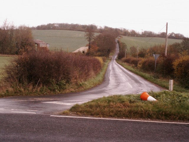
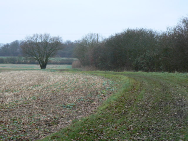
Littlebury Green is a small village located in the county of Essex, England. Situated approximately 3 miles southeast of the town of Saffron Walden, it lies amidst the picturesque countryside of the Uttlesford district. The village is surrounded by lush green fields, rolling hills, and charming woodland areas, making it an ideal retreat for nature lovers and those seeking a tranquil setting.

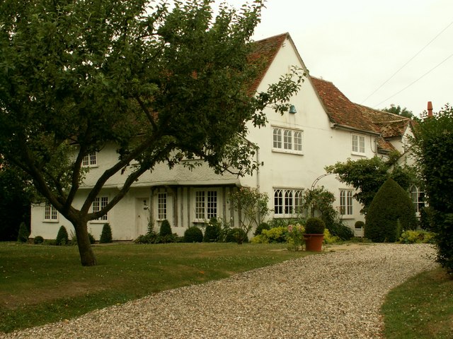
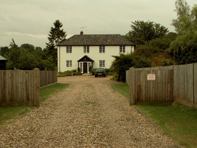
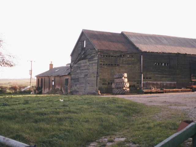
With a population of around 250 residents, Littlebury Green exudes a close-knit community atmosphere. The village is primarily residential, comprising a mix of traditional cottages, farmhouses, and modern homes. Its quaint and well-preserved architecture adds to the village's charm and character.

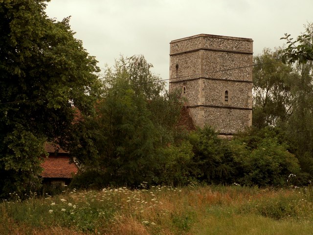
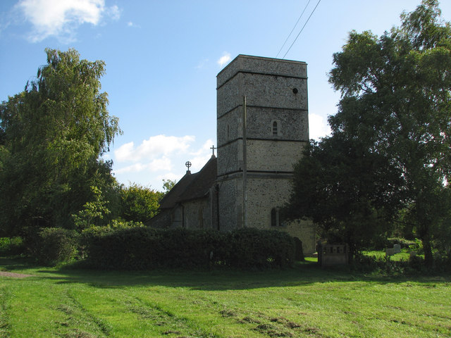
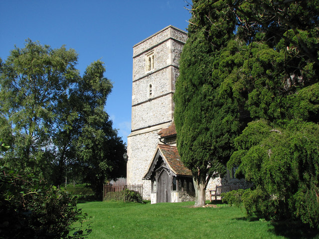
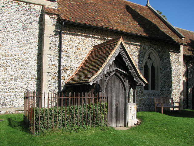
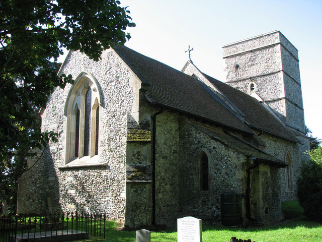
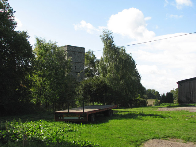
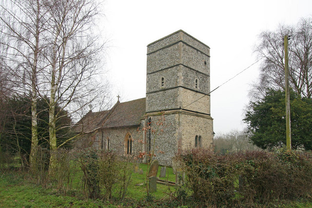
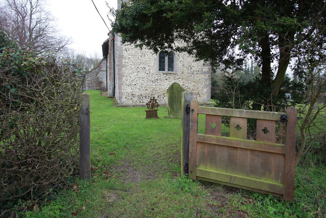
Littlebury Green is home to the Church of St. Peter and St. Paul, a Grade I listed building dating back to the 13th century. The church stands as a testament to the village's rich history and heritage, attracting visitors interested in its architectural significance.

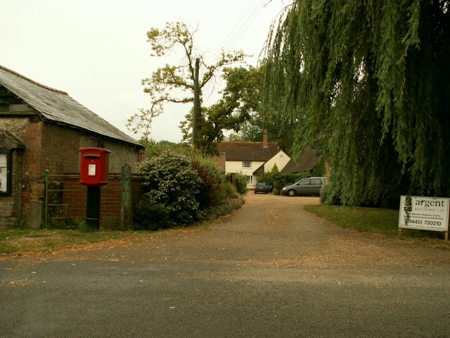
Despite its small size, the village offers a range of amenities to cater to its residents' needs. These include a local pub, The Crown Inn, which serves as a social hub for the community. The village also benefits from its proximity to Saffron Walden, where residents can access a wider array of shops, schools, and healthcare facilities.

Surrounded by beautiful countryside, Littlebury Green offers numerous opportunities for outdoor activities. The village boasts scenic footpaths and bridleways, making it an ideal location for walking, cycling, and horse riding enthusiasts. Additionally, the nearby Audley End House and Gardens provide a popular attraction for visitors, offering a glimpse into the area's historical past.

In summary, Littlebury Green is a charming and idyllic village in Essex, offering a peaceful rural lifestyle, a strong sense of community, and easy access to the nearby town of Saffron Walden.

If you have any feedback on the listing, please let us know in the comments section below.

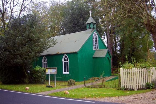
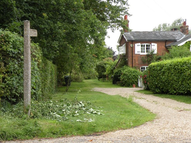
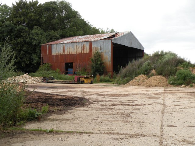
Littlebury Green Images

Images are sourced within 2km of 52.024363/0.173188 or Grid Reference TL4938. Thanks to Geograph Open Source API. All images are credited.

St. Mary's church, Strethall, Essex Almost entirely obscured by trees, Strethall church stands by a farm in a remote part of north Essex. The church dates back to the 11th century and has a Saxon nave with a fine Saxon chancel arch. The chancel and tower are 15th century.
St. Mary's church, Strethall, Essex
Almost entirely obscured by trees, Strethall church stands by a farm in a remote part of north Essex. The church dates back to the 11th century and has a Saxon nave with a fine Saxon chancel arch. The chancel and tower are 15th century.
Old house at Catmere End, Strethall, Essex
Seamans Farm, Littlebury Green, Essex
Green Farm, Littlebury Green, Essex
Farm buildings at New Farm Farm buildings at New Farm on the b1039 near Littlebury green
Farm buildings at New Farm
Farm buildings at New Farm on the b1039 near Littlebury green
The road to Littlebury Green Road to Littlebury Green from the B1039
The road to Littlebury Green
Road to Littlebury Green from the B1039
Communications tower near Littlebury Green Communications tower near Littlebury Green, almost certainly a mobile phone repeater.
Communications tower near Littlebury Green
Communications tower near Littlebury Green, almost certainly a mobile phone repeater.
Some path near Strethall Picture of a path and tree in top NE corner of the grid square. Best picture of the ones I took, as this square is just fields, and landscape shots were pretty hazy due to the clouds and it being quite a dark day.
Some path near Strethall
Picture of a path and tree in top NE corner of the grid square. Best picture of the ones I took, as this square is just fields, and landscape shots were pretty hazy due to the clouds and it being quite a dark day.
St Peter's, Littlebury Green St Peter's was set up as a chapel of ease to save residents the trek to the parish church in Littlebury.  It was assembled from a kit which came complete with stained glass windows.
St Peter's, Littlebury Green
St Peter's was set up as a chapel of ease to save residents the trek to the parish church in Littlebury. It was assembled from a kit which came complete with stained glass windows.
Public byway to Free Wood and beyond
An old farm building, southwest of Littlebury Green
Strethall: St Mary Parts of Strethall church date from the 11th century. It stands at the end of a lane high in the chalk hills of North Essex, just south of the Cambridgeshire border. For more about Strethall, see <span class="nowrap"><a title="http://www.recordinguttlesfordhistory.org.uk/strethall/strethallbriefhistory.html" rel="nofollow ugc noopener" href="http://www.recordinguttlesfordhistory.org.uk/strethall/strethallbriefhistory.html">Link</a><img style="margin-left:2px;" alt="External link" title="External link - shift click to open in new window" src="https://s1.geograph.org.uk/img/external.png" width="10" height="10"/></span> .
Strethall: St Mary
Parts of Strethall church date from the 11th century. It stands at the end of a lane high in the chalk hills of North Essex, just south of the Cambridgeshire border. For more about Strethall, see LinkExternal link .
Strethall: St Mary's church tower Parts of Strethall church date from the 11th century. It stands at the end of a lane high in the chalk hills of North Essex, just south of the Cambridgeshire border. The churchyard is small and there are lots of trees, so it's not easy to get a picture of the whole building. For more about Strethall, see <span class="nowrap"><a title="http://www.recordinguttlesfordhistory.org.uk/strethall/strethallbriefhistory.html" rel="nofollow ugc noopener" href="http://www.recordinguttlesfordhistory.org.uk/strethall/strethallbriefhistory.html">Link</a><img style="margin-left:2px;" alt="External link" title="External link - shift click to open in new window" src="https://s1.geograph.org.uk/img/external.png" width="10" height="10"/></span> .
Strethall: St Mary's church tower
Parts of Strethall church date from the 11th century. It stands at the end of a lane high in the chalk hills of North Essex, just south of the Cambridgeshire border. The churchyard is small and there are lots of trees, so it's not easy to get a picture of the whole building. For more about Strethall, see LinkExternal link .
Strethall: St Mary - the porch Parts of Strethall church date from the 11th century. It stands at the end of a lane high in the chalk hills of North Essex, just south of the Cambridgeshire border. For more about Strethall, see <span class="nowrap"><a title="http://www.recordinguttlesfordhistory.org.uk/strethall/strethallbriefhistory.html" rel="nofollow ugc noopener" href="http://www.recordinguttlesfordhistory.org.uk/strethall/strethallbriefhistory.html">Link</a><img style="margin-left:2px;" alt="External link" title="External link - shift click to open in new window" src="https://s1.geograph.org.uk/img/external.png" width="10" height="10"/></span> .
Strethall: St Mary - the porch
Parts of Strethall church date from the 11th century. It stands at the end of a lane high in the chalk hills of North Essex, just south of the Cambridgeshire border. For more about Strethall, see LinkExternal link .
Strethall: St Mary Parts of Strethall church date from the 11th century. It stands at the end of a lane high in the chalk hills of North Essex, just south of the Cambridgeshire border. The churchyard is small and there are lots of trees, so it is difficult to get a picture of the whole building, especially from the shadows on a bright September morning. For more about Strethall, see <span class="nowrap"><a title="http://www.recordinguttlesfordhistory.org.uk/strethall/strethallbriefhistory.html" rel="nofollow ugc noopener" href="http://www.recordinguttlesfordhistory.org.uk/strethall/strethallbriefhistory.html">Link</a><img style="margin-left:2px;" alt="External link" title="External link - shift click to open in new window" src="https://s1.geograph.org.uk/img/external.png" width="10" height="10"/></span> .
Strethall: St Mary
Parts of Strethall church date from the 11th century. It stands at the end of a lane high in the chalk hills of North Essex, just south of the Cambridgeshire border. The churchyard is small and there are lots of trees, so it is difficult to get a picture of the whole building, especially from the shadows on a bright September morning. For more about Strethall, see LinkExternal link .
Strethall: St Mary Parts of Strethall church date from the 11th century. It stands amid trees next to a farm at the end of a lane high in the chalk hills of North Essex, just south of the Cambridgeshire border. For more about Strethall, see <span class="nowrap"><a title="http://www.recordinguttlesfordhistory.org.uk/strethall/strethallbriefhistory.html" rel="nofollow ugc noopener" href="http://www.recordinguttlesfordhistory.org.uk/strethall/strethallbriefhistory.html">Link</a><img style="margin-left:2px;" alt="External link" title="External link - shift click to open in new window" src="https://s1.geograph.org.uk/img/external.png" width="10" height="10"/></span> .
Strethall: St Mary
Parts of Strethall church date from the 11th century. It stands amid trees next to a farm at the end of a lane high in the chalk hills of North Essex, just south of the Cambridgeshire border. For more about Strethall, see LinkExternal link .
St Mary, Strethall, Essex
Show me another place!

Littlebury Green is located at Grid Ref: TL4938 (Lat: 52.024363, Lng: 0.173188)

Administrative County: Essex

District: Uttlesford

Police Authority: Essex

What 3 Words

///tangent.palms.vitamins. Near Great Chesterford, Essex

Related Wikis

Littlebury Green

Littlebury Green is a village in the civil parish of Littlebury and the district of Uttlesford in Essex, England. Littlebury Green is one of three settlements...

Strethall

Strethall is a village and a civil parish in the Uttlesford District, in the English county of Essex, near the town of Saffron Walden. Having suffered...

Elmdon

See also, Elmdon, West Midlands.Elmdon is a village in the civil parish of Elmdon, Duddenhoe End & Wenden Lofts situated in the Uttlesford district of...

St Mary the Virgin Church, Wendens Ambo

St Mary the Virgin Church is a Church of England parish church in the village of Wendens Ambo in Essex, England. It is listed Grade I for its architectural...

Garden Organic

Garden Organic, formerly known as the Henry Doubleday Research Association (HDRA), is a UK organic growing charity dedicated to researching and promoting...

Wendens Ambo

Wendens Ambo is a village in the Uttlesford district of Essex, England. The population at the 2011 census was measured at 473. Its name originates from...
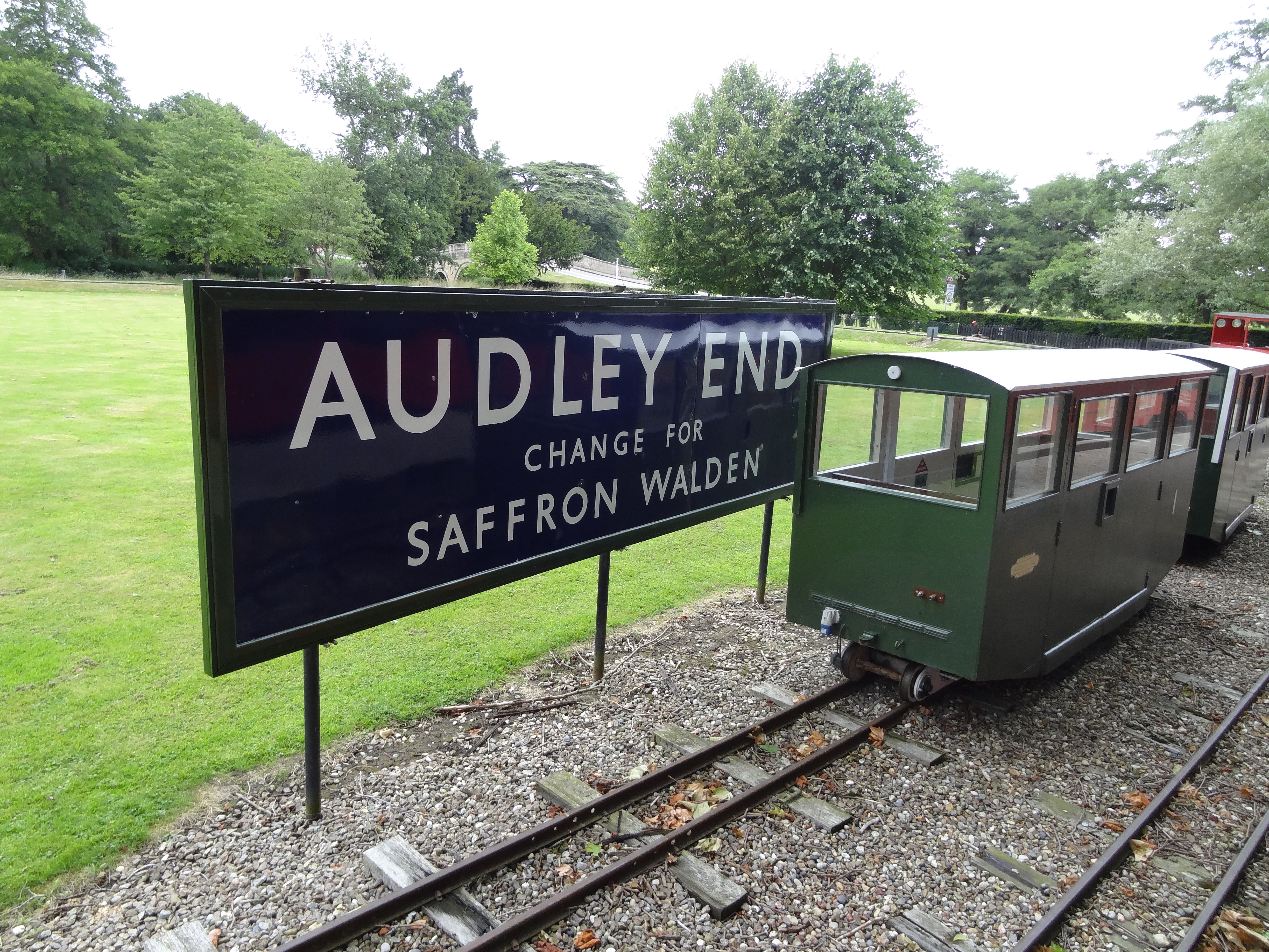
Audley End Railway

The Audley End Miniature Railway is a miniature railway in Essex, England. == Overview == The 10+1⁄4 in (260 mm)-gauge circuit was built by Lord Braybrooke...

Littlebury

Littlebury is a village and civil parish in the Uttlesford district, north-west Essex, England. The village is approximately a mile and a half from the...

Nearby Amenities

Located within 500m of 52.024363,0.173188
Access: yes
Leisure: playground
Lat/Long: 52.0244439/0.1680762
Seamans Farm
Landuse: farm
Note Retag: CS #48756035
Lat/Long: 52.0250417/0.1724834
Howe Hall
Landuse: farm
Note Retag: CS #48756035
Lat/Long: 52.0271289/0.1747282
Bus Stop
Thomas Walk
Bus: yes
Naptan AtcoCode: 1500IM996
Naptan Bearing: SW
Naptan BusStopType: CUS
Naptan CommonName: Thomas Walk
Naptan Crossing: Thomas Walk
Naptan Indicator: Adj
Naptan Landmark: Thomas Walk
Naptan NaptanCode: esxdawjd
Naptan Street: Littlebury Green Road
Naptan Verified: no
Public Transport: platform
Source: naptan_import
Lat/Long: 52.0246266/0.1697607
Bus Stop
Thomas Walk
Bus: yes
Naptan AtcoCode: 1500IM996AA
Naptan Bearing: NE
Naptan BusStopType: CUS
Naptan CommonName: Thomas Walk
Naptan Crossing: Thomas Walk
Naptan Indicator: Opp
Naptan Landmark: Thomas Walk
Naptan NaptanCode: esxgwpdj
Naptan Street: Littlebury Green Road
Naptan Verified: no
Public Transport: platform
Source: naptan_import
Lat/Long: 52.0247252/0.1698083
Post Box
Brand: Royal Mail
Brand Wikidata: Q638098
Brand Wikipedia: en:Royal Mail
Collection Times: Mo-Fr 16:00; Sa 10:45
Operator: Royal Mail
Operator Wikidata: Q638098
Post Box Design: type_m
Post Box Type: lamp
Ref: CB11 60
Royal Cypher: EIIR
Royal Cypher Wikidata: Q33102113
Source: survey
Lat/Long: 52.0238877/0.1671492
Barrier: kissing_gate
Lat/Long: 52.0243795/0.1683921
Telephone
Defibrillator
Booth: K6
Covered: booth
Defibrillator Location: inside old red phone box in Littlebury Green
Emergency: defibrillator
Man Made: telephone_box
Payment Telephone Cards: yes
Ref GB The Circuit: 521403CA-3F81-42C6-BA1A-AD7800CC745B
Lat/Long: 52.023782/0.1666981
Teapond Grove
Place: locality
Lat/Long: 52.0212032/0.1687816
Bench
Backrest: yes
Material: wood
Seats: 3
Lat/Long: 52.0259988/0.1739444
Bench
Backrest: yes
Material: wood
Seats: 6
Lat/Long: 52.0240217/0.1673282
The data included in this document is from www.openstreetmap.org. The data is made available under ODbL.

Have you been to Littlebury Green?

Leave your review of Littlebury Green below (or comments, questions and feedback).