Budle Bay

Bay in Northumberland

England

Budle Bay

End of Parking Area on the B1342 near to Budle
End of Parking Area on the B1342 near to Budle Credit: David Dixon

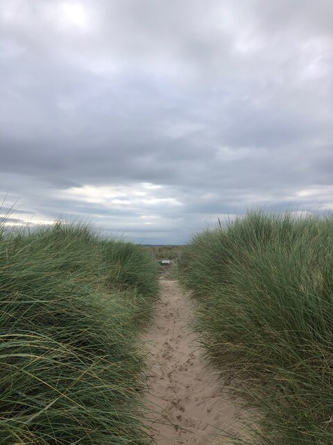
Budle Bay is a picturesque bay located on the Northumberland coast in northern England. It is situated near the village of Bamburgh and is part of the Northumberland Coast Area of Outstanding Natural Beauty. The bay is known for its stunning views of the surrounding coastline, sandy beaches, and diverse wildlife.

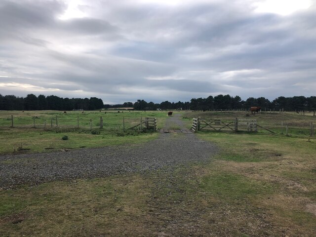
At low tide, Budle Bay transforms into a vast expanse of mudflats and salt marshes, providing vital habitat for a variety of bird species. It is a designated Special Protection Area for wildlife conservation and is particularly important for wintering waterfowl such as pink-footed geese and wigeons.

Visitors to Budle Bay can enjoy leisurely walks along the shoreline, birdwatching, and exploring the nearby coastal paths. The bay is also popular for water-based activities such as kayaking and paddleboarding. The nearby village of Bamburgh offers amenities such as cafes, shops, and accommodation options for those looking to stay in the area.

Overall, Budle Bay is a tranquil and beautiful spot on the Northumberland coast, perfect for nature lovers and outdoor enthusiasts alike.

If you have any feedback on the listing, please let us know in the comments section below.

Budle Bay Images

Images are sourced within 2km of 55.615065/-1.7647384 or Grid Reference NU1435. Thanks to Geograph Open Source API. All images are credited.

End of Parking Area on the B1342 near to Budle
Sheep Grazing above Budle Bay
Entrance to Budle Farm Campsite
Budle Bay Shore
Budle Bay Shore
Budle Bay at Waren Mill
B1342 Junction at Waren Mill
Ross Back Sands Looking Southeast with the Farne Islands and Bamburgh Castle visible on the horizon
Ross Back Sands
Looking Southeast with the Farne Islands and Bamburgh Castle visible on the horizon
Path crossing dunes at Ross Bank Sands
Gate and Cattle Grid at Ross Links
Ross Back Sands, Northumberland The wide white span of sandy beach at Ross Back Sands. In the far distance can be seen (to the right) Bamburgh Castle and (to the left) the Farne Islands.
Ross Back Sands, Northumberland
The wide white span of sandy beach at Ross Back Sands. In the far distance can be seen (to the right) Bamburgh Castle and (to the left) the Farne Islands.
Ross Back Sands, Northumberland The wide white sand beach of Ross Back Sands. In the far distance on the horizon can be seen (to the left)  the islands of Inner Farne and (to the right) Bamburgh Castle.
Ross Back Sands, Northumberland
The wide white sand beach of Ross Back Sands. In the far distance on the horizon can be seen (to the left) the islands of Inner Farne and (to the right) Bamburgh Castle.
Waren Mill, Northumberland Looking along a track in the vicinity of Waren Mill that runs down to Chesterhill Slakes and Budle Bay.
Waren Mill, Northumberland
Looking along a track in the vicinity of Waren Mill that runs down to Chesterhill Slakes and Budle Bay.
Budle, Northumberland Looking along the water edge between the village of Budle and Chesterhill Slakes/Budle Bay.
Budle, Northumberland
Looking along the water edge between the village of Budle and Chesterhill Slakes/Budle Bay.
Budle, Northumberland Looking over farmland towards Kiln Point from the vicinity of Budle. The lime kiln can be seen on the left edge of the image and Budle Bay can be seen in the distance.
Budle, Northumberland
Looking over farmland towards Kiln Point from the vicinity of Budle. The lime kiln can be seen on the left edge of the image and Budle Bay can be seen in the distance.
Lonsdale Hill, Northumberland Looking south over pastureland from the vicinity of Lonsdales Hill in the direction of Shada Plantation.
Lonsdale Hill, Northumberland
Looking south over pastureland from the vicinity of Lonsdales Hill in the direction of Shada Plantation.
Budle, Northumberland Looking north along a track to the east of the hamlet of Budle. Budle Bay can be seen in the distance.
Budle, Northumberland
Looking north along a track to the east of the hamlet of Budle. Budle Bay can be seen in the distance.
Sheep A group of sheep, including a couple of Jacobs, on Ross Farm.
Sheep
A group of sheep, including a couple of Jacobs, on Ross Farm.
Jacob Sheep A Jacob Sheep on Ross Farm.
Jacob Sheep
A Jacob Sheep on Ross Farm.
Show me another place!

Budle Bay is located at Grid Ref: NU1435 (Lat: 55.615065, Lng: -1.7647384)

Unitary Authority: Northumberland

Police Authority: Northumbria

What 3 Words

///modem.lungs.absorbing. Near Bamburgh, Northumberland

Related Wikis

Waren (port)

Waren, also known as Warn, Waren Bay, Warenmouth and Warenquay, was a seaport at Budle Bay, on the north-east coast of England, the recorded history of...

Budle Bay

Budle Bay is a 1 mile (1.6 km) wide bay on the North Sea in Northumberland, England, between Bamburgh to the southeast and Lindisfarne to the northwest...

Bamburgh Coast and Hills

Bamburgh Coast and Hills is the name given to a Site of Special Scientific Interest (SSSI) on the coast of north Northumberland, England. The site is one...

Brada Hill

Brada Hill is a small hill escarpment near the coast of north Northumberland in North East England, designated as a Site of Special Scientific Interest...

Nearby Amenities

Located within 500m of 55.615065,-1.7647384
Budle Bay
Natural: bay
Lat/Long: 55.6165819/-1.7627329
The data included in this document is from www.openstreetmap.org. The data is made available under ODbL.

Have you been to Budle Bay?

Leave your review of Budle Bay below (or comments, questions and feedback).