Auld Mill Bay

Bay in Aberdeenshire

Scotland

Auld Mill Bay

View of the coast from New Aberdour View of the coast from New Aberdour from the further point we could go that day
View of the coast from New Aberdour Credit: eric ramaz

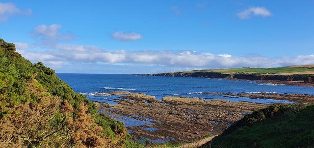
Auld Mill Bay is a picturesque coastal area located in Aberdeenshire, Scotland. Situated along the North Sea, this bay offers stunning views and a tranquil atmosphere to visitors. The bay is named after the historic Auld Mill, a former grain mill that once stood on the site.

The bay is characterized by its sandy beach, which stretches for approximately half a mile. The beach is a popular spot for locals and tourists alike, offering opportunities for relaxation, sunbathing, and leisurely walks along the shore. The crystal-clear waters of the North Sea are inviting for swimmers, although caution is advised due to strong currents.

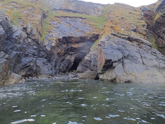
Auld Mill Bay is also known for its diverse wildlife. The surrounding cliffs and dunes provide a natural habitat for a variety of bird species, including puffins, guillemots, and cormorants. Birdwatchers flock to the area to catch a glimpse of these magnificent creatures in their natural habitat.

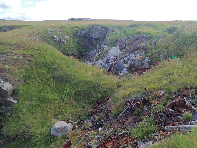
For those interested in history and archaeology, Auld Mill Bay has much to offer. The remnants of the Auld Mill can still be seen, showcasing the area's industrial past. Additionally, there have been archaeological finds in the vicinity, including ancient stone tools and pottery, providing insight into the bay's early inhabitants.

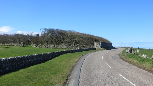
Auld Mill Bay is easily accessible, with parking facilities available nearby. Whether you're seeking a peaceful day by the sea, a chance to observe wildlife, or a glimpse into the area's history, Auld Mill Bay is a must-visit destination in Aberdeenshire.

If you have any feedback on the listing, please let us know in the comments section below.

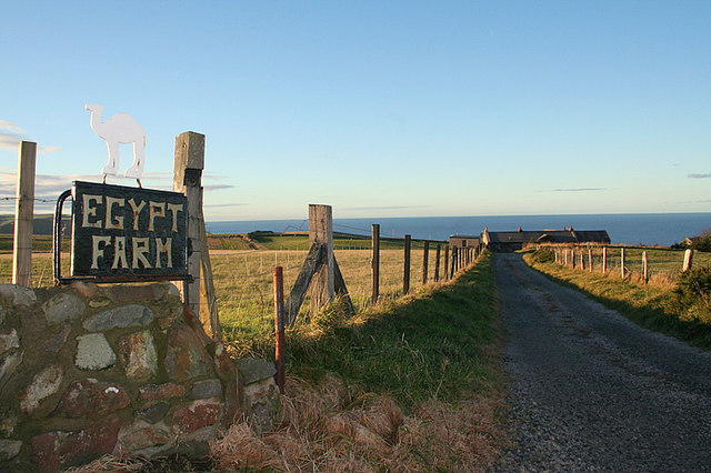
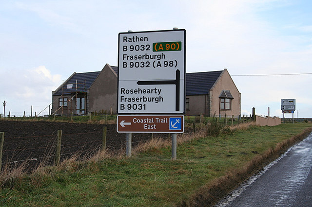
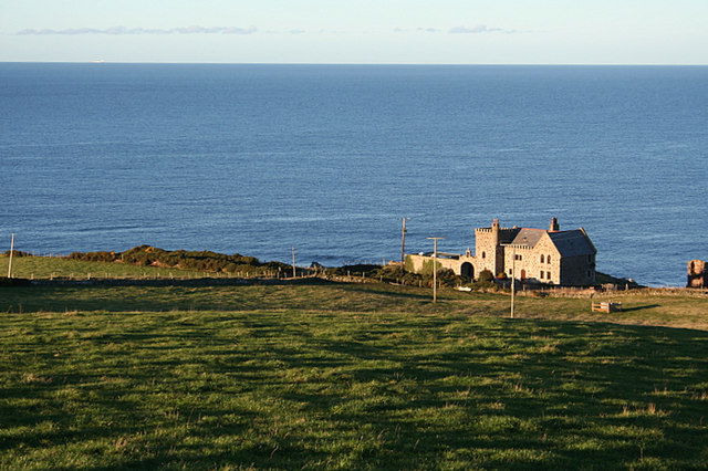
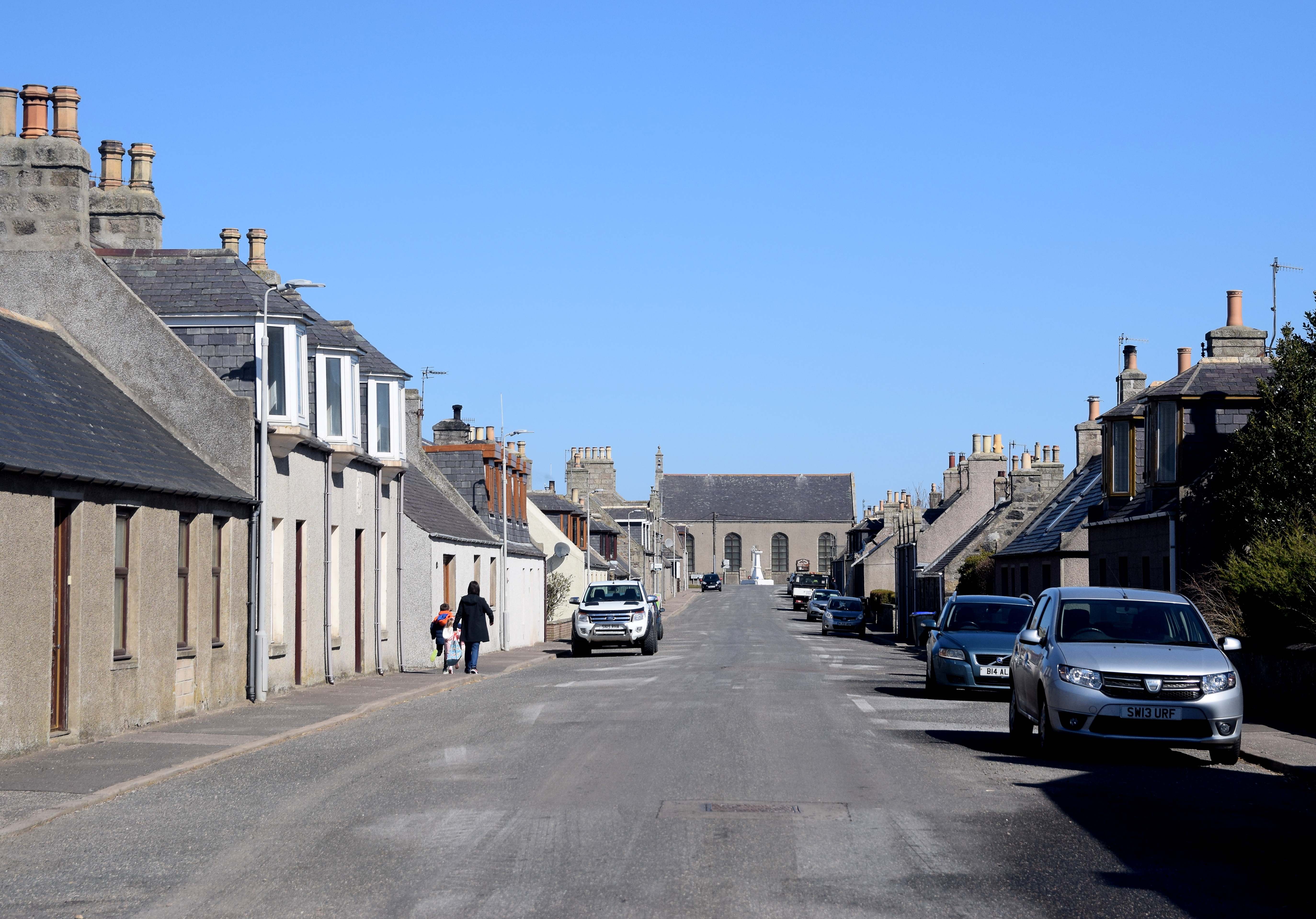
Auld Mill Bay Images

Images are sourced within 2km of 57.685404/-2.1495291 or Grid Reference NJ9166. Thanks to Geograph Open Source API. All images are credited.

View of the coast from New Aberdour View of the coast from New Aberdour from the further point we could go that day
View of the coast from New Aberdour
View of the coast from New Aberdour from the further point we could go that day
Fundamental bench mark, Rosehearty, Aberdeenshire The bench mark was used during the second and third geodetic levellings of Scotland which took place between 1936 and 1968.  It is now a passive station.
Fundamental bench mark, Rosehearty, Aberdeenshire
The bench mark was used during the second and third geodetic levellings of Scotland which took place between 1936 and 1968. It is now a passive station.
Quarry and Willie's Havens and Cat's Hole caves Quarry Haven is the near bay; Willie's Haven is the far one. There are two sea-caves at the bottom of the cliff on the far side of Willie's Haven. They are Cat's Hole North and South. Each has a chimney running up inside and parallel to the cliff face and each has a funnel shaped depression in the otherwise rather flat surface of the cliff top. These overlap. The depression has been used as a tip for building and other waste which may have blocked the south chimney, but the north one is still open.
Quarry and Willie's Havens and Cat's Hole caves
Quarry Haven is the near bay; Willie's Haven is the far one. There are two sea-caves at the bottom of the cliff on the far side of Willie's Haven. They are Cat's Hole North and South. Each has a chimney running up inside and parallel to the cliff face and each has a funnel shaped depression in the otherwise rather flat surface of the cliff top. These overlap. The depression has been used as a tip for building and other waste which may have blocked the south chimney, but the north one is still open.
Cat's Hole North Cave An intertidal sea-cave which has a chimney at the back which goes up to the surface of the top of the cliff above. Light from above could just be seen by eye, but has not made it into this photo. See the cave in context <a href="https://www.geograph.org.uk/photo/7555019">NJ9065 : Quarry and Willie's Havens and Cat's Hole caves</a>.
Cat's Hole North Cave
An intertidal sea-cave which has a chimney at the back which goes up to the surface of the top of the cliff above. Light from above could just be seen by eye, but has not made it into this photo. See the cave in context NJ9065 : Quarry and Willie's Havens and Cat's Hole caves.
Cat's Hole South Cave An intertidal sea-cave which has (or had) a chimney going up parallel to the cliff face to open into a depression in the flat cliff top. The top of the chimney has been partially, or perhaps totally blocked by building and other waste having been tipped into the depression. This cave can be seen in context in <a href="https://www.geograph.org.uk/photo/7555019">NJ9065 : Quarry and Willie's Havens and Cat's Hole caves</a>.
Cat's Hole South Cave
An intertidal sea-cave which has (or had) a chimney going up parallel to the cliff face to open into a depression in the flat cliff top. The top of the chimney has been partially, or perhaps totally blocked by building and other waste having been tipped into the depression. This cave can be seen in context in NJ9065 : Quarry and Willie's Havens and Cat's Hole caves.
Blowhole/Gloup at the top of Cat's Hole North Cave The triangular dark area is the open top of a natural chimney which extends down to the sea-cave below <a href="https://www.geograph.org.uk/photo/7555198">NJ9065 : Cat's Hole North Cave</a>. Evidence of this was the sound of doves cooing somewhere below.  Also dim light was seen from above when photographing said cave. It can be described as a blowhole. The down angle for this photo was about 30 degrees. Stones and other waste have been tipped from the west side, but this is partly grassed  over.
Blowhole/Gloup at the top of Cat's Hole North Cave
The triangular dark area is the open top of a natural chimney which extends down to the sea-cave below NJ9065 : Cat's Hole North Cave. Evidence of this was the sound of doves cooing somewhere below. Also dim light was seen from above when photographing said cave. It can be described as a blowhole. The down angle for this photo was about 30 degrees. Stones and other waste have been tipped from the west side, but this is partly grassed over.
Blowhole/Gloup at the top of Cat's Hole South Cave The view from a bit west of the blowhole from the north cave <a href="https://www.geograph.org.uk/photo/7555271">NJ9065 : Blowhole/Gloup at the top of Cat's Hole North Cave</a> towards what was the blowhole from the south cave <a href="https://www.geograph.org.uk/photo/7555249">NJ9065 : Cat's Hole South Cave</a>. It is possible to see something of the narrow part of the south blowhole by clambering down the trash pile. It is unclear whether or not it is fully blocked further down.
Blowhole/Gloup at the top of Cat's Hole South Cave
The view from a bit west of the blowhole from the north cave NJ9065 : Blowhole/Gloup at the top of Cat's Hole North Cave towards what was the blowhole from the south cave NJ9065 : Cat's Hole South Cave. It is possible to see something of the narrow part of the south blowhole by clambering down the trash pile. It is unclear whether or not it is fully blocked further down.
Parts of a shipwreck On the beach at Haven of Braco, about a mile west of Rosehearty
Parts of a shipwreck
On the beach at Haven of Braco, about a mile west of Rosehearty
Mounthooly Doocot This eye-catching mock Gothic building is perched on the top of a mound with a panoramic view including Rosehearty and surrounding land. 

An alternative name for it is Holy Mount.

It lies on the Pitsligo estate and was built for Lord Garden of Gardenstown, who acquired Pitsligo around 1800. 

It's a 12-foot square rubble masonry tower with canted angles. Above the anti-rat string course are oval oculi with another string course above, and the top is embellished with a parapet with tall crenels finished with ball finials. Inside the parapet is a pyramidal roof. The date 1800 is carved above one of the windows. There is a plain doorway on the west face.

Inside are about 300 nest boxes with brick slab bases, and a potence, which is a ladder that revolves around a pole in the centre of the building and gives access to all the nest boxes.

It is said that each of the 12 ball finials represents one of Lord Garden's 12 estates.
Mounthooly Doocot
This eye-catching mock Gothic building is perched on the top of a mound with a panoramic view including Rosehearty and surrounding land. An alternative name for it is Holy Mount. It lies on the Pitsligo estate and was built for Lord Garden of Gardenstown, who acquired Pitsligo around 1800. It's a 12-foot square rubble masonry tower with canted angles. Above the anti-rat string course are oval oculi with another string course above, and the top is embellished with a parapet with tall crenels finished with ball finials. Inside the parapet is a pyramidal roof. The date 1800 is carved above one of the windows. There is a plain doorway on the west face. Inside are about 300 nest boxes with brick slab bases, and a potence, which is a ladder that revolves around a pole in the centre of the building and gives access to all the nest boxes. It is said that each of the 12 ball finials represents one of Lord Garden's 12 estates.
B9031 Passing Braco Park outside Rosehearty.
B9031
Passing Braco Park outside Rosehearty.
Craigiefold B9031 approaches Rosehearty.
Craigiefold
B9031 approaches Rosehearty.
Mounthooly Doocot This eye-catching mock Gothic building is perched on the top of a mound with a panoramic view including Rosehearty and surrounding land. 

An alternative name for it is Holy Mount.

It lies on the Pitsligo estate and was built for Lord Garden of Gardenstown, who acquired Pitsligo around 1800. 

It's a 12-foot square rubble masonry tower with canted angles. Above the anti-rat string course are oval oculi with another string course above, and the top is embellished with a parapet with tall crenels finished with ball finials. Inside the parapet is a pyramidal roof. The date 1800 is carved above one of the windows. There is a plain doorway on the west face.

Inside are about 300 nest boxes with brick slab bases, and a potence, which is a ladder that revolves around a pole in the centre of the building and gives access to all the nest boxes.

It is said that each of the 12 ball finials represents one of Lord Garden's 12 estates.
Mounthooly Doocot
This eye-catching mock Gothic building is perched on the top of a mound with a panoramic view including Rosehearty and surrounding land. An alternative name for it is Holy Mount. It lies on the Pitsligo estate and was built for Lord Garden of Gardenstown, who acquired Pitsligo around 1800. It's a 12-foot square rubble masonry tower with canted angles. Above the anti-rat string course are oval oculi with another string course above, and the top is embellished with a parapet with tall crenels finished with ball finials. Inside the parapet is a pyramidal roof. The date 1800 is carved above one of the windows. There is a plain doorway on the west face. Inside are about 300 nest boxes with brick slab bases, and a potence, which is a ladder that revolves around a pole in the centre of the building and gives access to all the nest boxes. It is said that each of the 12 ball finials represents one of Lord Garden's 12 estates.
Mounthooly Doocot This two-storey structure was built in 1800 and is a notable landmark in the area.  The balls around the summit are supposed to each represent one of the farms on the owner's estate.
Mounthooly Doocot
This two-storey structure was built in 1800 and is a notable landmark in the area. The balls around the summit are supposed to each represent one of the farms on the owner's estate.
Farm buildings at Egypt.   Where?? I wonder how the name was derived.
Farm buildings at Egypt. Where??
I wonder how the name was derived.
Lane to Egypt Farm.
Lane to Egypt Farm.
Road to Iron Hill and Poukburn.
Doocot by Craigiefold. This eye-catching mock Gothic building is perched on the top of a mound with a panoramic view including Rosehearty and surrounding land. 

An alternative name for it is Holy Mount.

It lies on the Pitsligo estate and was built for Lord Garden of Gardenstown, who acquired Pitsligo around 1800. 

It's a 12-foot square rubble masonry tower with canted angles. Above the anti-rat string course are oval oculi with another string course above, and the top is embellished with a parapet with tall crenels finished with ball finials. Inside the parapet is a pyramidal roof. The date 1800 is carved above one of the windows. There is a plain doorway on the west face.

Inside are about 300 nest boxes with brick slab bases, and a potence, which is a ladder that revolves around a pole in the centre of the building and gives access to all the nest boxes.

It is said that each of the 12 ball finials represents one of Lord Garden's 12 estates.
Doocot by Craigiefold.
This eye-catching mock Gothic building is perched on the top of a mound with a panoramic view including Rosehearty and surrounding land. An alternative name for it is Holy Mount. It lies on the Pitsligo estate and was built for Lord Garden of Gardenstown, who acquired Pitsligo around 1800. It's a 12-foot square rubble masonry tower with canted angles. Above the anti-rat string course are oval oculi with another string course above, and the top is embellished with a parapet with tall crenels finished with ball finials. Inside the parapet is a pyramidal roof. The date 1800 is carved above one of the windows. There is a plain doorway on the west face. Inside are about 300 nest boxes with brick slab bases, and a potence, which is a ladder that revolves around a pole in the centre of the building and gives access to all the nest boxes. It is said that each of the 12 ball finials represents one of Lord Garden's 12 estates.
Road sign and house at Hillcrest.
Show me another place!

Auld Mill Bay is located at Grid Ref: NJ9166 (Lat: 57.685404, Lng: -2.1495291)

Unitary Authority: Aberdeenshire

Police Authority: North East

What 3 Words

///together.dame.proposals. Near Rosehearty, Aberdeenshire

Related Wikis

Aberdour House (Aberdeenshire)

Aberdour House is Category A listed country house in New Aberdour, Aberdeenshire, Scotland. Dating to around 1740, it was built by John Forbes, of Knappernay...

Dundarg Castle

Dundarg Castle is a ruined castle about 2 kilometres (1.2 mi) north-northeast of New Aberdour, Aberdeenshire, Scotland, built within the ramparts of an...

Rosehearty

Rosehearty (Scottish Gaelic: Ros Abhartaich) is a settlement on the Moray Firth coast, four miles west of the town Fraserburgh, in the historical county...
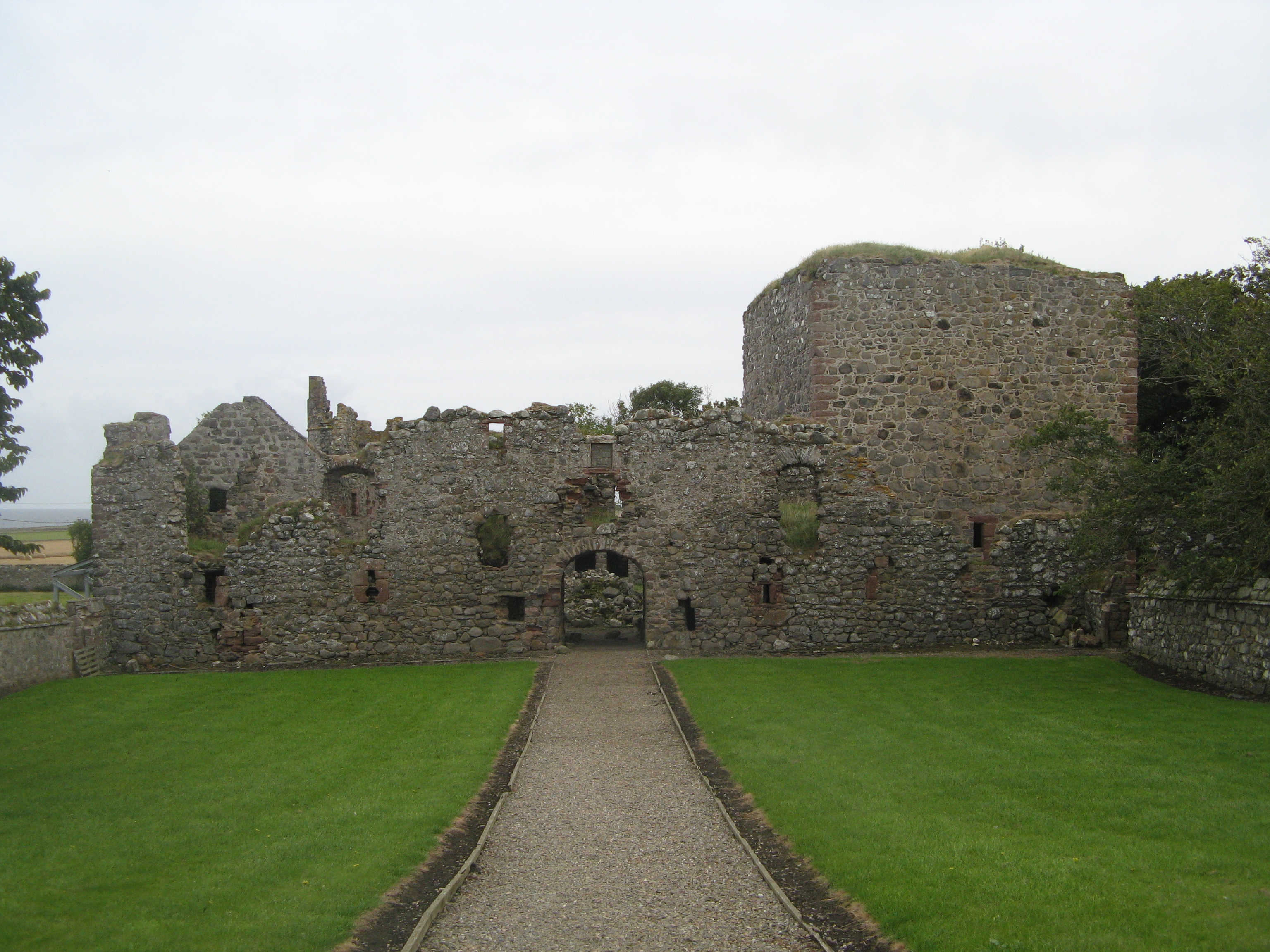
Pitsligo Castle

Pitsligo Castle is a ruined castle half a mile east of Rosehearty, Aberdeenshire, Scotland. Modified in the 1570s by the Forbes of Druminnor, it was described...

Rescue from SS William Hope

In the 1884 rescue from SS William Hope in Aberdour Bay off the north coast of Aberdeenshire in Scotland Jane Whyte rescued fifteen sailors from their...

Pittulie Castle

Pittulie Castle is an oblong tower house probably dating from 1596, half a mile from Pitsligo Castle, Rosehearty, Aberdeenshire, Scotland. It is a scheduled...

Tyrie, Aberdeenshire

Tyrie is a hamlet and parish in the Banff and Buchan district of Aberdeenshire, north-east Scotland. Tyrie is located on the A98 road, around 5.5 miles...

New Aberdour

New Aberdour is a small planned village in the Aberdour parish of Aberdeenshire, Scotland, situated south of Aberdour Bay on the Moray Firth. It lies 7...

Nearby Amenities

Located within 500m of 57.685404,-2.1495291
Source: Old Landsat image trace
Lat/Long: 57.6864243/-2.1465029
Source: Old Landsat image trace
Lat/Long: 57.6832485/-2.153308
Source: Old Landsat image trace
Lat/Long: 57.6857455/-2.1488901
Source: Old Landsat image trace
Lat/Long: 57.6843521/-2.1515187
Source: Old Landsat image trace
Lat/Long: 57.6879323/-2.1433594
Source: Old Landsat image trace
Lat/Long: 57.6862894/-2.1475758
Source: Old Landsat image trace
Lat/Long: 57.6873475/-2.1449628
Source: Old Landsat image trace
Lat/Long: 57.6865215/-2.1453601
Source: Old Landsat image trace
Lat/Long: 57.6836791/-2.1509822
Source: Old Landsat image trace
Lat/Long: 57.6859078/-2.1488633
Source: Old Landsat image trace
Lat/Long: 57.6847525/-2.1507832
Source: Old Landsat image trace
Lat/Long: 57.6873129/-2.1441042
Source: Old Landsat image trace
Lat/Long: 57.6863023/-2.148583
Source: Old Landsat image trace
Lat/Long: 57.6864621/-2.1451136
Power: pole
Lat/Long: 57.6824406/-2.1452424
Power: pole
Lat/Long: 57.6817895/-2.1446312
The data included in this document is from www.openstreetmap.org. The data is made available under ODbL.

Have you been to Auld Mill Bay?

Leave your review of Auld Mill Bay below (or comments, questions and feedback).