Bay of Houseby

Bay in Orkney

Scotland

Bay of Houseby

Cave Entrance Whale Geo Stronsay Cave entrance Whale Geo Stronsay. Cave runs under Land Head from Whale Geo to Lamb Bay.
Cave Entrance Whale Geo Stronsay Credit: William Hodgson

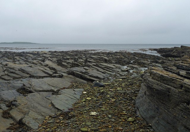
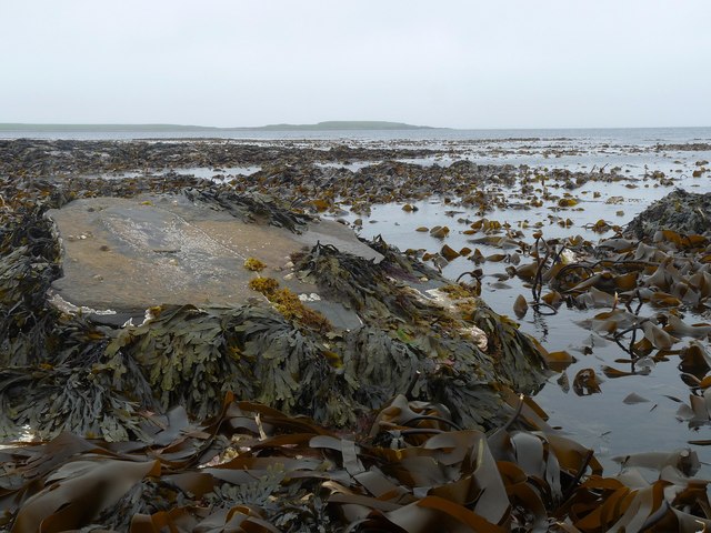
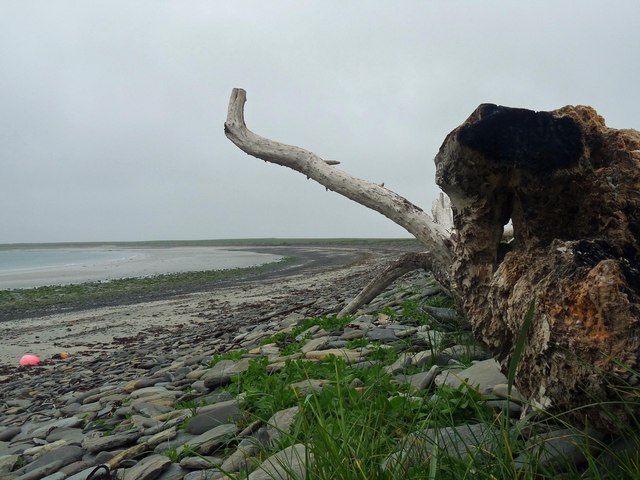
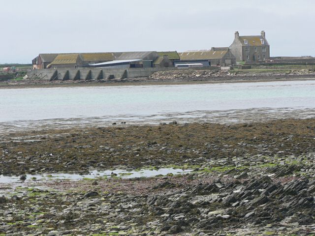
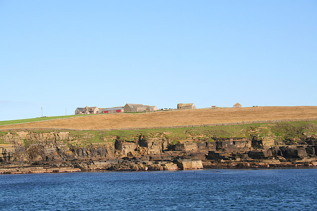
The Bay of Houseby, located in the Orkney Islands, Scotland, is a picturesque bay that offers stunning views and a rich historical background. Situated on the eastern coast of the Mainland, the largest island in the Orkney archipelago, the bay is known for its natural beauty and tranquil surroundings.

Surrounded by rugged cliffs and rolling green hills, the Bay of Houseby boasts pristine sandy beaches and crystal-clear turquoise waters. The bay is often frequented by locals and tourists alike, who come to enjoy its peaceful atmosphere and breathtaking scenery. It is an ideal spot for relaxation, picnicking, and beachcombing.

The bay also holds historical significance, as it is home to the remains of Houseby, a Norse farmstead that dates back to the Viking Age. The archeological site, which consists of several buildings and a stone wall, provides insights into the lives and culture of the early settlers in the Orkney Islands.

In addition to its natural and historical attractions, the Bay of Houseby offers opportunities for outdoor activities such as hiking, birdwatching, and fishing. The area is known for its diverse birdlife, including puffins, guillemots, and gannets, making it a popular destination for bird enthusiasts.

Overall, the Bay of Houseby is a must-visit location in Orkney, combining stunning natural beauty, rich history, and a peaceful ambiance that leaves visitors with lasting memories.

If you have any feedback on the listing, please let us know in the comments section below.

Bay of Houseby Images

Images are sourced within 2km of 59.078825/-2.5587849 or Grid Reference HY6821. Thanks to Geograph Open Source API. All images are credited.

Cave Entrance Whale Geo Stronsay Cave entrance Whale Geo Stronsay. Cave runs under Land Head from Whale Geo to Lamb Bay.
Cave Entrance Whale Geo Stronsay
Cave entrance Whale Geo Stronsay. Cave runs under Land Head from Whale Geo to Lamb Bay.
Langa Mae, Stronsay, Orkney Looking towards Lamb Head.
Langa Mae, Stronsay, Orkney
Looking towards Lamb Head.
Kelp forest, Langa Mae, Stronsay, Orkney Looking towards Lamb Head.
Kelp forest, Langa Mae, Stronsay, Orkney
Looking towards Lamb Head.
Sand of the Crook and ayre, Stronsay, Orkney Behind the ayre (shingle bank) is <a href="https://www.geograph.org.uk/photo/1086440">HY6621 : Lea Shun</a> loch.
Sand of the Crook and ayre, Stronsay, Orkney
Behind the ayre (shingle bank) is HY6621 : Lea Shun loch.
The Danes' Pier, Lamb  Ness, Stronsay, Orkney From <span class="nowrap"><a title="http://canmore.rcahms.gov.uk/en/site/3382/details/stronsay+the+danes+pier" rel="nofollow ugc noopener" href="http://canmore.rcahms.gov.uk/en/site/3382/details/stronsay+the+danes+pier">Link</a><img style="margin-left:2px;" alt="External link" title="External link - shift click to open in new window" src="https://s1.geograph.org.uk/img/external.png" width="10" height="10"/></span> : "In spite of the persistent tradition of artificial construction, this remarkable L-shaped boulder-spit off the S side of Lamb Ness is nowadays dismissed as a natural formation. While there is certainly no indication of built structures, and the natural origin must be accepted, the parallel with features in Sanday and Papa Westray require that the matter be given further thought."
The Danes' Pier, Lamb Ness, Stronsay, Orkney
From LinkExternal link : "In spite of the persistent tradition of artificial construction, this remarkable L-shaped boulder-spit off the S side of Lamb Ness is nowadays dismissed as a natural formation. While there is certainly no indication of built structures, and the natural origin must be accepted, the parallel with features in Sanday and Papa Westray require that the matter be given further thought."
Bay of Houseby, Stronsay Looking across the western side of the bay
Bay of Houseby, Stronsay
Looking across the western side of the bay
Track at Bay of Houseby, Stronsay The track from Lamb Ness on the eastern edge of the bay is bounded by field walls to the north.
Track at Bay of Houseby, Stronsay
The track from Lamb Ness on the eastern edge of the bay is bounded by field walls to the north.
Near Geo of Gessan, Stronsay The south eastern coastline of Stronsay is composed of fractured rock with many complex fissures.
Near Geo of Gessan, Stronsay
The south eastern coastline of Stronsay is composed of fractured rock with many complex fissures.
Broch, Lamb Head Part of the wall of this broch is still visible, but most of it is buried in a shapeless mound.
Broch, Lamb Head
Part of the wall of this broch is still visible, but most of it is buried in a shapeless mound.
Bay of Houseby The farm at Holland can be seen on the skyline.
Bay of Houseby
The farm at Holland can be seen on the skyline.
Wrecked buoy This large buoy lies abandoned on the beach in the Bay of Houseby.
Wrecked buoy
This large buoy lies abandoned on the beach in the Bay of Houseby.
Cleat, Stronsay A modern barbed wire fence replaces the old stone boundary.
Cleat, Stronsay
A modern barbed wire fence replaces the old stone boundary.
Housebay, Stronsay This farm is built right next to the coast.
Housebay, Stronsay
This farm is built right next to the coast.
Farmland on Stronsay Much of Stronsay is farmland like this.
Farmland on Stronsay
Much of Stronsay is farmland like this.
Burgh Hill, Stronsay's "summit"
Hells Mouth by Lamb Head, Stronsay. Abandon hope all ye who enter here!! The naming of this feature is a mixture of humour and fear but most apt.
Hells Mouth by Lamb Head, Stronsay.
Abandon hope all ye who enter here!! The naming of this feature is a mixture of humour and fear but most apt.
Northwest towards Housebay from south of Lamb Head..
Stronsay trig N.B. It's the OS name for the trig.
Stronsay trig
N.B. It's the OS name for the trig.
Show me another place!

Bay of Houseby is located at Grid Ref: HY6821 (Lat: 59.078825, Lng: -2.5587849)

Unitary Authority: Orkney Islands

Police Authority: Highlands and Islands

What 3 Words

///riding.rashers.pheasants. Near Whitehall, Orkney Islands

Nearby Locations

Nousty Geo Bay of Houseby

Related Wikis

Odness

Odness is a peninsula and headland on the island of Stronsay, in Orkney, Scotland. The Odness peninsula contains the farm of Odiness. Odness is also within...

Stronsay

Stronsay () is an island in Orkney, Scotland. It is known as Orkney's 'Island of Bays', owing to an irregular shape with miles of coastline, with three...

Auskerry

Auskerry (Scots: Soond; Old Norse: Austrsker, east skerry) is a small island in eastern Orkney, Scotland. It lies in the North Sea south of Stronsay and...

Whitehall, Orkney

Whitehall is the village on the island of Stronsay, in the Orkney Islands of Scotland. It is a small village with about 50 houses. It also has a shop...

Papa Stronsay

Papa Stronsay (Scots: Papa Stronsee; Old Norse: Papey Minni) is a small island in Orkney, Scotland, lying north east of Stronsay. It is 74 hectares (183...

Sons of the Most Holy Redeemer

The Congregation of the Sons of the Most Holy Redeemer (Latin: Filii Sanctissimi Redemptoris; FSSR), commonly known as the Transalpine Redemptorists or...

Linga Holm

Linga Holm, commonly known as Linga, Midgarth and the Holm of Midgarth is an uninhabited Scottish island extending to approximately 57 hectares (0.22...

Linga Sound, Orkney

Linga Sound is the strait between the islands of Linga Holm and Stronsay in the Orkney islands of Scotland. It leads into St. Catherines Bay from the north...

Nearby Amenities

Located within 500m of 59.078825,-2.5587849
Bay of Houseby
Natural: bay
Lat/Long: 59.0796638/-2.558806
The data included in this document is from www.openstreetmap.org. The data is made available under ODbL.

Have you been to Bay of Houseby?

Leave your review of Bay of Houseby below (or comments, questions and feedback).