Dingyshowe Bay

Bay in Orkney

Scotland

Dingyshowe Bay

Anti-tank structures These are not marked on any map I can find, nor is their purpose obvious. But research reveals that they are WW2 anti tank (anti-invasion) structures. Mostly of truncated pyramids though some are filled oil-drums. Others, I'm told, can be found nearby on dry land.
Anti-tank structures Credit: Derek Mayes

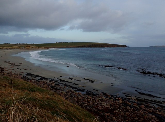
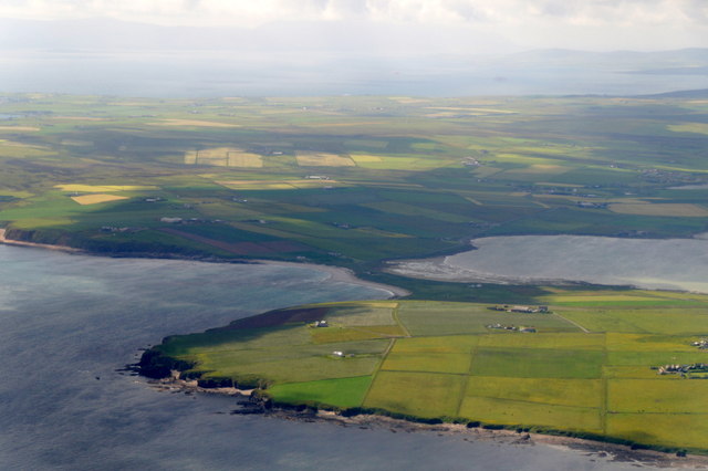
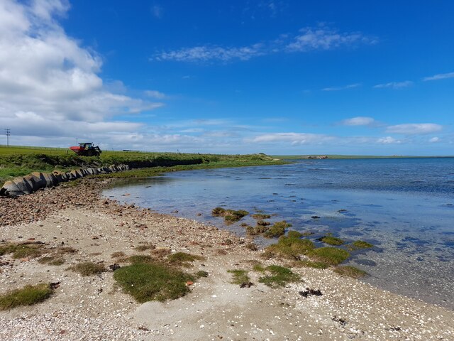
Dingyshowe Bay is a picturesque bay located on the island of Orkney, which is part of the archipelago situated off the northeastern coast of Scotland. This beautiful bay is renowned for its stunning natural beauty and tranquil atmosphere, making it a popular destination for both locals and tourists alike.

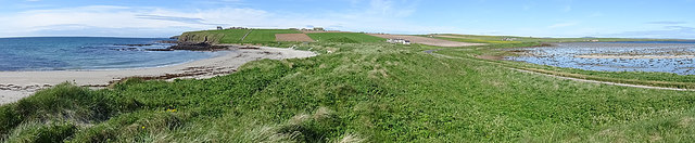
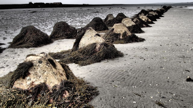
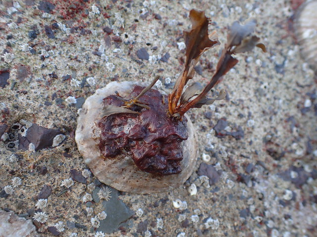
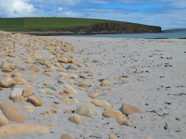
The bay is characterized by its pristine sandy beach, which stretches for approximately half a mile along the coastline. The sand is golden in color and is often dotted with shells and pebbles, adding to its charm. The crystal-clear waters of the bay are perfect for swimming and paddleboarding, and the beach provides ample space for sunbathing and picnicking.

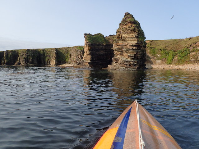
Surrounded by rolling green hills and picturesque cliffs, Dingyshowe Bay offers breathtaking panoramic views of the surrounding landscape and the vast expanse of the North Sea. The bay is also home to a variety of seabirds, including puffins, guillemots, and fulmars, making it a haven for birdwatchers.

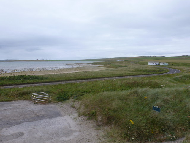
The bay is easily accessible and has ample parking facilities nearby. There are also a few local amenities, including a café and restroom facilities, making it convenient for visitors. Dingyshowe Bay is a tranquil and idyllic destination that offers a perfect escape from the hustle and bustle of daily life, allowing visitors to connect with nature and enjoy the peaceful serenity of this stunning location.

If you have any feedback on the listing, please let us know in the comments section below.

Dingyshowe Bay Images

Images are sourced within 2km of 58.91407/-2.7846641 or Grid Reference HY5403. Thanks to Geograph Open Source API. All images are credited.
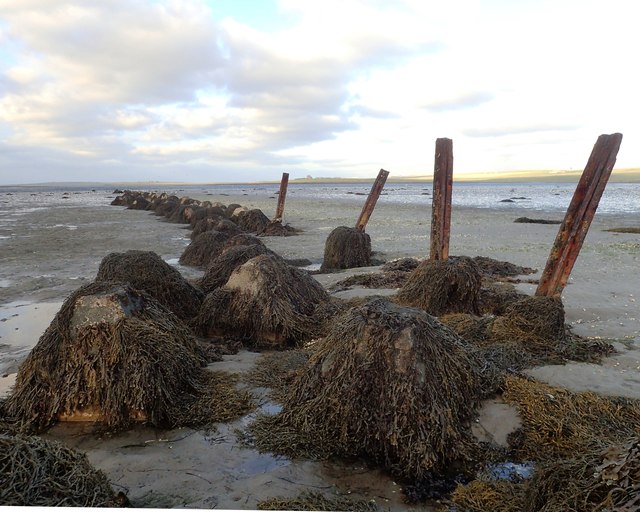
Anti-tank structures These are not marked on any map I can find, nor is their purpose obvious. But research reveals that they are WW2 anti tank (anti-invasion) structures. Mostly of truncated pyramids though some are filled oil-drums. Others, I'm told, can be found nearby on dry land.
Anti-tank structures
These are not marked on any map I can find, nor is their purpose obvious. But research reveals that they are WW2 anti tank (anti-invasion) structures. Mostly of truncated pyramids though some are filled oil-drums. Others, I'm told, can be found nearby on dry land.
Lastlight in the bay Dingieshowe Bay is very popular in the summer. Lovely sand, gentle beach, sand-dunes, toilets and a good view of islands.
This is the beach where I collect washed-up small red seaweeds to identify at home.
Lastlight in the bay
Dingieshowe Bay is very popular in the summer. Lovely sand, gentle beach, sand-dunes, toilets and a good view of islands. This is the beach where I collect washed-up small red seaweeds to identify at home.
Dingieshowe Bay west end A very popular bay all year but specially with summer visitors, the skies are big and the sea bracing!
Dingieshowe Bay west end
A very popular bay all year but specially with summer visitors, the skies are big and the sea bracing!
The isthmus connecting Deerness to Mainland, from the air
The Kame of Camy It has taken me 6 years to get to the square good and proper. Taken of the buttress seen in <a title="https://www.geograph.org.uk/photo/2703940," href="https://www.geograph.org.uk/photo/2703940,">Link</a> the outer edge of which is in the square where I am sat in my kayak.
It can all be seen in <a title="https://www.geograph.org.uk/photo/2698368" href="https://www.geograph.org.uk/photo/2698368">Link</a> but the stack (probably called King of Camy) is just out of sight in this picture.
The Kame of Camy
It has taken me 6 years to get to the square good and proper. Taken of the buttress seen in Link the outer edge of which is in the square where I am sat in my kayak. It can all be seen in Link but the stack (probably called King of Camy) is just out of sight in this picture.
The King of Camy Taken about 10 metres from the foot of the rickety stack on the calmest day possible.
One can see the complete scene here <a title="https://www.geograph.org.uk/photo/2698368" href="https://www.geograph.org.uk/photo/2698368">Link</a> and today it was possible to paddle around the whole tower.
The bay is pretty locked off by cliffs but a descent can possibly be made at the southern corner, just seen in the picture.
The King of Camy
Taken about 10 metres from the foot of the rickety stack on the calmest day possible. One can see the complete scene here Link and today it was possible to paddle around the whole tower. The bay is pretty locked off by cliffs but a descent can possibly be made at the southern corner, just seen in the picture.
Tombolo The isthmus that links Deerness to the rest of Orkney is a tombolo, formed by two beaches back-to-back.
Tombolo
The isthmus that links Deerness to the rest of Orkney is a tombolo, formed by two beaches back-to-back.
Beach on Taracliff Bay This is the southerly, and more exposed, of the two sandy beaches making up the tombolo between Deerness and the rest of Mainland. The farms on the headland are Turnpike on the left and Biggings on the right.
Beach on Taracliff Bay
This is the southerly, and more exposed, of the two sandy beaches making up the tombolo between Deerness and the rest of Mainland. The farms on the headland are Turnpike on the left and Biggings on the right.
Sandi Sand This is the more northerly, and much more sheltered, of the two beaches that together make up the tombolo that links Deerness to the rest of Mainland.
Sandi Sand
This is the more northerly, and much more sheltered, of the two beaches that together make up the tombolo that links Deerness to the rest of Mainland.
Old Milestone by the A960, St Peter's Pool, Kirkwall By the A960, in parish of Kirkwall St Ola (Mainland District), St Peter's Pool, West of bungalow.

Inscription reads:- : K / 8 : : D / 3¾ : (To Kirkwall and Deerness)

Surveyed

Milestone Society National ID: OR_KWDN08
Old Milestone by the A960, St Peter's Pool, Kirkwall
By the A960, in parish of Kirkwall St Ola (Mainland District), St Peter's Pool, West of bungalow. Inscription reads:- : K / 8 : : D / 3¾ : (To Kirkwall and Deerness) Surveyed Milestone Society National ID: OR_KWDN08
Old Milestone by the A960, west of Grind, St Andrews and Deerness Stone post by the A960, in parish of St Andrews and Deerness (Mainland District), West of Grind, on banking, South side of road.

Inscription reads:-
: K / 9 : : D / 2¾ :
(To Kirkwall and Deerness)

Surveyed

Milestone Society National ID: OR_KWDN09
Old Milestone by the A960, west of Grind, St Andrews and Deerness
Stone post by the A960, in parish of St Andrews and Deerness (Mainland District), West of Grind, on banking, South side of road. Inscription reads:- : K / 9 : : D / 2¾ : (To Kirkwall and Deerness) Surveyed Milestone Society National ID: OR_KWDN09
Wartime Structures These structures are worth recording - I can find no Web-references. They are significant historical and ecological features. The whole line, of mostly concrete truncated pyramids, reaches nearly 200 metres from dry land to quite low water. Some are exposed for most of the day, others for only an hour or two.
They all have a good coating of Wracks (seaweeds) which hide a varied collection of other Marine organisms, some quite rare.
Linked to <a title="https://www.geograph.org.uk/photo/4717066" href="https://www.geograph.org.uk/photo/4717066">Link</a>
and my series of iSpot Observations here <span class="nowrap"><a title="https://www.ispotnature.org/communities/uk-and-ireland/view/observation/778731/" rel="nofollow ugc noopener" href="https://www.ispotnature.org/communities/uk-and-ireland/view/observation/778731/">Link</a><img style="margin-left:2px;" alt="External link" title="External link - shift click to open in new window" src="https://s1.geograph.org.uk/img/external.png" width="10" height="10"/></span>
Wartime Structures
These structures are worth recording - I can find no Web-references. They are significant historical and ecological features. The whole line, of mostly concrete truncated pyramids, reaches nearly 200 metres from dry land to quite low water. Some are exposed for most of the day, others for only an hour or two. They all have a good coating of Wracks (seaweeds) which hide a varied collection of other Marine organisms, some quite rare. Linked to Link and my series of iSpot Observations here LinkExternal link
Rare seaweed The Wartime anti-tank structures at this location <a title="https://www.geograph.org.uk/photo/6190823" href="https://www.geograph.org.uk/photo/6190823">Link</a> are ecologically significant. Some of the lowest ones host quite rare marine organisms. There are plenty of common limpets of course.
On a few, and on some concrete surfaces, there is the quite rare seaweed Colaconema caespitosum - <span class="nowrap"><a title="http://www.seaweed.ie/descriptions/Colaconema_caespitosum.php" rel="nofollow ugc noopener" href="http://www.seaweed.ie/descriptions/Colaconema_caespitosum.php">Link</a><img style="margin-left:2px;" alt="External link" title="External link - shift click to open in new window" src="https://s1.geograph.org.uk/img/external.png" width="10" height="10"/></span>
World distribution - <span class="nowrap"><a title="https://www.gbif.org/species/5278379" rel="nofollow ugc noopener" href="https://www.gbif.org/species/5278379">Link</a><img style="margin-left:2px;" alt="External link" title="External link - shift click to open in new window" src="https://s1.geograph.org.uk/img/external.png" width="10" height="10"/></span>
Personally, I think the structures should be protected for their historical and environmental value.
Rare seaweed
The Wartime anti-tank structures at this location Link are ecologically significant. Some of the lowest ones host quite rare marine organisms. There are plenty of common limpets of course. On a few, and on some concrete surfaces, there is the quite rare seaweed Colaconema caespitosum - LinkExternal link World distribution - LinkExternal link Personally, I think the structures should be protected for their historical and environmental value.
Taracliff Bay Sandy bay on the south side of the isthmus that joins the peninsula of Deerness to the rest of Mainland Orkney.
Taracliff Bay
Sandy bay on the south side of the isthmus that joins the peninsula of Deerness to the rest of Mainland Orkney.
Sandi Sand This looks rather less inviting [except to wading birds] than the fine sandy beach on the other side of the isthmus.
Sandi Sand
This looks rather less inviting [except to wading birds] than the fine sandy beach on the other side of the isthmus.
Eggs for Sale By the roadside near Garth.
Eggs for Sale
By the roadside near Garth.
Sandi Sand Anti-tank structures on the left of the photograph.
Sandi Sand
Anti-tank structures on the left of the photograph.
Deerness: Sandi Sand An undeniably accurate name for this sandy beach at the head of St. Peter's Bay, viewed from the sand dunes running across the very narrow isthmus which connects Deerness with the bulk of the Orkney mainland. A car park is immediately below us.
Deerness: Sandi Sand
An undeniably accurate name for this sandy beach at the head of St. Peter's Bay, viewed from the sand dunes running across the very narrow isthmus which connects Deerness with the bulk of the Orkney mainland. A car park is immediately below us.
Show me another place!

Dingyshowe Bay is located at Grid Ref: HY5403 (Lat: 58.91407, Lng: -2.7846641)

Unitary Authority: Orkney Islands

Police Authority: Highlands and Islands

What 3 Words

///spruced.blacken.hurry. Near Deerness, Orkney Islands

Related Wikis

St Peter's Pool, Orkney

St Peter's Pool is a bay in the East Mainland of Orkney, Scotland. This bay was the site of significant coastal defences during World War II, when a German...

Point of Ayre, Orkney

There are also two similarly named points in the British Isles: Point of Ayre, Isle of Man and Point of Ayr, Wales.Point of Ayre is a headland in the parish...

Deerness

Deerness (, locally , Old Norse: Dyrnes) is a quoad sacra parish (i.e. one created and functioning for ecclesiastical purposes only) and peninsula in Mainland...

Black Holm

Black Holm is a small tidal island in the Orkney Islands, near Copinsay to the west of Corn Holm off the north-eastern coast of Scotland. == Geography... ==

Mine Howe

Mine Howe is an Iron Age subterranean man-made chamber dug 6 meters (20 feet) deep inside a large mound. It is located in the Tankerness area of Orkney...

Corn Holm

Corn Holm is a small tidal island in Orkney, near Copinsay to the west, off the north-eastern coast of Scotland. There was once a small chapel there, and...

Toab, Orkney

Toab is a parish on the Orkney Mainland, situated in the East Mainland. Toab is located off the A960 road at the head of Deer Sound on the Mainland, Orkney...

Tankerness

Tankerness is a district in the St Andrews parish in Mainland, Orkney, Scotland. Essentially a peninsula, it is about 13 kilometres (8 mi) south-east of...

Nearby Amenities

Located within 500m of 58.91407,-2.7846641
Power: pole
Lat/Long: 58.9117555/-2.7906883
Power: pole
Lat/Long: 58.9122264/-2.789728
Power: pole
Lat/Long: 58.912671/-2.7888054
Power: pole
Lat/Long: 58.9131059/-2.7879256
Power: pole
Lat/Long: 58.9136709/-2.7880785
Power: pole
Lat/Long: 58.9142082/-2.7882126
Power: pole
Lat/Long: 58.9146251/-2.7882394
Power: pole
Lat/Long: 58.9156194/-2.7925336
Power: pole
Lat/Long: 58.9154034/-2.7908143
Power: pole
Lat/Long: 58.9152522/-2.7895299
Power: pole
Lat/Long: 58.9151026/-2.7883038
Power: pole
Lat/Long: 58.9150251/-2.787683
Power: pole
Lat/Long: 58.9178438/-2.780517
Power: pole
Lat/Long: 58.9148411/-2.7919033
Dingy's Howe Broch (remains -Iron Age)
Historic: archaeological_site
Lat/Long: 58.914673/-2.7872096
Generator Method: photovoltaic
Generator Output Electricity: yes
Generator Source: solar
Generator Type: solar_photovoltaic_panel
Power: generator
Lat/Long: 58.9171699/-2.7813905
Bicycle Parking
Lat/Long: 58.9157398/-2.7836678
Informal campsite
Tourism: camp_site
Lat/Long: 58.9157335/-2.7828446
The data included in this document is from www.openstreetmap.org. The data is made available under ODbL.

Have you been to Dingyshowe Bay?

Leave your review of Dingyshowe Bay below (or comments, questions and feedback).