Bay of Kirkwall

Bay in Orkney

Scotland

Bay of Kirkwall

Kirkwall Harbour, Orkney Looking back toward the harbour at sunset.
Kirkwall Harbour, Orkney Credit: Dorcas Sinclair

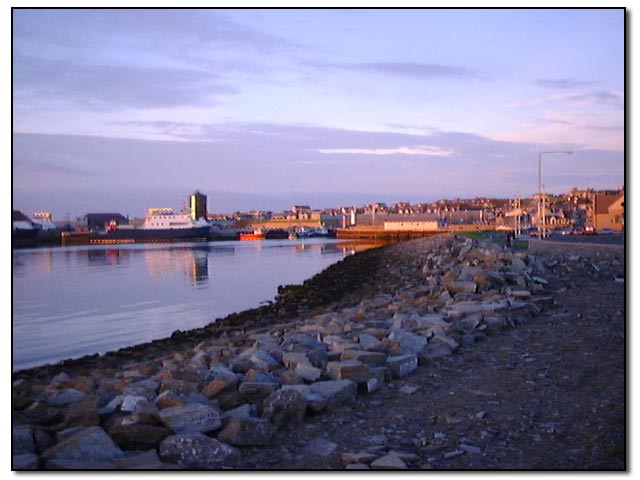
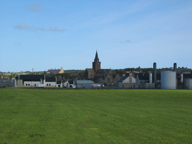
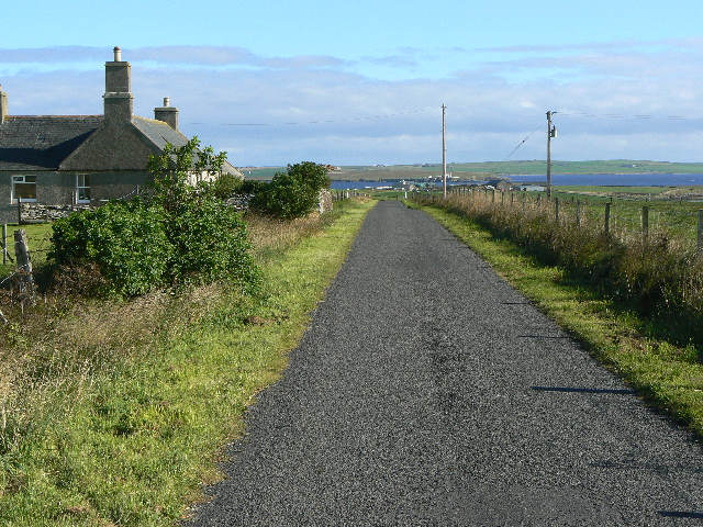
The Bay of Kirkwall, located in Orkney, Scotland, is a picturesque natural harbor that serves as the main port for the town of Kirkwall. With its breathtaking views and strategic location, the bay plays a crucial role in the region's maritime activities.

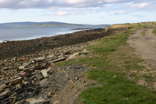
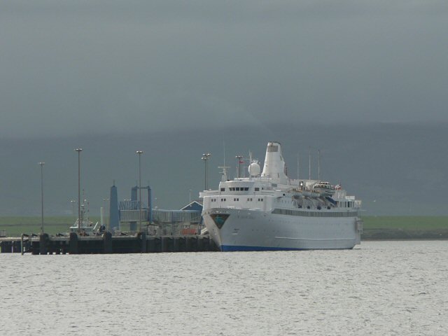
Surrounded by rolling hills and cliffs, the Bay of Kirkwall offers a sheltered inlet for ships, making it an ideal location for trading and fishing vessels. The bay's deep waters allow for large ships to dock, facilitating the transportation of goods and passengers. The town's economy heavily relies on the bay's port facilities, as it serves as a hub for both domestic and international trade.

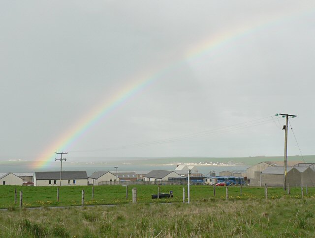
Along the bay, one can find a variety of attractions and amenities. The bustling harbor area is lined with quays and piers, providing moorings for ships and a place for visitors to observe the comings and goings of boats. The bay is also home to several marinas and boatyards, accommodating recreational boating and yachting activities.

The Bay of Kirkwall is not only significant for its practical purposes but also for its natural beauty. The surrounding landscape, featuring rugged cliffs and rolling green hills, provides a stunning backdrop to the bay's tranquil waters. Visitors can enjoy leisurely walks along the bay, taking in the scenic views and observing the diverse marine life.

Overall, the Bay of Kirkwall is a vital and picturesque destination that serves as the gateway to the town of Kirkwall and offers a unique blend of natural beauty and maritime activity.

If you have any feedback on the listing, please let us know in the comments section below.

Bay of Kirkwall Images

Images are sourced within 2km of 58.999111/-2.9663652 or Grid Reference HY4412. Thanks to Geograph Open Source API. All images are credited.

Kirkwall Harbour, Orkney Looking back toward the harbour at sunset.
Kirkwall Harbour, Orkney
Looking back toward the harbour at sunset.
Kirkwall
Kirkwall
Kirkwall
Kirkwall
Grain earth house Another souterrain, entered through the cellar roof.  The strange shaped long hump is the course of the underground passage which once linked the cellar to its house.  In the centre of an industrial estate, this is one of the more unlikely places for an ancient monument!
Grain earth house
Another souterrain, entered through the cellar roof. The strange shaped long hump is the course of the underground passage which once linked the cellar to its house. In the centre of an industrial estate, this is one of the more unlikely places for an ancient monument!
Foreshore Bay of Kirkwall Looking N towards Iceland Skerry
Foreshore Bay of Kirkwall
Looking N towards Iceland Skerry
Rainbow over Kirkwall Industrial Estate
Grainepark, Kirkwall A small housing estate on the edge of Kirkwall.
Grainepark, Kirkwall
A small housing estate on the edge of Kirkwall.
Kirkwall houses These houses are on the northern outskirts of Kirkwall, facing the sea.
Kirkwall houses
These houses are on the northern outskirts of Kirkwall, facing the sea.
Cruise liner at Kirkwall This is the MV Black Prince, arrived from Bergen following a Scandinavian cruise, and returning to Greenock.
Cruise liner at Kirkwall
This is the MV Black Prince, arrived from Bergen following a Scandinavian cruise, and returning to Greenock.
Craigiefield This large house stands at the south of Craigiefield.
Craigiefield
This large house stands at the south of Craigiefield.
Road junction at HY463119 Turning right at the junction leads to the Head of Work (HY4713); left leads down towards Craigiefield.  Land in the extreme distance, left side, is the island of Rousay.  Land in the extreme distance, centre and right, is the island of Shapinsay.
Road junction at HY463119
Turning right at the junction leads to the Head of Work (HY4713); left leads down towards Craigiefield. Land in the extreme distance, left side, is the island of Rousay. Land in the extreme distance, centre and right, is the island of Shapinsay.
Farm of Blackhall The farm, with the Shapinsay Sound and Isle of Shapinsay beyond.
Farm of Blackhall
The farm, with the Shapinsay Sound and Isle of Shapinsay beyond.
Orkney Auction Mart, Hatston Industrial Estate The most important agricultural building in Orkney.  It's here that cattle and sheep are bought and sold, and exported for finishing elsewhere.

The Hatston Industrial Estate has been hugely expanded in recent years, not reflected in the OS mapping (yet :-)  )
Orkney Auction Mart, Hatston Industrial Estate
The most important agricultural building in Orkney. It's here that cattle and sheep are bought and sold, and exported for finishing elsewhere. The Hatston Industrial Estate has been hugely expanded in recent years, not reflected in the OS mapping (yet :-) )
Ferry Terminal, Hatston, Kirkwall Built about 5 years ago, this is the terminal for the Aberdeen / Kirkwall / Lerwick ferry operated by CalMac since 2006 - though badged as Northlink.  In the left foreground you can see the linkspan used to drive vehicles on and off.
Ferry Terminal, Hatston, Kirkwall
Built about 5 years ago, this is the terminal for the Aberdeen / Kirkwall / Lerwick ferry operated by CalMac since 2006 - though badged as Northlink. In the left foreground you can see the linkspan used to drive vehicles on and off.
Cruise liner and North Isles Ferry seen from Ferry terminal Kirkwall is a popular cruise liner port of call.  The little North Isles ferry is one of a fleet of 3.
Cruise liner and North Isles Ferry seen from Ferry terminal
Kirkwall is a popular cruise liner port of call. The little North Isles ferry is one of a fleet of 3.
Kirkwall Harbour
Kirkwall Harbour
Hatston Industrial Estate A charity walk passes along road through industrial estate
Hatston Industrial Estate
A charity walk passes along road through industrial estate
Pipe band Pipe band performing outside St Magnus's cathedral, Albert Street, Kirkwall.
Pipe band
Pipe band performing outside St Magnus's cathedral, Albert Street, Kirkwall.
Show me another place!

Bay of Kirkwall is located at Grid Ref: HY4412 (Lat: 58.999111, Lng: -2.9663652)

Unitary Authority: Orkney Islands

Police Authority: Highlands and Islands

What 3 Words

///validated.empires.slant. Near Kirkwall, Orkney Islands

Nearby Locations

Bay of Kirkwall Crow Ness

Related Wikis

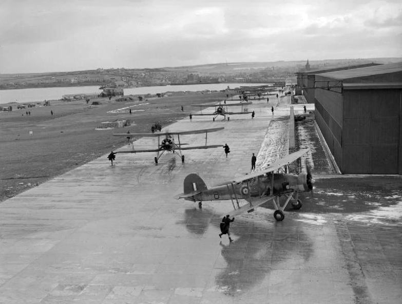
RNAS Hatston (HMS Sparrowhawk)

Royal Naval Air Station Hatston (RNAS Hatston, also called HMS Sparrowhawk), was a Royal Naval Air Station, one mile to the north west of Kirkwall on the...

Orkney Wireless Museum

The Orkney Wireless Museum in Kirkwall, Orkney, Scotland, houses a collection of domestic and military wireless equipment. It developed from the private...

UHI Orkney

Orkney College (Scottish Gaelic: Colaiste Arcaibh) is a further and higher education college in Orkney, an archipelago in northern Scotland. It is an academic...

UHI Archaeology Institute

UHI Archaeology Institute is an academic department of the University of the Highlands and Islands in Scotland. It was founded in 2014, incorporating Orkney...

Nearby Amenities

Located within 500m of 58.999111,-2.9663652
Crow Ness
Place: locality
Lat/Long: 58.9952219/-2.9678912
Ferry Terminal
Northlink Ferry Terminal
Ferry: yes
Public Transport: station
Lat/Long: 58.9996914/-2.9740819
Bus Stop
Shuttle
Bus: yes
Name En: Shuttle
Public Transport: platform
Lat/Long: 59.0002112/-2.9748248
Bay of Kirkwall
Natural: bay
Lat/Long: 59.0019645/-2.9618884
The data included in this document is from www.openstreetmap.org. The data is made available under ODbL.

Have you been to Bay of Kirkwall?

Leave your review of Bay of Kirkwall below (or comments, questions and feedback).