Rack Wick

Bay in Orkney

Scotland

Rack Wick

Roadside letter box at Rackwick, Westray
Roadside letter box at Rackwick, Westray Credit: Alpin Stewart

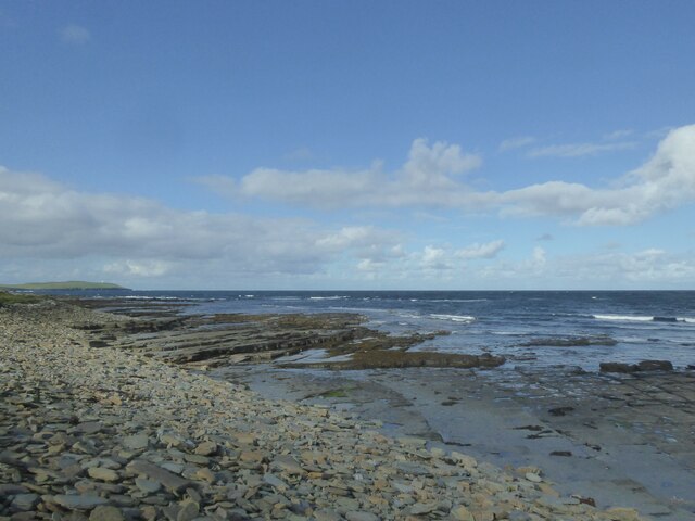
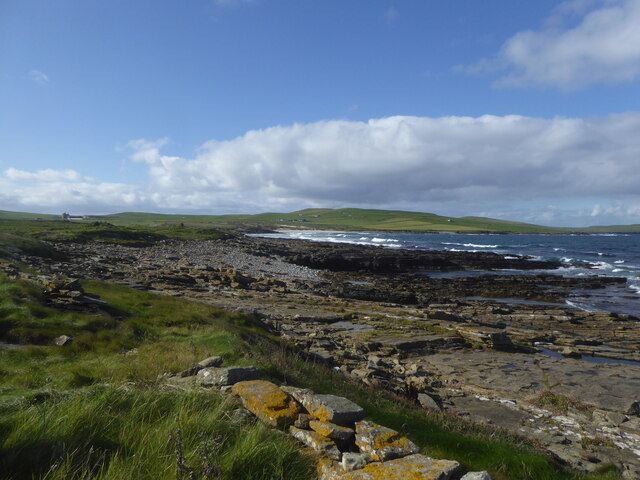
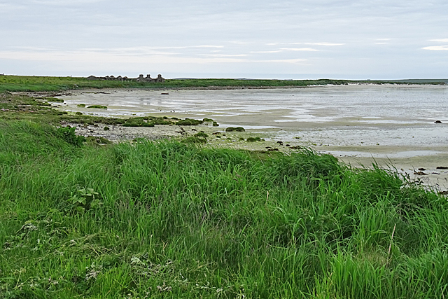
Rack Wick is a small bay located on the northeastern coast of Orkney, an archipelago in Scotland. Situated approximately 10 miles southeast of the town of Wick, Rack Wick offers a picturesque and tranquil environment for visitors. The bay is nestled between rugged cliffs and rolling green hills, providing stunning panoramic views of the surrounding landscape.

The bay itself is characterized by a sandy beach, which stretches for about half a mile along the coastline. This sandy expanse is ideal for leisurely walks, sunbathing, or picnicking, and also serves as a popular spot for birdwatching enthusiasts, as various species of seabirds can be observed in the area.

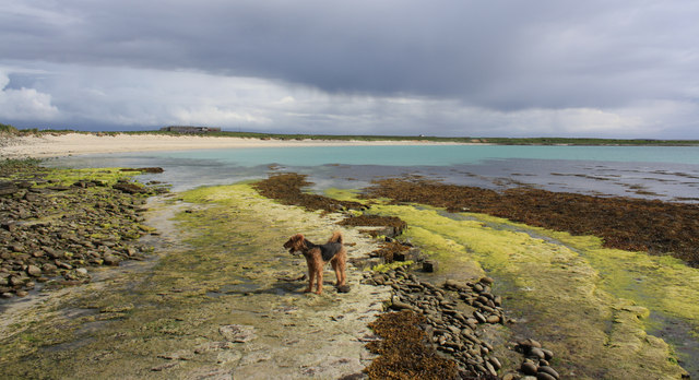
The clear and pristine waters of Rack Wick Bay are perfect for swimming or engaging in water sports like kayaking or paddleboarding. The bay is also known for its rich marine life, making it a great spot for snorkeling or diving.

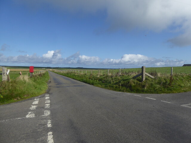
Rack Wick is a remote and peaceful location, often attracting those seeking solitude and a break from the bustling city life. The bay is accessible by road, and there is a small car park nearby for visitors. However, amenities in the immediate vicinity are limited, so it is advisable to bring essentials such as food, water, and sunscreen.

Overall, Rack Wick Bay offers a serene and unspoiled coastal experience, showcasing the natural beauty that Orkney has to offer.

If you have any feedback on the listing, please let us know in the comments section below.

Rack Wick Images

Images are sourced within 2km of 59.337343/-2.9868557 or Grid Reference HY4350. Thanks to Geograph Open Source API. All images are credited.

Roadside letter box at Rackwick, Westray
Field at Trenabie, Westray
Rocky shore at Rackwick, Westray
Communications mast at Nether Fiold, Westray
Rocky shore at Narr Ness, Westray
Beach at Grobust, Westray
Windywalls Like most of the farms here, Windywalls stands on slightly higher ground.
Windywalls
Like most of the farms here, Windywalls stands on slightly higher ground.
The Ouse The Ouse is a shallow sandy bay in the north of Westray. The buildings on the far side of the bay are at Hahouse.
The Ouse
The Ouse is a shallow sandy bay in the north of Westray. The buildings on the far side of the bay are at Hahouse.
The Ouse The Ouse is a bay of fine white sand, almost cut by the Ayre of Ouse, a spit of sand that extends most of the way across the bay.
The Ouse
The Ouse is a bay of fine white sand, almost cut by the Ayre of Ouse, a spit of sand that extends most of the way across the bay.
Old Milestone by the B9066, Aikerness, Westray parish Stone post by the B9066, in parish of Westray (District), South of bungalow, on verge, East side of road.

Inscription reads:-
: P / 2 : : T / 1 :
(To Pierowall and Trenabie)

Surveyed

Milestone Society National ID: OR_WYPWTN02
Old Milestone by the B9066, Aikerness, Westray parish
Stone post by the B9066, in parish of Westray (District), South of bungalow, on verge, East side of road. Inscription reads:- : P / 2 : : T / 1 : (To Pierowall and Trenabie) Surveyed Milestone Society National ID: OR_WYPWTN02
Bay of Skaill
Bay of Skaill
Bay of Skaill
Bay of Skaill
The Ouse Not looking at its best with the tide out. There are some tyre tracks in the sand but I've no idea where they could be going.
The Ouse
Not looking at its best with the tide out. There are some tyre tracks in the sand but I've no idea where they could be going.
Rackwick: postbox № KW17 116 The northernmost postbox on the island of Westray is emptied at 11am on weekdays and Saturdays but items collected are subject to a 24-hour delay (48 on Saturdays) because it will by then have missed the day's ferry connection and won't go anywhere till the following day's.
Rackwick: postbox № KW17 116
The northernmost postbox on the island of Westray is emptied at 11am on weekdays and Saturdays but items collected are subject to a 24-hour delay (48 on Saturdays) because it will by then have missed the day's ferry connection and won't go anywhere till the following day's.
Rackwick, Westray A long straight road towards The Ouse.
Rackwick, Westray
A long straight road towards The Ouse.
Stone breaker, Rackwick, Westray, Orkney This is a Baxter's Improved Stone Breaker with patent knapping motion, made by WH Baxter Ltd of Leeds.  It lies adjacent to the road which runs behind the links at Rackwick.

The poetic instructions on it read,

'Lubricate this breaker well
tightened bolts prevent all rapping
and be sure all parts are clean
that's the way to keep it
"knapping".'
Stone breaker, Rackwick, Westray, Orkney
This is a Baxter's Improved Stone Breaker with patent knapping motion, made by WH Baxter Ltd of Leeds. It lies adjacent to the road which runs behind the links at Rackwick. The poetic instructions on it read, 'Lubricate this breaker well tightened bolts prevent all rapping and be sure all parts are clean that's the way to keep it "knapping".'
Coastline, Rackwick, Westray, Orkney Looking towards Noup Head.
Coastline, Rackwick, Westray, Orkney
Looking towards Noup Head.
Boat nausts, Rackwick, Westray, Orkney From <span class="nowrap"><a title="http://canmore.org.uk/event/638992" rel="nofollow ugc noopener" href="http://canmore.org.uk/event/638992">Link</a><img style="margin-left:2px;" alt="External link" title="External link - shift click to open in new window" src="https://s1.geograph.org.uk/img/external.png" width="10" height="10"/></span> : "Two boat noosts lie to the landward side of a rough track, some 5m from the head of the shore. The noosts are defined by a semi-circular drystone wall with an internal stone wall partition. They have pointed ends and measure 2m in width and 4m in length; the walls stand up to 0.5m high."
Boat nausts, Rackwick, Westray, Orkney
From LinkExternal link : "Two boat noosts lie to the landward side of a rough track, some 5m from the head of the shore. The noosts are defined by a semi-circular drystone wall with an internal stone wall partition. They have pointed ends and measure 2m in width and 4m in length; the walls stand up to 0.5m high."
Show me another place!

Rack Wick is located at Grid Ref: HY4350 (Lat: 59.337343, Lng: -2.9868557)

Unitary Authority: Orkney Islands

Police Authority: Highlands and Islands

What 3 Words

///pictured.developed.amuses. Near Pierowall, Orkney Islands

Related Wikis

Quoygrew settlement, Westray

Quoygrew, Westray is the site of a medieval Norse settlement on the island of Westray in Orkney, Scotland. Established as a small farmstead most likely...

Lady Kirk

The Lady Kirk (or St Mary's Kirk) at Pierowall is a ruined 17th-century church on the island of Westray, in Orkney, Scotland. The church was built in 1674...

Links of Noltland

Links of Noltland is a large prehistoric settlement located on the north coast of the island of Westray in Orkney, Scotland. The extensive ruins includes...

Noltland Castle

Noltland Castle is located near Pierowall on the island of Westray in the Orkney Islands of Scotland. It dates mainly to the later 16th century, although...

Nearby Amenities

Located within 500m of 59.337343,-2.9868557
Quoygrew
Place: locality
Lat/Long: 59.33861/-2.9797298
Quoygrew viking house
Board Type: history
Information: board
Tourism: information
Lat/Long: 59.3386386/-2.9799845
Viking House (remains)
Description: Remains of a Viking house from AD950
Historic: archaeological_site
Lat/Long: 59.3387013/-2.9800288
The data included in this document is from www.openstreetmap.org. The data is made available under ODbL.

Have you been to Rack Wick?

Leave your review of Rack Wick below (or comments, questions and feedback).