Kailpot Bay
Bay in Westmorland Eden
England
Kailpot Bay

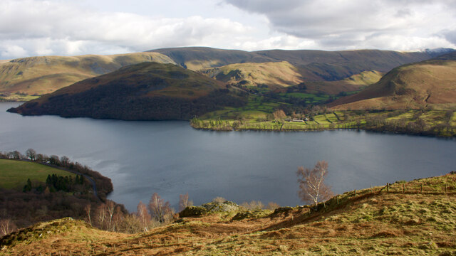
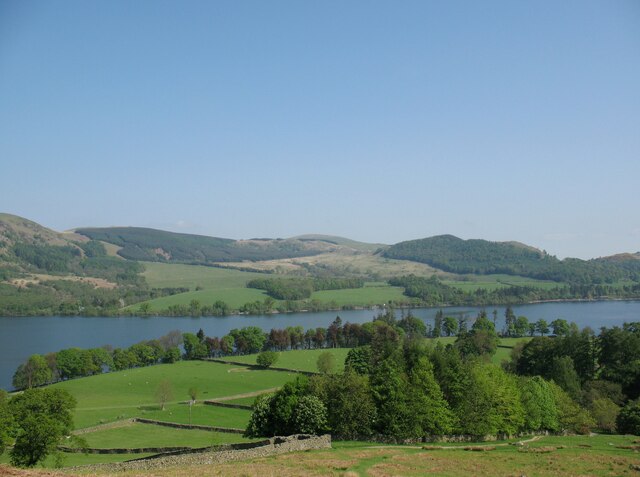
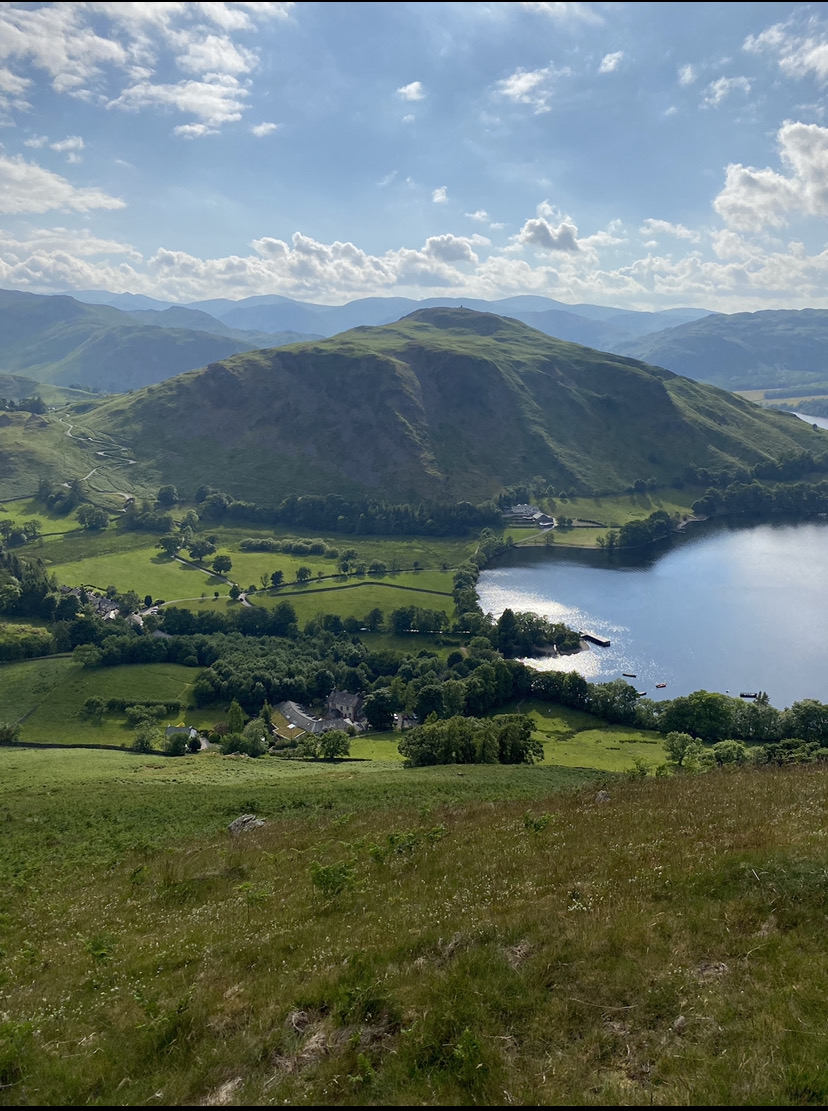
Kailpot Bay, located in Westmorland, is a picturesque bay situated on the eastern side of Lake Windermere, which is the largest lake in England. Surrounded by lush green hills and dense forests, Kailpot Bay is a popular tourist destination, known for its stunning natural beauty and tranquil atmosphere.
The bay offers a wide range of recreational activities for visitors to enjoy. Boating and sailing are particularly popular, with several boat rental services available in the area. The calm waters of the bay provide an idyllic setting for water sports enthusiasts and nature lovers alike.
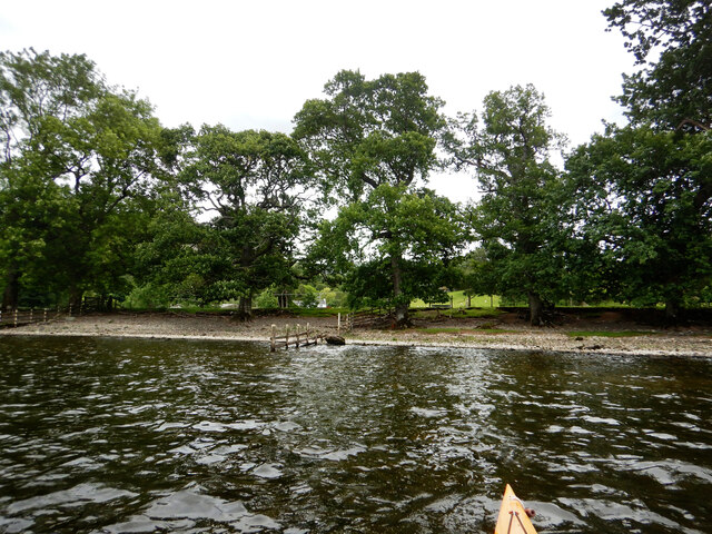
The shoreline of Kailpot Bay is dotted with pebble beaches, making it an ideal spot for picnicking, sunbathing, or simply taking a leisurely stroll along the water's edge. The bay also offers breathtaking views of the surrounding mountains and the distant peaks of the Lake District National Park.
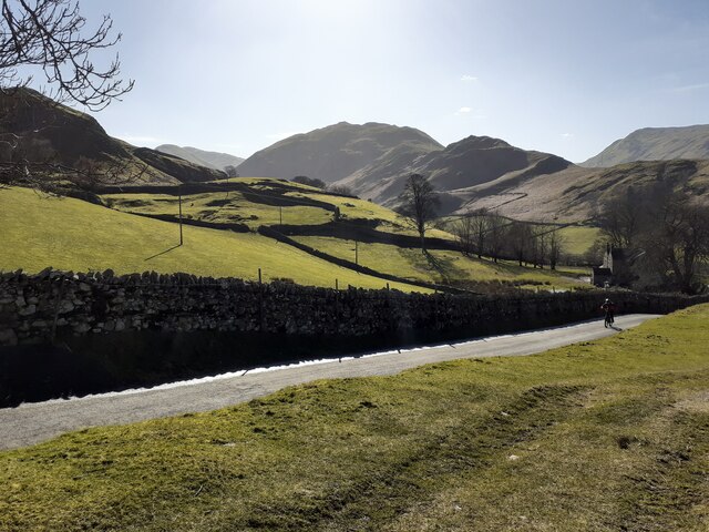
For those looking to explore the area further, Kailpot Bay is conveniently located near several hiking trails and walking paths. These trails provide access to the stunning countryside and nearby attractions such as Wray Castle, a Victorian Gothic mansion, and Claife Viewing Station, a historic building offering panoramic views of the lake.
Additionally, Kailpot Bay is in close proximity to a variety of accommodation options, including hotels, bed and breakfasts, and self-catering cottages, ensuring visitors can find a comfortable place to stay during their visit.
Overall, Kailpot Bay, Westmorland, offers a peaceful and picturesque setting for visitors to unwind, explore nature, and indulge in the beauty of the Lake District region.
If you have any feedback on the listing, please let us know in the comments section below.
Kailpot Bay Images
Images are sourced within 2km of 54.57535/-2.8794689 or Grid Reference NY4320. Thanks to Geograph Open Source API. All images are credited.


Kailpot Bay is located at Grid Ref: NY4320 (Lat: 54.57535, Lng: -2.8794689)
Administrative County: Cumbria
District: Eden
Police Authority: Cumbria
What 3 Words
///ironic.lawful.inefficient. Near Penrith, Cumbria
Nearby Locations
Related Wikis

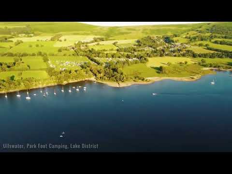
Ullswater
Ullswater is a glacial lake in Cumbria, England and part of the Lake District National Park. It is the second largest lake in the region by both area and...
Hallin Fell
Hallin Fell is a hill in the English Lake District surrounded on three sides by Ullswater. == Topography == The fell is a continuation of the ridge leading...

Howtown
Howtown is a hamlet in Cumbria, England, situated at a small harbour on the east shore of Ullswater in the Lake District. It lies within the civil parish...
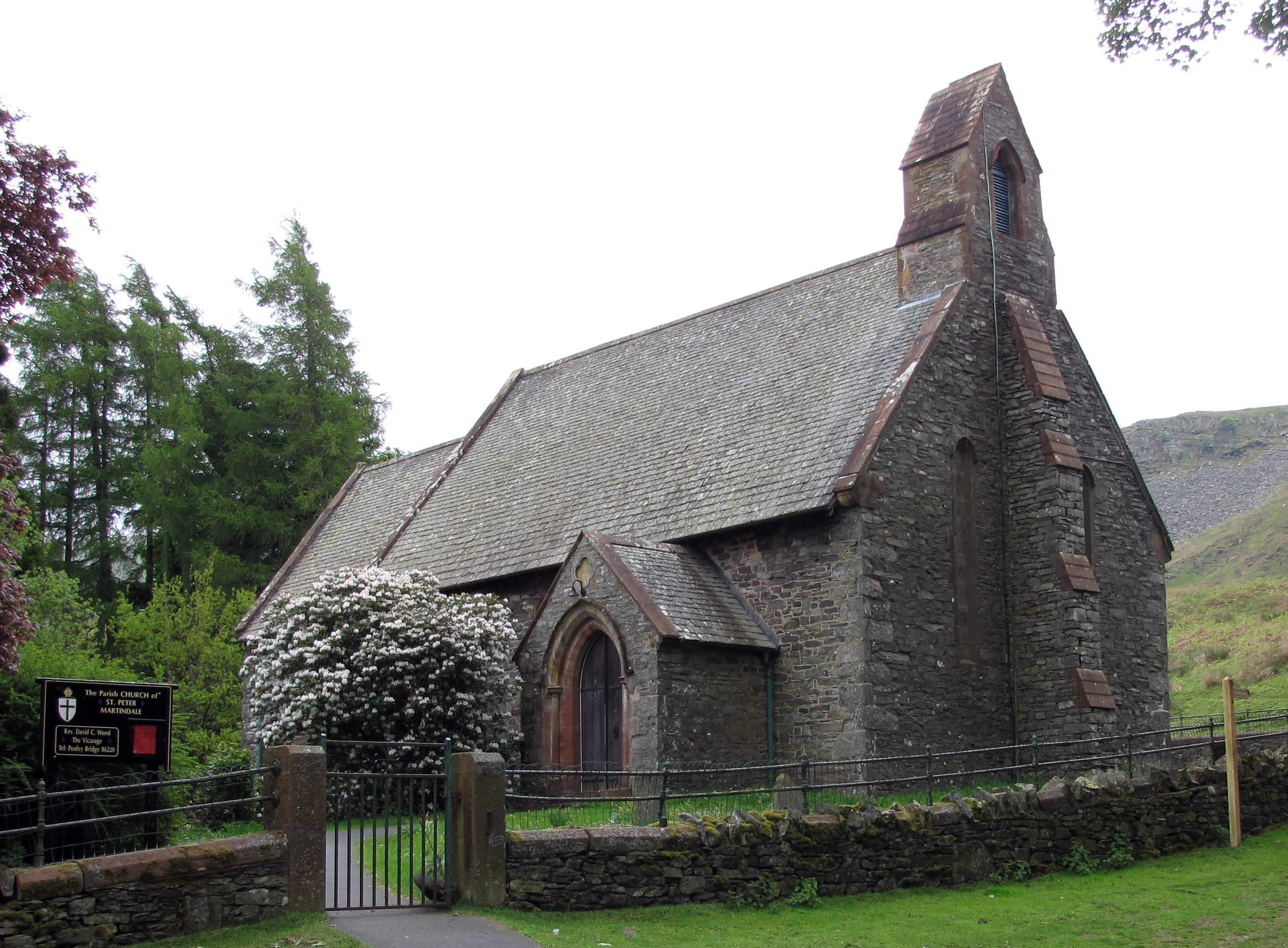
St Peter's Church, Martindale
St Peter’s Church is situated in the valley of Martindale in Cumbria, England. The church is located at the top of the hause on the minor road between...

Howtown Hotel
Howtown Hotel is a hotel in Howtown, Cumbria, England, located near the southern shore of the Ullswater lake. Although it won the César Award for Best...
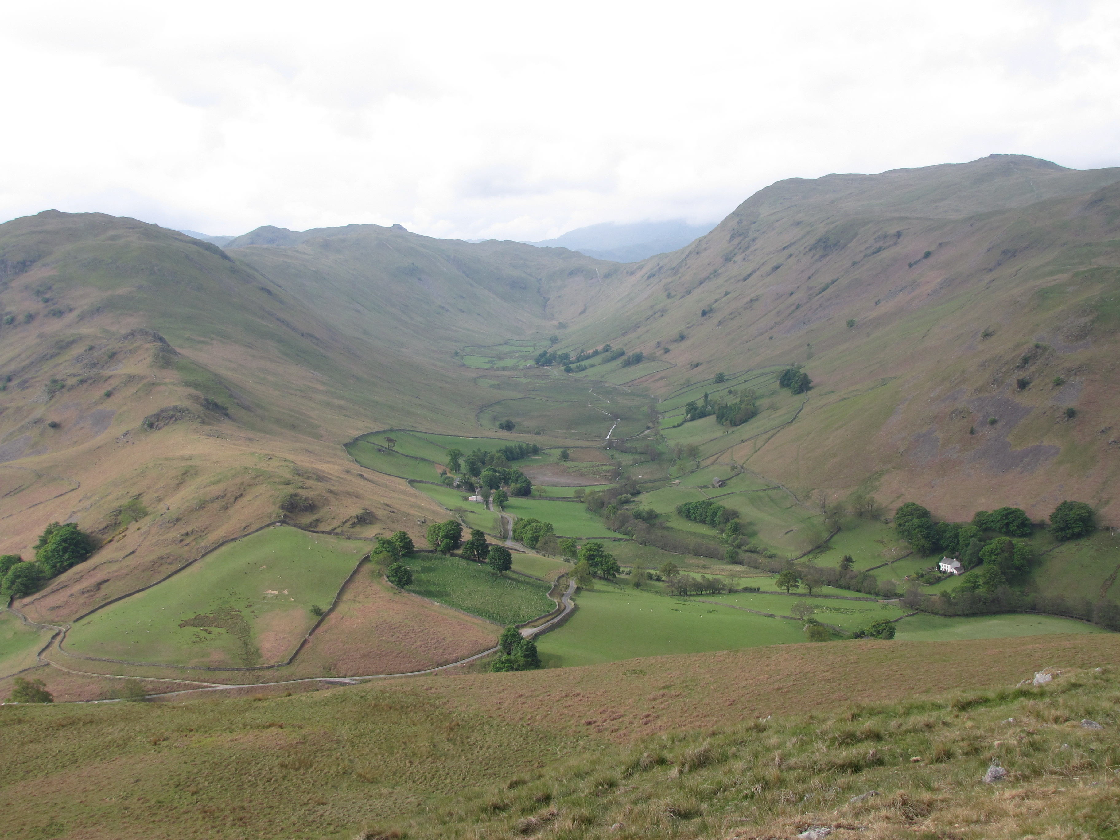
Boredale
Boredale sometimes known as Boardale, is a valley within Lake District National Park, in Cumbria, England. The valley is close to the eastern shore of...
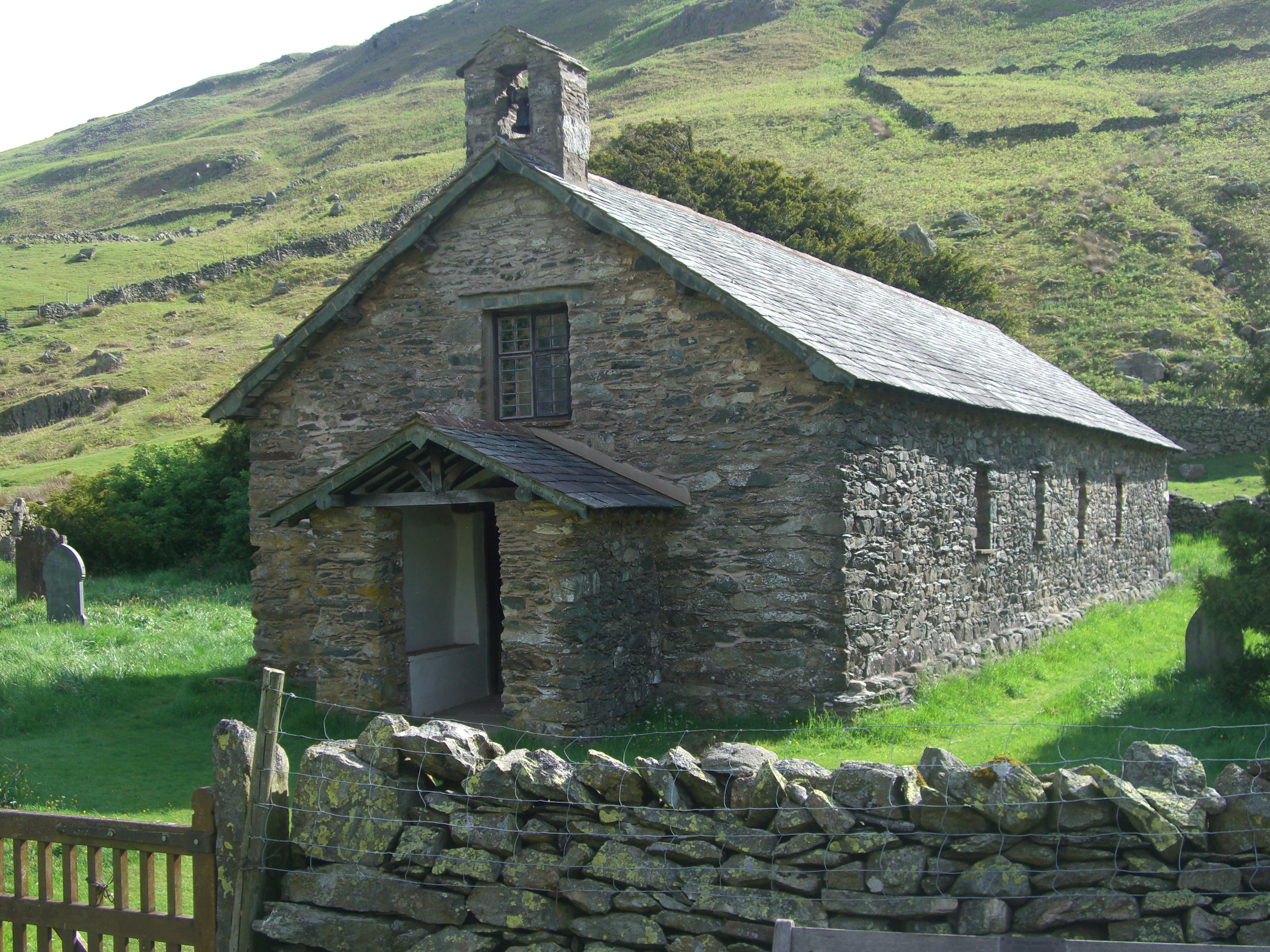
St Martin's Church, Martindale
St Martin's Church, Martindale is located in the valley of Martindale in Cumbria, England. It is often referred to as the "Old Church" to avoid confusion...

Martindale, Cumbria
Martindale is a valley, village and civil parish in Cumbria, England, situated within the Lake District National Park between the lakes of Ullswater and...
Related Videos

Walking the Ullswater Way
The Ullswater Way is a stunning 20 mile route around Ullswater lake. See just a few of the views, easy paths and charming ...

Hallin Fell - Fully Labelled Summit View Panorama. Lake District Walks & Hiking
A slow panorama from the summit of Hallin in the English Lake District with all main view points labelled.

Hallin Fell #52
Up and down from St Peter's Church https://jimearl6.com/a-short-walk-up-hallin-fell/#more-7209 A short walk up and down from St ...
Nearby Amenities
Located within 500m of 54.57535,-2.8794689Have you been to Kailpot Bay?
Leave your review of Kailpot Bay below (or comments, questions and feedback).