Sandwick Bay

Bay in Westmorland Eden

England

Sandwick Bay

The Lodge. Taken from Birkie knott.
The Lodge. Credit: steven ruffles

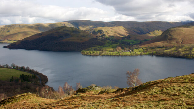
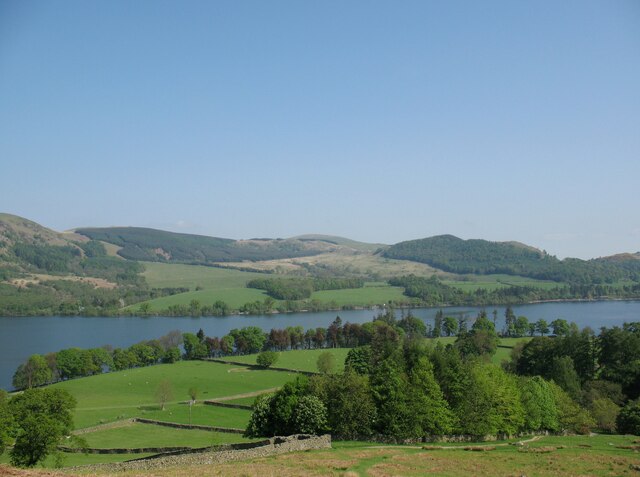
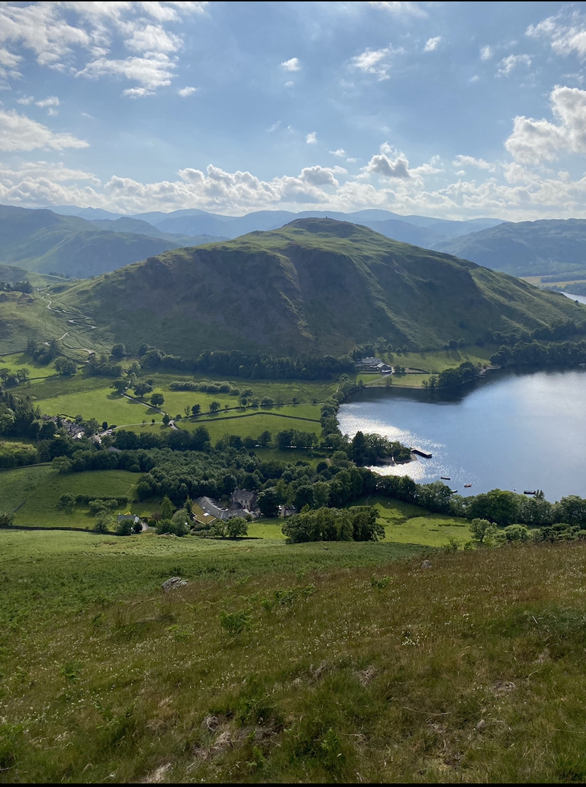
Sandwick Bay is a picturesque coastal area located in the historic county of Westmorland, in the northwestern region of England. Situated on the Irish Sea coast, this bay offers stunning views of the surrounding landscape and a peaceful retreat for visitors.

The bay is known for its sandy beach, which stretches for approximately one mile along the coastline. The soft golden sand provides an ideal spot for sunbathing, beachcombing, and building sandcastles. The beach is also a popular destination for water sports enthusiasts, with opportunities for swimming, surfing, and windsurfing.

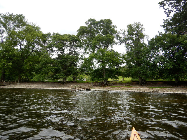
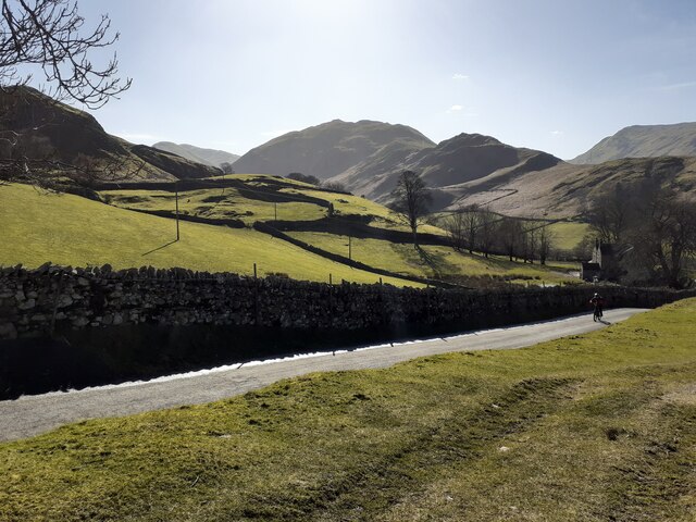
Surrounded by rolling hills and cliffs, Sandwick Bay is a haven for nature lovers. The area is home to a diverse range of flora and fauna, including various species of seabirds that can be observed nesting along the cliffs. The bay's unique geological formations, including rock pools and caves, also attract curious explorers.

In addition to its natural beauty, Sandwick Bay offers a range of amenities for visitors. There are car parking facilities nearby, as well as public toilets and a café for refreshments. The bay is easily accessible by road, and there are several walking trails that allow visitors to explore the stunning coastal scenery.

Overall, Sandwick Bay is a hidden gem on the Westmorland coastline, offering a tranquil and idyllic setting for those seeking relaxation, natural beauty, and outdoor activities. Whether it's a leisurely stroll along the beach or an adventurous exploration of the cliffs, Sandwick Bay has something to offer for everyone.

If you have any feedback on the listing, please let us know in the comments section below.

Sandwick Bay Images

Images are sourced within 2km of 54.572433/-2.8900331 or Grid Reference NY4220. Thanks to Geograph Open Source API. All images are credited.

The Lodge. Taken from Birkie knott.
The Lodge.
Taken from Birkie knott.
Sandwick from Gowbarrow A view across Ullswater from the mighty heights of Gowbarrow fell.

On the opposite shore, Sandwick lies at the junction of Martindale and Boredale separated by the ridge of Beda Fell.

Patches of snow on Rampsgill Head.

Martindale once boasted a public house, the Star Inn, now a farm called Cotehow. Dorothy Wordsworth recalls dining here with her brother on the 29th December 1801. She writes they had porridge with a second course of Christmas pies.

In fact the Wordsworths made several journeys to Martindale, one time arriving by boat at Sandwick Bay and walking from there:

“… a beautiful summer path, at first though a copse by the Lake-side, then through green fields. The Village and brook very pretty, shut out from mountains and lake.”

For sources see my blog <span class="nowrap"><a title="http://www.fhithich.uk/?p=27506" rel="nofollow ugc noopener" href="http://www.fhithich.uk/?p=27506">Link</a><img style="margin-left:2px;" alt="External link" title="External link - shift click to open in new window" src="https://s1.geograph.org.uk/img/external.png" width="10" height="10"/></span>
Sandwick from Gowbarrow
A view across Ullswater from the mighty heights of Gowbarrow fell. On the opposite shore, Sandwick lies at the junction of Martindale and Boredale separated by the ridge of Beda Fell. Patches of snow on Rampsgill Head. Martindale once boasted a public house, the Star Inn, now a farm called Cotehow. Dorothy Wordsworth recalls dining here with her brother on the 29th December 1801. She writes they had porridge with a second course of Christmas pies. In fact the Wordsworths made several journeys to Martindale, one time arriving by boat at Sandwick Bay and walking from there: “… a beautiful summer path, at first though a copse by the Lake-side, then through green fields. The Village and brook very pretty, shut out from mountains and lake.” For sources see my blog LinkExternal link
Sleet Fell
Sleet Fell
Ullswater shore west of Sandwick
Martindale Looking down the road with Martindale Common in the background
Martindale
Looking down the road with Martindale Common in the background
Houses at Howtown A row of properties at the small settlement of Howtown on the south side of the bay of Ullswater, Howtown Wyke.
Houses at Howtown
A row of properties at the small settlement of Howtown on the south side of the bay of Ullswater, Howtown Wyke.
Fell side behind Hause Hall The lower slopes of Hallin Fell above Martindale; part of the garden of Hause Hall is in the foreground.
Hause Hall was previously known as Hause Farm and was a traditional Lake District sheep farm.  It has subsequently been renamed and converted into holiday accommodation.
Fell side behind Hause Hall
The lower slopes of Hallin Fell above Martindale; part of the garden of Hause Hall is in the foreground. Hause Hall was previously known as Hause Farm and was a traditional Lake District sheep farm. It has subsequently been renamed and converted into holiday accommodation.
Ullswater and Little Mell Fell Ullswater and Little Mell Fell viewed from the fell side above Sandwick.
Ullswater and Little Mell Fell
Ullswater and Little Mell Fell viewed from the fell side above Sandwick.
Ullswater from above Yew Crag
Ullswater shoreline Hallin Fell can be seen in distance.
Ullswater shoreline
Hallin Fell can be seen in distance.
Ullswater and Angler
Ullswater shoreline at Dobbin Wood View south-west along the shore to Kilbert How on the other side of the lake.
Ullswater shoreline at Dobbin Wood
View south-west along the shore to Kilbert How on the other side of the lake.
Ullswater at Dobbin Wood Looking south-west up the lake towards Sheffield Pike.
Ullswater at Dobbin Wood
Looking south-west up the lake towards Sheffield Pike.
View towards the Knotts The landing stage and boat house in the centre of the picture are just in this square.
View towards the Knotts
The landing stage and boat house in the centre of the picture are just in this square.
Kailpot Crag Seen from an Ullswater steamer.
Kailpot Crag
Seen from an Ullswater steamer.
View towards Sandwick Sleet Fell in the background. Taken from an Ullswater steamer.
View towards Sandwick
Sleet Fell in the background. Taken from an Ullswater steamer.
Ullswater steamer Gowbarrow Park and Swinburn's Park in the background.
Ullswater steamer
Gowbarrow Park and Swinburn's Park in the background.
Yew Crag and Green Hill Seen from an Ullswater steamer.
Yew Crag and Green Hill
Seen from an Ullswater steamer.
Show me another place!

Sandwick Bay is located at Grid Ref: NY4220 (Lat: 54.572433, Lng: -2.8900331)

Administrative County: Cumbria

District: Eden

Police Authority: Cumbria

What 3 Words

///escape.crafted.relies. Near Penrith, Cumbria

Related Wikis

Hallin Fell

Hallin Fell is a hill in the English Lake District surrounded on three sides by Ullswater. == Topography == The fell is a continuation of the ridge leading...

Ullswater

Ullswater is a glacial lake in Cumbria, England and part of the Lake District National Park. It is the second largest lake in the region by both area and...

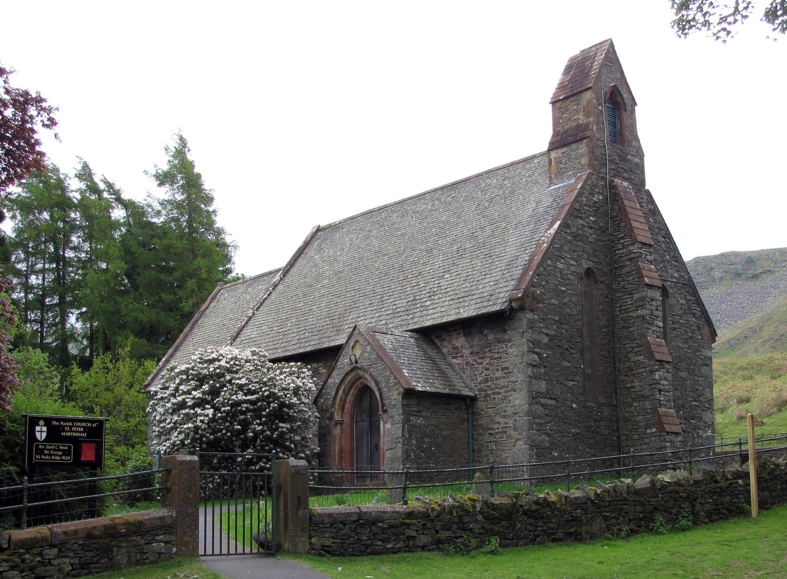
St Peter's Church, Martindale

St Peter’s Church is situated in the valley of Martindale in Cumbria, England. The church is located at the top of the hause on the minor road between...
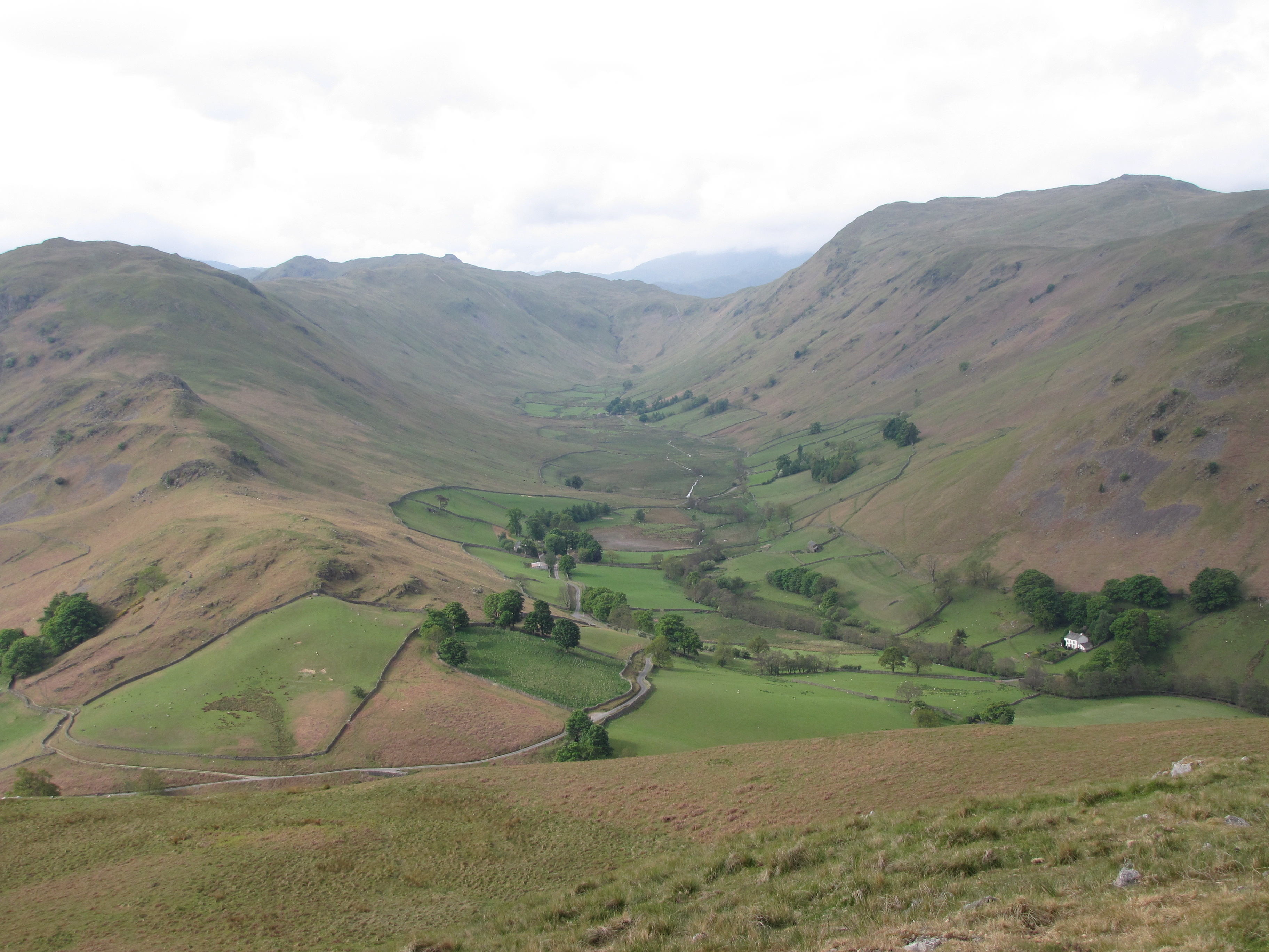
Boredale

Boredale sometimes known as Boardale, is a valley within Lake District National Park, in Cumbria, England. The valley is close to the eastern shore of...

Nearby Amenities

Located within 500m of 54.572433,-2.8900331
Sandwick
Is In: Eden, Cumbria
Place: hamlet
Lat/Long: 54.5690885/-2.8935887
Bus Stop
Sandwick Road End
Local Ref: AT
Naptan AtcoCode: 090074432927
Naptan Bearing: NE
Naptan BusStopType: CUS
Naptan CommonName: Sandwick Road End
Naptan Indicator: at
Naptan Landmark: Sandwick Road End
Naptan NaptanCode: cumdaptm
Naptan Street: No name
Naptan Verified: no
Source: naptan_import
Lat/Long: 54.568699/-2.8931188
Man Made: water_well
Lat/Long: 54.5687591/-2.8937571
Barrier: kissing_gate
Lat/Long: 54.570864/-2.8871974
Sandwick Bay
Place: locality
Lat/Long: 54.5725095/-2.8912406
Swine slacks
Place: locality
Lat/Long: 54.5710541/-2.8861337
Poetry Stones
Historic: monument
Lat/Long: 54.5726453/-2.8865451
Power: pole
Lat/Long: 54.5692083/-2.8943834
Power: pole
Lat/Long: 54.5690333/-2.8949425
The data included in this document is from www.openstreetmap.org. The data is made available under ODbL.

Have you been to Sandwick Bay?

Leave your review of Sandwick Bay below (or comments, questions and feedback).