Bay of Puldrite

Bay in Orkney

Scotland

Bay of Puldrite

Rendall towards Gairsay
Rendall towards Gairsay Credit: Catherine Morgan

Bay of Puldrite is a picturesque bay located on the southern coast of the island of Orkney in Scotland. It is situated approximately 5 miles southeast of the town of Kirkwall and is known for its stunning natural beauty and tranquil atmosphere.

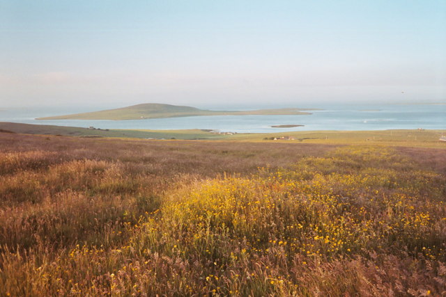
The bay is characterized by its sandy beaches, rocky outcrops, and crystal-clear turquoise waters. It offers visitors breathtaking views of the surrounding landscape, including rolling green hills and the distant islands of the Orkney archipelago. The bay is also home to an abundance of wildlife, making it a popular spot for birdwatching enthusiasts.

The Bay of Puldrite is a haven for outdoor activities such as swimming, snorkeling, and fishing. Its calm waters provide an ideal environment for water sports, while its rocky shoreline offers opportunities for exploration and rock pooling. The bay is also a designated nature reserve, protecting its diverse flora and fauna.

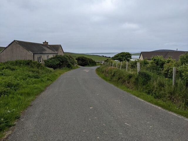
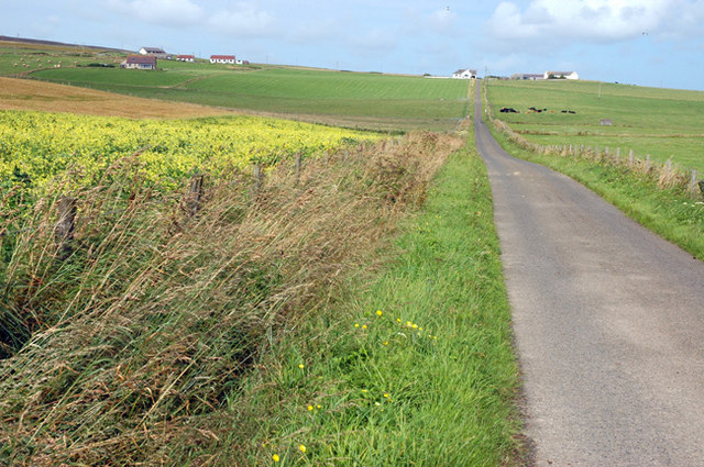
Surrounding the bay, there are several walking trails and coastal paths that offer visitors the chance to explore the area further. These paths provide access to nearby attractions such as the Brough of Birsay, a historic tidal island, and the stunning cliffs of Yesnaby.

Overall, Bay of Puldrite is a hidden gem in Orkney, offering visitors a chance to immerse themselves in the natural beauty and tranquility of Scotland's coastal landscape. Whether you seek relaxation or outdoor adventure, this bay is a must-visit destination.

If you have any feedback on the listing, please let us know in the comments section below.

Bay of Puldrite Images

Images are sourced within 2km of 59.050021/-3.0091951 or Grid Reference HY4218. Thanks to Geograph Open Source API. All images are credited.

Rendall towards Gairsay
The minor road near Quoyfree
Crookness Looking SE from position
Crookness
Looking SE from position
Bay of Puldrite Looking SW from position
Bay of Puldrite
Looking SW from position
Bay of Hinderayre Looking NNE from position
Bay of Hinderayre
Looking NNE from position
Rendall Old Cemetery Shapinsay in background
Rendall Old Cemetery
Shapinsay in background
Gorseness road at the new Rendall Cemetery The Bay of Isbister can be seen in the distance
Gorseness road at the new Rendall Cemetery
The Bay of Isbister can be seen in the distance
Corner on Gorseness road Looking toward North Aittit and North Isles
Corner on Gorseness road
Looking toward North Aittit and North Isles
Red telephone box on Gorseness Road, Rendall Still in use!
Red telephone box on Gorseness Road, Rendall
Still in use!
Noust at South Aittit Drystane boathouse on the shore of Bay of Hinderayre. In the distance is the ruined kirk and cemetery. The dark hill on the skyline is on Gairsay.
Noust at South Aittit
Drystane boathouse on the shore of Bay of Hinderayre. In the distance is the ruined kirk and cemetery. The dark hill on the skyline is on Gairsay.
Widefirth Self Catering New chalets at the farm of the Riff
Widefirth Self Catering
New chalets at the farm of the Riff
Road junction to Westshore in Rendall The road leads down to the Crookness headland. Wide Firth is seen in the distance.
Road junction to Westshore in Rendall
The road leads down to the Crookness headland. Wide Firth is seen in the distance.
The farm of Leuan in Rendall By the Bay of Isbister
The farm of Leuan in Rendall
By the Bay of Isbister
Looking north to North Aittit, Rendall
Shoreline, Bay of Isbister Looking NW along the pebble beach. Fibla Fiold on the skyline.
Shoreline, Bay of Isbister
Looking NW along the pebble beach. Fibla Fiold on the skyline.
Low cliffs At this point they are a couple of feet higher than me, about eight feet.
Low cliffs
At this point they are a couple of feet higher than me, about eight feet.
Pebble beach at low tide With Wide Firth beyond. Wideford Hill in the distance.
Pebble beach at low tide
With Wide Firth beyond. Wideford Hill in the distance.
Coastal erosion A recently exposed face.
Coastal erosion
A recently exposed face.
Show me another place!

Bay of Puldrite is located at Grid Ref: HY4218 (Lat: 59.050021, Lng: -3.0091951)

Unitary Authority: Orkney Islands

Police Authority: Highlands and Islands

What 3 Words

///utensil.relegate.hesitate. Near Rendall, Orkney Islands

Nearby Locations

Tor Ness Bay of Puldrite

Related Wikis

Rendall

Rendall (Old Norse: Rennudalr or Rennadal) is a parish on Mainland, Orkney, Scotland. It is in the north west of the island and lies east of the parishes...

Gairsay

Gairsay (Old Norse: Gáreksey) is a small island in Orkney, Scotland, located in the parish of Rendall, 1.5 miles (2.4 km) off the coast, astride one of...

Vasa Loch

Vasa Loch is a brackish lagoon in southwestern Shapinsay, Orkney Islands. (Ordnance, 2002) This water body has been shown on early maps of the island...

Sweyn Holm

Note: There is also a "Sweyn Holm" off St Ninian's Isle, Shetland Sweyn Holm is a small island in the Orkney Islands, next to Gairsay. It is thought to...

Nearby Amenities

Located within 500m of 59.050021,-3.0091951
Power: pole
Lat/Long: 59.0484902/-3.0169792
Power: pole
Lat/Long: 59.0489977/-3.0161662
Power: pole
Lat/Long: 59.0495064/-3.0153996
Power: pole
Lat/Long: 59.0500043/-3.0146514
Power: pole
Lat/Long: 59.0505499/-3.01385
Power: pole
Lat/Long: 59.0510752/-3.0128957
Power: pole
Lat/Long: 59.0515719/-3.0120155
Power: pole
Lat/Long: 59.0520424/-3.011228
Power: pole
Lat/Long: 59.0525165/-3.0103849
Power: pole
Lat/Long: 59.0531418/-3.0092685
Power: pole
Lat/Long: 59.0535778/-3.0085041
The data included in this document is from www.openstreetmap.org. The data is made available under ODbL.

Have you been to Bay of Puldrite?

Leave your review of Bay of Puldrite below (or comments, questions and feedback).