Bay of Isbister

Bay in Orkney

Scotland

Bay of Isbister

Minor road and a bungalow near Norseman's Village
Minor road and a bungalow near Norseman's Village Credit: David Medcalf

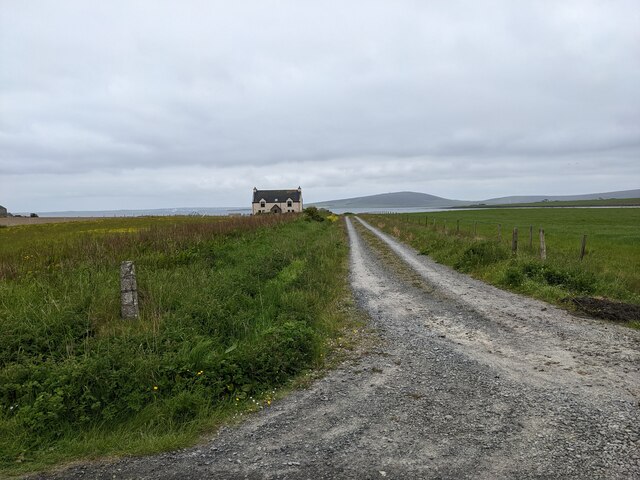
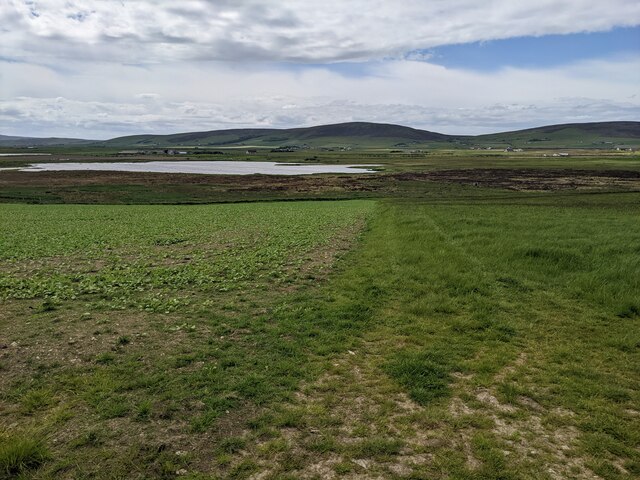
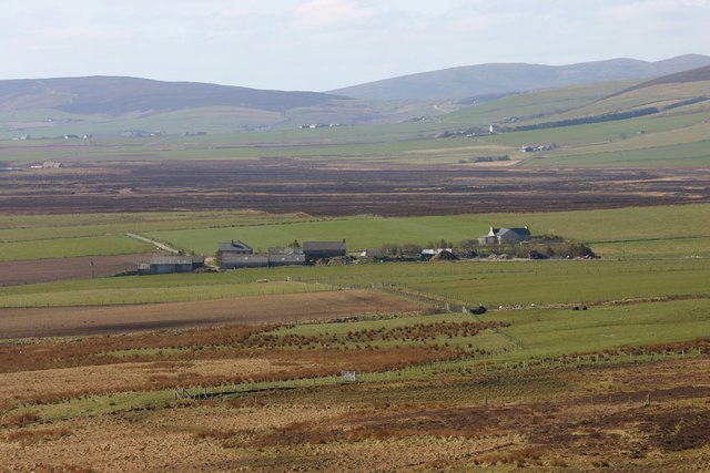
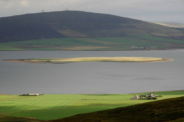
The Bay of Isbister is a picturesque bay located on the west coast of the Orkney Islands in Scotland. Nestled between the rugged cliffs and rolling hills, the bay offers stunning panoramic views of the North Atlantic Ocean. This natural harbor is surrounded by a diverse landscape, including sandy beaches, rocky shores, and fertile grasslands.

The bay is an important historical and archaeological site, with evidence of human occupation dating back thousands of years. The nearby Neolithic village of Skara Brae, a UNESCO World Heritage Site, provides a glimpse into the lives of the ancient inhabitants of the area. The bay also features several burial mounds and standing stones, adding to its rich cultural significance.

The Bay of Isbister is a haven for wildlife enthusiasts, as it is home to a wide variety of bird species, including fulmars, gulls, and oystercatchers. Seals can often be spotted basking on the rocks, while otters playfully swim in the bay's clear waters. The bay is also a popular spot for fishing, with anglers flocking to its shores in search of mackerel, cod, and haddock.

Visitors to the Bay of Isbister can enjoy leisurely walks along the sandy beaches, explore the nearby caves, or simply take in the breathtaking views of the surrounding landscape. The bay's peaceful and unspoiled atmosphere offers a tranquil escape from the bustling city life, making it a favored destination for nature lovers and those seeking a serene retreat.

If you have any feedback on the listing, please let us know in the comments section below.

Bay of Isbister Images

Images are sourced within 2km of 59.042163/-3.0432104 or Grid Reference HY4017. Thanks to Geograph Open Source API. All images are credited.

Minor road and a bungalow near Norseman's Village
A house and lane above Bay of Isbister The house is not shown on the OS map.
A house and lane above Bay of Isbister
The house is not shown on the OS map.
Looking towards the Loch of Brockan
A collection of equipment at Sandyhall It is said that Orkneymen are 'farmers who fish a bit' - which seems to be the case for the owner of this collection.
A collection of equipment at Sandyhall
It is said that Orkneymen are 'farmers who fish a bit' - which seems to be the case for the owner of this collection.
Cattle at Isbister Looking north west across pastures at Millbrig towards the distant hills of Mid Tooin and Fibla Fold.
Cattle at Isbister
Looking north west across pastures at Millbrig towards the distant hills of Mid Tooin and Fibla Fold.
Crookness Looking SE from position
Crookness
Looking SE from position
Gorseness road at the new Rendall Cemetery The Bay of Isbister can be seen in the distance
Gorseness road at the new Rendall Cemetery
The Bay of Isbister can be seen in the distance
Widefirth Self Catering New chalets at the farm of the Riff
Widefirth Self Catering
New chalets at the farm of the Riff
Road junction to Westshore in Rendall The road leads down to the Crookness headland. Wide Firth is seen in the distance.
Road junction to Westshore in Rendall
The road leads down to the Crookness headland. Wide Firth is seen in the distance.
The farm of Leuan in Rendall By the Bay of Isbister
The farm of Leuan in Rendall
By the Bay of Isbister
Shoreline, Bay of Isbister Looking NW along the pebble beach. Fibla Fiold on the skyline.
Shoreline, Bay of Isbister
Looking NW along the pebble beach. Fibla Fiold on the skyline.
Low cliffs At this point they are a couple of feet higher than me, about eight feet.
Low cliffs
At this point they are a couple of feet higher than me, about eight feet.
Pebble beach at low tide With Wide Firth beyond. Wideford Hill in the distance.
Pebble beach at low tide
With Wide Firth beyond. Wideford Hill in the distance.
Coastal erosion A recently exposed face.
Coastal erosion
A recently exposed face.
Broad Taing Crookness At the time of taking this photo, this may have been the very last piece of Orkney Mainland without a geograph.
Just 'round the corner and still within the grid Square are some interesting Graffiti Rocks <a href="https://www.geograph.org.uk/photo/2706785">HY4217 : Shoreline Graffiti - Broad Taing</a>
Broad Taing Crookness
At the time of taking this photo, this may have been the very last piece of Orkney Mainland without a geograph. Just 'round the corner and still within the grid Square are some interesting Graffiti Rocks HY4217 : Shoreline Graffiti - Broad Taing
Shoreline Graffiti - Broad Taing Almost lost on the shore and just in the square by a few metres, this flat rock, like another nearby, has been worked.
It's too clear and symmetrical to be prehistoric but it was a delightful find.
See its partner <a href="https://www.geograph.org.uk/photo/2706812">HY4117 : Shoreline Graffiti - Crookness</a>. There may be more.
Harpy Taing is seen in the picture
Shoreline Graffiti - Broad Taing
Almost lost on the shore and just in the square by a few metres, this flat rock, like another nearby, has been worked. It's too clear and symmetrical to be prehistoric but it was a delightful find. See its partner HY4117 : Shoreline Graffiti - Crookness. There may be more. Harpy Taing is seen in the picture
Shoreline Graffiti - Crookness A few metres from its partner <a href="https://www.geograph.org.uk/photo/2706785">HY4217 : Shoreline Graffiti - Broad Taing</a>, this worked stone is well below the high-water mark.
Possibly too regular and deeply etched to be pre-historic but nice to find.
This location straddles the crucial grid line.
Shoreline Graffiti - Crookness
A few metres from its partner HY4217 : Shoreline Graffiti - Broad Taing, this worked stone is well below the high-water mark. Possibly too regular and deeply etched to be pre-historic but nice to find. This location straddles the crucial grid line.
Broad Taing An uninspiring view of the shoreline. But it was an inspiring place, even in the rain, after I found the Worked Rocks nearby <a href="https://www.geograph.org.uk/photo/2706785">HY4217 : Shoreline Graffiti - Broad Taing</a>
Broad Taing
An uninspiring view of the shoreline. But it was an inspiring place, even in the rain, after I found the Worked Rocks nearby HY4217 : Shoreline Graffiti - Broad Taing
Show me another place!

Bay of Isbister is located at Grid Ref: HY4017 (Lat: 59.042163, Lng: -3.0432104)

Unitary Authority: Orkney Islands

Police Authority: Highlands and Islands

What 3 Words

///results.named.crockery. Near Rendall, Orkney Islands

Nearby Locations

Bay of Isbister

Related Wikis

Rendall

Rendall (Old Norse: Rennudalr or Rennadal) is a parish on Mainland, Orkney, Scotland. It is in the north west of the island and lies east of the parishes...

Damsay

Damsay is an islet in the Orkney archipelago in Scotland. It is approximately 18 hectares (0.07 sq mi) in extent and rises to only 11 metres (36 ft) above...

Holm of Grimbister

Holm of Grimbister is an inhabited tidal islet in the Orkney archipelago of Scotland. Located in the Bay of Firth near Finstown it is connected to Mainland...

Rennibister Earth House

Rennibister Earth House is an Iron Age underground structure known as a souterrain. It is located on the Mainland of Orkney, in Scotland. The monument...

Nearby Amenities

Located within 500m of 59.042163,-3.0432104
Bay of Isbister
Natural: bay
Lat/Long: 59.0404881/-3.0414878
The data included in this document is from www.openstreetmap.org. The data is made available under ODbL.

Have you been to Bay of Isbister?

Leave your review of Bay of Isbister below (or comments, questions and feedback).