Orphir Bay
Bay in Orkney
Scotland
Orphir Bay

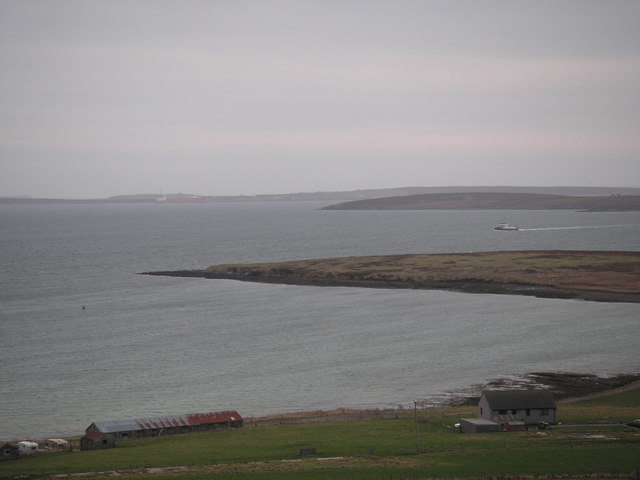
Orphir Bay is a picturesque bay located on the south coast of the Orkney Mainland, Scotland. It is situated in the parish of Orphir, near the village of Stenness. The bay is renowned for its stunning natural beauty, with its calm waters and sweeping views of the surrounding landscapes.
The bay is flanked by rolling green hills, providing a tranquil and idyllic setting for visitors. The beach at Orphir Bay is a mix of sand and pebbles, perfect for leisurely walks or relaxing picnics. It is also a popular spot for birdwatching, as the bay attracts a variety of seabirds and waders.
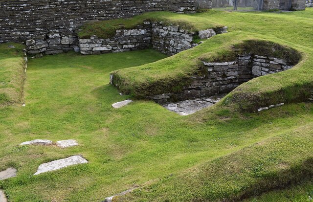
One of the main attractions of Orphir Bay is the remains of the Orphir Round Church, known as the Orkneyinga Saga Centre. This 12th-century church is a significant historical site, once part of a larger complex that served as the religious center for Orkney's Norse rulers. The ruins are now open to the public, offering insight into the island's rich Viking heritage.
Visitors to Orphir Bay can also explore the nearby Neolithic sites, such as the Standing Stones of Stenness and the Ring of Brodgar. These ancient stone circles are part of the UNESCO World Heritage Site known as the Heart of Neolithic Orkney.
Overall, Orphir Bay is a captivating destination that combines natural beauty with historical significance. Whether it's enjoying the serene beach, marveling at the ancient ruins, or immersing oneself in Orkney's fascinating history, visitors to Orphir Bay are sure to be captivated by its charm.
If you have any feedback on the listing, please let us know in the comments section below.
Orphir Bay Images
Images are sourced within 2km of 58.919388/-3.1565178 or Grid Reference HY3304. Thanks to Geograph Open Source API. All images are credited.


![Postbox New Romec postbox [KW17 13] above the ferry terminal at Houton](https://s2.geograph.org.uk/geophotos/04/63/24/4632454_7c9cd837.jpg)

Orphir Bay is located at Grid Ref: HY3304 (Lat: 58.919388, Lng: -3.1565178)
Unitary Authority: Orkney Islands
Police Authority: Highlands and Islands
What 3 Words
///flagging.term.pleaser. Near Orphir, Orkney Islands
Nearby Locations
Related Wikis
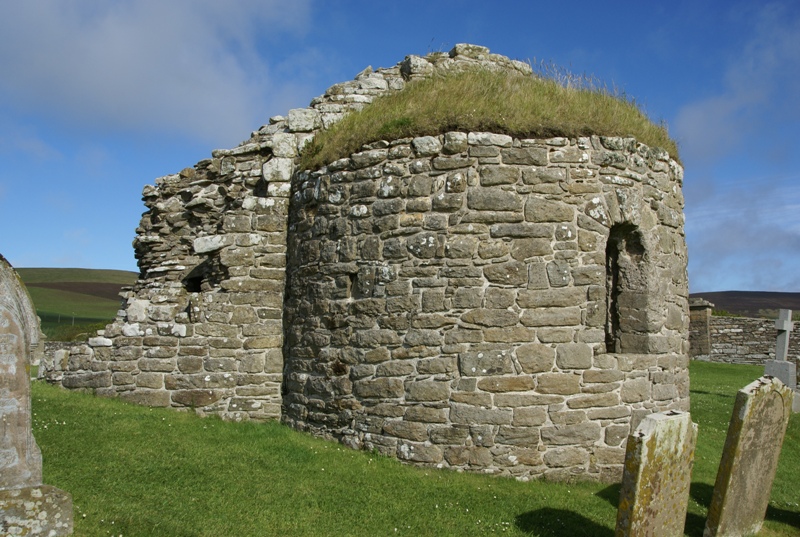
Orphir Round Church
The remains of the Orphir Round Church (or Round Kirk), also St Nicholas's Church, are located in Orphir Parish on the Mainland, Orkney, Scotland. It has...

Orphir
Orphir (pronounced , Old Norse: Jorfjara/Orfjara) is a parish and settlement on Mainland, Orkney, Scotland. It is approximately 9 miles (14 kilometres...
Houton
Houton is a settlement 5 miles (8.0 km) southeast of Stromness on the island of Mainland, Orkney, Scotland. The settlement is within the parish of Orphir...
Holm of Houton
The Holm of Houton is one of the southern Orkney islands. == Geography == The Holm is in Midland Harbour, part of Scapa Flow. It is south of the Mainland...
Nearby Amenities
Located within 500m of 58.919388,-3.1565178Have you been to Orphir Bay?
Leave your review of Orphir Bay below (or comments, questions and feedback).