Bay of Ireland

Bay in Orkney

Scotland

Bay of Ireland

Ness and the Hills of Hoy Ness is one of many houses, farmsteads and cottages, commanding wonderful views, along this shoreline.
Ness and the Hills of Hoy Credit: Derek Mayes

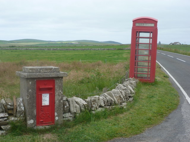
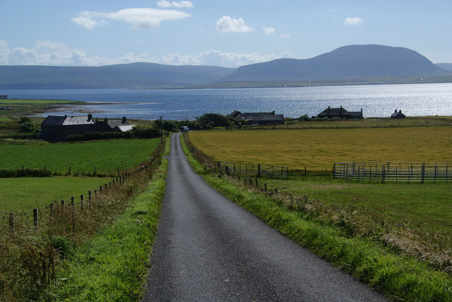
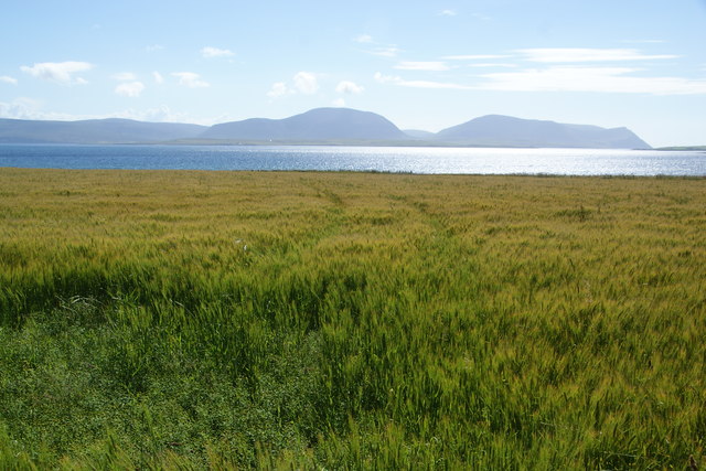
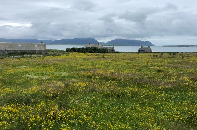
Bay of Ireland is a picturesque bay located on the west coast of the Orkney Mainland, the largest island in the Orkney archipelago, Scotland. This bay is nestled between two headlands, known as Point of Ness and Point of Westness, providing a natural shelter from the strong Atlantic currents and winds. The bay derives its name from the fact that it faces towards Ireland, approximately 400 kilometers to the southwest.

With its stunning sandy beaches and crystal-clear blue waters, the Bay of Ireland is a popular destination for locals and tourists alike. The bay offers breathtaking panoramic views of the surrounding rugged coastline and the nearby islands. It is also home to a diverse range of wildlife, including seals, seabirds, and occasionally even dolphins and whales.

The Bay of Ireland is steeped in history, with numerous archaeological sites in its vicinity. Notably, the nearby Broch of Gurness is an Iron Age settlement that provides a glimpse into the ancient way of life in Orkney. Visitors can explore the remains of stone houses, defensive walls, and even a well-preserved underground passage.

The bay also offers various recreational activities for visitors. Beachcombing, picnicking, and swimming are popular during the summer months, while birdwatching and nature walks are enjoyed year-round. The Bay of Ireland truly exemplifies the natural beauty and rich history that the Orkney Islands have to offer.

If you have any feedback on the listing, please let us know in the comments section below.

Bay of Ireland Images

Images are sourced within 2km of 58.968478/-3.2486307 or Grid Reference HY2809. Thanks to Geograph Open Source API. All images are credited.

Ness and the Hills of Hoy Ness is one of many houses, farmsteads and cottages, commanding wonderful views, along this shoreline.
Ness and the Hills of Hoy
Ness is one of many houses, farmsteads and cottages, commanding wonderful views, along this shoreline.
FarmSpread The spread of farm buildings at Coldomo
FarmSpread
The spread of farm buildings at Coldomo
Garson Farm  Horse Mill This 19th Century Farm has a Horse Mill <span class="nowrap"><a title="http://en.wikipedia.org/wiki/Horse_mill" rel="nofollow ugc noopener" href="http://en.wikipedia.org/wiki/Horse_mill">Link</a><img style="margin-left:2px;" alt="External link" title="External link - shift click to open in new window" src="https://s1.geograph.org.uk/img/external.png" width="10" height="10"/></span>
The Farm is close to Garson House, itself an historic building overlooking The Bay of Navershaw, Cairston Roads and North Hoy
Garson Farm Horse Mill
This 19th Century Farm has a Horse Mill LinkExternal link The Farm is close to Garson House, itself an historic building overlooking The Bay of Navershaw, Cairston Roads and North Hoy
Stenness: postbox № KW16 11 and phone, Mill of Ireland These two red objects stand by the A964 and both probably see very little use. The postbox is a George V-reign specimen and is emptied at 12:30 on weekday and Saturday lunchtimes.
Stenness: postbox № KW16 11 and phone, Mill of Ireland
These two red objects stand by the A964 and both probably see very little use. The postbox is a George V-reign specimen and is emptied at 12:30 on weekday and Saturday lunchtimes.
Road to Hall of Ireland Hall of Ireland is the settlement at the bottom. The Bay of Ireland is beyond, between here and Hoy.
Road to Hall of Ireland
Hall of Ireland is the settlement at the bottom. The Bay of Ireland is beyond, between here and Hoy.
Field of barley near Hall of Ireland It has a way to go yet before it is ripe. The Bay of Ireland lies beyond.
Field of barley near Hall of Ireland
It has a way to go yet before it is ripe. The Bay of Ireland lies beyond.
Arable fields at Ireland The area is called Ireland, being a collection of isolated farms. The hillside is the lower part of the high ground around Ward Hill, which can be seen ahead.
Arable fields at Ireland
The area is called Ireland, being a collection of isolated farms. The hillside is the lower part of the high ground around Ward Hill, which can be seen ahead.
Barley field near Hall of Ireland It overlooks the Bay of Ireland and Hoy.
Barley field near Hall of Ireland
It overlooks the Bay of Ireland and Hoy.
Garson Industrial Estate The entrance here describes it as a food park. It is on the edge of Stromness.
Garson Industrial Estate
The entrance here describes it as a food park. It is on the edge of Stromness.
The A964 heading for Stromness Many roads on Orkney Mainland are surprisingly straight, given that the Romans never got this far north! Of course there is plenty of open space.
The A964 heading for Stromness
Many roads on Orkney Mainland are surprisingly straight, given that the Romans never got this far north! Of course there is plenty of open space.
A964 at Mill of Ireland, Orkney
The A964 near Bea
The A964 near Bea
Coldomo Farm Stromness is on the headland on the right
Coldomo Farm
Stromness is on the headland on the right
Hall of Ireland Hoy and Stromness in the background
Hall of Ireland
Hoy and Stromness in the background
Hall of Ireland There doesn't seem to be a hall here, but the name is applied to the farm.
Hall of Ireland
There doesn't seem to be a hall here, but the name is applied to the farm.
Cottage near Hall of Ireland An abandoned cottage with a good view towards Hoy. If it were not for the bank of haar there would also be a view of Graemsay.
Cottage near Hall of Ireland
An abandoned cottage with a good view towards Hoy. If it were not for the bank of haar there would also be a view of Graemsay.
Garson House The house dates from the early 19th century and, like the adjacent and contemporary farm house, outbuildings and horse mill, it is Category B Listed. See <span class="nowrap"><a title="https://portal.historicenvironment.scot/designation/LB41834" rel="nofollow ugc noopener" href="https://portal.historicenvironment.scot/designation/LB41834">Link</a><img style="margin-left:2px;" alt="External link" title="External link - shift click to open in new window" src="https://s1.geograph.org.uk/img/external.png" width="10" height="10"/></span> for details.
Garson House
The house dates from the early 19th century and, like the adjacent and contemporary farm house, outbuildings and horse mill, it is Category B Listed. See LinkExternal link for details.
Ramsquoy
Ramsquoy
Show me another place!

Bay of Ireland is located at Grid Ref: HY2809 (Lat: 58.968478, Lng: -3.2486307)

Unitary Authority: Orkney Islands

Police Authority: Highlands and Islands

What 3 Words

///cakewalk.replied.hypnotist. Near Stenness, Orkney Islands

Related Wikis

Mill of Ayreland

The Mill of Ayreland is an historic watermill driven by water force of the Burn of Ayreland, a northwesterly flowing coastal stream within Mainland Orkney...

Cairston

Cairston is a village on Mainland, in Orkney, Scotland. The settlement is within the parish of Stromness. == References == == External links == Canmore...

Burn of Ayreland

The Burn of Ayreland (or Ireland) is a northwesterly flowing coastal stream on Mainland Orkney, Scotland, that discharges to the Clestrain Sound about...

Unstan Chambered Cairn

Unstan (or Onstan, or Onston) is a Neolithic chambered cairn located about 2 mi (3 km) north-east of Stromness on Mainland, Orkney, Scotland. The tomb...

Inner Holm

Inner Holm is a small inhabited island in Stromness harbour and one of the Orkney islands of Scotland. It is about 350 metres (1,150 ft) east of the harbour...

Hall of Clestrain

The Hall of Clestrain is a house in the parish of Orphir, Orkney, Scotland. The house was the birthplace of the explorer John Rae in 1813. Currently...

Pier Arts Centre

The Pier Arts Centre is an art gallery and museum in Stromness, Orkney, Scotland. It was established in 1979 to provide a home for an important collection...

European Marine Energy Centre

The European Marine Energy Centre (EMEC) Ltd is a UKAS accredited test and research center focused on wave and tidal power development, based in the Orkney...

Nearby Amenities

Located within 500m of 58.968478,-3.2486307
Bay of Ireland
Natural: bay
Lat/Long: 58.9683313/-3.2512665
The data included in this document is from www.openstreetmap.org. The data is made available under ODbL.

Have you been to Bay of Ireland?

Leave your review of Bay of Ireland below (or comments, questions and feedback).