Bay of Navershaw

Bay in Orkney

Scotland

Bay of Navershaw

Pier Arts Centre, Stromness
Pier Arts Centre, Stromness Credit: Graeme Yuill

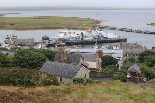
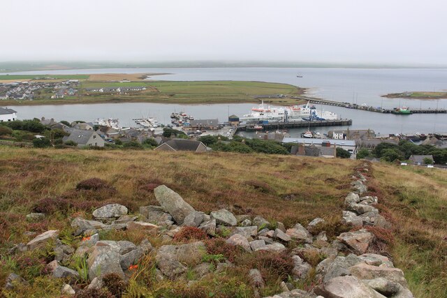
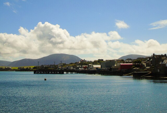
The Bay of Navershaw is a picturesque inlet located on the eastern coast of the Orkney Islands in Scotland. It is situated between the parishes of Deerness and St. Andrews, and is known for its stunning natural beauty and rich historical significance.

Surrounded by rugged cliffs and rolling green hills, the Bay of Navershaw offers breathtaking panoramic views of the North Sea. Its calm and clear waters provide a haven for wildlife, making it a popular spot for birdwatching and seal spotting. The bay is also home to a diverse range of marine species, including various fish and shellfish.

Navershaw Bay has deep historical roots, with evidence of human occupation dating back thousands of years. The area is dotted with ancient archaeological sites, such as the remains of a Neolithic chambered cairn and a Pictish broch. These sites offer a glimpse into the lives of the people who once inhabited the area and provide valuable insight into the region's past.

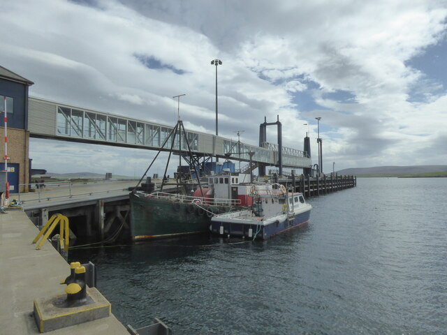
Today, the Bay of Navershaw attracts visitors from all over the world who come to admire its natural wonders and explore its historical sites. Hiking trails along the cliffs offer breathtaking views, and the nearby sandy beaches provide opportunities for leisurely walks and picnics. The bay is also a popular spot for fishing and boating enthusiasts.

In summary, the Bay of Navershaw is a captivating destination that combines stunning natural beauty with a rich historical heritage. Its tranquil waters, scenic vistas, and ancient sites make it a must-visit location for nature lovers and history enthusiasts alike.

If you have any feedback on the listing, please let us know in the comments section below.

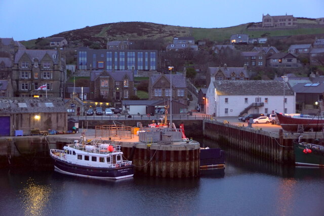
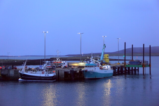
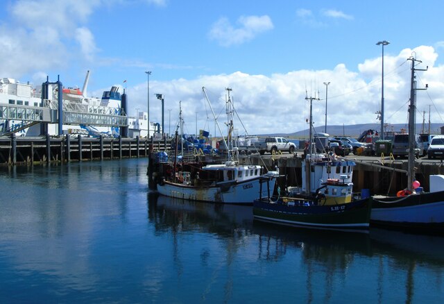
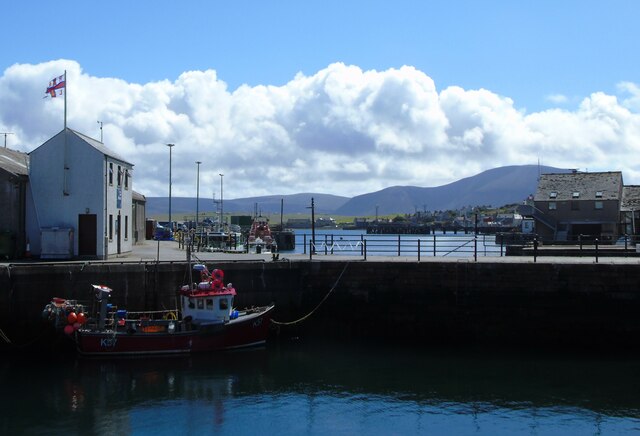
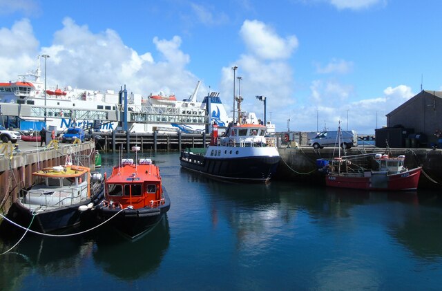
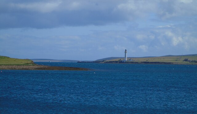
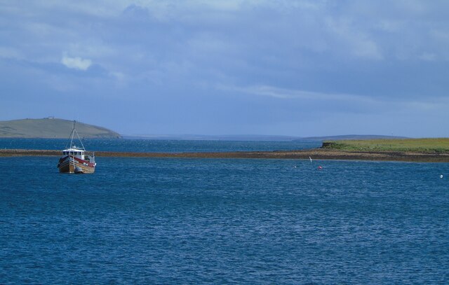
Bay of Navershaw Images

Images are sourced within 2km of 58.962441/-3.2717649 or Grid Reference HY2609. Thanks to Geograph Open Source API. All images are credited.

Pier Arts Centre, Stromness
MV Hamnavoe, Stromness Harbour
Stromness Harbour From Brinkies Brae
Stromness Harbour
From Brinkies Brae
Pier Arts Centre Extension, Stromness Designed by Reiach and Hall Architects
Pier Arts Centre Extension, Stromness
Designed by Reiach and Hall Architects
Navigation Light, Hellihole Road, Stromness
Stromness harbour
Stromness harbour
Copland's Dock, Stromness
Stromness Harbour (1) Stromness harbour and ferry terminal, Orkney. The ferry is the MV Hamnavoe which plies the Stromness-Scrabster route. The fishing boat to the left in the foreground is bringing in its catch of mussels.
Stromness Harbour (1)
Stromness harbour and ferry terminal, Orkney. The ferry is the MV Hamnavoe which plies the Stromness-Scrabster route. The fishing boat to the left in the foreground is bringing in its catch of mussels.
Stromness Harbour (2) Stromness Harbour and the Stromness RNLI station, Orkney. The Ness can be seen beyond and Graemsay with Hoy rising above it on the horizon.
Stromness Harbour (2)
Stromness Harbour and the Stromness RNLI station, Orkney. The Ness can be seen beyond and Graemsay with Hoy rising above it on the horizon.
Stromness Harbour (3) Stromness Harbour, Orkney. The NorthLink MV Hamnavoe is docked on the North Pier ahead and the Graemsay ferry is docked on the South Pier to my right.
Stromness Harbour (3)
Stromness Harbour, Orkney. The NorthLink MV Hamnavoe is docked on the North Pier ahead and the Graemsay ferry is docked on the South Pier to my right.
Hoy Sound (High) Lighthouse Hoy Sound (High) Lighthouse, Graemsay, as seen (in zoom) from the end of the South Pier, Stromness Harbour, Orkney. Part of the small, low island  of Outer Holm can be seen on the left and Hoy is on the horizon.
Hoy Sound (High) Lighthouse
Hoy Sound (High) Lighthouse, Graemsay, as seen (in zoom) from the end of the South Pier, Stromness Harbour, Orkney. Part of the small, low island of Outer Holm can be seen on the left and Hoy is on the horizon.
The Holms, Stromness Harbour The Holms as seen (in zoom) from the end of the South Pier, Stromness Harbour, Orkney. Clestrain Sound leads out to Houton Head to the left of shot.
The Holms, Stromness Harbour
The Holms as seen (in zoom) from the end of the South Pier, Stromness Harbour, Orkney. Clestrain Sound leads out to Houton Head to the left of shot.
Stromness (south) I am looking from the end of the South Pier, Stromness Harbour, Orkney, to the southern end of the town and the Ness beyond. The distinctive outlines of the hills of Hoy rise up in the distance.
Stromness (south)
I am looking from the end of the South Pier, Stromness Harbour, Orkney, to the southern end of the town and the Ness beyond. The distinctive outlines of the hills of Hoy rise up in the distance.
Graham Place, Stromness, Orkney
Boats in Stromness Harbour, Orkney
Houses above Stromness The round part is a characteristic of Orkney houses and was once a kiln for drying grain.
Houses above Stromness
The round part is a characteristic of Orkney houses and was once a kiln for drying grain.
A navigation marker on Hellihole Road
The lower navigation marker on Hellihole Road There are two such markers on the road side. Boats approaching Stromness would line them up to give a safe passage into or out of the harbour approach.
The lower navigation marker on Hellihole Road
There are two such markers on the road side. Boats approaching Stromness would line them up to give a safe passage into or out of the harbour approach.
Show me another place!

Bay of Navershaw is located at Grid Ref: HY2609 (Lat: 58.962441, Lng: -3.2717649)

Unitary Authority: Orkney Islands

Police Authority: Highlands and Islands

What 3 Words

///clicker.medium.outgoing. Near Stromness, Orkney Islands

Nearby Locations

Bay of Navershaw

Related Wikis

Inner Holm

Inner Holm is a small inhabited island in Stromness harbour and one of the Orkney islands of Scotland. It is about 350 metres (1,150 ft) east of the harbour...

Cairston

Cairston is a village on Mainland, in Orkney, Scotland. The settlement is within the parish of Stromness. == References == == External links == Canmore...
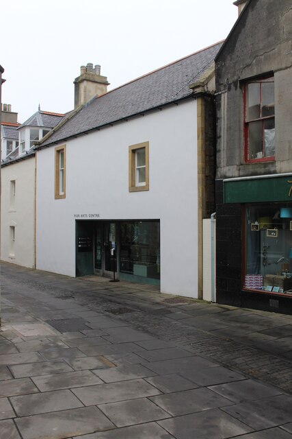
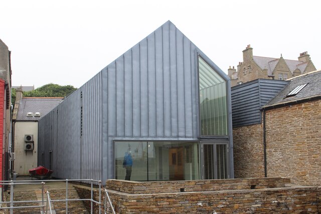
Pier Arts Centre

The Pier Arts Centre is an art gallery and museum in Stromness, Orkney, Scotland. It was established in 1979 to provide a home for an important collection...

European Marine Energy Centre

The European Marine Energy Centre (EMEC) Ltd is a UKAS accredited test and research center focused on wave and tidal power development, based in the Orkney...

Nearby Amenities

Located within 500m of 58.962441,-3.2717649
Bay of Navershaw
Natural: bay
Lat/Long: 58.9631098/-3.27487
Bu' Point
Place: locality
Lat/Long: 58.96267/-3.2639372
Generator Method: wind_turbine
Generator Source: wind
Power: generator
Lat/Long: 58.9646948/-3.2657898
Generator Method: wind_turbine
Generator Source: wind
Power: generator
Lat/Long: 58.964614/-3.265234
Generator Method: wind_turbine
Generator Source: wind
Power: generator
Lat/Long: 58.9647755/-3.2649851
Broch (Iron Age), Souterrain (Prehistoric)
Historic: archaeological_site
Lat/Long: 58.965562/-3.2713803
The data included in this document is from www.openstreetmap.org. The data is made available under ODbL.

Have you been to Bay of Navershaw?

Leave your review of Bay of Navershaw below (or comments, questions and feedback).