Bay of Sandside

Bay in Orkney

Scotland

Bay of Sandside

Hoy Low Lighthouse, Graemesay
Hoy Low Lighthouse, Graemesay Credit: Mike Pennington

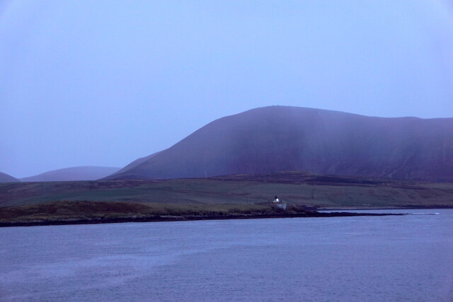
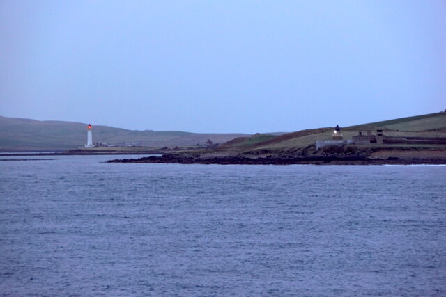
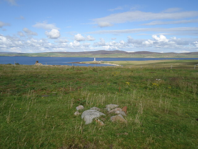
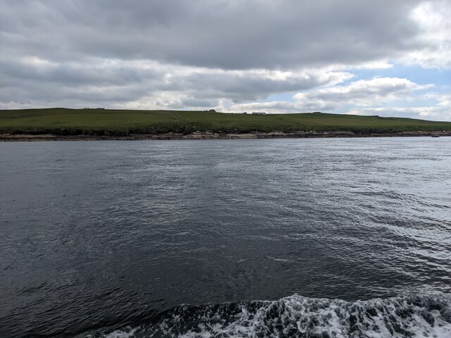
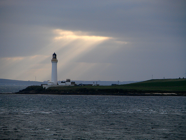
The Bay of Sandside, located on the western coast of the Orkney mainland in Scotland, is a picturesque and tranquil bay renowned for its natural beauty and historical significance. Nestled between the rugged cliffs and rolling green hills, the bay offers stunning panoramic views of the North Atlantic Ocean.

The bay's sandy beach stretches for approximately 1.5 kilometers and is a popular spot for locals and tourists alike. The pristine sands are ideal for leisurely strolls, picnics, and sunbathing during the summer months. The crystal-clear waters are also inviting for swimmers, although caution is advised due to strong currents.

Bay of Sandside is rich in wildlife and is a haven for birdwatchers. The bay is home to a variety of seabirds, including fulmars, guillemots, razorbills, and kittiwakes. Visitors can enjoy observing these magnificent creatures in their natural habitat.

The bay is also steeped in history, with archaeological sites dating back thousands of years. The nearby Skara Brae, a prehistoric village, is a UNESCO World Heritage Site and offers a fascinating glimpse into Neolithic life. Other notable historical sites in the area include the Ring of Brodgar, a stone circle, and the Stones of Stenness.

In addition to its natural and historical attractions, the Bay of Sandside offers a peaceful and serene atmosphere, making it an idyllic setting for relaxation and reflection. Whether exploring the sandy shores, admiring the breathtaking views, or immersing oneself in the rich history, visitors to Bay of Sandside are sure to be captivated by its charm and natural wonders.

If you have any feedback on the listing, please let us know in the comments section below.

Bay of Sandside Images

Images are sourced within 2km of 58.937741/-3.2782927 or Grid Reference HY2606. Thanks to Geograph Open Source API. All images are credited.

Hoy Low Lighthouse, Graemesay
Hoy Low and Hoy High Lighthouses, Graemesay
The summit of West Hill, Graemsay Looking past the Sandside Lighthouse to Mid Hill and Ward Hill on Orkney Mainland.
The summit of West Hill, Graemsay
Looking past the Sandside Lighthouse to Mid Hill and Ward Hill on Orkney Mainland.
The western shore of Graemsay I see from the map that the farm just visible in the distance is called 'Windywalls'. Probably a very apt name!
The western shore of Graemsay
I see from the map that the farm just visible in the distance is called 'Windywalls'. Probably a very apt name!
The lighthouse at Point of Oxan
The Skerry of Ness The white pole is a navigation mark on the edge of the reef. Taken from the Hoy ferry.
The Skerry of Ness
The white pole is a navigation mark on the edge of the reef. Taken from the Hoy ferry.
The southern end of Outer Holm Where the high point of 8m is located.
The southern end of Outer Holm
Where the high point of 8m is located.
The lighthouse at Sandside, Graemsay From across Hoy Sound
The lighthouse at Sandside, Graemsay
From across Hoy Sound
Point of Ness The last headland before entering harbour at Stromness, with the bulky outline of Hoy in the distance.
Point of Ness
The last headland before entering harbour at Stromness, with the bulky outline of Hoy in the distance.
North Cardinal Buoy and Hoy Sound (High) Lighthouse The north cardinal buoy, its two triangles pointing upwards and its black over yellow colour scheme, has a white light which flashes quickly continuously.
The characteristic of the lighthouse is an occulting light (ie it is more off than on) having red and white sectors which flashes every 8 seconds.
North Cardinal Buoy and Hoy Sound (High) Lighthouse
The north cardinal buoy, its two triangles pointing upwards and its black over yellow colour scheme, has a white light which flashes quickly continuously. The characteristic of the lighthouse is an occulting light (ie it is more off than on) having red and white sectors which flashes every 8 seconds.
Skerry of Ness beacon Navigation beacon marking the location of the rocky outcrop near the Point of Ness.  The beacon has a white sector and a smaller green sector which can be seen in the dark as the beacon flashes once every four seconds.  The green sector generally points westwards.
Skerry of Ness beacon
Navigation beacon marking the location of the rocky outcrop near the Point of Ness. The beacon has a white sector and a smaller green sector which can be seen in the dark as the beacon flashes once every four seconds. The green sector generally points westwards.
Taing of Sandside lighthouse On Graemsay Island, viewed from the ferry just entering Stromness Harbour.
Taing of Sandside lighthouse
On Graemsay Island, viewed from the ferry just entering Stromness Harbour.
A relatively intact gun emplacement at Point of Ness, Stromness
Mowing the green at Stromness Golf Course
A view from Point of Ness Looking towards Hoy. The light at Point of Oxan on Graemsay is seen in the centre. Hoy is beyond that. Stromness golf course is on the right.
A view from Point of Ness
Looking towards Hoy. The light at Point of Oxan on Graemsay is seen in the centre. Hoy is beyond that. Stromness golf course is on the right.
The Ness campsite at Point of Ness, Stromness
Point and Skerry of Ness With Stromness to the left and the beacon on the skerry to the right.
Point and Skerry of Ness
With Stromness to the left and the beacon on the skerry to the right.
Hoy Sound, and the beacon on the Skerry of Ness Looking across the sound to Cuilags on Hoy, and the Hoy Low Light on Graemsay.
Hoy Sound, and the beacon on the Skerry of Ness
Looking across the sound to Cuilags on Hoy, and the Hoy Low Light on Graemsay.
Show me another place!

Bay of Sandside is located at Grid Ref: HY2606 (Lat: 58.937741, Lng: -3.2782927)

Unitary Authority: Orkney Islands

Police Authority: Highlands and Islands

What 3 Words

///bleat.upward.yachting. Near Stromness, Orkney Islands

Related Wikis

Graemsay

Graemsay () is an island in the western approaches to Scapa Flow, in the Orkney Islands of Scotland. The island has two lighthouses. Graemsay lies within...

Clestrain Sound

Clestrain Sound is a strait between Mainland Orkney and the Isle of Graemsay within the Orkney Islands, Scotland.Clestrain Sound lies in the western entrance...

Inner Holm

Inner Holm is a small inhabited island in Stromness harbour and one of the Orkney islands of Scotland. It is about 350 metres (1,150 ft) east of the harbour...

Stromness Museum

Stromness Museum is a small independent museum in the town of Stromness in Orkney, Scotland focusing on the town's connections to maritime and natural...

Stromness

Stromness (locally , Old Norse: Straumnes; Norn: Stromnes) is the second-most populous town in Orkney, Scotland. It is in the southwestern part of Mainland...

Pier Arts Centre

The Pier Arts Centre is an art gallery and museum in Stromness, Orkney, Scotland. It was established in 1979 to provide a home for an important collection...

European Marine Energy Centre

The European Marine Energy Centre (EMEC) Ltd is a UKAS accredited test and research center focused on wave and tidal power development, based in the Orkney...

Hall of Clestrain

The Hall of Clestrain is a house in the parish of Orphir, Orkney, Scotland. The house was the birthplace of the explorer John Rae in 1813. Currently...

Nearby Amenities

Located within 500m of 58.937741,-3.2782927
Hoy High Lighthouse
Man Made: lighthouse
Seamark Light 1 Category: upper
Seamark Light 1 Character: Oc
Seamark Light 1 Colour: red
Seamark Light 1 Height: 35
Seamark Light 1 Period: 8
Seamark Light 1 Range: 16
Seamark Light 1 Sector End: 112
Seamark Light 1 Sector Start: 97
Seamark Light 1 Sequence: 6+(2)
Seamark Light 2 Category: upper
Seamark Light 2 Character: Oc
Seamark Light 2 Colour: white
Seamark Light 2 Height: 35
Seamark Light 2 Period: 8
Seamark Light 2 Range: 20
Seamark Light 2 Sector End: 163
Seamark Light 2 Sector Start: 112
Seamark Light 2 Sequence: 6+(2)
Seamark Light 3 Category: upper
Seamark Light 3 Character: Oc
Seamark Light 3 Colour: red
Seamark Light 3 Height: 35
Seamark Light 3 Period: 8
Seamark Light 3 Range: 16
Seamark Light 3 Sector End: 178
Seamark Light 3 Sector Start: 163
Seamark Light 3 Sequence: 6+(2)
Seamark Light 4 Category: upper
Seamark Light 4 Character: Oc
Seamark Light 4 Colour: white
Seamark Light 4 Height: 35
Seamark Light 4 Period: 8
Seamark Light 4 Range: 20
Seamark Light 4 Sector End: 332
Seamark Light 4 Sector Start: 178
Seamark Light 4 Sequence: 6+(2)
Seamark Light Reference: A 3644.1
Seamark Name: Hoy High
Seamark Type: light_major
Source: Bing
Wikidata: Q14906863
Lat/Long: 58.9356656/-3.2732917
Power: pole
Lat/Long: 58.9344714/-3.2753447
Power: pole
Lat/Long: 58.9336977/-3.2747197
Taing of Sandside
Place: locality
Lat/Long: 58.9369498/-3.2766904
Post Office
Graemsay Post Office
Addr City: Stromness
Addr Housename: Hoy House Lighthouse
Addr Housenumber: 1
Addr Postcode: KW16 3NG
Addr Street: Hoy High
Addr Suburb: Graemsay
Brand: Post Office
Brand Wikidata: Q1783168
Check Date: 2023-09-27
Check Date Opening Hours: 2023-09-27
Opening Hours: Mo 07:30-09:30; We 07:30-09:30; Fr 07:30-09:30
Ref Pol Id: 96588
Website: https://www.postoffice.co.uk/branch-finder/1488457/graemsay
Lat/Long: 58.9352824/-3.2726388
The data included in this document is from www.openstreetmap.org. The data is made available under ODbL.

Have you been to Bay of Sandside?

Leave your review of Bay of Sandside below (or comments, questions and feedback).