Bathinghouse Bay

Bay in Kirkcudbrightshire

Scotland

Bathinghouse Bay

Lane towards Mutehill This country lane flirts with this grid square, being inside it for some 200m here and for a similar length at the NW corner of the grid square.
Lane towards Mutehill Credit: Gordon Hatton

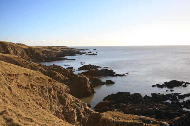
Bathinghouse Bay is a picturesque coastal location situated in the region of Kirkcudbrightshire, Scotland. This bay is known for its stunning natural beauty, making it a popular destination for locals and tourists alike. With its calm waters and sandy beach, Bathinghouse Bay offers a tranquil and idyllic setting for visitors to relax and enjoy the surrounding scenery.

The bay takes its name from the historic bathing house that once stood on its shores. This structure served as a changing room and storage facility for bathers during the Victorian era when sea bathing was a popular recreational activity. Although the bathing house is no longer present, the bay still retains its historical charm and significance.

The beach at Bathinghouse Bay stretches for approximately half a kilometer and is composed of fine golden sand, perfect for sunbathing and building sandcastles. The bay is also home to a variety of marine life, making it a great spot for snorkeling and exploring the underwater world.

Surrounded by rolling green hills and rugged cliffs, Bathinghouse Bay offers breathtaking panoramic views of the surrounding landscape. The bay is also a prime location for birdwatching, with various seabirds and waders frequenting the area.

Access to Bathinghouse Bay is relatively easy, with a nearby car park and a well-maintained footpath leading to the beach. Facilities such as toilets and picnic areas are available for visitors, ensuring a comfortable and enjoyable experience.

Overall, Bathinghouse Bay in Kirkcudbrightshire is a hidden gem along the Scottish coastline, offering visitors a chance to immerse themselves in nature and enjoy a relaxing day by the sea.

If you have any feedback on the listing, please let us know in the comments section below.

Bathinghouse Bay Images

Images are sourced within 2km of 54.792808/-4.0666306 or Grid Reference NX6746. Thanks to Geograph Open Source API. All images are credited.
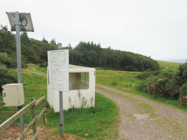
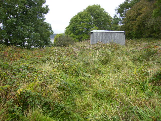
Lane towards Mutehill This country lane flirts with this grid square, being inside it for some 200m here and for a similar length at the NW corner of the grid square.
Lane towards Mutehill
This country lane flirts with this grid square, being inside it for some 200m here and for a similar length at the NW corner of the grid square.
Military training area, access point No red flag and no sentry on duty at the little hut, so one could venture into the danger area.
Military training area, access point
No red flag and no sentry on duty at the little hut, so one could venture into the danger area.
Edge of the danger area A short stroll down the track from the road [no red flag flying] and one could photograph the track that leads towards the coast near Torrs Point.
Edge of the danger area
A short stroll down the track from the road [no red flag flying] and one could photograph the track that leads towards the coast near Torrs Point.
Farmland near Torrs Green pastures between the coast and Castle Hill.
Farmland near Torrs
Green pastures between the coast and Castle Hill.
Long Robin, Dee Estuary Rocky foreshore at Long Robin on the River Dee Estuary, looking NNW towards St Mary's Isle and Kirkcudbright.
Long Robin, Dee Estuary
Rocky foreshore at Long Robin on the River Dee Estuary, looking NNW towards St Mary's Isle and Kirkcudbright.
Kirkcudbright Lifeboat Station Looking SW across the Dee Estuary.
Kirkcudbright Lifeboat Station
Looking SW across the Dee Estuary.
Coastline at Balmae Ha'en The view over the Solway Firth, southwest of Torrs Point on the coastal path.
Coastline at Balmae Ha'en
The view over the Solway Firth, southwest of Torrs Point on the coastal path.
Balmae Gardens The Head Gardener's cottage, hence its being situated in the wall of the walled gardens.
This house in its beautiful location, now owned by the MOD was built in the eighteenth century by people with vision and style. It now stands open to the elements and its huge walled garden is  overgrown with mature trees. To let a fine building like this to rot should be a crime.
Balmae Gardens
The Head Gardener's cottage, hence its being situated in the wall of the walled gardens. This house in its beautiful location, now owned by the MOD was built in the eighteenth century by people with vision and style. It now stands open to the elements and its huge walled garden is overgrown with mature trees. To let a fine building like this to rot should be a crime.
Torrs Moor, Galloway The house nearby is also named Torrs Moor
Torrs Moor, Galloway
The house nearby is also named Torrs Moor
Verdant Galloway in February No wonder the Galloway steaks are good what with cattle feeding on grass like this all day and every day.
Verdant Galloway in February
No wonder the Galloway steaks are good what with cattle feeding on grass like this all day and every day.
Dirty weather off the Senwick shore Roughly behind where the boat is in the photograph are remains of medieval salt pans, known as 'the Devil's threshing floor'.
Dirty weather off the Senwick shore
Roughly behind where the boat is in the photograph are remains of medieval salt pans, known as 'the Devil's threshing floor'.
The Dee estuary near to Parkgate
Corrugated iron shed sited near Parkgate
Little Ross - both lighthouses can be seen Viewed from Balmae.
The larger lighthouse is in grid square <a href="https://www.geograph.org.uk/gridref/NX6543">NX6543</a>.
<span class="nowrap"><a title="http://www.scottishradiance.com/light/light204.htm" rel="nofollow ugc noopener" href="http://www.scottishradiance.com/light/light204.htm">Link</a><img style="margin-left:2px;" alt="External link" title="External link - shift click to open in new window" src="https://s1.geograph.org.uk/img/external.png" width="10" height="10"/></span>
The smaller lighthouse sits in grid square <a href="https://www.geograph.org.uk/gridref/NX6643">NX6643</a>.
Little Ross - both lighthouses can be seen
Viewed from Balmae. The larger lighthouse is in grid square NX6543. LinkExternal link The smaller lighthouse sits in grid square NX6643.
Rights of access notice board Some parts of the MoD ranges around the Kirkcudbright Training Area are open access for walkers when the red flags are not flying. This is for the majority of the time.
Rights of access notice board
Some parts of the MoD ranges around the Kirkcudbright Training Area are open access for walkers when the red flags are not flying. This is for the majority of the time.
Road junction at Townhead
The Duck Pond The duck pond at Torrs Farm.
The Duck Pond
The duck pond at Torrs Farm.
Torrs Lochan The un-named lochan near Torrs Farm.
Torrs Lochan
The un-named lochan near Torrs Farm.
Show me another place!

Bathinghouse Bay is located at Grid Ref: NX6746 (Lat: 54.792808, Lng: -4.0666306)

Unitary Authority: Dumfries and Galloway

Police Authority: Dumfries and Galloway

What 3 Words

///reporting.tennis.sugars. Near Kirkcudbright, Dumfries & Galloway

Related Wikis

River Dee, Galloway

The River Dee (Scottish Gaelic: Dè / Uisge Dhè), in south-west Scotland, flows from its source in Loch Dee amongst the Galloway Hills, firstly to Clatteringshaws...

Kirkcudbright Bay

Kirkcudbright Bay is an inlet of the Irish Sea on the coast of Galloway in southwest Scotland. Its coastline falls entirely within the modern administrative...
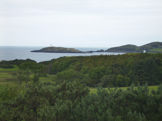
Little Ross

Little Ross is a 29-acre (12-hectare) island with a lighthouse on the Solway Coast south of the town of Kirkcudbright in Galloway, Scotland. It is next...
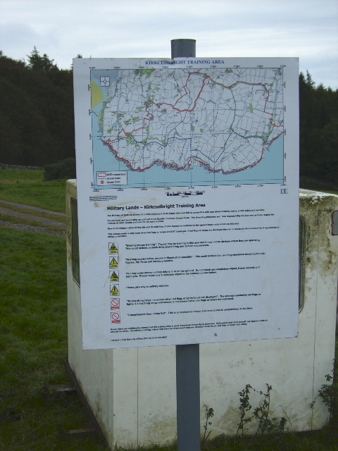
Dundrennan Range

Dundrennan Range is a weapons testing range on the Solway Firth, near Kirkcudbright in Dumfries and Galloway, in south west Scotland, it is part of the...

Nearby Amenities

Located within 500m of 54.792808,-4.0666306
Source: PGS
Lat/Long: 54.79554/-4.0607084
Source: PGS
Lat/Long: 54.7953404/-4.0608
Source: PGS
Lat/Long: 54.7951564/-4.0611335
Source: PGS
Lat/Long: 54.7950417/-4.0614612
Source: PGS
Lat/Long: 54.7950781/-4.0618752
Source: PGS
Lat/Long: 54.7948463/-4.0624993
Source: PGS
Lat/Long: 54.7946927/-4.0627359
Source: PGS
Lat/Long: 54.7943036/-4.0631084
Source: PGS
Lat/Long: 54.7926051/-4.0635453
Source: PGS
Lat/Long: 54.7921237/-4.0641679
Source: PGS
Lat/Long: 54.7917761/-4.0645463
Source: PGS
Lat/Long: 54.7913117/-4.0646754
Source: PGS
Lat/Long: 54.790944/-4.06463
Source: PGS
Lat/Long: 54.7905488/-4.0646996
Source: PGS
Lat/Long: 54.7901046/-4.0646478
Source: PGS
Lat/Long: 54.7897025/-4.0649255
Source: PGS
Lat/Long: 54.7886719/-4.0651264
Seamark Buoy Lateral Category: starboard
Seamark Buoy Lateral Colour: green
Seamark Buoy Lateral Shape: conical
Seamark Buoy Lateral System: iala-a
Seamark Light Character: Fl
Seamark Light Colour: green
Seamark Light Group: 2
Seamark Light Period: 6
Seamark Type: buoy_lateral
Lat/Long: 54.7955519/-4.0629711
Seamark Buoy Lateral Category: port
Seamark Buoy Lateral Colour: red
Seamark Buoy Lateral Shape: can
Seamark Buoy Lateral System: iala-a
Seamark Light Character: Fl
Seamark Light Colour: red
Seamark Light Group: 2
Seamark Light Period: 6
Seamark Name: No 2
Seamark Type: buoy_lateral
Lat/Long: 54.7960608/-4.0633
The data included in this document is from www.openstreetmap.org. The data is made available under ODbL.

Have you been to Bathinghouse Bay?

Leave your review of Bathinghouse Bay below (or comments, questions and feedback).