Porth Llanlleiana

Bay in Anglesey

Wales

Porth Llanlleiana

Porth Wen brickworks This view from across the bay shows the brickworks buildings at the base of the cliff and also the winding engine remains on the hilltop to the left. A darker line of vegetation shows the line of the tramway which brought the quartzite from the hilltop quarry down to a crushing house at the back of the works. The silca rich bricks made here were suitable for lining industrial furnaces.
Porth Wen brickworks Credit: Gordon Hatton

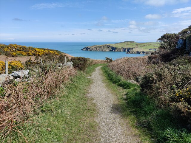
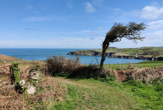
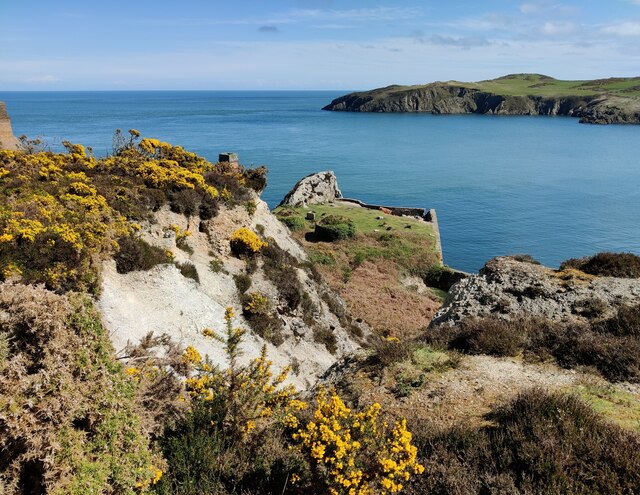
Porth Llanlleiana is a picturesque bay located on the northern coast of Anglesey, an island in North Wales. This bay is known for its stunning natural beauty and is a popular destination for both locals and tourists alike.

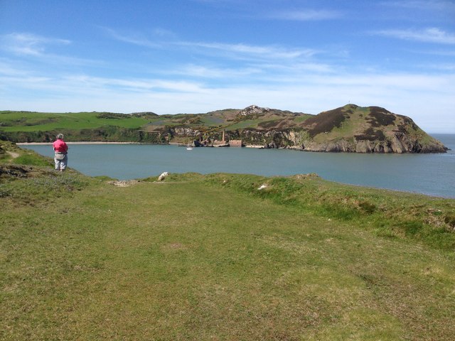
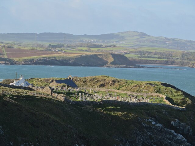
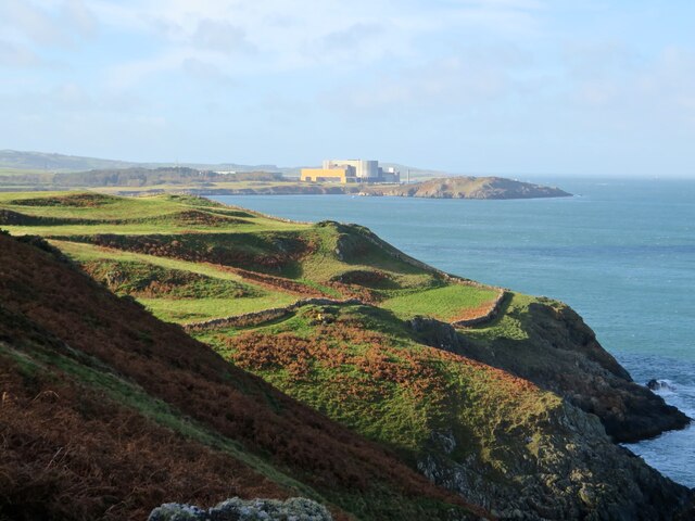
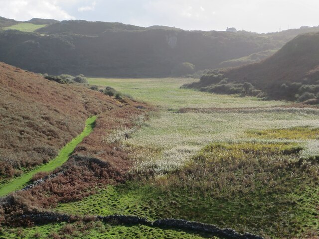
Surrounded by rugged cliffs and rolling hills, Porth Llanlleiana offers breathtaking views of the Irish Sea. The bay itself is characterized by its sandy beach and crystal-clear waters, making it an ideal spot for swimming, sunbathing, and picnicking. The beach is relatively secluded and often less crowded than other nearby beaches, providing a peaceful and tranquil atmosphere for visitors.

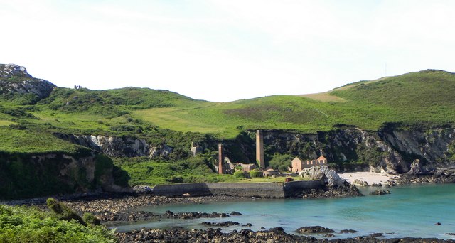
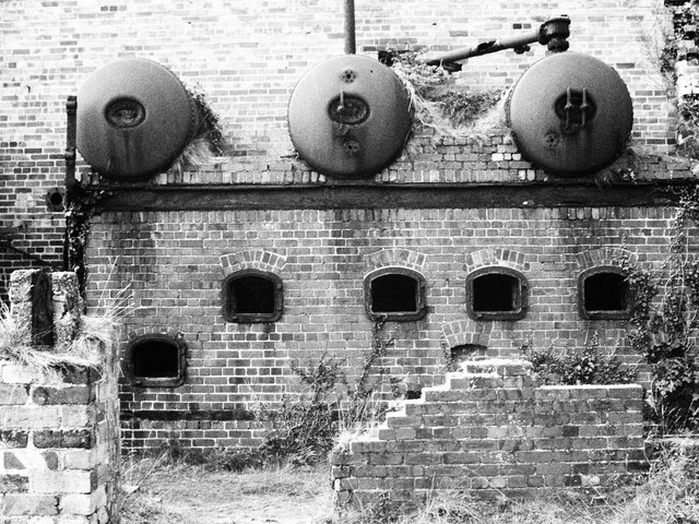
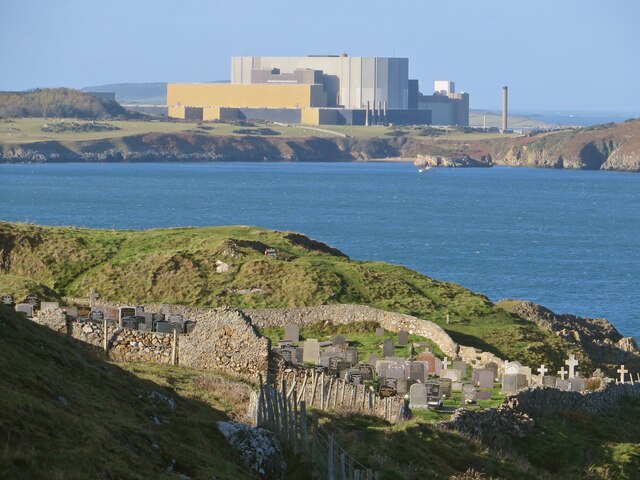
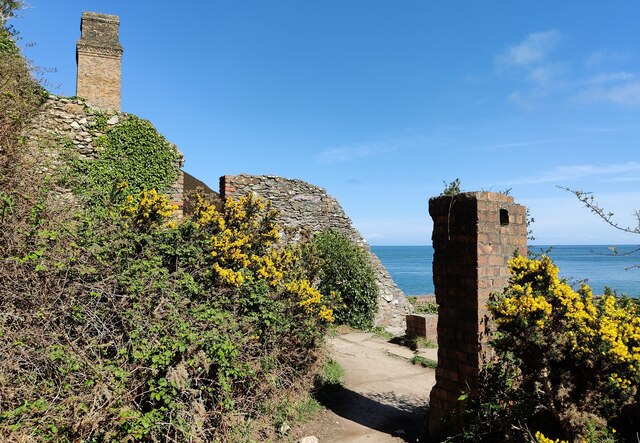
Porth Llanlleiana is also notable for its rich history. It was once a bustling harbor during the 19th century, serving as a hub for the local fishing and quarrying industries. The remnants of old lime kilns can still be seen along the bay, serving as a reminder of its industrial past.

In addition to its natural and historical significance, Porth Llanlleiana is a haven for wildlife enthusiasts. The bay is home to a variety of bird species, including puffins, razorbills, and guillemots, making it a popular spot for birdwatching. The surrounding cliffs also provide nesting sites for several seabird colonies.

Overall, Porth Llanlleiana is a hidden gem on the Anglesey coast, offering a unique blend of natural beauty, historical charm, and abundant wildlife. Whether you are seeking relaxation, adventure, or a glimpse into the island's past, this bay is a must-visit destination.

If you have any feedback on the listing, please let us know in the comments section below.

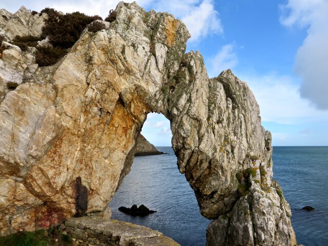
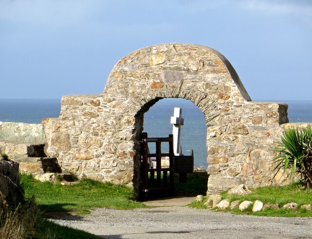
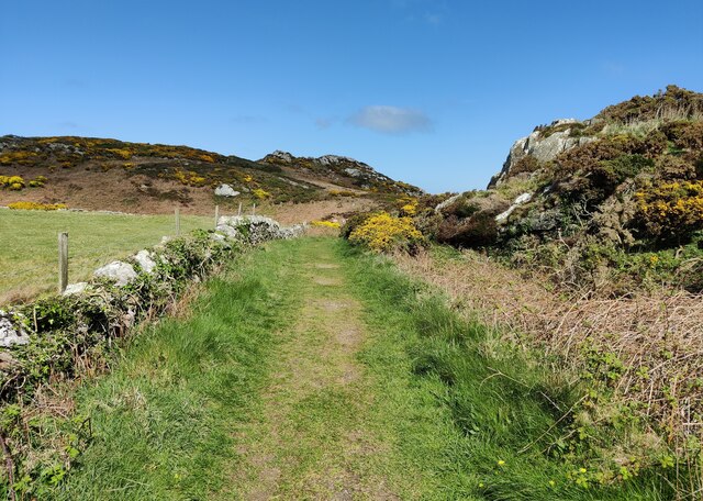
Porth Llanlleiana Images

Images are sourced within 2km of 53.427848/-4.4314619 or Grid Reference SH3895. Thanks to Geograph Open Source API. All images are credited.

Porth Wen brickworks This view from across the bay shows the brickworks buildings at the base of the cliff and also the winding engine remains on the hilltop to the left. A darker line of vegetation shows the line of the tramway which brought the quartzite from the hilltop quarry down to a crushing house at the back of the works. The silca rich bricks made here were suitable for lining industrial furnaces.
Porth Wen brickworks
This view from across the bay shows the brickworks buildings at the base of the cliff and also the winding engine remains on the hilltop to the left. A darker line of vegetation shows the line of the tramway which brought the quartzite from the hilltop quarry down to a crushing house at the back of the works. The silca rich bricks made here were suitable for lining industrial furnaces.
Looking towards Porth Wen brickworks
Boilers, Porth Wen Brick Works
Mynwent a môr, Llanbadrig A view through the graveyard of Llanbadrig church, which sits on cliffs at the northern tip of Wales.
Mynwent a môr, Llanbadrig
A view through the graveyard of Llanbadrig church, which sits on cliffs at the northern tip of Wales.
Mynwent Llanbadrig a Gorsaf Pŵer Wylfa From the coast path, a curious juxtaposition of ancient cliff-top churchyard and redundant nuclear power station.
Mynwent Llanbadrig a Gorsaf Pŵer Wylfa
From the coast path, a curious juxtaposition of ancient cliff-top churchyard and redundant nuclear power station.
Eglwys a mynwent Llanbadrig The clifftop llan of St Padrig from further along the coast path.
Eglwys a mynwent Llanbadrig
The clifftop llan of St Padrig from further along the coast path.
Arfordir Ynys Môn View just short of Llanlleiana, looking back towards Llanbadrig and the looming bulk of Wylfa power plant.
Arfordir Ynys Môn
View just short of Llanlleiana, looking back towards Llanbadrig and the looming bulk of Wylfa power plant.
Llanlleiana Head From the coast path. The stump of a tower on the headland is the remains of one built to commemorate the coronation of Edward VII in 1902.
Llanlleiana Head
From the coast path. The stump of a tower on the headland is the remains of one built to commemorate the coronation of Edward VII in 1902.
Dyffryn Llanlleiana The track into the old porcelain works now makes for a fine green path through the bracken, next to the reedbeds filling the marshland of the valley.
Dyffryn Llanlleiana
The track into the old porcelain works now makes for a fine green path through the bracken, next to the reedbeds filling the marshland of the valley.
Porth Wen A view of the bay through a window of the old brick works.
Porth Wen
A view of the bay through a window of the old brick works.
Bwa, Porth Wen A natural rock arch by the old brick works.
Bwa, Porth Wen
A natural rock arch by the old brick works.
Porth y mynwent, Llanbadrig The gate into the churchyard at Llanbadrig.
Porth y mynwent, Llanbadrig
The gate into the churchyard at Llanbadrig.
Path near Bryn Llewelyn
Path to Porth Wen
Path to Porth Wen
Path to Porth Wen
Path to Porth Wen
Wind shaped tree at Porth Wen
Porth Wen on the Anglesey coast The abandoned brickworks at Porth Wen lies on the north coast of Anglesey, a few miles to the west of Amlwch.  It was opened to make refractory bricks for use in the steel industry.

It is believed that the manufacture of bricks on the site began around the turn of the twentieth century. The type of brick produced was based on the local yellow clay rather than the usual red house brick. They were capable of withstanding higher temperatures that normal bricks and may have been used for the lining of kilns and furnaces.

Despite the high quality brick and tiles produced, transport was always a problem for the brickworks as all raw materials and products had to be transported by sea. A small quay was built for the loading and unloading of ships but the poor harbour became a big hindrance to profitability.  As well as the effects of tides, a heavy swell was often encountered and the small vessels were often battered while at the quayside; the sharp, jagged rocks of the seabed caused much damage to the craft so that many owners refused to risk their ships mooring there. 

The works closed at the start of the First World War and most of the useful equipment and machinery was removed to be used by a firm in Caernarfon some time before the Second World War.  Most of the remainder has slowly rusted away ever since.

Recommended further reading:
<span class="nowrap"><a title="http://www.penmorfa.com/porthwen/" rel="nofollow ugc noopener" href="http://www.penmorfa.com/porthwen/">Link</a><img style="margin-left:2px;" alt="External link" title="External link - shift click to open in new window" src="https://s1.geograph.org.uk/img/external.png" width="10" height="10"/></span> (Dave Sallery’s History of Porth Wen Brickworks)
<span class="nowrap"><a title="http://www.anglesey-hidden-gem.com/porth-wen-brick-works.html" rel="nofollow ugc noopener" href="http://www.anglesey-hidden-gem.com/porth-wen-brick-works.html">Link</a><img style="margin-left:2px;" alt="External link" title="External link - shift click to open in new window" src="https://s1.geograph.org.uk/img/external.png" width="10" height="10"/></span> (Anglesey Hidden Gems)
Porth Wen on the Anglesey coast
The abandoned brickworks at Porth Wen lies on the north coast of Anglesey, a few miles to the west of Amlwch. It was opened to make refractory bricks for use in the steel industry. It is believed that the manufacture of bricks on the site began around the turn of the twentieth century. The type of brick produced was based on the local yellow clay rather than the usual red house brick. They were capable of withstanding higher temperatures that normal bricks and may have been used for the lining of kilns and furnaces. Despite the high quality brick and tiles produced, transport was always a problem for the brickworks as all raw materials and products had to be transported by sea. A small quay was built for the loading and unloading of ships but the poor harbour became a big hindrance to profitability. As well as the effects of tides, a heavy swell was often encountered and the small vessels were often battered while at the quayside; the sharp, jagged rocks of the seabed caused much damage to the craft so that many owners refused to risk their ships mooring there. The works closed at the start of the First World War and most of the useful equipment and machinery was removed to be used by a firm in Caernarfon some time before the Second World War. Most of the remainder has slowly rusted away ever since. Recommended further reading: LinkExternal link (Dave Sallery’s History of Porth Wen Brickworks) LinkExternal link (Anglesey Hidden Gems)
Ruins at Porth Wen The abandoned brickworks at Porth Wen lies on the north coast of Anglesey, a few miles to the west of Amlwch.  It was opened to make refractory bricks for use in the steel industry.

It is believed that the manufacture of bricks on the site began around the turn of the twentieth century. The type of brick produced was based on the local yellow clay rather than the usual red house brick. They were capable of withstanding higher temperatures that normal bricks and may have been used for the lining of kilns and furnaces.

Despite the high quality brick and tiles produced, transport was always a problem for the brickworks as all raw materials and products had to be transported by sea. A small quay was built for the loading and unloading of ships but the poor harbour became a big hindrance to profitability.  As well as the effects of tides, a heavy swell was often encountered and the small vessels were often battered while at the quayside; the sharp, jagged rocks of the seabed caused much damage to the craft so that many owners refused to risk their ships mooring there. 

The works closed at the start of the First World War and most of the useful equipment and machinery was removed to be used by a firm in Caernarfon some time before the Second World War.  Most of the remainder has slowly rusted away ever since.

Recommended further reading:
<span class="nowrap"><a title="http://www.penmorfa.com/porthwen/" rel="nofollow ugc noopener" href="http://www.penmorfa.com/porthwen/">Link</a><img style="margin-left:2px;" alt="External link" title="External link - shift click to open in new window" src="https://s1.geograph.org.uk/img/external.png" width="10" height="10"/></span> (Dave Sallery’s History of Porth Wen Brickworks)
<span class="nowrap"><a title="http://www.anglesey-hidden-gem.com/porth-wen-brick-works.html" rel="nofollow ugc noopener" href="http://www.anglesey-hidden-gem.com/porth-wen-brick-works.html">Link</a><img style="margin-left:2px;" alt="External link" title="External link - shift click to open in new window" src="https://s1.geograph.org.uk/img/external.png" width="10" height="10"/></span> (Anglesey Hidden Gems)
Ruins at Porth Wen
The abandoned brickworks at Porth Wen lies on the north coast of Anglesey, a few miles to the west of Amlwch. It was opened to make refractory bricks for use in the steel industry. It is believed that the manufacture of bricks on the site began around the turn of the twentieth century. The type of brick produced was based on the local yellow clay rather than the usual red house brick. They were capable of withstanding higher temperatures that normal bricks and may have been used for the lining of kilns and furnaces. Despite the high quality brick and tiles produced, transport was always a problem for the brickworks as all raw materials and products had to be transported by sea. A small quay was built for the loading and unloading of ships but the poor harbour became a big hindrance to profitability. As well as the effects of tides, a heavy swell was often encountered and the small vessels were often battered while at the quayside; the sharp, jagged rocks of the seabed caused much damage to the craft so that many owners refused to risk their ships mooring there. The works closed at the start of the First World War and most of the useful equipment and machinery was removed to be used by a firm in Caernarfon some time before the Second World War. Most of the remainder has slowly rusted away ever since. Recommended further reading: LinkExternal link (Dave Sallery’s History of Porth Wen Brickworks) LinkExternal link (Anglesey Hidden Gems)
Show me another place!

Porth Llanlleiana is located at Grid Ref: SH3895 (Lat: 53.427848, Lng: -4.4314619)

Unitary Authority: Isle of Anglesey

Police Authority: North Wales

What 3 Words

///propelled.defaults.capillary. Near Cemaes Bay, Isle of Anglesey

Related Wikis

Llanbadrig - Dinas Gynfor

Llanbadrig - Dinas Gynfor is a Site of Special Scientific Interest (or SSSI) in Anglesey, North Wales. It has been designated as a Site of Special Scientific...

Middle Mouse

Middle Mouse (Welsh: Ynys Badrig - Patrick's island) is an uninhabited island situated 1 kilometre (1000 yards) off the north coast of Anglesey. It is...

St Padrig's Church, Llanbadrig

St Padrig's Church is a medieval church in the village of Llanbadrig, Anglesey, Wales. The building probably dates from the 12th century and underwent...

Llanbadrig

Llanbadrig is a village and community (and former electoral ward) in Anglesey, Wales. The parish includes the township of Clygyrog, Tregynrig and the port...

Nearby Amenities

Located within 500m of 53.427848,-4.4314619
Barrier: kissing_gate
Lat/Long: 53.4272483/-4.4278817
Barrier: kissing_gate
Lat/Long: 53.427386/-4.4356956
Barrier: kissing_gate
Lat/Long: 53.4273917/-4.4355236
Porth Llanlleiana
Natural: bay
Lat/Long: 53.4281981/-4.4290635
Dinas Gynfor
Ele: 60
Natural: peak
Wikidata: Q106710338
Lat/Long: 53.4284813/-4.4256718
Llanlleiana Nunnery and Graveyard (site of)
Historic: archaeological_site
Lat/Long: 53.4262648/-4.4276794
Dinas Gynfor Hillfort
Historic: archaeological_site
Lat/Long: 53.4283628/-4.4249283
The data included in this document is from www.openstreetmap.org. The data is made available under ODbL.

Have you been to Porth Llanlleiana?

Leave your review of Porth Llanlleiana below (or comments, questions and feedback).