Porth Aels

Bay in Anglesey

Wales

Porth Aels

St. Cwyfan’s Chapel, Anglesey St Cwyfan's Church is a Grade II listed medieval church in Anglesey, Wales. Located on the small tidal island. It is popularly known as the "Little Church in the Sea". The church dates from the 12th century, with some renovations made in the 19th century.

<span class="nowrap"><a title="https://en.wikipedia.org/wiki/St_Cwyfan%27s_Church,_Llangwyfan" rel="nofollow ugc noopener" href="https://en.wikipedia.org/wiki/St_Cwyfan%27s_Church,_Llangwyfan">Link</a><img style="margin-left:2px;" alt="External link" title="External link - shift click to open in new window" src="https://s1.geograph.org.uk/img/external.png" width="10" height="10"/></span>
St. Cwyfan’s Chapel, Anglesey Credit: Brian Deegan

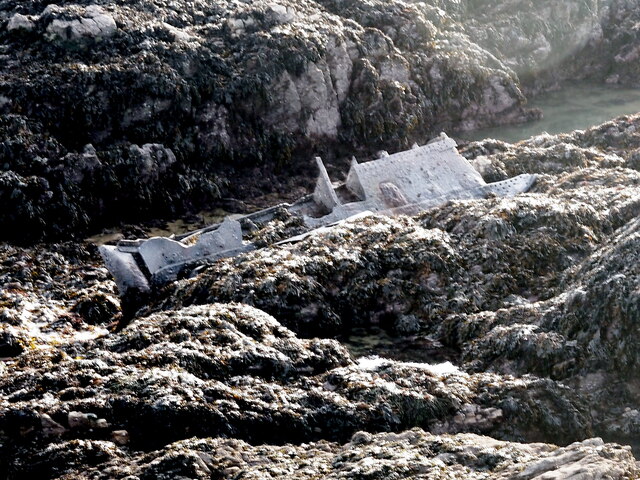
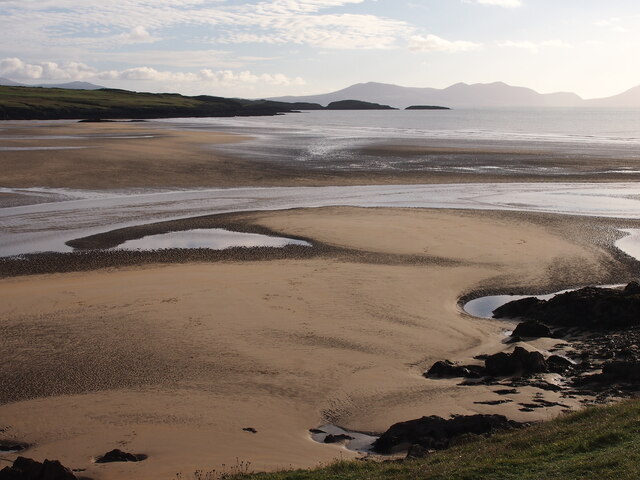
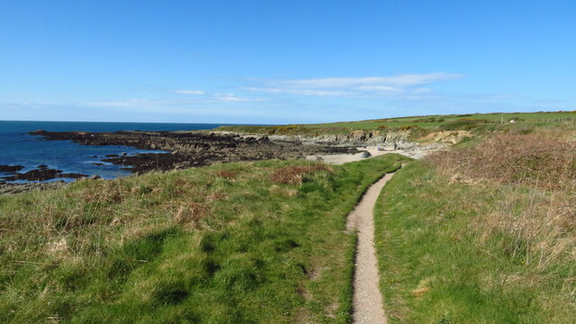
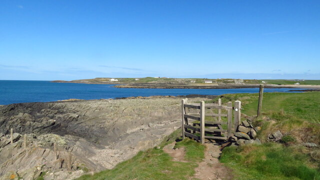
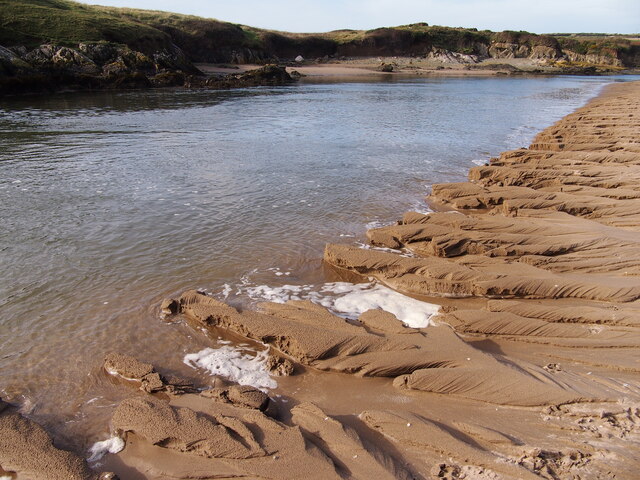
Porth Aels, also known as Ael y Bryn, is a picturesque bay located on the northwestern coast of Anglesey, an island in Wales, United Kingdom. Situated near the village of Rhoscolyn, Porth Aels offers stunning views of the Irish Sea and is a popular destination for locals and tourists alike.

The bay is known for its pristine sandy beach, which stretches for approximately 200 meters and is surrounded by rocky cliffs. The crystal-clear waters of Porth Aels make it a perfect spot for swimming, snorkeling, and other water activities.

The area surrounding Porth Aels is rich in biodiversity, with an abundance of marine life and bird species. It is a designated Area of Outstanding Natural Beauty, attracting nature enthusiasts and birdwatchers who come to observe the diverse wildlife that inhabits the bay.

Porth Aels is also famous for its stunning sunsets, which paint the sky in vibrant hues of orange and pink. The bay offers unobstructed views of the horizon, creating a tranquil and romantic atmosphere that is ideal for evening strolls along the beach.

Facilities near Porth Aels include a car park, public toilets, and a small café where visitors can grab a bite to eat or enjoy a hot beverage. The bay is easily accessible by car or foot, with a well-maintained footpath leading down to the beach.

Overall, Porth Aels is a hidden gem on the beautiful island of Anglesey, offering a serene and natural environment for visitors to enjoy the wonders of the Welsh coastline.

If you have any feedback on the listing, please let us know in the comments section below.

Porth Aels Images

Images are sourced within 2km of 53.178067/-4.4881383 or Grid Reference SH3367. Thanks to Geograph Open Source API. All images are credited.

St. Cwyfan’s Chapel, Anglesey St Cwyfan's Church is a Grade II listed medieval church in Anglesey, Wales. Located on the small tidal island. It is popularly known as the "Little Church in the Sea". The church dates from the 12th century, with some renovations made in the 19th century.

<span class="nowrap"><a title="https://en.wikipedia.org/wiki/St_Cwyfan%27s_Church,_Llangwyfan" rel="nofollow ugc noopener" href="https://en.wikipedia.org/wiki/St_Cwyfan%27s_Church,_Llangwyfan">Link</a><img style="margin-left:2px;" alt="External link" title="External link - shift click to open in new window" src="https://s1.geograph.org.uk/img/external.png" width="10" height="10"/></span>
St. Cwyfan’s Chapel, Anglesey
St Cwyfan's Church is a Grade II listed medieval church in Anglesey, Wales. Located on the small tidal island. It is popularly known as the "Little Church in the Sea". The church dates from the 12th century, with some renovations made in the 19th century. LinkExternal link
Ship Wreckage, Porth Aels Possibly part of the steamer 'Kyle Prince' that sank on the 8th of October 1938.
Ship Wreckage, Porth Aels
Possibly part of the steamer 'Kyle Prince' that sank on the 8th of October 1938.
Traeth Mawr
Traeth Mawr
Hairpin bend, Anglesey Circuit
Track and run-off, Anglesey Circuit
Paddock area, Anglesey Circuit
Peripheral roads, Anglesey Circuit
Anglesey Circuit
Anglesey Circuit
The mouth of the Afon Ffraw & Aberffraw Sands
Coastal path at Porth Lleidiog near Aberffraw
On the coast path approaching Porth Cwyfan
St Cwyfan's Church near Aberffraw
Bluebells at Llangwyfan-isaf near Aberffraw
The Afon Ffraw Meets The Sea
Bodfeirig, Aberffraw
Tirwedd melyn / A yellow landscape
Carreg drawsffurfiol rhigol / A fissured metamorphic rock
Eglwys Cwyfan / St Cwyfan's Church Dedicated to the Irish St Kevin of Glendalough
Eglwys Cwyfan / St Cwyfan's Church
Dedicated to the Irish St Kevin of Glendalough
Show me another place!

Porth Aels is located at Grid Ref: SH3367 (Lat: 53.178067, Lng: -4.4881383)

Unitary Authority: Isle of Anglesey

Police Authority: North Wales

What 3 Words

///chariots.butlers.start. Near Rhosneigr, Isle of Anglesey

Related Wikis

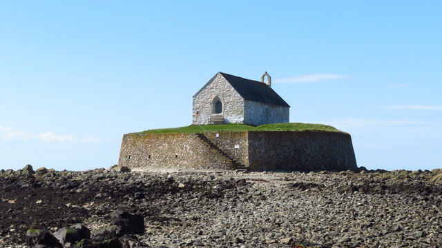
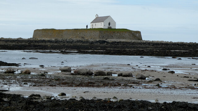
St Cwyfan's Church, Llangwyfan

St Cwyfan's Church (Welsh: Eglwys Cwyfan) is a Grade II*-listed medieval church in Llangadwaladr, Anglesey, Wales. Located on the small tidal island of...
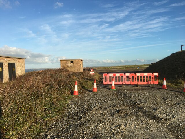
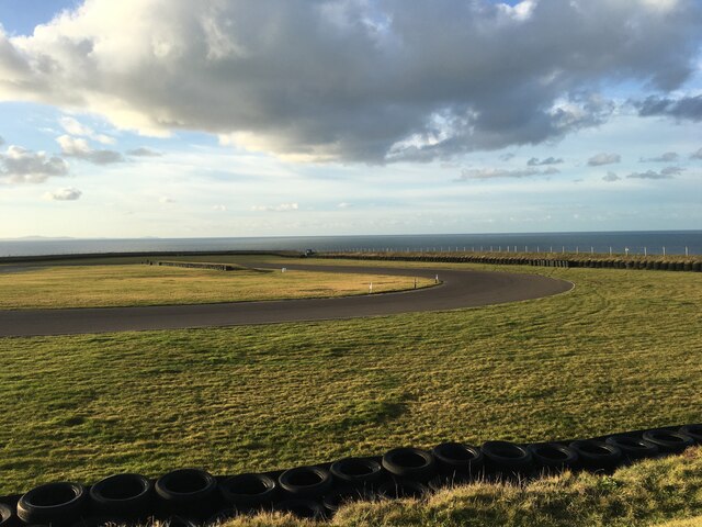
Anglesey Circuit

The Anglesey Circuit (Welsh: Trac Môn) is a motor racing circuit located in Ty Croes, Anglesey, Wales. It plays host to a variety of motorsport events...

Afon Ffraw

The Afon Ffraw is a short river on the Isle of Anglesey, Wales. It arises at Llyn Coron and flows southwest for two miles along the northwestern margin...

Llangwyfan, Anglesey

Llangwyfan named after St. Cwyfan is a hamlet in the community of Aberffraw, Anglesey, Wales, which is 130.8 miles (210.6 km) from Cardiff and 218 miles...

Nearby Amenities

Located within 500m of 53.178067,-4.4881383
Source: PGS
Lat/Long: 53.1820005/-4.4896357
Source: PGS
Lat/Long: 53.1818022/-4.4894397
Source: PGS
Lat/Long: 53.1814237/-4.4893552
Source: PGS
Lat/Long: 53.1812244/-4.4893222
Source: PGS
Lat/Long: 53.1807691/-4.4894038
Source: PGS
Lat/Long: 53.1805182/-4.4888729
Source: PGS
Lat/Long: 53.1803674/-4.4888311
Created By: dmgroom_coastlines
Source: PGS
Lat/Long: 53.180262/-4.488731
Created By: dmgroom_coastlines
Source: PGS
Lat/Long: 53.180006/-4.488722
Created By: dmgroom_coastlines
Source: PGS
Lat/Long: 53.179744/-4.489139
Created By: dmgroom_coastlines
Source: PGS
Lat/Long: 53.178976/-4.489113
Created By: dmgroom_coastlines
Source: PGS
Lat/Long: 53.178467/-4.488881
Created By: dmgroom_coastlines
Source: PGS
Lat/Long: 53.178605/-4.488033
Created By: dmgroom_coastlines
Source: PGS
Lat/Long: 53.178736/-4.487825
Created By: dmgroom_coastlines
Source: PGS
Lat/Long: 53.178866/-4.487615
Source: PGS
Lat/Long: 53.1789725/-4.4873538
Created By: dmgroom_coastlines
Source: PGS
Lat/Long: 53.178491/-4.486963
Created By: dmgroom_coastlines
Source: PGS
Lat/Long: 53.177722/-4.486937
Created By: dmgroom_coastlines
Source: PGS
Lat/Long: 53.1778107/-4.4864357
Created By: dmgroom_coastlines
Source: PGS
Lat/Long: 53.177607/-4.485866
Created By: dmgroom_coastlines
Source: PGS
Lat/Long: 53.177874/-4.485022
Created By: dmgroom_coastlines
Source: PGS
Lat/Long: 53.178005/-4.484814
Source: PGS
Lat/Long: 53.1783355/-4.4844949
Source: PGS
Lat/Long: 53.1784616/-4.484097
Source: PGS
Lat/Long: 53.1787252/-4.4840155
Source: PGS
Lat/Long: 53.1789411/-4.4836331
Source: PGS
Lat/Long: 53.179118/-4.4832927
Source: PGS
Lat/Long: 53.1793323/-4.4828743
Source: PGS
Lat/Long: 53.1795939/-4.482549
Source: PGS
Lat/Long: 53.1798238/-4.481976
Source: PGS
Lat/Long: 53.1798775/-4.481452
Barrier: kissing_gate
Lat/Long: 53.1789486/-4.4868625
Barrier: kissing_gate
Lat/Long: 53.1816739/-4.4889186
The data included in this document is from www.openstreetmap.org. The data is made available under ODbL.

Have you been to Porth Aels?

Leave your review of Porth Aels below (or comments, questions and feedback).