Porth China

Bay in Anglesey

Wales

Porth China

Junction on the A4080 near Anglesey Circuit
Junction on the A4080 near Anglesey Circuit Credit: Steven Brown

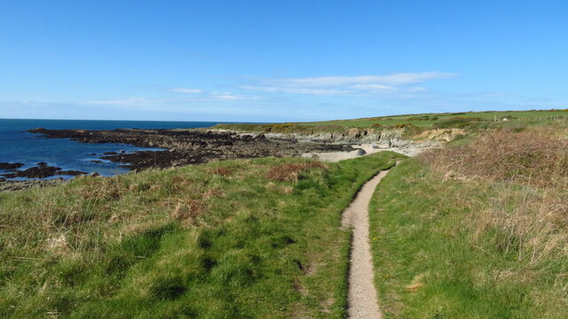
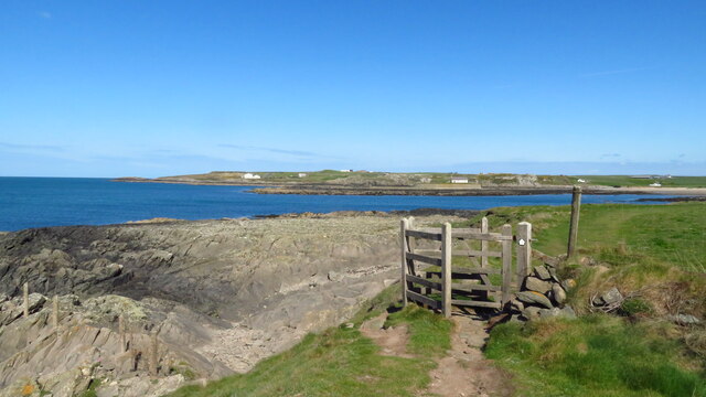
Porth China is a picturesque bay located on the Isle of Anglesey, Wales. Situated on the western coast of the island, it is known for its stunning natural beauty and tranquil atmosphere. The bay can be found between Porth Nobla and Porth Trecastell, and is nestled within a rugged coastline that is dotted with jagged cliffs and sandy beaches.

Porth China offers visitors a unique and unspoiled experience of the Welsh coast. The bay is known for its crystal-clear waters, making it a popular spot for swimming and snorkeling. The beach itself is a mix of soft sand and pebbles, perfect for a leisurely stroll or a picnic by the sea.

One of the highlights of Porth China is its abundance of wildlife. The bay is home to a variety of bird species, including oystercatchers and gulls, making it a haven for birdwatching enthusiasts. Seals can also be spotted swimming in the bay, adding to the area's natural charm.

The bay is easily accessible and offers ample parking facilities for visitors. It is a popular destination for both locals and tourists, who come to enjoy the peaceful surroundings and soak in the beauty of the Welsh coast. Porth China is a hidden gem on Anglesey, offering a serene and idyllic escape from the hustle and bustle of everyday life.

If you have any feedback on the listing, please let us know in the comments section below.
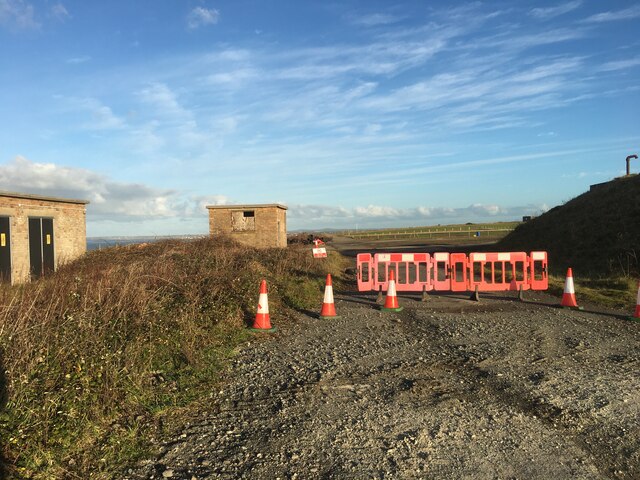
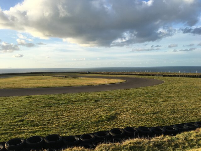
Porth China Images

Images are sourced within 2km of 53.186249/-4.4963062 or Grid Reference SH3368. Thanks to Geograph Open Source API. All images are credited.

Junction on the A4080 near Anglesey Circuit
St. Cwyfan’s Chapel, Anglesey St Cwyfan's Church is a Grade II listed medieval church in Anglesey, Wales. Located on the small tidal island. It is popularly known as the "Little Church in the Sea". The church dates from the 12th century, with some renovations made in the 19th century.

<span class="nowrap"><a title="https://en.wikipedia.org/wiki/St_Cwyfan%27s_Church,_Llangwyfan" rel="nofollow ugc noopener" href="https://en.wikipedia.org/wiki/St_Cwyfan%27s_Church,_Llangwyfan">Link</a><img style="margin-left:2px;" alt="External link" title="External link - shift click to open in new window" src="https://s1.geograph.org.uk/img/external.png" width="10" height="10"/></span>
St. Cwyfan’s Chapel, Anglesey
St Cwyfan's Church is a Grade II listed medieval church in Anglesey, Wales. Located on the small tidal island. It is popularly known as the "Little Church in the Sea". The church dates from the 12th century, with some renovations made in the 19th century. LinkExternal link
Ship Wreckage, Porth Aels Possibly part of the steamer 'Kyle Prince' that sank on the 8th of October 1938.
Ship Wreckage, Porth Aels
Possibly part of the steamer 'Kyle Prince' that sank on the 8th of October 1938.
Hairpin bend, Anglesey Circuit
Track and run-off, Anglesey Circuit
Paddock area, Anglesey Circuit
Gate and field near Anglesey Circuit
Peripheral roads, Anglesey Circuit
Anglesey Circuit
Anglesey Circuit
The mouth of the Afon Ffraw & Aberffraw Sands
Coastal path at Porth Lleidiog near Aberffraw
On the coast path approaching Porth Cwyfan
St Cwyfan's Church near Aberffraw
Bluebells at Llangwyfan-isaf near Aberffraw
Bodfeirig, Aberffraw
Tirwedd melyn / A yellow landscape
Carreg drawsffurfiol rhigol / A fissured metamorphic rock
Eglwys Cwyfan / St Cwyfan's Church Dedicated to the Irish St Kevin of Glendalough
Eglwys Cwyfan / St Cwyfan's Church
Dedicated to the Irish St Kevin of Glendalough
Show me another place!

Porth China is located at Grid Ref: SH3368 (Lat: 53.186249, Lng: -4.4963062)

Unitary Authority: Isle of Anglesey

Police Authority: North Wales

What 3 Words

///prefix.spell.afraid. Near Rhosneigr, Isle of Anglesey

Related Wikis

St Cwyfan's Church, Llangwyfan

St Cwyfan's Church (Welsh: Eglwys Cwyfan) is a Grade II*-listed medieval church in Llangadwaladr, Anglesey, Wales. Located on the small tidal island of...
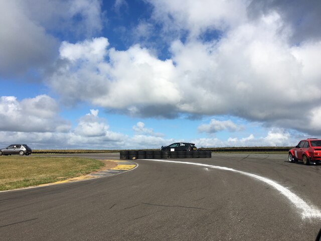
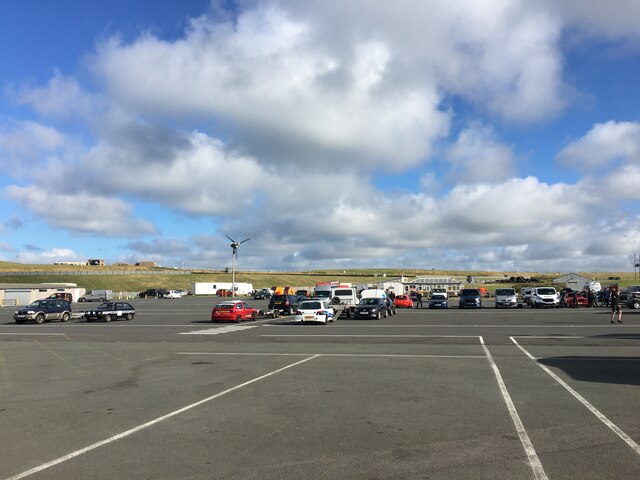
Anglesey Circuit

The Anglesey Circuit (Welsh: Trac Môn) is a motor racing circuit located in Ty Croes, Anglesey, Wales. It plays host to a variety of motorsport events...

Llangwyfan, Anglesey

Llangwyfan named after St. Cwyfan is a hamlet in the community of Aberffraw, Anglesey, Wales, which is 130.8 miles (210.6 km) from Cardiff and 218 miles...

Afon Ffraw

The Afon Ffraw is a short river on the Isle of Anglesey, Wales. It arises at Llyn Coron and flows southwest for two miles along the northwestern margin...

Nearby Amenities

Located within 500m of 53.186249,-4.4963062
Source: PGS
Lat/Long: 53.1852504/-4.4923648
Source: PGS
Lat/Long: 53.1853059/-4.4923569
Source: PGS
Lat/Long: 53.1855443/-4.4921626
Source: PGS
Lat/Long: 53.1856423/-4.4917114
Source: PGS
Lat/Long: 53.1854482/-4.4918398
Source: PGS
Lat/Long: 53.1852496/-4.4920961
Source: PGS
Lat/Long: 53.1852229/-4.492188
Source: PGS
Lat/Long: 53.1851995/-4.4922493
Source: PGS
Lat/Long: 53.1852128/-4.4923384
Source: PGS
Lat/Long: 53.1868796/-4.5026599
Source: PGS
Lat/Long: 53.186922/-4.5010416
Source: PGS
Lat/Long: 53.1866818/-4.4995031
Source: PGS
Lat/Long: 53.1862802/-4.4985716
Source: PGS
Lat/Long: 53.186078/-4.4981824
Source: PGS
Lat/Long: 53.1860529/-4.4973634
Source: PGS
Lat/Long: 53.1864335/-4.4961903
Source: PGS
Lat/Long: 53.1866682/-4.4954175
Created By: dmgroom_coastlines
Source: PGS
Lat/Long: 53.186208/-4.494694
Created By: dmgroom_coastlines
Source: PGS
Lat/Long: 53.186339/-4.494486
Created By: dmgroom_coastlines
Source: PGS
Lat/Long: 53.186469/-4.494277
Created By: dmgroom_coastlines
Source: PGS
Lat/Long: 53.1868878/-4.4938341
Created By: dmgroom_coastlines
Source: PGS
Lat/Long: 53.1871498/-4.4931628
Created By: dmgroom_coastlines
Source: PGS
Lat/Long: 53.187259/-4.492598
Source: PGS
Lat/Long: 53.1876353/-4.4917073
Created By: dmgroom_coastlines
Source: PGS
Lat/Long: 53.1876575/-4.4912014
Source: PGS
Lat/Long: 53.1867437/-4.4889005
Corkscrew
Description: Corkscrew
Lat/Long: 53.1891155/-4.4994818
Barrier: stile
Lat/Long: 53.1880545/-4.4913299
School Corner
Description: School Corner
Lat/Long: 53.1881423/-4.4995134
Power: pole
Lat/Long: 53.1895761/-4.4918971
Power: pole
Lat/Long: 53.1886578/-4.491233
Source: PGS
Lat/Long: 53.1869268/-4.4905499
Source: PGS
Lat/Long: 53.1874384/-4.4908913
Bench
Lat/Long: 53.1854828/-4.4920943
Bench
Lat/Long: 53.1855775/-4.49185
Generator Method: wind_turbine
Generator Source: wind
Power: generator
Lat/Long: 53.1896103/-4.4972363
Tom Pryce Straight
Description: Tom Pryce Straight
Lat/Long: 53.1905353/-4.498302
Bus Stop
Description: Bus Stop
Lat/Long: 53.1889379/-4.498253
Crossing
Crossing: uncontrolled
Crossing Markings: yes
Lat/Long: 53.1890713/-4.4966038
Crossing
Crossing: uncontrolled
Crossing Markings: yes
Lat/Long: 53.1892823/-4.4966753
Crossing
Crossing: uncontrolled
Crossing Markings: yes
Lat/Long: 53.1894691/-4.4967409
Crossing
Crossing: uncontrolled
Crossing Markings: yes
Lat/Long: 53.1896743/-4.4967728
Vending Machine
Vending: fuel
Lat/Long: 53.1893377/-4.4976706
Start/Finish
Lat/Long: 53.188408/-4.4964048
Man Made: water_tap
Lat/Long: 53.1890992/-4.4952901
The data included in this document is from www.openstreetmap.org. The data is made available under ODbL.

Have you been to Porth China?

Leave your review of Porth China below (or comments, questions and feedback).