Thurrock, Little

Settlement in Essex

England

Thurrock, Little

Baker Street, Thurrock Passing underneath the A13
Baker Street, Thurrock Credit: David Howard

Thurrock, Little is a small village located in the county of Essex, England. Situated in the borough of Thurrock, it is nestled on the eastern bank of the River Thames, just a few miles away from the bustling town of Grays. The village covers an area of approximately 2 square miles and is home to a population of around 1,500 residents.

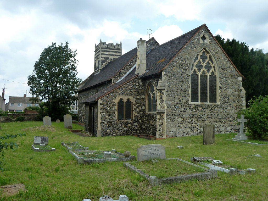
Thurrock, Little has a rich history dating back to the medieval period, and evidence of its past can be seen in the form of several historic buildings and landmarks. One notable example is the All Saints Church, a beautiful Grade II listed building that dates back to the 13th century and features stunning architectural details. The village also has a small primary school, providing education to local children.

Despite its small size, Thurrock, Little benefits from its proximity to larger towns and cities. The nearby town of Grays offers a wide range of amenities, including shopping centers, supermarkets, and leisure facilities. The village is well-connected to the rest of Essex and London via a network of roads and public transportation, making it an attractive location for commuters.

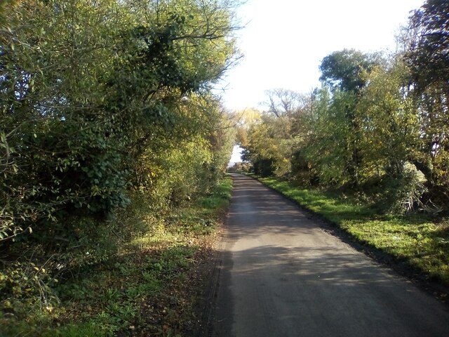
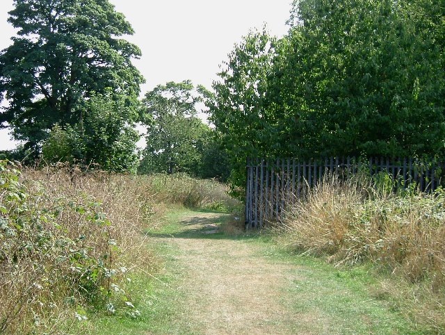
Surrounded by picturesque countryside, Thurrock, Little provides residents with opportunities for outdoor activities and walks along the river. The village has a strong sense of community, with various local events and activities organized throughout the year. Overall, Thurrock, Little offers a peaceful and charming environment for those seeking a quiet residential area within easy reach of urban amenities.

If you have any feedback on the listing, please let us know in the comments section below.

Thurrock, Little Images

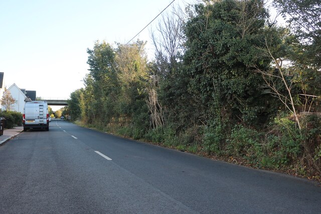
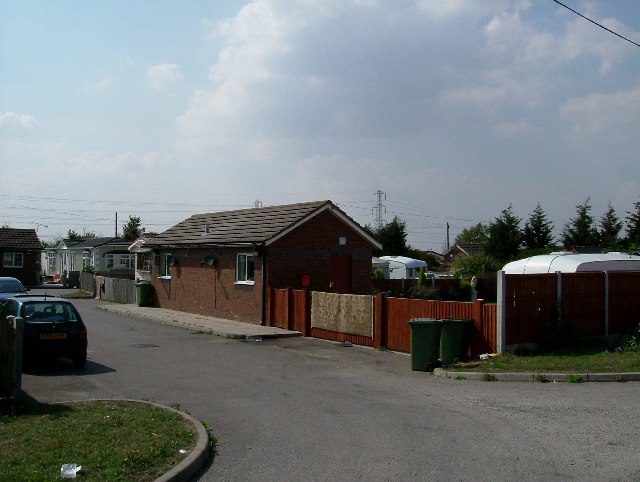
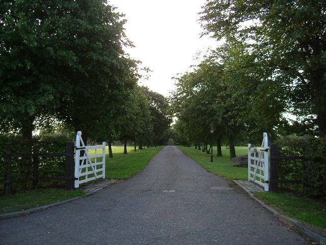
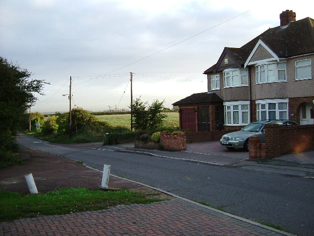
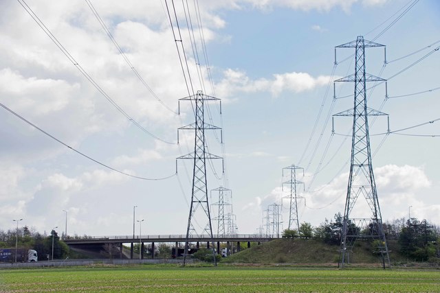
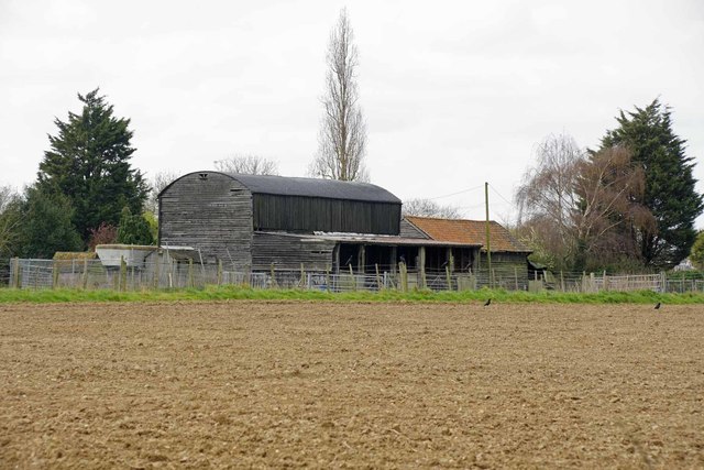
Images are sourced within 2km of 51.487078/0.344165 or Grid Reference TQ6279. Thanks to Geograph Open Source API. All images are credited.

Baker Street, Thurrock Passing underneath the A13
Baker Street, Thurrock
Passing underneath the A13
Stanford Road, Thurrock
Travellers Rest Thurrock has three permanent traveller sites like this one.
Travellers Rest
Thurrock has three permanent traveller sites like this one.
Drive to Heath Place This is the tree-lined drive to Heath Place located off Hornsby Lane between Orsett Heath and  the A1013
Drive to Heath Place
This is the tree-lined drive to Heath Place located off Hornsby Lane between Orsett Heath and the A1013
Last House on Blackshots Lane During the 1930’s Grays extended northwards towards Orsett particularly ribbon development along Blackshots and Long Lane. Post war there was much infill but the town and country planning act has ensured there is some countryside between them. This is the point where town and country meet.
Last House on Blackshots Lane
During the 1930’s Grays extended northwards towards Orsett particularly ribbon development along Blackshots and Long Lane. Post war there was much infill but the town and country planning act has ensured there is some countryside between them. This is the point where town and country meet.
A13, eastbound The A13 is a major road linking the City of London with south Essex. Its route is  similar to the route of the London, Tilbury and Southend Railway, and runs the entire length of the northern Thames Gateway area, terminating on the Thames Estuary at Shoeburyness. It is a Trunk Road as far as the Tilbury turn-off, a primary route between there and Sadlers Hall Farm near South Benfleet, and a non-primary route between there and Shoeburyness. Total length 41 miles.
<span class="nowrap"><a title="https://www.sabre-roads.org.uk/wiki/index.php?title=A13" rel="nofollow ugc noopener" href="https://www.sabre-roads.org.uk/wiki/index.php?title=A13">Link</a><img style="margin-left:2px;" alt="External link" title="External link - shift click to open in new window" src="https://s1.geograph.org.uk/img/external.png" width="10" height="10"/></span>
A13, eastbound
The A13 is a major road linking the City of London with south Essex. Its route is similar to the route of the London, Tilbury and Southend Railway, and runs the entire length of the northern Thames Gateway area, terminating on the Thames Estuary at Shoeburyness. It is a Trunk Road as far as the Tilbury turn-off, a primary route between there and Sadlers Hall Farm near South Benfleet, and a non-primary route between there and Shoeburyness. Total length 41 miles. LinkExternal link
A1089 at Baker Street Interchange The A1089 is a short (4½ miles) but busy route connecting the docks and port of Tilbury to the rest of the UK’s main road system which it joins at the Baker Street Interchange on the A13. It is dual carriageway for most of its length.
A1089 at Baker Street Interchange
The A1089 is a short (4½ miles) but busy route connecting the docks and port of Tilbury to the rest of the UK’s main road system which it joins at the Baker Street Interchange on the A13. It is dual carriageway for most of its length.
Undeveloped Land and Harrowed field With the pressure to build new houses the bit of green to the left of the fence would seem a prime site for some affordable houses.
Undeveloped Land and Harrowed field
With the pressure to build new houses the bit of green to the left of the fence would seem a prime site for some affordable houses.
Long Lane, Keir Hardy House & Thurrock RFC Sign No prizes for guessing the colour of the local Council when this block was named! The road past the trees is the drive to Thurrock Rugby Football Club.
Long Lane, Keir Hardy House & Thurrock RFC Sign
No prizes for guessing the colour of the local Council when this block was named! The road past the trees is the drive to Thurrock Rugby Football Club.
Pylons, Legumes & A1013 Flyover The flyover carries the A1013 Stanford Road over the A1089 Dock Approach Road. The field has been planted with beans but they might be peas.
Pylons, Legumes & A1013 Flyover
The flyover carries the A1013 Stanford Road over the A1089 Dock Approach Road. The field has been planted with beans but they might be peas.
Barns Off Hornsby Lane The barns don't look much like they are in active agricultural use any more.
Barns Off Hornsby Lane
The barns don't look much like they are in active agricultural use any more.
The rural end of Long Lane
Field of Broad Beans
Vital green belt for Grays Fields on the northern fringe of Grays, with the busy A13 well hidden in the distance.
Vital green belt for Grays
Fields on the northern fringe of Grays, with the busy A13 well hidden in the distance.
Hornsby Lane
Hornsby Lane
Thurrock Rugby Football Club Signs at the head of the lane leading to Thurrock Rugby Football Club which is adjacent to the newly opened Orsett Heath Academy
Thurrock Rugby Football Club
Signs at the head of the lane leading to Thurrock Rugby Football Club which is adjacent to the newly opened Orsett Heath Academy
Baker Street passes  under the A13 Further on, it also passes under the spur road from the westbound A13 to the A1089 to Tilbury. On the left, the hoardings appear to be around the forthcoming 'Orsett Grange' housing development, which is on an old industrial site.
Baker Street passes under the A13
Further on, it also passes under the spur road from the westbound A13 to the A1089 to Tilbury. On the left, the hoardings appear to be around the forthcoming 'Orsett Grange' housing development, which is on an old industrial site.
Show me another place!

Thurrock, Little is located at Grid Ref: TQ6279 (Lat: 51.487078, Lng: 0.344165)

Unitary Authority: Thurrock

Police Authority: Essex

What 3 Words

///horses.delay.headed. Near Chadwell St Mary, Essex

Related Wikis

Hangman's Wood and Deneholes

Hangman's Wood and Deneholes is a 3-hectare (7.4-acre) biological Site of Special Scientific Interest in Little Thurrock in Essex. The deneholes, which...

Little Thurrock

Little Thurrock () is an area, ward, former civil parish and Church of England parish in the town of Grays, in the unitary authority of Thurrock, Essex...

Thurrock and Basildon College

Thurrock and Basildon College was a further education college in Grays, Essex, England (Woodview Campus) and Basildon, Essex, England (Nethermayne Campus...

The Dell, Thurrock

The Dell is a house in Grays, Thurrock, Essex, built in concrete—one of the earliest houses in Britain to be built in this material. It was built on the...

Nearby Amenities

Located within 500m of 51.487078,0.344165
Crossing
Bicycle: yes
Crossing: traffic_signals
Crossing Island: yes
Tactile Paving: yes
Lat/Long: 51.4891572/0.3407403
Traffic Signals
Traffic Signals: traffic_lights
Traffic Signals Direction: both
Lat/Long: 51.4840678/0.3403906
Created By: YahooApplet 1.0
Lat/Long: 51.4892577/0.3379515
Created By: YahooApplet 1.0
Lat/Long: 51.4831604/0.3406858
Mini Roundabout
Direction: clockwise
Lat/Long: 51.4848286/0.3482175
Direction: both
Surface: asphalt
Traffic Calming: cushion
Lat/Long: 51.4849791/0.3444985
Created By: YahooApplet 1.0
Lat/Long: 51.4869926/0.3502559
Created By: YahooApplet 1.0
Lat/Long: 51.4866895/0.3436509
Crossing
Crossing: marked
Crossing Island: no
Crossing Ref: zebra
Tactile Paving: no
Lat/Long: 51.4913504/0.3421275
Traffic Calming: table
Lat/Long: 51.4885678/0.3507421
Crossing
Crossing: unmarked
Crossing Markings: no
Lat/Long: 51.4893421/0.3441973
Pub
The Oak
Addr City: Grays
Addr Country: GB
Addr Housenumber: 35
Addr Street: Lodge Lane
Lat/Long: 51.4888947/0.3403005
Crossing
Bicycle: yes
Crossing: traffic_signals
Crossing Island: yes
Tactile Paving: yes
Lat/Long: 51.4890849/0.3404929
Post Office
The Parade Post Office
Addr City: Grays
Addr Country: GB
Addr Postcode: RM17 5RZ
Addr Street: Lodge Lane
Brand: Post Office
Brand Wikidata: Q1783168
Brand Wikipedia: en:Post Office Ltd
Contact Website: https://www.postoffice.co.uk/branch-finder/1450263/the-parade
Ref Pol Id: 19120
Lat/Long: 51.4889211/0.3397215
Addr City: Grays
Addr Street: Lodge Lane
Disused Shop: yes
Survey Date: 2021-07-20
Lat/Long: 51.4889427/0.339397
Atm
Lat/Long: 51.4889825/0.3384593
D Johnson & Sons
Addr City: Grays
Addr Street: Lodge Lane
Shop: butcher
Survey Date: 2021-07-20
Lat/Long: 51.4889416/0.3396568
Fast Food
Munchinos
Addr City: Grays
Addr Street: Lodge Lane
Cuisine: fish_and_chips
Survey Date: 2021-07-20
Lat/Long: 51.488942/0.339571
Fast Food
Agra Tandoori
Addr City: Grays
Addr Street: Lodge Lane
Survey Date: 2021-07-20
Lat/Long: 51.488943/0.3393283
Fast Food
Chen's Garden
Addr City: Grays
Addr Street: Lodge Lane
Cuisine: chinese
Survey Date: 2021-07-20
Lat/Long: 51.4889454/0.3382253
Pharmacy
Lloyds Pharmacy
Brand: Lloyds Pharmacy
Brand Wikidata: Q6662870
Brand Wikipedia: en:LloydsPharmacy
Dispensing: yes
Drive Through: no
Healthcare: pharmacy
Lat/Long: 51.4889502/0.3410368
Post Box
Brand: Royal Mail
Brand Wikidata: Q638098
Brand Wikipedia: en:Royal Mail
Drive Through: no
Operator: Royal Mail
Operator Wikidata: Q638098
Ref: RM17 78
Lat/Long: 51.4849397/0.3479572
Crossing
Bicycle: yes
Crossing: traffic_signals
Crossing Ref: pegasus
Tactile Paving: yes
Lat/Long: 51.4898599/0.3458478
Affordable Carpets
Phone: +44 1375 387270
Shop: carpet
Lat/Long: 51.4889148/0.3447834
Grays Office Supplies
Addr City: Grays
Addr Country: GB
Addr Housenumber: 1
Addr Street: Lodge Lane
Shop: stationery
Lat/Long: 51.4889433/0.3416713
Bus Stop
Chadwell Road
Bus: yes
Naptan AtcoCode: 1590019901
Naptan Bearing: E
Naptan CommonName: Rectory Road
Naptan Indicator: Eastbound
Naptan Landmark: Rectory Road
Naptan NaptanCode: thuamgd
Naptan Street: Chadwell Road
Naptan Verified: no
Public Transport: platform
Source: naptan_import
Lat/Long: 51.4843116/0.3411282
Bus Stop
Eastern Road
Bus: yes
Naptan AtcoCode: 1590020001
Naptan Bearing: N
Naptan CommonName: Eastern Road
Naptan Crossing: Chadwell Road
Naptan Indicator: Northbound
Naptan Landmark: Eastern Road
Naptan NaptanCode: thuamgj
Naptan Street: Rectory Road
Naptan Verified: no
Public Transport: platform
Source: naptan_import
Lat/Long: 51.484724/0.3402415
Bus Stop
The Oak
Bus: yes
Naptan AtcoCode: 1590023101
Naptan Bearing: E
Naptan CommonName: The Oak
Naptan Indicator: Eastbound
Naptan Landmark: The Oak
Naptan NaptanCode: thudjga
Naptan Street: Lodge Lane
Naptan Verified: no
Public Transport: platform
Source: naptan_import
Lat/Long: 51.4892238/0.3412637
Bus Stop
The Oak
Bus: yes
Naptan AtcoCode: 1590023201
Naptan Bearing: W
Naptan CommonName: The Oak
Naptan Indicator: Westbound
Naptan Landmark: The Oak
Naptan NaptanCode: thudjgd
Naptan Street: Lodge Lane
Naptan Verified: no
Public Transport: platform
Source: naptan_import
Lat/Long: 51.4890356/0.3411225
Bus Stop
Leisure Centre
Bus: yes
Naptan AtcoCode: 1590023501
Naptan Bearing: S
Naptan CommonName: Leisure Centre
Naptan Indicator: Southbound
Naptan Landmark: Blackshots Lane Leisure Centre
Naptan NaptanCode: thuamtj
Naptan Street: Blackshots Lane
Naptan Verified: no
Public Transport: platform
Source: naptan_import
Lat/Long: 51.490594/0.3409105
Bus Stop
Stanford Road
Bus: yes
Naptan AtcoCode: 1590024801
Naptan Bearing: SW
Naptan CommonName: Stanford Road
Naptan Indicator: South West
Naptan Landmark: Hangmans Wood
Naptan NaptanCode: thudjgm
Naptan Street: Stanford Road
Naptan Verified: no
Public Transport: platform
Source: naptan_import
Lat/Long: 51.4904741/0.3474814
Bus Stop
Chadwell Road Cemetery
Bus: yes
Naptan AtcoCode: 1590024901
Naptan Bearing: E
Naptan CommonName: Chadwell Road Cemetery
Naptan Indicator: Eastbound
Naptan Landmark: Ridgeway
Naptan NaptanCode: thudjgp
Naptan Street: Chadwell Road
Naptan Verified: no
Public Transport: platform
Source: naptan_import
Lat/Long: 51.4848785/0.3472175
Bus Stop
Chadwell Road Cemetery
Bus: yes
Naptan AtcoCode: 1590025001
Naptan Bearing: W
Naptan CommonName: Chadwell Road Cemetery
Naptan Indicator: Westbound
Naptan Landmark: Ridgeway
Naptan NaptanCode: thuapag
Naptan Street: Chadwell Road
Naptan Verified: no
Public Transport: platform
Source: naptan_import
Lat/Long: 51.4847817/0.3461677
Bus Stop
Wood View
Bus: yes
Naptan AtcoCode: 1590025501
Naptan Bearing: E
Naptan CommonName: Wood View
Naptan Indicator: Eastbound
Naptan Landmark: King Edward Drive
Naptan NaptanCode: thuapap
Naptan Street: Wood View
Naptan Verified: no
Public Transport: platform
Source: naptan_import
Lat/Long: 51.4860067/0.3500259
Bus Stop
King Edward Drive
Bus: yes
Naptan AtcoCode: 1590025601
Naptan Bearing: S
Naptan CommonName: King Edward Drive
Naptan Indicator: Southbound
Naptan Landmark: Wood View
Naptan NaptanCode: thuapat
Naptan Street: King Edward Drive
Naptan Verified: no
Public Transport: platform
Source: naptan_import
Lat/Long: 51.4866593/0.3501127
Bus Stop
King Edward Drive
Bus: yes
Naptan AtcoCode: 1590025701
Naptan Bearing: N
Naptan CommonName: King Edward Drive
Naptan Indicator: Northbound
Naptan Landmark: Wood View
Naptan NaptanCode: thuapaw
Naptan Street: King Edward Drive
Naptan Verified: no
Public Transport: platform
Source: naptan_import
Lat/Long: 51.4868874/0.3500691
Bus Stop
Grangewood Avenue
Bus: yes
Naptan AtcoCode: 1590025801
Naptan Bearing: N
Naptan CommonName: Grangewood Avenue
Naptan Indicator: Northbound
Naptan Landmark: Wood View
Naptan NaptanCode: thuapda
Naptan Street: King Edward Drive
Naptan Verified: no
Public Transport: platform
Source: naptan_import
Lat/Long: 51.4881876/0.3505752
Bus Stop
Parkside
Bus: yes
Naptan AtcoCode: 1590042601
Naptan Bearing: E
Naptan CommonName: Wood View Parkside
Naptan Indicator: Eastbound
Naptan Landmark: Parkside
Naptan NaptanCode: thuawgw
Naptan Street: Wood View
Naptan Verified: no
Public Transport: platform
Source: naptan_import
Lat/Long: 51.4880109/0.3451879
Bus Stop
Chadwell Road
Bus: yes
Naptan AtcoCode: 1590048401
Naptan Bearing: W
Naptan CommonName: Rectory Road
Naptan Indicator: Westbound
Naptan Landmark: Rectory Road
Naptan NaptanCode: thudmpa
Naptan Street: Chadwell Road
Naptan Verified: no
Public Transport: platform
Source: naptan_import
Lat/Long: 51.4838431/0.3396761
Place Of Worship
Place Of Worship: cemetery_chapel
Religion: christian
Lat/Long: 51.4845495/0.3452919
Post Box
Brand: Royal Mail
Brand Wikidata: Q638098
Brand Wikipedia: en:Royal Mail
Drive Through: no
Operator: Royal Mail
Operator Wikidata: Q638098
Post Box Type: pillar
Ref: RM17 1
Lat/Long: 51.4889935/0.3397562
The Bon Bon
Shop: convenience
Lat/Long: 51.4882936/0.3510144
Co-op Food
Addr City: Grays
Addr Street: Lodge Lane
Brand: Co-op Food
Brand Wikidata: Q3277439
Brand Wikipedia: en:Co-op Food
Operator: The Co-operative Group
Operator Wikidata: Q117202
Shop: supermarket
Survey Date: 2021-07-20
Website: https://www.coop.co.uk/store-finder/RM17-5RZ/65-67-lodge-lane
Lat/Long: 51.4889458/0.3385185
Hannahs
Addr City: Grays
Addr Street: Lodge Lane
Fixme: Check shop type
Shop: bakery
Survey Date: 2021-07-20
Lat/Long: 51.4889454/0.3387821
Cafe
Orchard Cafe
Lat/Long: 51.4842738/0.3438838
Bus Stop
Bus: yes
Public Transport: platform
Lat/Long: 51.4857703/0.349409
Bus Stop
Bus: yes
Public Transport: platform
Lat/Long: 51.4856129/0.3494743
Bus Stop
Bus: yes
Public Transport: platform
Lat/Long: 51.485418/0.3495211
Bus Stop
Bus: yes
Public Transport: platform
Lat/Long: 51.4852376/0.3495513
Bus Stop
Bus: yes
Public Transport: platform
Lat/Long: 51.4850447/0.3495262
Bus Stop
Bus: yes
Public Transport: platform
Lat/Long: 51.4848696/0.3494759
Communication Mobile Phone: yes
Man Made: antenna
Lat/Long: 51.4890489/0.3443519
Communication Mobile Phone: yes
Man Made: antenna
Lat/Long: 51.4888786/0.3444968
Communication Mobile Phone: yes
Man Made: antenna
Lat/Long: 51.4888731/0.3443963
Bus Stop
Ridgeway
Bus: yes
Naptan AtcoCode: 15907075121
Naptan NaptanCode: thuajw
Naptan Verified: no
Public Transport: platform
Source: naptan
Lat/Long: 51.4868897/0.3473943
Operator: UK Power Networks
Operator Wikidata: Q7864927
Power: substation
Substation: minor_distribution
Lat/Long: 51.4883698/0.3436714
Crossing
Bicycle: yes
Crossing: marked
Crossing Island: no
Crossing Markings: yes
Crossing Ref: tiger
Tactile Paving: yes
Lat/Long: 51.489803/0.3419284
Traffic Calming: choker
Lat/Long: 51.4887162/0.342675
Crossing
Crossing: traffic_signals
Horse: yes
Lat/Long: 51.4898353/0.3457417
Crossing
Crossing: marked
Crossing Island: yes
Crossing Ref: zebra
Tactile Paving: yes
Lat/Long: 51.4859351/0.3500272
Direction: both
Surface: asphalt
Traffic Calming: cushion
Lat/Long: 51.4847965/0.3465074
Direction: both
Surface: asphalt
Traffic Calming: cushion
Lat/Long: 51.4849339/0.3452926
Direction: both
Surface: asphalt
Traffic Calming: cushion
Lat/Long: 51.4847198/0.3432394
Direction: both
Surface: asphalt
Traffic Calming: cushion
Lat/Long: 51.4845593/0.3425469
Direction: both
Surface: asphalt
Traffic Calming: cushion
Lat/Long: 51.4843718/0.3416369
Direction: both
Surface: asphalt
Traffic Calming: cushion
Lat/Long: 51.4841692/0.3407754
Direction: both
Surface: asphalt
Traffic Calming: cushion
Lat/Long: 51.4839113/0.339676
Generator Method: photovoltaic
Generator Output Electricity: yes
Generator Source: solar
Generator Type: solar_photovoltaic_panel
Location: roof
Power: generator
Lat/Long: 51.4863496/0.3512835
Generator Method: photovoltaic
Generator Output Electricity: yes
Generator Source: solar
Generator Type: solar_photovoltaic_panel
Location: roof
Power: generator
Lat/Long: 51.4863111/0.3509805
Generator Method: photovoltaic
Generator Output Electricity: yes
Generator Source: solar
Generator Type: solar_photovoltaic_panel
Location: roof
Power: generator
Lat/Long: 51.4863704/0.3510569
Generator Method: photovoltaic
Generator Output Electricity: yes
Generator Source: solar
Generator Type: solar_photovoltaic_panel
Location: roof
Power: generator
Lat/Long: 51.4864548/0.3510918
Generator Method: photovoltaic
Generator Output Electricity: yes
Generator Source: solar
Generator Type: solar_photovoltaic_panel
Location: roof
Power: generator
Lat/Long: 51.4865049/0.3511468
Generator Method: photovoltaic
Generator Output Electricity: yes
Generator Source: solar
Generator Type: solar_photovoltaic_panel
Location: roof
Power: generator
Lat/Long: 51.4865575/0.3511776
Generator Method: photovoltaic
Generator Output Electricity: yes
Generator Source: solar
Generator Type: solar_photovoltaic_panel
Location: roof
Power: generator
Lat/Long: 51.4865967/0.3511977
Generator Method: photovoltaic
Generator Output Electricity: yes
Generator Source: solar
Generator Type: solar_photovoltaic_panel
Location: roof
Power: generator
Lat/Long: 51.486646/0.3512205
Generator Method: photovoltaic
Generator Output Electricity: yes
Generator Source: solar
Generator Type: solar_photovoltaic_panel
Location: roof
Power: generator
Lat/Long: 51.4866936/0.3512487
Generator Method: photovoltaic
Generator Output Electricity: yes
Generator Source: solar
Generator Type: solar_photovoltaic_panel
Location: roof
Power: generator
Lat/Long: 51.4867337/0.3512755
Generator Method: photovoltaic
Generator Output Electricity: yes
Generator Source: solar
Generator Type: solar_photovoltaic_panel
Location: roof
Power: generator
Lat/Long: 51.4867905/0.351368
Turning Circle
Lat/Long: 51.4878264/0.3416732
Direction: forward
Surface: asphalt
Traffic Calming: hump
Lat/Long: 51.4911047/0.3413156
Direction: both
Surface: asphalt
Traffic Calming: table
Lat/Long: 51.4868159/0.3402429
Direction: both
Surface: asphalt
Traffic Calming: cushion
Lat/Long: 51.4871545/0.3403088
Direction: both
Surface: asphalt
Traffic Calming: table
Lat/Long: 51.4874958/0.3403899
Direction: both
Surface: asphalt
Traffic Calming: cushion
Lat/Long: 51.4879026/0.3404469
Direction: both
Surface: asphalt
Traffic Calming: cushion
Lat/Long: 51.4862531/0.3401677
Direction: both
Surface: asphalt
Traffic Calming: cushion
Lat/Long: 51.4855257/0.3402269
Direction: both
Surface: asphalt
Traffic Calming: cushion
Lat/Long: 51.4848092/0.340299
Direction: both
Surface: asphalt
Traffic Calming: cushion
Lat/Long: 51.4832647/0.3406826
Crossing
Crossing: unmarked
Crossing Island: yes
Tactile Paving: yes
Lat/Long: 51.4848278/0.3481325
Traffic Signals
Traffic Signals: traffic_lights
Traffic Signals Direction: forward
Lat/Long: 51.4891581/0.3406629
Traffic Signals
Traffic Signals: traffic_lights
Traffic Signals Direction: forward
Lat/Long: 51.4890844/0.3405737
Cut Inn
Addr City: Grays
Addr Street: Lodge Lane
Shop: hairdresser
Survey Date: 2021-07-20
Lat/Long: 51.4889024/0.3399566
Coral
Addr City: Grays
Addr Street: Lodge Lane
Brand: Coral
Brand Wikidata: Q54621344
Shop: bookmaker
Survey Date: 2021-07-20
Lat/Long: 51.4889408/0.3398285
The Parade Premier Express
Addr City: Grays
Addr Street: Lodge Lane
Brand: Premier Express
Brand Wikidata: Q7240340
Opening Hours: 06:00-22:00
Shop: convenience
Survey Date: 2021-07-20
Lat/Long: 51.4889412/0.3397434
Addr City: Grays
Addr Street: Lodge Lane
Disused Shop: yes
Survey Date: 2021-07-20
Lat/Long: 51.4889423/0.339502
J Brown
Addr City: Grays
Addr Street: Lodge Lane
Fixme: What is this?
Shop: yes
Survey Date: 2021-07-20
Lat/Long: 51.4889424/0.3394658
TLC
Addr City: Grays
Addr Street: Lodge Lane
Shop: hairdresser
Survey Date: 2021-07-20
Lat/Long: 51.4889432/0.3392881
Take 4 Personel
Addr City: Grays
Addr Street: Lodge Lane
Office: employment_agency
Survey Date: 2021-07-20
Lat/Long: 51.4889435/0.3392217
Fast Food
Pizza Hut Delivery
Addr City: Grays
Addr Street: Lodge Lane
Brand: Pizza Hut Delivery
Brand Wikidata: Q107293079
Cuisine: pizza
Delivery: yes
Survey Date: 2021-07-20
Takeaway: only
Lat/Long: 51.4889439/0.3391305
Restaurant
Bombay
Addr City: Grays
Addr Street: Lodge Lane
Cuisine: indian
Survey Date: 2021-07-20
Lat/Long: 51.4889443/0.3390433
Betfred
Addr City: Grays
Addr Street: Lodge Lane
Brand: Betfred
Brand Wikidata: Q4897425
Shop: bookmaker
Survey Date: 2021-07-20
Lat/Long: 51.4889447/0.3389575
Deluxe Dry Cleaners
Addr City: Grays
Addr Street: Lodge Lane
Shop: dry_cleaning
Survey Date: 2021-07-20
Lat/Long: 51.4889451/0.3388649
Havers Hospices
Addr City: Grays
Addr Street: Lodge Lane
Fixme: Check name
Shop: charity
Survey Date: 2021-07-20
Lat/Long: 51.4889458/0.3386946
Crown Barbers
Addr City: Grays
Addr Street: Lodge Lane
Shop: hairdresser
Survey Date: 2021-07-20
Lat/Long: 51.4889455/0.3383017
Fast Food
Gray's Express
Addr City: Grays
Addr Street: Lodge Lane
Survey Date: 2021-07-20
Lat/Long: 51.4889456/0.3383795
Cafe
Cafe Lodge
Addr City: Grays
Addr Street: Lodge Lane
Survey Date: 2021-07-20
Lat/Long: 51.4889453/0.3381488
Stag & Fawn
Addr City: Grays
Addr Street: Lodge Lane
Shop: variety_store
Survey Date: 2021-07-20
Lat/Long: 51.4889452/0.338075
Post Box
Operator: Royal Mail
Operator Wikidata: Q638098
Post Box Type: pillar
Lat/Long: 51.4883302/0.350953
Brand: Premier
Brand Wikidata: Q7240340
Shop: convenience
Lat/Long: 51.4883413/0.3510164
Waste Basket
Lat/Long: 51.4883268/0.3509036
Crossing
Crossing: unmarked
Crossing Island: no
Crossing Markings: no
Tactile Paving: yes
Traffic Calming: table
Lat/Long: 51.4884094/0.3507183
Crossing
Crossing: unmarked
Crossing Island: no
Crossing Markings: no
Tactile Paving: yes
Traffic Calming: table
Lat/Long: 51.4886647/0.3507534
Crossing
Crossing: unmarked
Crossing Island: no
Crossing Markings: no
Tactile Paving: yes
Traffic Calming: table
Lat/Long: 51.4885568/0.3508796
Little Thurrock
Is In: Grays, Thurrock, Essex, England, UK
Place: suburb
Lat/Long: 51.4841521/0.3404673
The data included in this document is from www.openstreetmap.org. The data is made available under ODbL.

Have you been to Thurrock, Little?

Leave your review of Thurrock, Little below (or comments, questions and feedback).