Badcall Bay

Bay in Sutherland

Scotland

Badcall Bay

Badcall Bay
Badcall Bay Credit: Peter Jeffery

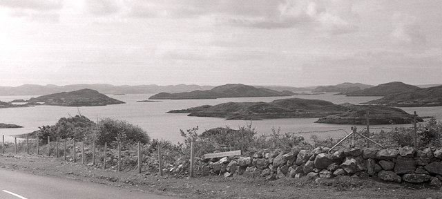
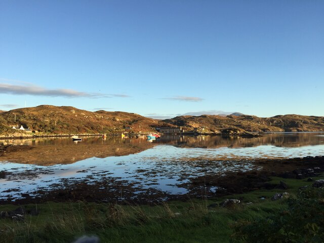
Badcall Bay is a picturesque coastal area located in the county of Sutherland, in the northernmost part of mainland Scotland. Nestled within the rugged and breathtaking Scottish Highlands, this bay is renowned for its natural beauty and tranquility.

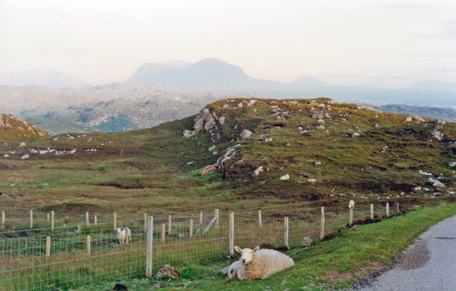
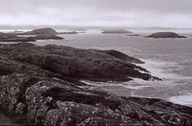
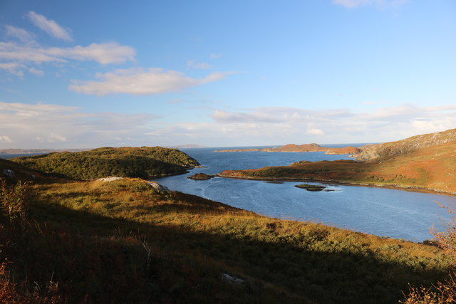
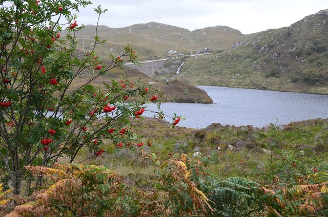
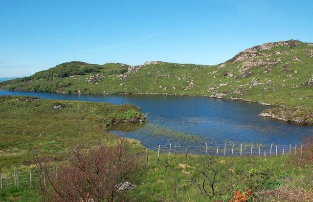
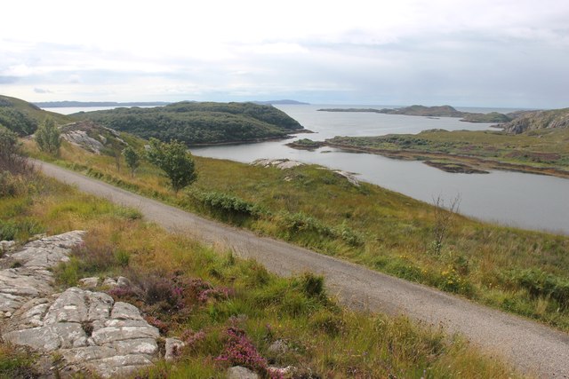
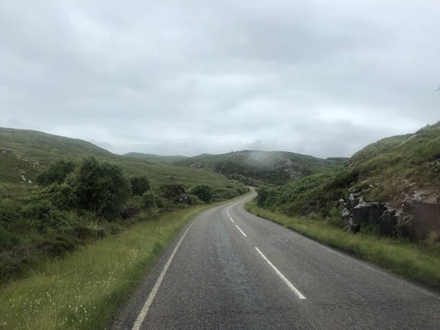
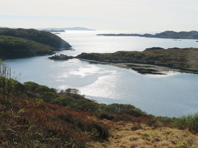
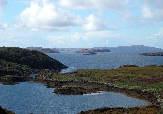
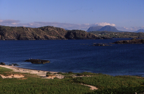
The bay stretches along the northwest coast of Sutherland and is characterized by its dramatic cliffs, pristine beaches, and crystal-clear waters. The coastline is dotted with small rocky coves, providing a haven for wildlife and creating a sense of seclusion and peacefulness.

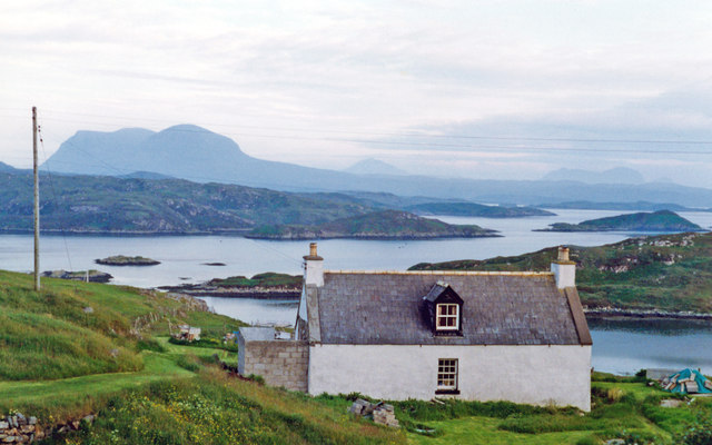
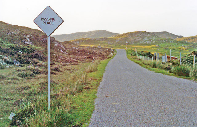
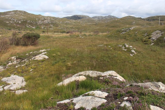
The area surrounding Badcall Bay is predominantly uninhabited, with only a few scattered cottages and farmsteads. This remote and unspoiled setting offers visitors a chance to immerse themselves in the untamed wilderness of the Scottish Highlands. The lack of urban development and light pollution makes it an ideal spot for stargazing, with the night sky offering a spectacular display of stars and constellations.

The bay is also a haven for wildlife enthusiasts, as it attracts a diverse range of seabirds, such as puffins, guillemots, and razorbills. Otters and seals can often be spotted along the shoreline, while golden eagles soar high above the cliffs. The rich marine environment supports a variety of fish species, making it a popular spot for anglers.

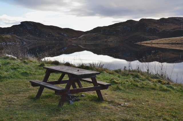
In addition to its natural attractions, Badcall Bay offers opportunities for outdoor activities such as hiking, cycling, and kayaking. There are several walking trails that meander through the surrounding hills and offer panoramic views of the bay and the surrounding landscape.

Overall, Badcall Bay is a hidden gem in the Scottish Highlands, offering visitors a chance to connect with nature and experience the untamed beauty of this remote coastal area.

If you have any feedback on the listing, please let us know in the comments section below.

Badcall Bay Images

Images are sourced within 2km of 58.322088/-5.1436543 or Grid Reference NC1541. Thanks to Geograph Open Source API. All images are credited.

Badcall Bay
Badcall Bay
South view above Upper Badcall over Badcall Bay in late mid-summer evening, 1994 On the horizon are Canisp (2779ft/846m) and Suilven (2399ft/731m). It was after 10 p.m.
South view above Upper Badcall over Badcall Bay in late mid-summer evening, 1994
On the horizon are Canisp (2779ft/846m) and Suilven (2399ft/731m). It was after 10 p.m.
Late evening view to Quinag and Assynt mountains from above Badcall Taken on same road and direction as <a href="https://www.geograph.org.uk/photo/4762350">NC1542 : South view above Upper Badcall over Badcall Bay in late mid-summer evening, 1994</a>, but about 1/2 mile ahead; possibly zoomed in this case, with Badcall Bay hidden by the hillock on the right. (Cf. also <a href="https://www.geograph.org.uk/photo/2463952">NC1642 : A894 heads south, west of Loch a' Chreagain Theth</a>).
Late evening view to Quinag and Assynt mountains from above Badcall
Taken on same road and direction as NC1542 : South view above Upper Badcall over Badcall Bay in late mid-summer evening, 1994, but about 1/2 mile ahead; possibly zoomed in this case, with Badcall Bay hidden by the hillock on the right. (Cf. also NC1642 : A894 heads south, west of Loch a' Chreagain Theth).
Southward from Badcall in evening (21.30), 1994 Across Badcall Bay and its islets, over the Rubha Gisgil and then across Loch Cairnbawn (Loch a' Chàirn Bhàin) is the dramatic double peak of Quinag (2,550-2,653 ft.); beyond Quinag and south of Loch Assynt, can be seen Canisp (2779 ft.) and the double peak of Suilven (2399 ft.).
Southward from Badcall in evening (21.30), 1994
Across Badcall Bay and its islets, over the Rubha Gisgil and then across Loch Cairnbawn (Loch a' Chàirn Bhàin) is the dramatic double peak of Quinag (2,550-2,653 ft.); beyond Quinag and south of Loch Assynt, can be seen Canisp (2779 ft.) and the double peak of Suilven (2399 ft.).
Typical Highland minor road: northward towards Scourie from Upper Badcall NE view about a mile above Badcall. (There were/are millions of those 'Passing Place' signs in Scotland.)
Typical Highland minor road: northward towards Scourie from Upper Badcall
NE view about a mile above Badcall. (There were/are millions of those 'Passing Place' signs in Scotland.)
Picnic site by Loch an Daimh Mor 'Loch of the Big Stag' on the A894 1km south of Scourie.
Picnic site by Loch an Daimh Mor
'Loch of the Big Stag' on the A894 1km south of Scourie.
Islands in Badcall Bay Seen from the side of the A894.
Islands in Badcall Bay
Seen from the side of the A894.
Rocky shore at Liobhadh Looking out over the islands in Badcall Bay. The rocks here are Lewisian gneiss.
Rocky shore at Liobhadh
Looking out over the islands in Badcall Bay. The rocks here are Lewisian gneiss.
Badcall Bay
Badcall Bay
Loch an Obain and the Minch Autumn
Rowan berries near Loch a' Chreagain Daraich By the old road down to Duartbeg within the Nature Reserve. The A894 to Scourie is in view across the loch.
Rowan berries near Loch a' Chreagain Daraich
By the old road down to Duartbeg within the Nature Reserve. The A894 to Scourie is in view across the loch.
Loch a' Chreagain Daraich One of many West Sutherland lochs among rocky hills and moorland near the coast. Viewed in late July.
Loch a' Chreagain Daraich
One of many West Sutherland lochs among rocky hills and moorland near the coast. Viewed in late July.
The moor above Duartbeg
Road to Duartbeg
Road to Duartbeg
The A894 heading south
Loch an Obain Small sea loch which looks out into Eddrachillis Bay with various islands in the distance.
Loch an Obain
Small sea loch which looks out into Eddrachillis Bay with various islands in the distance.
Loch an Obain
Loch an Obain
The A894 at Lower Badcall The islands and waters of Badcall Bay ahead.
The A894 at Lower Badcall
The islands and waters of Badcall Bay ahead.
Show me another place!

Badcall Bay is located at Grid Ref: NC1541 (Lat: 58.322088, Lng: -5.1436543)

Unitary Authority: Highland

Police Authority: Highlands and Islands

What 3 Words

///oven.stitching.upper. Near Oldshoremore, Highland

Related Wikis

Badcall, Scourie

Badcall comprises two remote hamlets, called Lower Badcall and Upper Badcall. Upper Badcall, a crofting township, is the larger of the two and is situated...

Scourie F.C.

Scourie Football Club were a senior association football club from the village of Scourie in the Scottish Highlands. They competed in the North Caledonian...

Scourie

Scourie (Scottish Gaelic: Sgobhairigh), historically spelled "Scoury", is a village on the north west coast of Scotland, about halfway between Ullapool...

Calbha Mòr

Calbha Mòr is a tidal islet in Eddrachillis Bay, Sutherland, Scotland. == Geography == Calbha Mòr lies north of the Kylesku Bridge and west of the Duartmore...

Nearby Amenities

Located within 500m of 58.322088,-5.1436543
Source: PGS
Lat/Long: 58.3203057/-5.1510118
Source: PGS
Lat/Long: 58.3205513/-5.1510086
Source: PGS
Lat/Long: 58.3206558/-5.150865
Source: PGS
Lat/Long: 58.3208358/-5.150582
Source: PGS
Lat/Long: 58.3210753/-5.1506054
Source: PGS
Lat/Long: 58.3214386/-5.1500954
Source: PGS
Lat/Long: 58.3215148/-5.1486083
Source: PGS
Lat/Long: 58.3220608/-5.1483903
Source: PGS
Lat/Long: 58.3221936/-5.1488833
Source: PGS
Lat/Long: 58.3221336/-5.1492696
Source: PGS
Lat/Long: 58.3219901/-5.1499382
Source: PGS
Lat/Long: 58.3221722/-5.150181
Source: PGS
Lat/Long: 58.322201/-5.1506375
Source: PGS
Lat/Long: 58.3234576/-5.1516324
Source: PGS
Lat/Long: 58.3235472/-5.1510405
Source: PGS
Lat/Long: 58.3236553/-5.1505182
Created By: almien_coastlines
Source: PGS
Lat/Long: 58.323855/-5.150263
Source: PGS
Lat/Long: 58.3239638/-5.1502882
Source: PGS
Lat/Long: 58.3240793/-5.1493635
Created By: almien_coastlines
Source: PGS
Lat/Long: 58.324011/-5.148568
Created By: almien_coastlines
Source: PGS
Lat/Long: 58.324143/-5.148333
Source: PGS
Lat/Long: 58.3242438/-5.1482763
Source: PGS
Lat/Long: 58.3244797/-5.1480425
Source: PGS
Lat/Long: 58.3245433/-5.1476977
Source: PGS
Lat/Long: 58.3246234/-5.1474284
Source: PGS
Lat/Long: 58.3256255/-5.1464872
Source: PGS
Lat/Long: 58.3264492/-5.1426874
Source: PGS
Lat/Long: 58.3240978/-5.1365059
Source: PGS
Lat/Long: 58.3240466/-5.1366329
Source: PGS
Lat/Long: 58.3240172/-5.136769
Source: PGS
Lat/Long: 58.3232388/-5.1374328
Created By: almien_coastlines
Source: PGS
Lat/Long: 58.323175/-5.137323
Created By: almien_coastlines
Source: PGS
Lat/Long: 58.322943/-5.135849
Leisure: slipway
Lat/Long: 58.323656/-5.1379022
The data included in this document is from www.openstreetmap.org. The data is made available under ODbL.

Have you been to Badcall Bay?

Leave your review of Badcall Bay below (or comments, questions and feedback).