Port nan Clach

Bay in Sutherland

Scotland

Port nan Clach

Loch Duartbeg
Loch Duartbeg Credit: John Ferguson

Port nan Clach, Sutherland, also known as Bay, is a picturesque coastal village located in the northernmost region of mainland Scotland. Situated in the historic county of Sutherland, the bay is nestled between the larger settlements of Durness and Kinlochbervie.

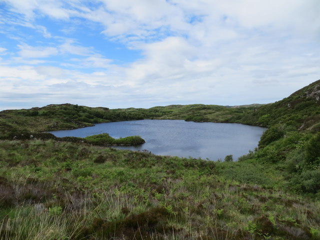
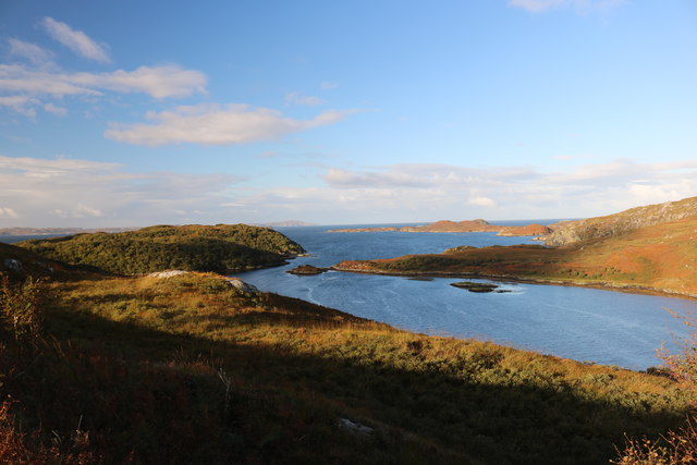
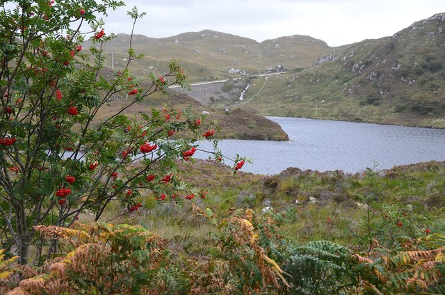
The bay is renowned for its stunning natural beauty, characterized by pristine sandy beaches, rugged cliffs, and crystal-clear turquoise waters. It serves as a popular destination for outdoor enthusiasts, offering a range of activities such as swimming, kayaking, and beachcombing. The bay is particularly famous for its rich marine life, attracting divers and snorkelers who can explore the vibrant underwater ecosystem teeming with colorful fish and abundant kelp forests.

The village itself is a small but welcoming community, with a handful of houses and amenities catering to both locals and visitors. The local economy primarily revolves around fishing and tourism, with a few quaint bed and breakfast establishments providing accommodation for those seeking an authentic coastal experience.

Port nan Clach is also steeped in history, with archaeological sites documenting the area's ancient past. The nearby ruins of an ancient broch, a circular stone tower from the Iron Age, serve as a reminder of the region's early inhabitants.

Visitors to Port nan Clach can immerse themselves in the tranquility of this remote location, surrounded by breathtaking scenery and a sense of peaceful seclusion. Whether exploring the bay's natural wonders, delving into its history, or simply enjoying the serenity of the Scottish coast, Port nan Clach offers a unique and unforgettable experience for all who venture there.

If you have any feedback on the listing, please let us know in the comments section below.

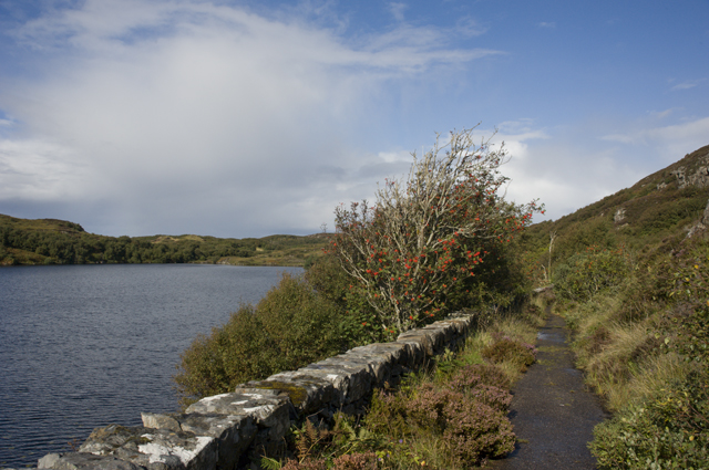
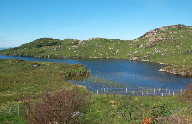
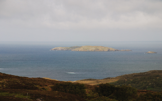
Port nan Clach Images

Images are sourced within 2km of 58.302854/-5.1437051 or Grid Reference NC1539. Thanks to Geograph Open Source API. All images are credited.

Loch Duartbeg
Loch Duartbeg
Calbha Mor from Rubh a' Mhucard
Rubh a' Mhucard looking to Calbha Beag
Coast at Rubh'an Dobhrain
Coastline at Rubh'an Dobhrain looking towards Leathann Bay
Loch a' Mhuillinn from the road to Duartbeg
Loch an Obain and the Minch Autumn
Loch a' Chreagain Daraich
Bay at Port nan Clach Seals basking on the rock in the foreground in a small cove next to Rubh'an Dobhrain, near Duartbeg.
Bay at Port nan Clach
Seals basking on the rock in the foreground in a small cove next to Rubh'an Dobhrain, near Duartbeg.
Rowan berries near Loch a' Chreagain Daraich By the old road down to Duartbeg within the Nature Reserve. The A894 to Scourie is in view across the loch.
Rowan berries near Loch a' Chreagain Daraich
By the old road down to Duartbeg within the Nature Reserve. The A894 to Scourie is in view across the loch.
Road end, Duartbeg The gate closes off to vehicles the rest of the loop of the old road, where the remaining tarmac is now the base of a footpath past Loch Duartbeg.
Road end, Duartbeg
The gate closes off to vehicles the rest of the loop of the old road, where the remaining tarmac is now the base of a footpath past Loch Duartbeg.
Old road and Loch Duartbeg The old road is close by the Loch a' Mhuilinn nature reserve and this section is closed to all but pedestrians. Heather, grass, moss and lichens are taking over the tarmac.
Old road and Loch Duartbeg
The old road is close by the Loch a' Mhuilinn nature reserve and this section is closed to all but pedestrians. Heather, grass, moss and lichens are taking over the tarmac.
Tarmac disappearing near Loch Duartbeg As the years go by, grass, moss and lichens are taking over the surface of the old disused single-track A894, as on this loop by Loch Duartbeg. The section in view is about half a metre wide.
Tarmac disappearing near Loch Duartbeg
As the years go by, grass, moss and lichens are taking over the surface of the old disused single-track A894, as on this loop by Loch Duartbeg. The section in view is about half a metre wide.
The old man road north and Loch Duartbeg Tracing my father's footsteps north to Cape Wrath in the 1920's
The old man road north and Loch Duartbeg
Tracing my father's footsteps north to Cape Wrath in the 1920's
The old road north Passing place on the old A894
The old road north
Passing place on the old A894
Loch a' Chreagain Daraich One of many West Sutherland lochs among rocky hills and moorland near the coast.
Loch a' Chreagain Daraich
One of many West Sutherland lochs among rocky hills and moorland near the coast.
Loch a' Chreagain Daraich One of many West Sutherland lochs among rocky hills and moorland near the coast. Viewed in late July.
Loch a' Chreagain Daraich
One of many West Sutherland lochs among rocky hills and moorland near the coast. Viewed in late July.
Loch a' Mhuilinn This area is a National Nature Reserve, operated by Scottish Natural Heritage. The extensive area of native broad-leaved woodland, shown on the left-hand side of this photo, is difficult to access but the insect life that depends on it was abundant during our July visit.
Loch a' Mhuilinn
This area is a National Nature Reserve, operated by Scottish Natural Heritage. The extensive area of native broad-leaved woodland, shown on the left-hand side of this photo, is difficult to access but the insect life that depends on it was abundant during our July visit.
Show me another place!

Port nan Clach is located at Grid Ref: NC1539 (Lat: 58.302854, Lng: -5.1437051)

Unitary Authority: Highland

Police Authority: Highlands and Islands

What 3 Words

///argue.triads.caused. Near Clachtoll, Highland

Related Wikis

Calbha Beag

Calbha Beag is an uninhabited island in Eddrachillis Bay, off Sutherland, Highland, Scotland. It is immediately to the west of Calbha Mor. An estimate...

Calbha Mòr

Calbha Mòr is a tidal islet in Eddrachillis Bay, Sutherland, Scotland. == Geography == Calbha Mòr lies north of the Kylesku Bridge and west of the Duartmore...

Badcall, Scourie

Badcall comprises two remote hamlets, called Lower Badcall and Upper Badcall. Upper Badcall, a crofting township, is the larger of the two and is situated...

Scourie F.C.

Scourie Football Club were a senior association football club from the village of Scourie in the Scottish Highlands. They competed in the North Caledonian...

Nearby Amenities

Located within 500m of 58.302854,-5.1437051
Source: PGS
Lat/Long: 58.3070104/-5.1408296
Created By: almien_coastlines
Source: PGS
Lat/Long: 58.306978/-5.141211
Source: PGS
Lat/Long: 58.3068996/-5.1415304
Source: PGS
Lat/Long: 58.3066502/-5.1418987
Source: PGS
Lat/Long: 58.3063423/-5.1423138
Source: PGS
Lat/Long: 58.305891/-5.1430817
Source: PGS
Lat/Long: 58.3056646/-5.14331
Source: PGS
Lat/Long: 58.3055431/-5.1434337
Source: PGS
Lat/Long: 58.3049559/-5.1431742
Source: PGS
Lat/Long: 58.3045688/-5.1435296
Source: PGS
Lat/Long: 58.3044798/-5.1437178
Source: PGS
Lat/Long: 58.3042152/-5.1438637
Source: PGS
Lat/Long: 58.3040249/-5.1443414
Source: PGS
Lat/Long: 58.303868/-5.143545
Created By: almien_coastlines
Source: PGS
Lat/Long: 58.303996/-5.143462
Created By: almien_coastlines
Source: PGS
Lat/Long: 58.303481/-5.143675
Source: PGS
Lat/Long: 58.3033582/-5.1437017
Source: PGS
Lat/Long: 58.3022094/-5.1429139
Source: PGS
Lat/Long: 58.3021383/-5.1443918
Source: PGS
Lat/Long: 58.3024417/-5.1445052
Source: PGS
Lat/Long: 58.303052/-5.1461093
Source: PGS
Lat/Long: 58.3028408/-5.1468169
Source: PGS
Lat/Long: 58.3024407/-5.1472148
Source: PGS
Lat/Long: 58.302133/-5.1473389
Created By: almien_coastlines
Source: PGS
Lat/Long: 58.301889/-5.146984
Source: PGS
Lat/Long: 58.3014945/-5.1472273
Source: PGS
Lat/Long: 58.3014343/-5.1471308
Source: PGS
Lat/Long: 58.3013195/-5.1473846
Source: PGS
Lat/Long: 58.301133/-5.1477653
Source: PGS
Lat/Long: 58.300902/-5.1480288
Source: PGS
Lat/Long: 58.3007606/-5.1480867
Source: PGS
Lat/Long: 58.3004361/-5.148107
Source: PGS
Lat/Long: 58.3000715/-5.1469988
Source: PGS
Lat/Long: 58.3001796/-5.1458374
Source: PGS
Lat/Long: 58.2996145/-5.1459907
Source: PGS
Lat/Long: 58.2992758/-5.146301
Source: PGS
Lat/Long: 58.299307/-5.1450083
Source: PGS
Lat/Long: 58.2992496/-5.1446379
Source: PGS
Lat/Long: 58.2988573/-5.1456687
Source: PGS
Lat/Long: 58.2990774/-5.143095
Source: PGS
Lat/Long: 58.2990631/-5.1426468
Source: PGS
Lat/Long: 58.2994234/-5.1421481
Source: PGS
Lat/Long: 58.3000841/-5.1382652
The data included in this document is from www.openstreetmap.org. The data is made available under ODbL.

Have you been to Port nan Clach?

Leave your review of Port nan Clach below (or comments, questions and feedback).