Fintray Bay

Bay in Buteshire

Scotland

Fintray Bay

Barbay Hill - Isle of Cumbrae Geographical indicator and trig point on the summit of Barbay Hill.
Trig Point : TP1016
Flush Bracket : S4807
Barbay Hill - Isle of Cumbrae Credit: Morag McKay

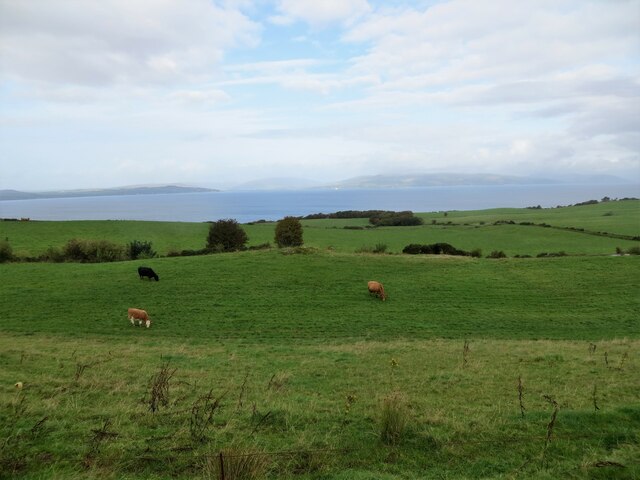
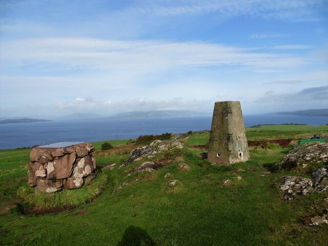
Fintray Bay is a picturesque bay located in Buteshire, Scotland. Situated on the western coast of the Isle of Bute, it is known for its stunning natural beauty and serene atmosphere. The bay is nestled between rugged cliffs and rolling green hills, creating a breathtaking backdrop for visitors and locals alike.

The bay itself is a small, sheltered inlet, providing a safe haven for boats and yachts. Its calm waters make it popular among boating and sailing enthusiasts, who often visit to enjoy the peacefulness and scenic surroundings. The bay is also home to a variety of marine life, including seals, dolphins, and various species of seabirds, making it a haven for wildlife enthusiasts and bird watchers.

The surrounding area offers a range of activities and attractions for visitors. The nearby town of Rothesay, the largest settlement on the Isle of Bute, is just a short drive away and offers a selection of shops, cafes, and restaurants. Visitors can explore the historic Rothesay Castle, which dates back to the 13th century, or take a leisurely stroll along the promenade to enjoy the views across the bay.

For those seeking outdoor adventures, Fintray Bay is surrounded by beautiful countryside, perfect for hiking, cycling, and wildlife spotting. The bay is also a popular spot for fishing, with opportunities to catch a variety of fish including mackerel and cod.

Overall, Fintray Bay is a hidden gem in Buteshire, offering visitors a tranquil and picturesque escape with its stunning natural beauty, abundant wildlife, and range of outdoor activities.

If you have any feedback on the listing, please let us know in the comments section below.
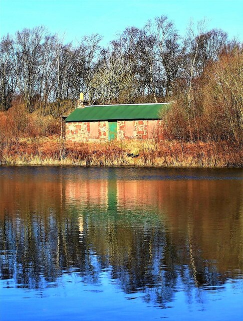
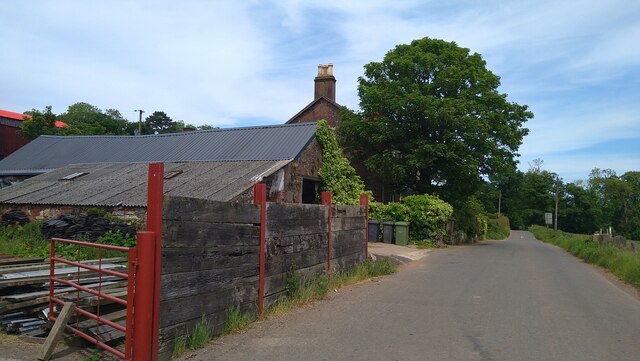
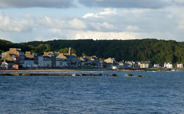
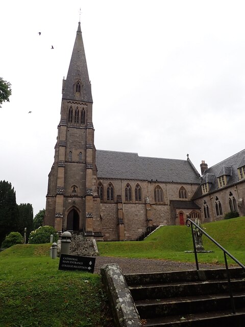
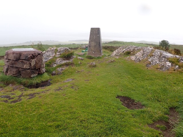
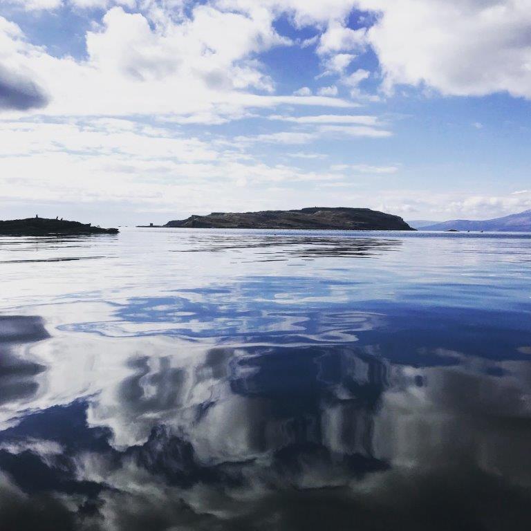
Fintray Bay Images

Images are sourced within 2km of 55.769039/-4.9382654 or Grid Reference NS1556. Thanks to Geograph Open Source API. All images are credited.

Barbay Hill - Isle of Cumbrae Geographical indicator and trig point on the summit of Barbay Hill.
Trig Point : TP1016
Flush Bracket : S4807
Barbay Hill - Isle of Cumbrae
Geographical indicator and trig point on the summit of Barbay Hill. Trig Point : TP1016 Flush Bracket : S4807
Grazing land at Figgatoch Farm
Trig pillar on Barbay Hill
Garrison House (Sunken Garden) - Millport, Isle of Cumbrae Garrison House in Millport was built in 1745 as the residence of the Captain and officers of the Revenue Sailing Ship the ‘Royal George’.

Garrison's Sunken Garden

This restored sunken garden is based on an original design by Robert Weir Schulz.

In 1908 and 1909, the 4th Marquess of Bute hired Schulz to create terraces and a new sunken garden at Garrison House. His design reflects the Arts and Crafts style of the time.

Schulz was an architect based in London. He worked on many of the Bute properties during this period.

Schulz, along with other designers like William Robertson and Gertrude Jerkyll, helped define the Arts and Crafts garden in the U.K. Typical elements included : Drystone walling using local stone, Crazy stone paving, Wild plants instead of glasshouse plants and Plants in niches in rocks in walls, steps and paths.

These elements resulted in a 'Cottage' look that was less formal than previous styles of garden. Quite bold in front of a Gothic Revival house like Garrison !
Garrison House (Sunken Garden) - Millport, Isle of Cumbrae
Garrison House in Millport was built in 1745 as the residence of the Captain and officers of the Revenue Sailing Ship the ‘Royal George’. Garrison's Sunken Garden This restored sunken garden is based on an original design by Robert Weir Schulz. In 1908 and 1909, the 4th Marquess of Bute hired Schulz to create terraces and a new sunken garden at Garrison House. His design reflects the Arts and Crafts style of the time. Schulz was an architect based in London. He worked on many of the Bute properties during this period. Schulz, along with other designers like William Robertson and Gertrude Jerkyll, helped define the Arts and Crafts garden in the U.K. Typical elements included : Drystone walling using local stone, Crazy stone paving, Wild plants instead of glasshouse plants and Plants in niches in rocks in walls, steps and paths. These elements resulted in a 'Cottage' look that was less formal than previous styles of garden. Quite bold in front of a Gothic Revival house like Garrison !
Gouklan Standing Stone - Isle of Cumbrae The Gouklan Stone stands in the southeast corner of Gouklan Wood.
Gouklan Standing Stone - Isle of Cumbrae
The Gouklan Stone stands in the southeast corner of Gouklan Wood.
Gouklan Standing Stone - Isle of Cumbrae The Gouklan Stone stands in the southeast corner of Gouklan Wood.
Gouklan Standing Stone - Isle of Cumbrae
The Gouklan Stone stands in the southeast corner of Gouklan Wood.
Minke Whale - Isle of Cumbrae The very sad sight of a Minke whale at Sheriff's Port on the Isle of Cumbrae.
Minke Whale - Isle of Cumbrae
The very sad sight of a Minke whale at Sheriff's Port on the Isle of Cumbrae.
Kirkton (c700) - Cumbrae's Medieval Centre Kirkton was a medieval village on Cumbrae and existed for many centuries before Millport was built.
The plaque reads "Remains of the ancient jougs by which prisoners were manacled to the rocks. They date back to the 15th century".

North Ayrshire Heritage Trails <span class="nowrap"><a title="https://www.naheritagetrails.co.uk/heritagetrails_cumbrae_kirkton.php" rel="nofollow ugc noopener" href="https://www.naheritagetrails.co.uk/heritagetrails_cumbrae_kirkton.php">Link</a><img style="margin-left:2px;" alt="External link" title="External link - shift click to open in new window" src="https://s1.geograph.org.uk/img/external.png" width="10" height="10"/></span>
Kirkton (c700) - Cumbrae's Medieval Centre
Kirkton was a medieval village on Cumbrae and existed for many centuries before Millport was built. The plaque reads "Remains of the ancient jougs by which prisoners were manacled to the rocks. They date back to the 15th century". North Ayrshire Heritage Trails LinkExternal link
The Gowk Stone - Isle of Cumbrae In folklore a gowk is a cuckoo or fool, the latter were thought to be fairy-touched.
Gowk’s Day was the old Scottish April Fool's Day, which was held on 13th April when the cuckoo begins to call.
The call of the cuckoo is believed to beckon the souls of the dead, and the cuckoo was thought to be able to travel back and forth between the worlds of the living and the dead.
The Gowk Stone - Isle of Cumbrae
In folklore a gowk is a cuckoo or fool, the latter were thought to be fairy-touched. Gowk’s Day was the old Scottish April Fool's Day, which was held on 13th April when the cuckoo begins to call. The call of the cuckoo is believed to beckon the souls of the dead, and the cuckoo was thought to be able to travel back and forth between the worlds of the living and the dead.
Millport Curling Club Bothy - Isle of Cumbrae Wee Minnemoer Bothy is the home of Millport Curling Club which was founded in 1838.

The first President was John Wishart from a report of a meeting held in the Kelburne Arms. The bothy was built by William Wishart about 1845. In these early years curling on Cumbrae was run less formally but from 1925 the Curling Club has flourished and more recently ladies were admitted to the club as members. The Club has been and remains active in many competitions organised by the Argyll Province and the Royal Club.
Millport Curling Club Bothy - Isle of Cumbrae
Wee Minnemoer Bothy is the home of Millport Curling Club which was founded in 1838. The first President was John Wishart from a report of a meeting held in the Kelburne Arms. The bothy was built by William Wishart about 1845. In these early years curling on Cumbrae was run less formally but from 1925 the Curling Club has flourished and more recently ladies were admitted to the club as members. The Club has been and remains active in many competitions organised by the Argyll Province and the Royal Club.
Ballochmartin, Great Cumbrae Island The island is more generally known as "The Big Cumbrae" or just "Millport" after its main town.
Ballochmartin, Great Cumbrae Island
The island is more generally known as "The Big Cumbrae" or just "Millport" after its main town.
Great Cumbrae - Millport Looking across Millport Bay from near to the Millport Pier Hotel over to Glasgow Street which hugs the northern end of the bay.
Great Cumbrae - Millport
Looking across Millport Bay from near to the Millport Pier Hotel over to Glasgow Street which hugs the northern end of the bay.
Great Cumbrae - The Cathedral of the Isles - from the south The Cathedral of the Isles and Collegiate Church of the Holy Spirit (to give it its full appellation) is a Category A listed <span class="nowrap"><a title="http://portal.historicenvironment.scot/designation/LB37824" rel="nofollow ugc noopener" href="http://portal.historicenvironment.scot/designation/LB37824">Link</a><img style="margin-left:2px;" alt="External link" title="External link - shift click to open in new window" src="https://s1.geograph.org.uk/img/external.png" width="10" height="10"/></span> cathedral in the town of Millport on the island of Great Cumbrae. It is one of the smallest (possibly *the* smallest) cathedral in Britain, with many a parish church being larger.
For more information, see <span class="nowrap"><a title="http://www.scottishchurches.org.uk/sites/site/id/7562/name/Millport+Episcopal+Cathedral+of+the+Isles+Millport+Strathclyde" rel="nofollow ugc noopener" href="http://www.scottishchurches.org.uk/sites/site/id/7562/name/Millport+Episcopal+Cathedral+of+the+Isles+Millport+Strathclyde">Link</a><img style="margin-left:2px;" alt="External link" title="External link - shift click to open in new window" src="https://s1.geograph.org.uk/img/external.png" width="10" height="10"/></span>

The whole of Millport is a designated conservation area - see <span class="nowrap"><a title="https://www.north-ayrshire.gov.uk/Documents/CorporateServices/LegalProtective/LocalDevelopmentPlan/MillportConservationArea.pdf" rel="nofollow ugc noopener" href="https://www.north-ayrshire.gov.uk/Documents/CorporateServices/LegalProtective/LocalDevelopmentPlan/MillportConservationArea.pdf">Link</a><img style="margin-left:2px;" alt="External link" title="External link - shift click to open in new window" src="https://s1.geograph.org.uk/img/external.png" width="10" height="10"/></span>
Great Cumbrae - The Cathedral of the Isles - from the south
The Cathedral of the Isles and Collegiate Church of the Holy Spirit (to give it its full appellation) is a Category A listed LinkExternal link cathedral in the town of Millport on the island of Great Cumbrae. It is one of the smallest (possibly *the* smallest) cathedral in Britain, with many a parish church being larger. For more information, see LinkExternal link The whole of Millport is a designated conservation area - see LinkExternal link
Great Cumbrae - The Cathedral of the Isles - from the East The Cathedral of the Isles and Collegiate Church of the Holy Spirit (to give it its full appellation) is a Category A listed <span class="nowrap"><a title="http://portal.historicenvironment.scot/designation/LB37824" rel="nofollow ugc noopener" href="http://portal.historicenvironment.scot/designation/LB37824">Link</a><img style="margin-left:2px;" alt="External link" title="External link - shift click to open in new window" src="https://s1.geograph.org.uk/img/external.png" width="10" height="10"/></span> cathedral in the town of Millport on the island of Great Cumbrae. It is one of the smallest (possibly *the* smallest) cathedral in Britain, with many a parish church being larger.
For more information, see <span class="nowrap"><a title="http://www.scottishchurches.org.uk/sites/site/id/7562/name/Millport+Episcopal+Cathedral+of+the+Isles+Millport+Strathclyde" rel="nofollow ugc noopener" href="http://www.scottishchurches.org.uk/sites/site/id/7562/name/Millport+Episcopal+Cathedral+of+the+Isles+Millport+Strathclyde">Link</a><img style="margin-left:2px;" alt="External link" title="External link - shift click to open in new window" src="https://s1.geograph.org.uk/img/external.png" width="10" height="10"/></span>

The whole of Millport is a designated conservation area - see <span class="nowrap"><a title="https://www.north-ayrshire.gov.uk/Documents/CorporateServices/LegalProtective/LocalDevelopmentPlan/MillportConservationArea.pdf" rel="nofollow ugc noopener" href="https://www.north-ayrshire.gov.uk/Documents/CorporateServices/LegalProtective/LocalDevelopmentPlan/MillportConservationArea.pdf">Link</a><img style="margin-left:2px;" alt="External link" title="External link - shift click to open in new window" src="https://s1.geograph.org.uk/img/external.png" width="10" height="10"/></span>
Great Cumbrae - The Cathedral of the Isles - from the East
The Cathedral of the Isles and Collegiate Church of the Holy Spirit (to give it its full appellation) is a Category A listed LinkExternal link cathedral in the town of Millport on the island of Great Cumbrae. It is one of the smallest (possibly *the* smallest) cathedral in Britain, with many a parish church being larger. For more information, see LinkExternal link The whole of Millport is a designated conservation area - see LinkExternal link
Great Cumbrae - Cathedral of the Isles - Nave & Chancel Looking along the nave into the chancel of the Cathedral of the Isles in Millport, Great Cumbrae. See <a href="https://www.geograph.org.uk/photo/7219178">NS1655 : Great Cumbrae - The Cathedral of the Isles - from the south</a> and <a href="https://www.geograph.org.uk/photo/7219182">NS1655 : Great Cumbrae - The Cathedral of the Isles - from the East</a> for more information
Great Cumbrae - Cathedral of the Isles - Nave & Chancel
Looking along the nave into the chancel of the Cathedral of the Isles in Millport, Great Cumbrae. See NS1655 : Great Cumbrae - The Cathedral of the Isles - from the south and NS1655 : Great Cumbrae - The Cathedral of the Isles - from the East for more information
Great Cumbrae - The Cathedral of the Isles - Ancient relics A small plaque above these relics states:
"These Crosses
and
Carved Fragments
Relics of the ancient Christianity of the Island
were deposited within the College precincts
by the Founder
George Frederick, 6th Earl of Glasgow
Ye have considered the days of old and the
years of ancient times. Psalms LXXVII 5"
Great Cumbrae - The Cathedral of the Isles - Ancient relics
A small plaque above these relics states: "These Crosses and Carved Fragments Relics of the ancient Christianity of the Island were deposited within the College precincts by the Founder George Frederick, 6th Earl of Glasgow Ye have considered the days of old and the years of ancient times. Psalms LXXVII 5"
Great Cumbrae - Millport - The Garrison The Category 'B' listed <span class="nowrap"><a title="http://portal.historicenvironment.scot/designation/LB37825" rel="nofollow ugc noopener" href="http://portal.historicenvironment.scot/designation/LB37825">Link</a><img style="margin-left:2px;" alt="External link" title="External link - shift click to open in new window" src="https://s1.geograph.org.uk/img/external.png" width="10" height="10"/></span>  Garrison in Millport, Great Cumbrae has had several uses since its original construction in the C18th as a garrison for the local excise men and associated troops. However, little of the original building remains as the house was extensively renovated in the 19th century for the Earl of Glasgow. It now houses an interesting little museum.
Great Cumbrae - Millport - The Garrison
The Category 'B' listed LinkExternal link Garrison in Millport, Great Cumbrae has had several uses since its original construction in the C18th as a garrison for the local excise men and associated troops. However, little of the original building remains as the house was extensively renovated in the 19th century for the Earl of Glasgow. It now houses an interesting little museum.
Great Cumbrae - Barbay Hill - Trig point This Trig Point (or triangulation pillar) is on the highest point of Great Cumbrae island at 417' (127m). The views can be stunning from here  apparently - unfortunately this was not the case at the time of our visit as low cloud and rain obscured any such views.
Great Cumbrae - Barbay Hill - Trig point
This Trig Point (or triangulation pillar) is on the highest point of Great Cumbrae island at 417' (127m). The views can be stunning from here apparently - unfortunately this was not the case at the time of our visit as low cloud and rain obscured any such views.
Show me another place!

Fintray Bay is located at Grid Ref: NS1556 (Lat: 55.769039, Lng: -4.9382654)

Unitary Authority: North Ayrshire

Police Authority: Ayrshire

What 3 Words

///bulletins.bowls.custodian. Near Millport, North Ayrshire

Related Wikis

The Cumbraes

The Cumbraes are a group of islands in the Firth of Clyde, Scotland. The islands belong to the traditional county of Bute and the modern unitary authority...

Great Cumbrae

Great Cumbrae (Scots: Muckle Cumbrae; Scottish Gaelic: Cumaradh Mòr; also known as Great Cumbrae Island, Cumbrae or the Isle of Cumbrae) is the larger...

Lady Margaret Hospital

Lady Margaret Hospital is a small 10-bedded hospital at Millport on Great Cumbrae in North Ayrshire, Scotland. It is managed by NHS Ayrshire and Arran...

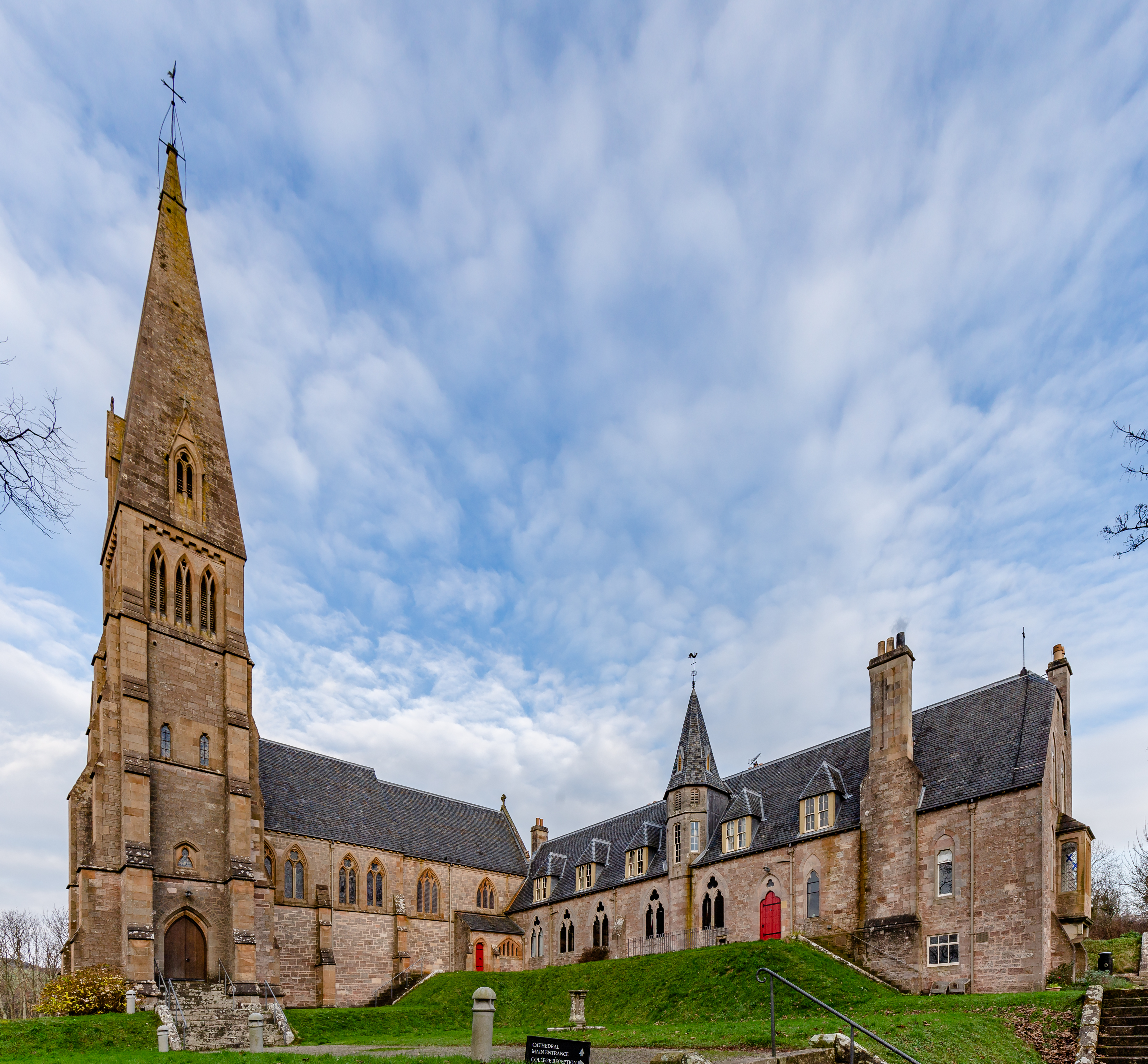
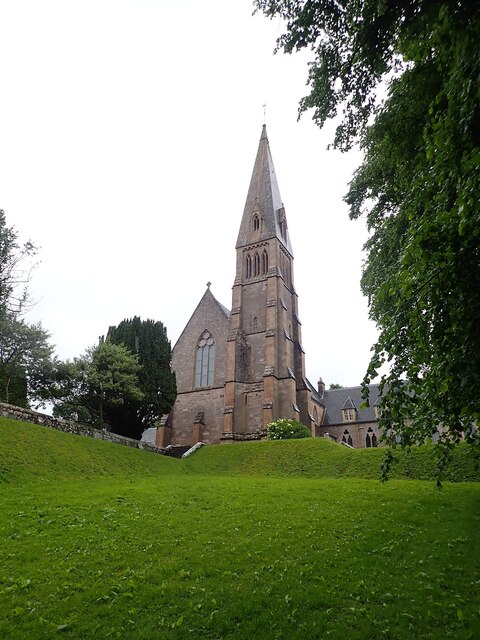
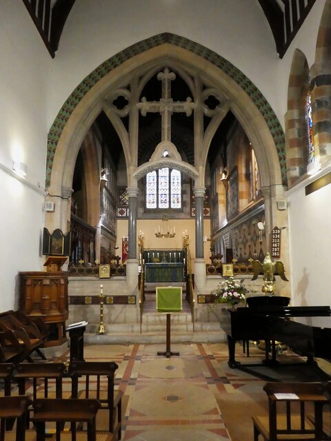
Cathedral of The Isles

The Cathedral of the Isles and Collegiate Church of the Holy Spirit is a Category A listed cathedral of the Scottish Episcopal Church in the town of Millport...
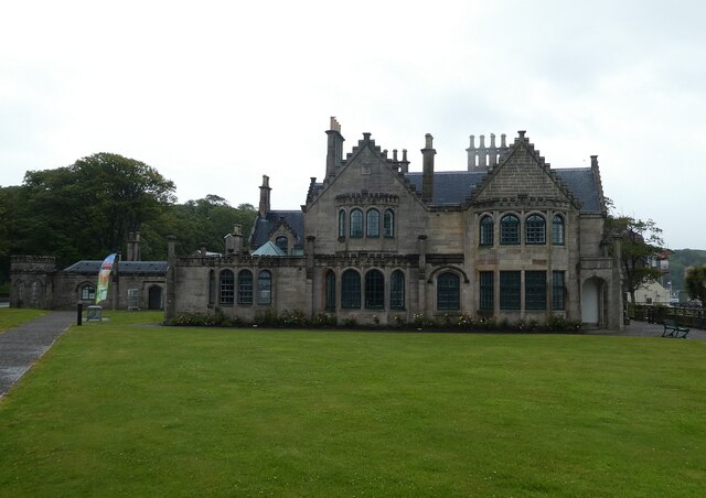
Millport Town Hall

Millport Town Hall is a municipal building in Clifton Street, Millport, North Ayrshire, Scotland. The structure is used as a community events centre....

Millport, Great Cumbrae

Millport (Scottish Gaelic: Port a' Mhuilinn) is the only town on the island of Great Cumbrae in the Firth of Clyde off the coast of mainland Scotland,...

The Eileans

The Eileans are two small, low-lying islands located in Newtown Bay, Millport on the island of Great Cumbrae, Scotland. (grid reference NS164545). The...

FSC Millport

FSC Millport, run by the Field Studies Council, is located on the island of Great Cumbrae in the Firth of Clyde, Scotland. The field centre was formerly...

Nearby Amenities

Located within 500m of 55.769039,-4.9382654
Barrier: kissing_gate
Foot: yes
Lat/Long: 55.767094/-4.9380321
Bench
Backrest: yes
Colour: green
Material: wood
Source: survey
Lat/Long: 55.7672424/-4.9402937
Bench
Backrest: yes
Colour: green
Material: wood
Source: survey
Lat/Long: 55.7677948/-4.9388717
Barrier: kissing_gate
Foot: yes
Source: survey
Lat/Long: 55.7679585/-4.9375142
Fintray Bay
Natural: bay
Lat/Long: 55.76992/-4.9391277
Power: pole
Lat/Long: 55.7711233/-4.9350901
The data included in this document is from www.openstreetmap.org. The data is made available under ODbL.

Have you been to Fintray Bay?

Leave your review of Fintray Bay below (or comments, questions and feedback).